
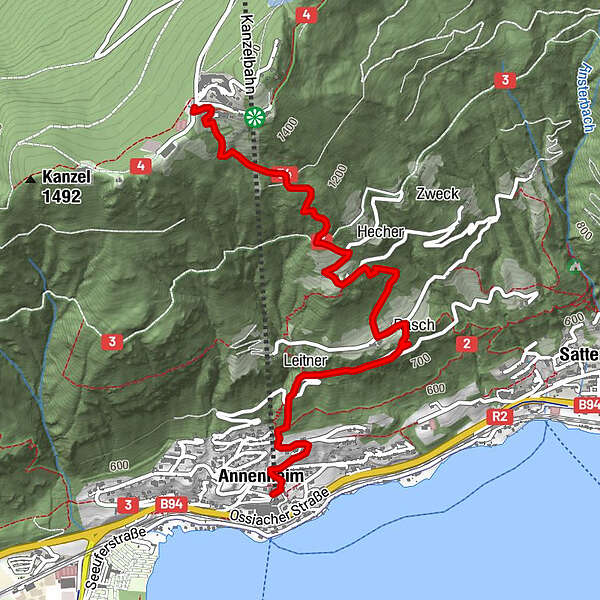
Tour data
4.03km
530
- 1,457m
884hm
884hm
02:00h
- Brief description
-
Mittelschwere Wanderung auf die Kanzelhöhe über Jägersteig
- Difficulty
-
difficult
- Rating
-
- Starting point
-
Parklplatz Gerlitzen Kanzelbahn
- Route
-
AnnenheimKanzel Stub'nHofer Bründl0.9 kmOssiachberg2.5 kmKanzelhöhe3.9 km
- Best season
-
JanFebMarAprMayJunJulAugSepOctNovDec
- Highest point
- Kanzelhöhe (1,457 m)
- Endpoint
-
Kanzelhöhe
- Rest/Retreat
-
Sonnenhotel Zabeck
- Information
-
-
- Ticket material
-
-
GPS Downloads


Trail conditions
Asphalt
(20%/3km)
Gravel
Meadow
Forest
(80%/6km)
Rock
Exposed
Other tours in the regions


