Oberstollwitz-Höfling-Rundweg

Logo Oberstollwitz-Höfling-Rundweg
Tour data
5.14km
681 - 927m
Distance
289hm
283hm
Ascent
01:30h
 
Duration
Brief description

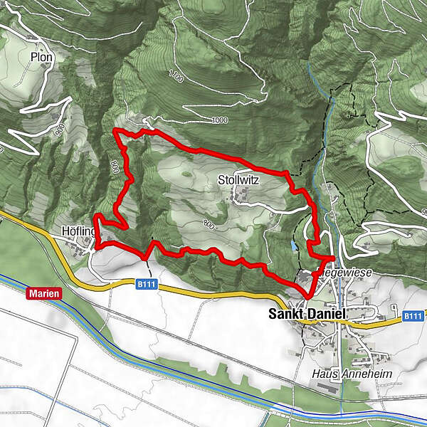
Mittlere Wandertour mit schönen Aussichtspunkten auf der Sonnenseite des Tals

Difficulty
medium
Rating
Technique
Fitness
Landscape
Experience
Route
Sankt Daniel
0.1 km
Stollwitz
1.0 km
Höfling
3.1 km
Sankt Daniel
4.8 km
Best season
Jan
Feb
Mar
Apr
May
Jun
Jul
Aug
Sep
Oct
Nov
Dec
Highest point
927 m
Endpoint

Alte Säge

Height profile

Author
The tour Oberstollwitz-Höfling-Rundweg is used by outdooractive.com provided.

3,5
Overall rating

5

50

%

4

0

%

3

0

%

2

50

%

1

0

%

GPS Downloads
  • GPX GPS Exchange Format (XML)
  • KML Google Earth, Google Maps
QR Download Codes for Mobile Phones

General info

Refreshment stop
A lot of view

Popular tours in the area

Kleiner Pal mit Freilichtmuseum am Gipfel

medium Hiking
7.83km | 754hm | 07:00h

Trogkofel (2.280 m)

difficult Hiking
8.12km | 770hm | 05:15h

Karlsbader Hütte über Rudl-Eller-Weg

difficult Hiking
5.1km | 753hm | 05:00h

Emberger Alm - Hochtristen

medium Hiking
9.5km | 870hm | 05:30h