
- Brief description
-
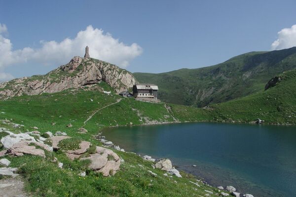
The flower paradise Mussen is situated in the middle of the Gailtaler Alps and fascinates with a unique flower splendour.
- Difficulty
-
medium
- Rating
-
- Route
-
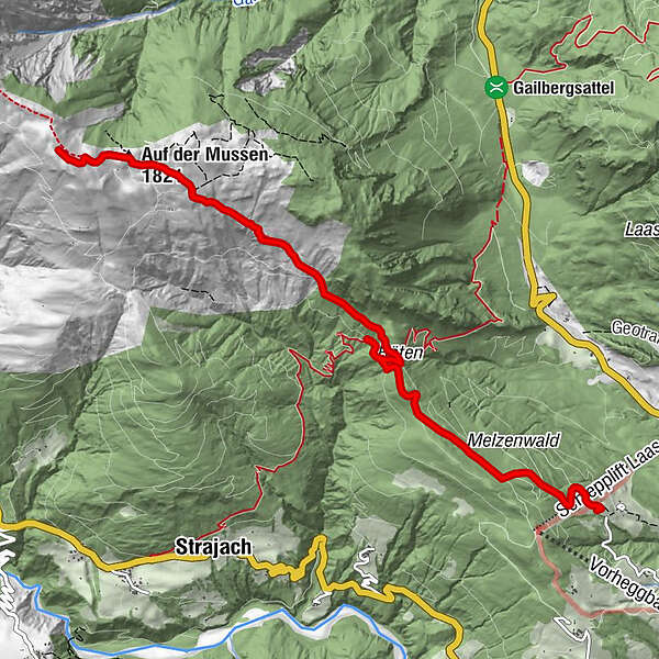
Röthenkreuz3.4 kmAuf der Mussen (1,821 m)6.2 km
- Best season
-
JanFebMarAprMayJunJulAugSepOctNovDec
- Description
-
Starting point Ödenhütte, from there you turn right and follow a forest path through the mountain forest to Röten. Continue walking through the forest to a hay hut, after which the Mussen alpine meadow area stretches out. Access also possible via St. Jakob (Lesachtal). Take drinks and snacks with you for the way. Condition Infrastructure Main blossoming time Almwiese Mussen is June/July Refreshment possibilities Ödenhütte, Gasthof Gailberghöhe or Alpenhof Strenge and Gasthof zum Löwen on the descent from Lesachtal Experience points Nature reserve, largest alpine plant diversity in Europe - more than 500 plant species, 280 higher plants, orchid and lily meadows. Further information
Starting point: Ödenhütte mountain inn, 1,180 m
Aiming point: Mussen (Kuku), 1,771 m above sea level
Length: 5.5Total walking time: 3 h
Level of difficulty: medium
Family hiking trail - Directions
-
From the Ödenhütte, turn right along a forest path through the mountain forest to Röten. Continue walking through the forest to a hay hut, after which the Mussen alpine meadow area stretches out. Access also possible via St. Jakob (Lesachtal). Take drinks and snacks with you for the way.
- Highest point
- 1,937 m
- Endpoint
-
Blumenparadies Mussen
- Height profile
-

- Equipment
-
Sturdy shoes
Snacks and drinks
Clothing for all weather conditions - Directions
-
Take the B111 or the B110 to Kötschach-Mauthen, continue towards Kreuth until you reach the Ödenhütte.
- Public transportation
-
Travel to Kötschach-Mauthen is possible by public transport.
- Parking
-
Parking spaces are available at the starting area.

- Author
-
The tour Blumenparadies Mussen (Ödenhütte - Röthen - Kuku) is used by outdooractive.com provided.