© NLW Tourismus Marketing GmbH - Tourismusinfo Nassfeld-Pressegger See

- Brief description
-
Leichte Wanderung in besonderer geologischen und floristischen Umgebung.
- Difficulty
-
easy
- Rating
-
- Route
-
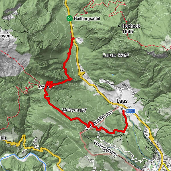
LaasMaierle1.5 kmRöthenkreuz4.4 km
- Best season
-
JanFebMarAprMayJunJulAugSepOctNovDec
- Description
-
From the church in Laas you walk downhill in a south-southeast direction, then slightly uphill to the last house on the plateau. Then follow the steep path through the forest and continue over meadows to the houses "Maierle" and further to the "Ödenhütte". From there the path continues northwest through the forest until it joins the goods road from Vorhegg to Röthenkreuz.
- Highest point
- 1,317 m
- Endpoint
-
Laas Kirche
- Height profile
-

- Tips
-
Special feature: the high moor at Gailberg

- Author
-
The tour Rundwanderweg Laas-Röthen-Gailberg is used by outdooractive.com provided.
GPS Downloads


General info
Refreshment stop
Other tours in the regions