
- Difficulty
-
easy
- Rating
-
- Starting point
-
Spittal/Nord – Evangelist church
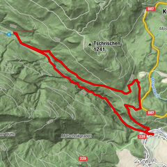
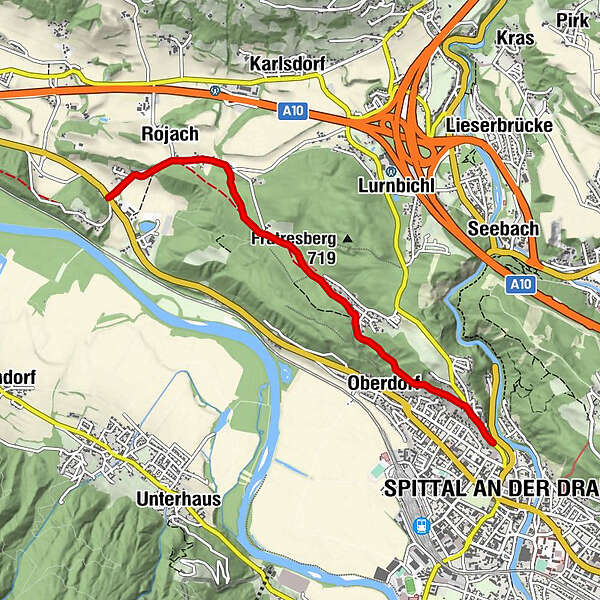
- Route
-
Spittal (560 m)Oberdorf1.0 kmRojach4.0 kmOberdorf8.3 kmSpittal (560 m)9.3 km
- Best season
-
JanFebMarAprMayJunJulAugSepOctNovDec
- Description
-
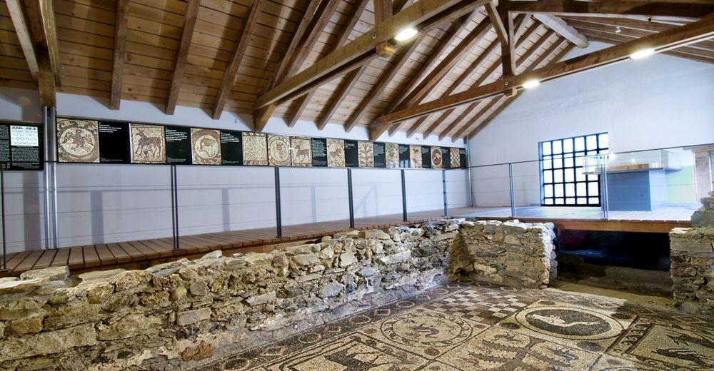
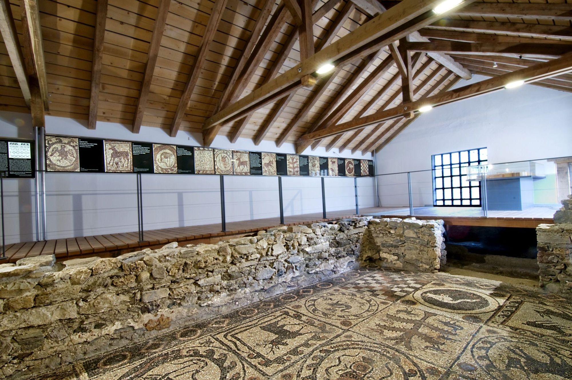
The settlement of St. Peter in Holz was founded around the 12th c. BC. The Celtic village of Teurnia was incorporated into a large urban centre planned by the Romans around 50 AD. In the 5th and 6th centuries Teurnia was a stronghold of the province of Noricum and a bishopric, as the huge ruins of an Episcopal church and cemetery church reveal. The mosaic floor of the church is one of the most important in Europe. The Roman museum in Teurnia is a recent creation.
- Directions
-
the walk starts from the car-park near the Evangelist church in Spittal. Turn left at Ebnerwiese meadow on Fratresstrasse street and walk through a wood as far as St. Peter in Holz (a late- Gothic church with frescoes and a lookout point). The Roman museum in Teurnia stands in front of the church. Past the museum you turn to the right and about 200 metres later you will find the oldest Episcopal church in Austria (ca. 4th c.). It is enclosed by a protective structure. Continue along this road for about 1 km (or you could have turned off earlier and taken a steep path for about 800 metres) where you will come across a church with a famous mosaic floor (ca. 5th c.).
- Highest point
- 645 m
- Endpoint
-
Spittal/Nord – Evangelist church
- Height profile
-

- Equipment
-
An important condition for the success of a hike is the study of the maps and optimal equipment. The basic equipment is fitting climbing boots and a water repelling and windproof jacket and trousers (rain shelter). Sun glasses, mobile phone and a first aid package should be in your backpack.
- Safety instructions
-
The most important emergency numbers in Austria
144 ambulance service
140 alpine emergency call
112 European emergency number
- Directions
-
by car from Seeboden to Spittal
- Author
-
The tour Roman Path for Teurnia is used by outdooractive.com provided.