Tour data
4.17km
1,660
- 1,950m
320hm
30hm
01:30h
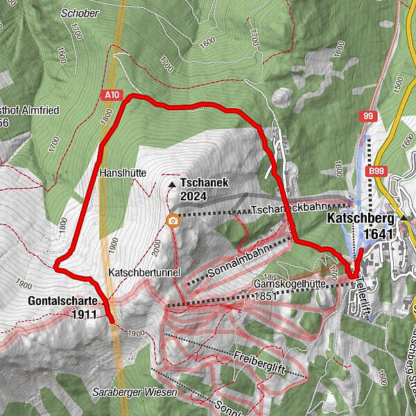
- Difficulty
-
medium
- Rating
-
- Starting point
-
Actionpark Katschberghöhe
- Route
-
KatschbergHanslbauer Hütte2.9 kmGontalscharte (1,911 m)3.9 km
- Best season
-
AugSepOctNovDecJanFebMarAprMayJunJul
- Highest point
- Gontalscharte (1,950 m)
- Endpoint
-
Gontalscharte
- Rest/Retreat
-
Nein


GPS Downloads


Other tours in the regions