

- Brief description
-
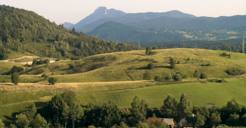
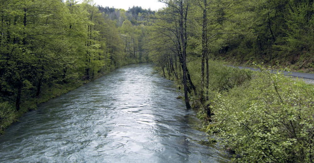
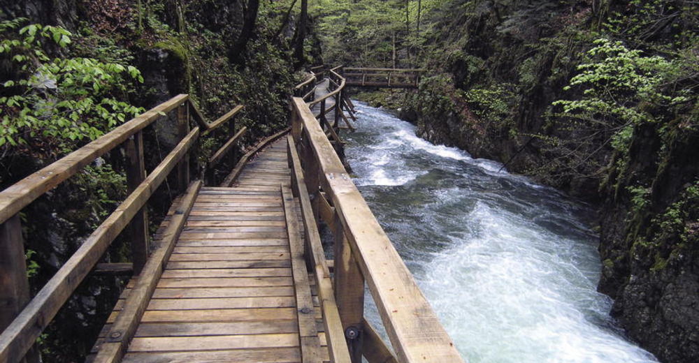
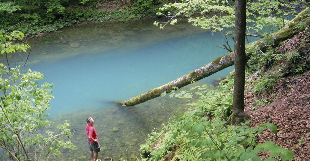
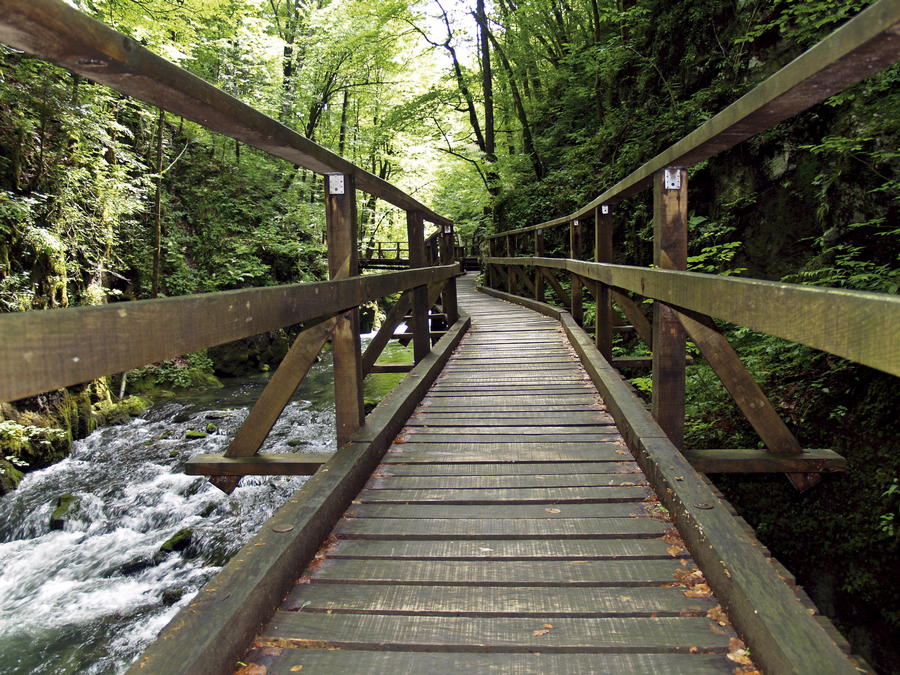
In the northern slopes of the forested massif of Velika Kapela, there is a canyon facing north, cut into the terrain, with a small river called Kamačnik flowing through it. In the area south of the canyon lies a vast uninhabited mountainous area – a continuation of the mountain of Klek above Ogulin. One of the highest peaks in this massif is Bijela kosa. The most attractive hiking point of interest is undoubtedly the canyon of Kamačnik, its waters springing out of a small dark green lake surrounded by steep slopes.
- Difficulty
-
medium
- Rating
-
- Starting point
-
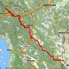
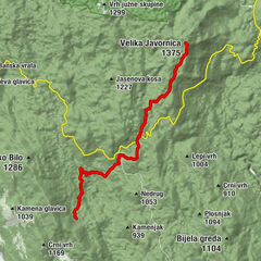
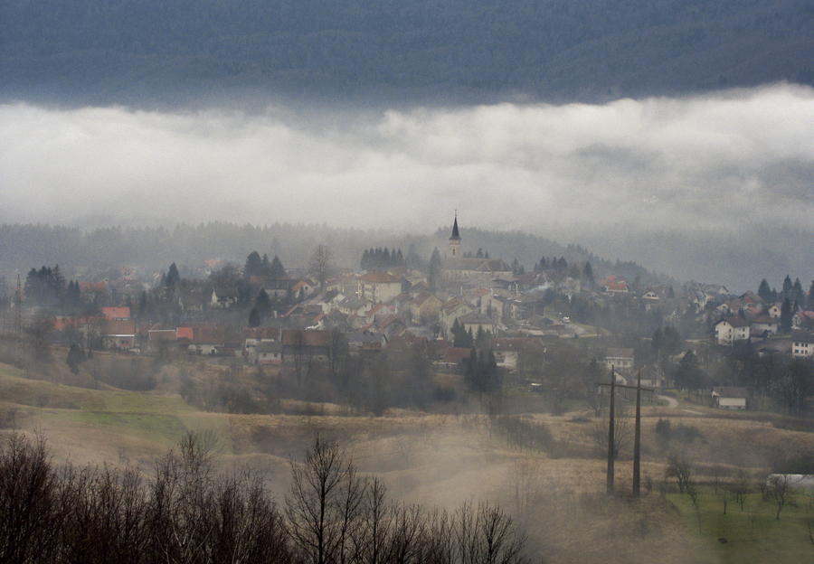
Vrbovsko
- Route
-
Restoran Kamačnik0.0 kmMedina marimba0.8 kmKamačnik3.1 kmKobeljak (954 m)20.9 kmSladivojka (946 m)22.3 kmSladivojka (906 m)22.5 km
- Best season
-
JanFebMarAprMayJunJulAugSepOctNovDec
- Description
-
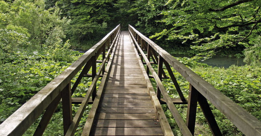
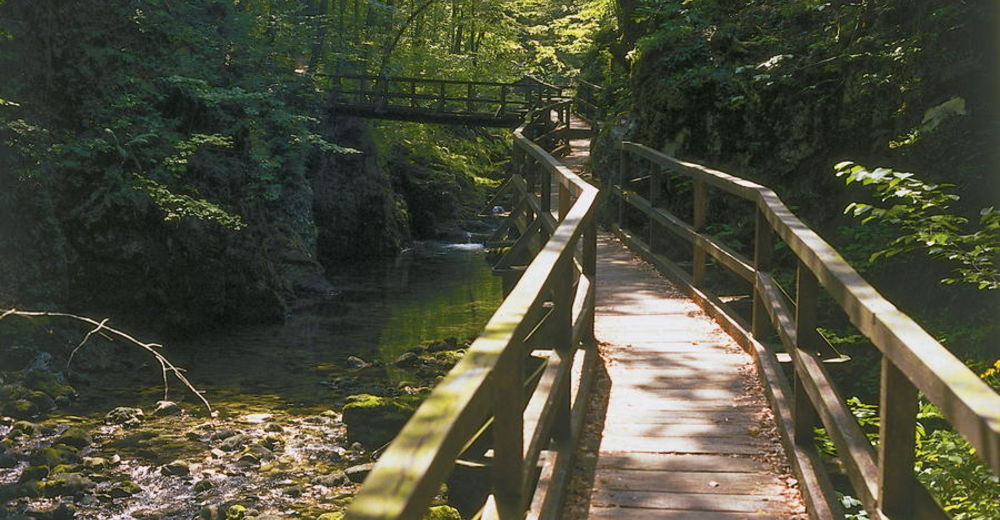
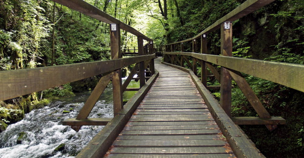
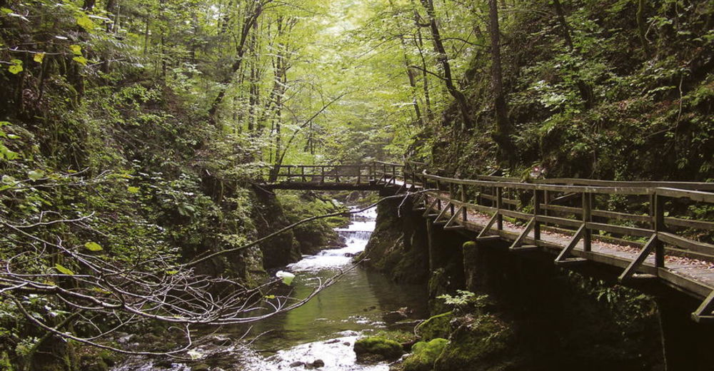
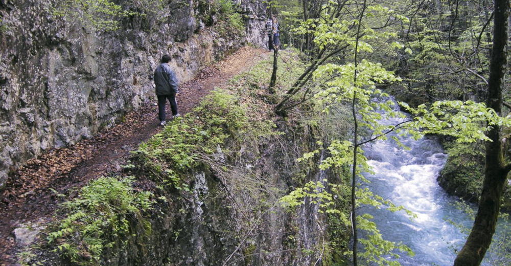
Trail markings taking hikers on a tour of Kamačnik and on the path towards Klek begin in the center of Vrbovsko. The route first briefly descends to the Vrbovsko railway station. We then cross the railway track (caution required due to poor visibility!), and soon reach a fishing hut (in fact a restaurant) at the confluence of the rivers Kamačnik and Dobra (10 minutes of hiking away from the railway station). This is where the tourist path through the canyon of Kamačnik begins. It takes us through a mix of sections along the edge of the rock, wooden galleries and bridges crossing from one side of the canyon to another. Two viaducts of the Zagreb – Rijeka Motorway pass above the canyon at its narrowest part. Not long after that, the canyon widens into a valley, and the route branches into two options: to the left, there is a marked trail leading towards Klek (6 hours of hiking), and to the right there is a wooden bridge taking visitors to the left bank of Kamačnik, with 15 more minutes of hiking remaining to the source of the small river.
From this intersection (prior to the wooden bridge in Kamačnik), the markings leading towards Klek first ascend to a forest facility with a forest road leading to it. We hike along this road for a couple of minutes. After that, the climb continues along forest paths and skid trails, intersected by four more forest roads. Along the initial forest road, there is an intersection with signposts. The route proceeding straight leads towards Klek. The route to the right leads to a climb to the peak of Bijela kosa. The route towards Klek passes through forest for a long time. Due to numerous intersections with forest roads and paths in this large forest area, having a good map is definitely a must. The route from Vrbovsko to the mountain lodge at Klek is maintained as a section of the Gorski Kotar Hiking Trail (GPP), and the tour takes approximately 7 hours.
- Highest point
- 1,068 m
- Endpoint
-
Klek
- Height profile
-
 © outdooractive.com


-

-
AuthorThe tour Via Dinarica HR-G-04 From Kamačnik to Klek is used by outdooractive.com provided.


-
Gorski kotar
28
-
Vrbovsko
7