

- Brief description
-
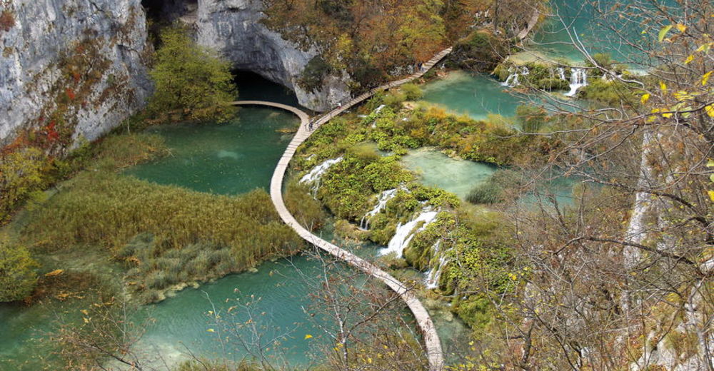
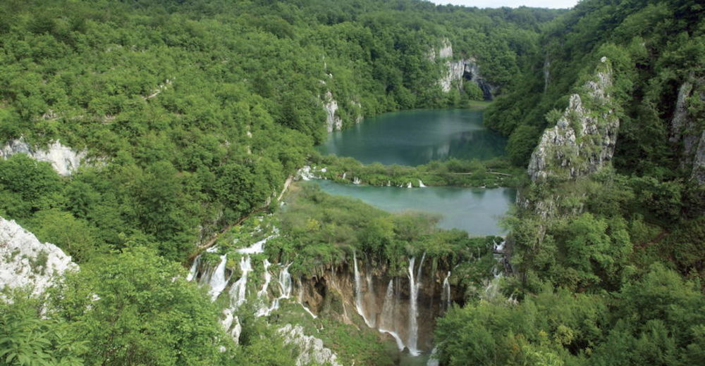
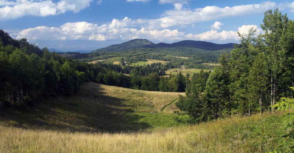
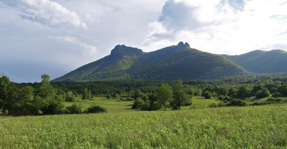
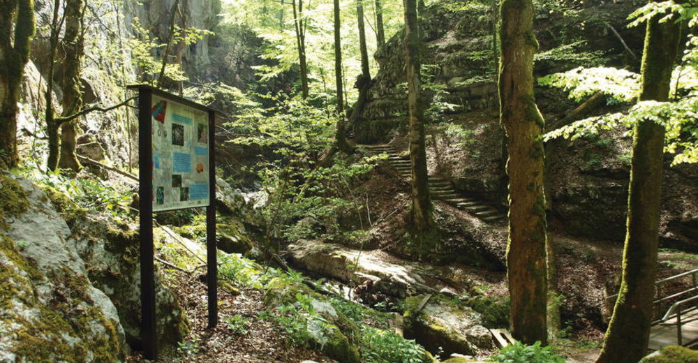
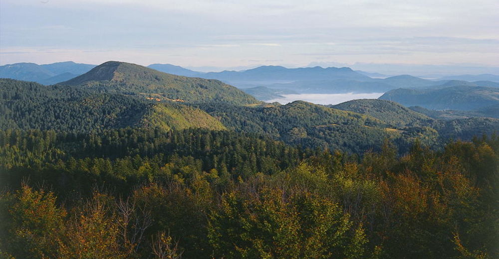
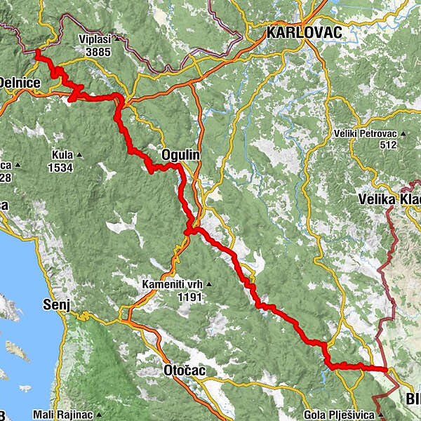
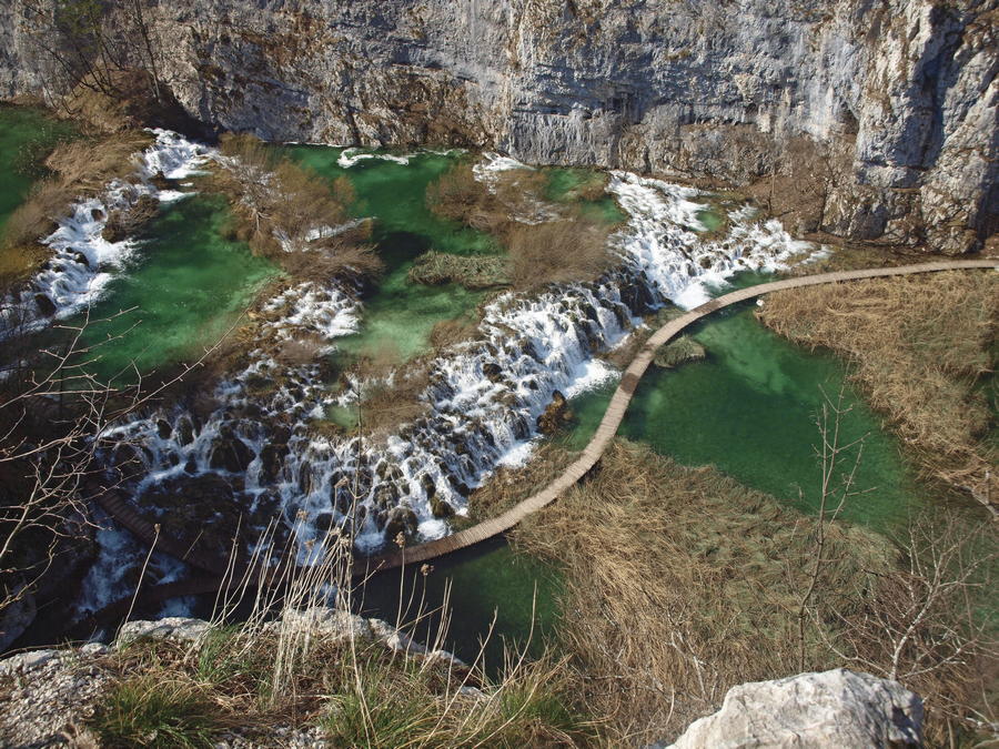
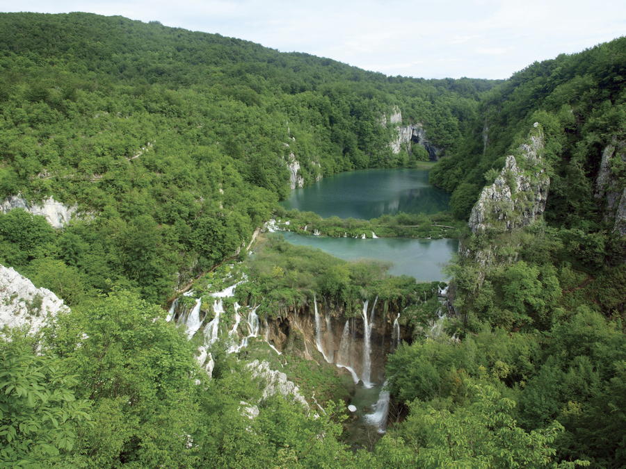
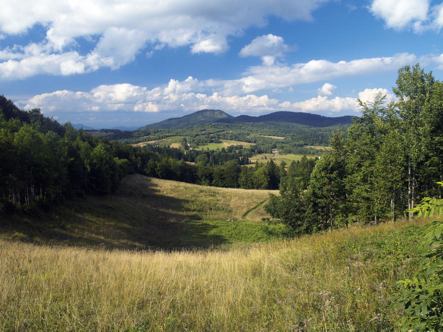
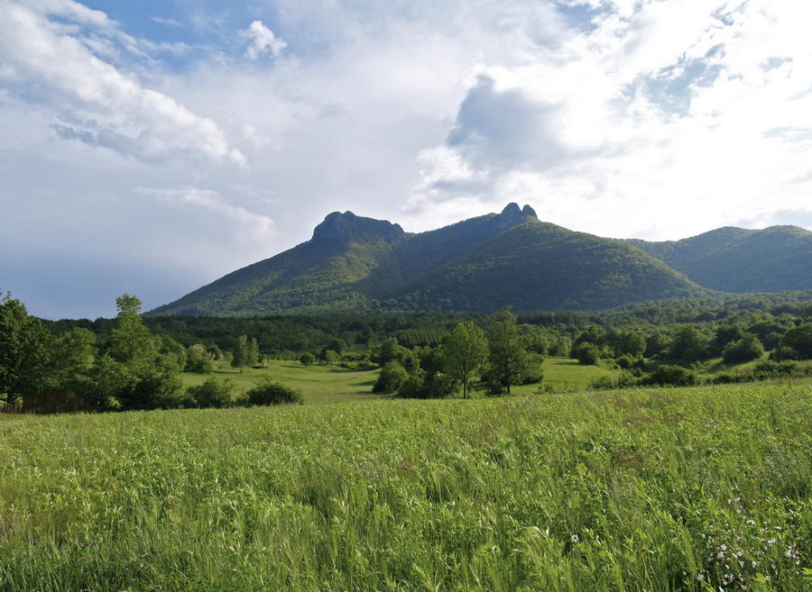
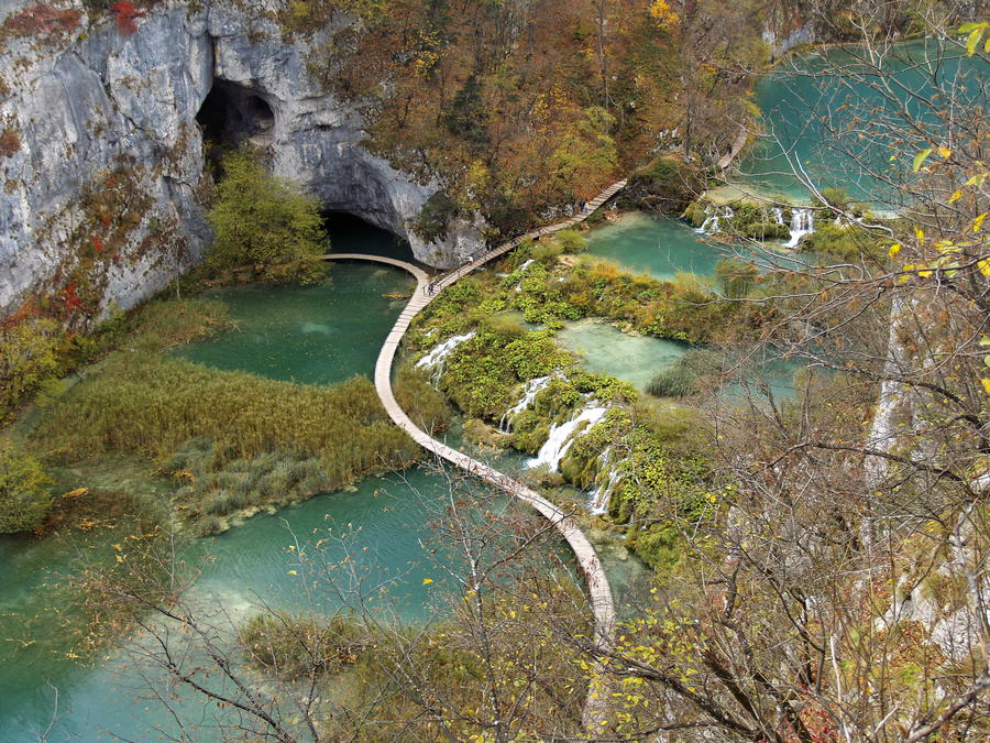
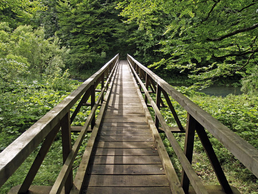
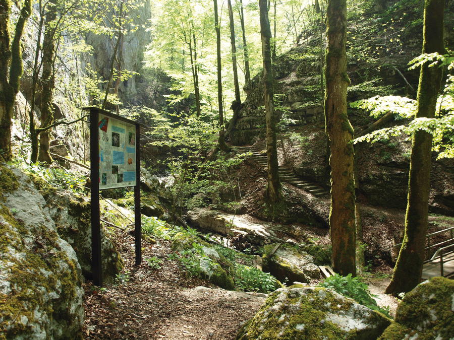
The Green Line of Via Dinarica offers an extraordinary opportunity to get acquainted with pristine green landscapes by taking a longitudinal tour of the continental area of the Dinarides. In Croatia, the Green Line connects hidden picturesque sites of the region of Gorski kotar with interesting and little known areas in the region of Lika from the city of Ogulin to Ličko Petrovo Selo. Particularly charming features of the Via Dinarica Green Line are mountain watercourses that create attractive canyons with numerous cascades and various hydrological phenomena on their way to the Sava River. The Green Line uniquely connects the Kupa River, small river of Iševnica at the site of Vražji prolaz, the source of the Dobra River at Skrad and its swallet at Ogulin, the source and the confluence of the small river of Kamačnik with the majestic water rhapsody of Plitvice Lakes and the initial meters of the Korana River. The Green Line also connects two biggest Croatian cascades – the cascade of the creek of Curak at Zeleni vir and the cascade of Plitvice at Plitvice Lakes. There are no demanding or very hard sections along the Green Line, and the longitudinal character of the route enables visitors to get acquainted with remarkably diverse mountain areas still unknown to many.
- Difficulty
-
difficult
- Rating
-
- Route
-
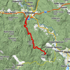
PetrinaMance0.1 kmBrod na Kupi0.3 kmKrivac0.7 kmIševnica1.7 kmVrh Brodski3.0 kmZeleni Vir7.2 kmHaus des Ehemanns8.0 kmSkrad10.4 kmSkrad11.1 kmVeliko Selce12.2 kmKavranova Stijena12.5 kmPodstena13.3 kmSkradski vrh (1,043 m)14.7 kmVidikovac14.9 kmHribac15.6 kmKicljev vrh (901 m)19.2 kmBijela Kicljeva jama20.3 kmKuća Javorova Kosa25.6 kmJavorova Kosa (1,016 m)25.7 kmRazgledna piramida25.8 kmBožji studenac26.2 kmcrkva svete Terezije Avilske28.0 kmRavna Gora28.8 kmRazgledna piramida29.2 kmKuća Javorova Kosa30.8 kmJavorova Kosa (1,016 m)31.0 kmVrh32.4 kmStara Sušica36.2 kmLisina37.7 kmJablan39.0 kmVrbovsko44.5 kmRestoran Kamačnik45.3 kmMedina marimba46.0 kmKamačnik48.3 kmKobeljak (954 m)65.9 kmSladivojka (946 m)67.3 kmSladivojka (906 m)67.5 kmBjelsko (620 m)70.9 kmKlek (1,181 m)74.1 kmMountain hut Klek (1,000 m)74.8 kmKneja78.7 kmFranjkovac79.4 kmSabljak Selo85.5 kmIVE85.6 kmSalopeki86.1 kmVučići88.3 kmRibarići88.4 kmZagorje89.9 kmLuketići90.8 kmGornje Zagorje92.2 kmDonje Zagorje93.0 kmDonji Puškarići93.4 kmLug95.5 kmAntončići96.9 kmModruš97.3 kmPalijani97.7 kmCrkva Sv. Antuna pustinjaka98.0 kmGornji Gašparovići99.1 kmDonji Keseri100.8 kmCrkva Sv Nikola101.8 kmDonji Gašparovići103.5 kmSabljaki Modruški105.6 kmBocino Brdo107.1 kmVukasi107.4 kmRakić Brdo109.1 kmRt109.3 kmLatmanovići109.5 kmBocina Draga109.6 kmKunić111.0 kmKlipe111.3 kmRadojčić Brdo111.8 kmMeđeđak112.8 kmSaborna crkva Vavedenja Presvete Bogorodice114.8 kmPlaški114.9 kmPlaški115.4 kmVera117.2 kmŠupice117.7 kmGradina (635 m)119.3 kmVršak (778 m)121.6 kmBlata123.1 kmGrbe123.3 kmBegovac126.0 kmVezmari126.5 kmLička Jesenica130.5 kmSaborsko134.9 kmFuntana136.9 kmPanjići137.5 kmDonja Biljevina138.6 kmBiljevina138.9 kmGornja Biljevina139.3 kmKuselj141.2 kmSertić Poljana145.2 kmPoljanak149.0 kmPansion Mila149.2 kmRestaurant149.4 kmGreat Waterfall151.7 kmSastavci151.7 kmSastavci151.8 kmBig cascades152.2 kmSlap Milke Trnine152.4 kmMilanovački slap153.0 kmPlitvička Jezera155.6 kmMedvjeđak oštri160.7 kmZaklopača167.4 kmLičko Petrovo Selo169.0 km
- Best season
-
JanFebMarAprMayJunJulAugSepOctNovDec
- Description
-
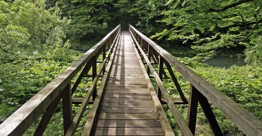
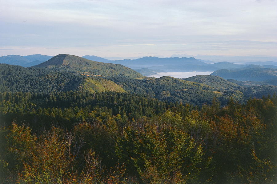
The Green Line enters Croatia at the settlement of Brod na Kupi, bypassing the course of the small river of Iševnica and following the Gorski Kotar Hiking Trail through Vražji prolaz towards Skrad. From Skrad to Ravna Gora, there is an interesting path leading across Skradski vrh, overlapping in its final section with part of the route of Ravna Gora Hiking Trail. The area from Ravna Gora to Vrbovsko abounds in amazingly picturesque landscapes, and the main travel route in the area is provided by the ancient Karolinska Road linking the two settlements (18 kilometers). In the section from Kamačnik to Klek, passing along the edges of Velika Kapela, the Green Line again follows the route of Gorski Kotar Hiking Trail.
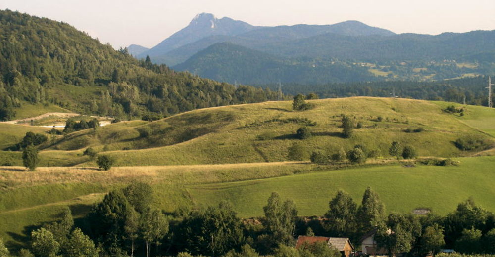
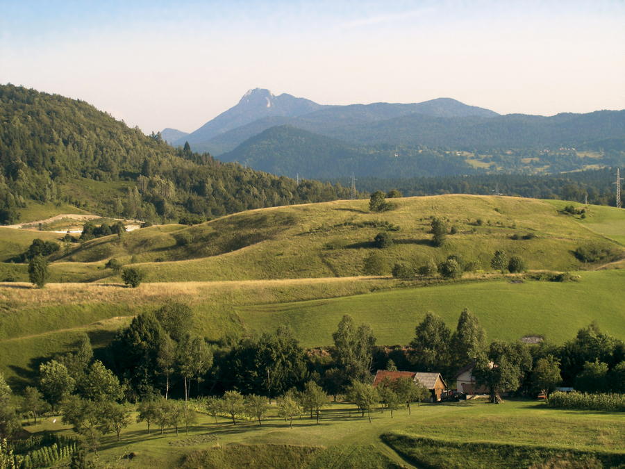
From Klek, the Green Line descends to Ogulin, and then it bypasses the lake of Sabljaci and the hill fort of Modruš. The trail continues southwards along Plaščanska dolina and across Plaški, Lička Jesenica and Saborsko all the way to the Plitvice Lakes National Park. In a long section south of Ogulin to Plitvice Lakes, there is no adequate hiking or tourism infrastructure for the time being. However, a section of the E-6 European Long-Distance Path is expected to be marked in the area in the future, which should improve the situation. The route in this zone predominantly consists of roads, and key values include extraordinarily picturesque landscapes and nature preserved in its pristine form. The Plitvice Lakes National Park is a unique and globally recognizable natural area. After the Plitvice Lakes, the route of the Green Line continues across Ličko Petrovo Selo to Bosnia and Herzegovina, where it proceeds towards the zone of the Una River.
- Highest point
- 1,092 m
- Height profile
-
 © outdooractive.com

-

-
AuthorThe tour Via Dinarica in Croatia - Green line - HR-G is used by outdooractive.com provided.


-
Ogulin
5