Running trail near Soběšice with ascend to the lookout tower Ostrá Horka


- Brief description
-
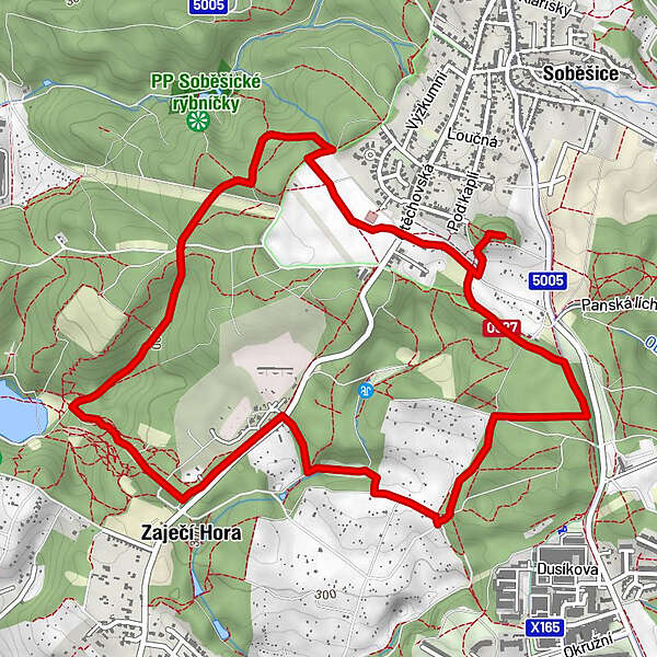
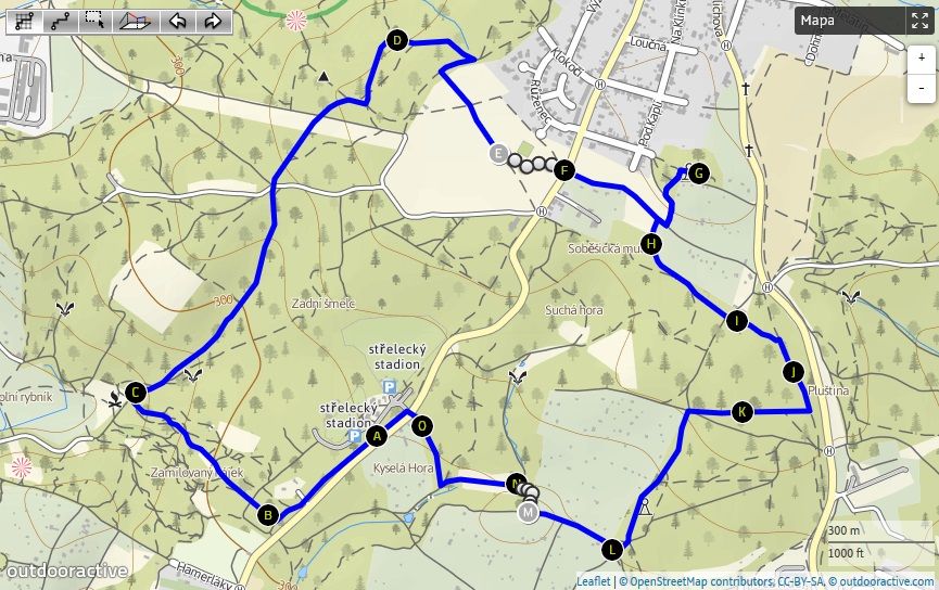
From the parking lot, it goes south-west. After 300 meters, the footpath turns to the right, followed by a 600-meter-long downhill with the groves on footpaths that partially serve bikers to wild rides. Below the hill, the route joins the yellow marked path. Turn right again. Ca. 1100-meter-long ascend with an elevation of about 110 meters will take us back to the plateau around Soběšice. From the yellow you have to turn right as we reach the upper edge of the forest. Climb the last meters on footpath and turn to the meadow beneath the village. On the meadow, turn left at the tennis courts and cross the road behind the meadow. Continue on the path heading to the top of Ostrá Horka with a view tower. The last part of the ascend follows a steep path. On the top, step 90 stairs to the upper platform of the lookout tower. We return back a bit along the same path - steep slope down and then turn left into the forest above Soběšická Mulda. We run through the forest above Lesna and among the gardener's colonies. After the course between the gardens, we turn along the fence on the right and descend into the valley with a little stream. It is followed by a meadow and a forest path, to which we turn right, before we reach another gardening colony. After the exit to the road we are already in the sight of the place from which we started - just 150 meters to run on the parking lot in front of Soběšice shooting range. For a fast afternoon training is quite sufficient.
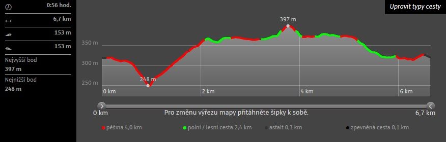
- Highest point
- 397 m
- Endpoint
-
Parkovisko pred strelnicou v Soběšiciach – Poľovnícky štadión
- Height profile
-
 © outdooractive.com
-

-
AuthorThe tour Running trail near Soběšice with ascend to the lookout tower Ostrá Horka is used by outdooractive.com provided.