"alpannonia" - feeder road: St. Kathrein am Hauenstein - Hauereck


- Brief description
-
From the UNESCO World Heritage Site Semmering or from the high altitude health resort Fischbach to the edge of the Pannonian plain near Köszeg, a path full of variety and attractions of nature leads: alpannonia®.
But it is also no problem if you want to start the trekking tour in the village of St. Kathrein am Hauenstein. From there the tour leads up to the Hauereck, where you can join the alpannonia trail. Also then you can call yourself an "alpannonier".
- Difficulty
-
medium
- Rating
-
- Starting point
-
Village center St. Kathrein am Hauenstein
- Route
-
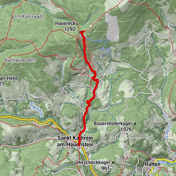
Sankt Kathrein am HauensteinBergbausiedlung1.9 kmHauereckschutzhütte4.0 kmHauereck (1,292 m)4.0 km
- Best season
-
JanFebMarAprMayJunJulAugSepOctNovDec
- Description
-
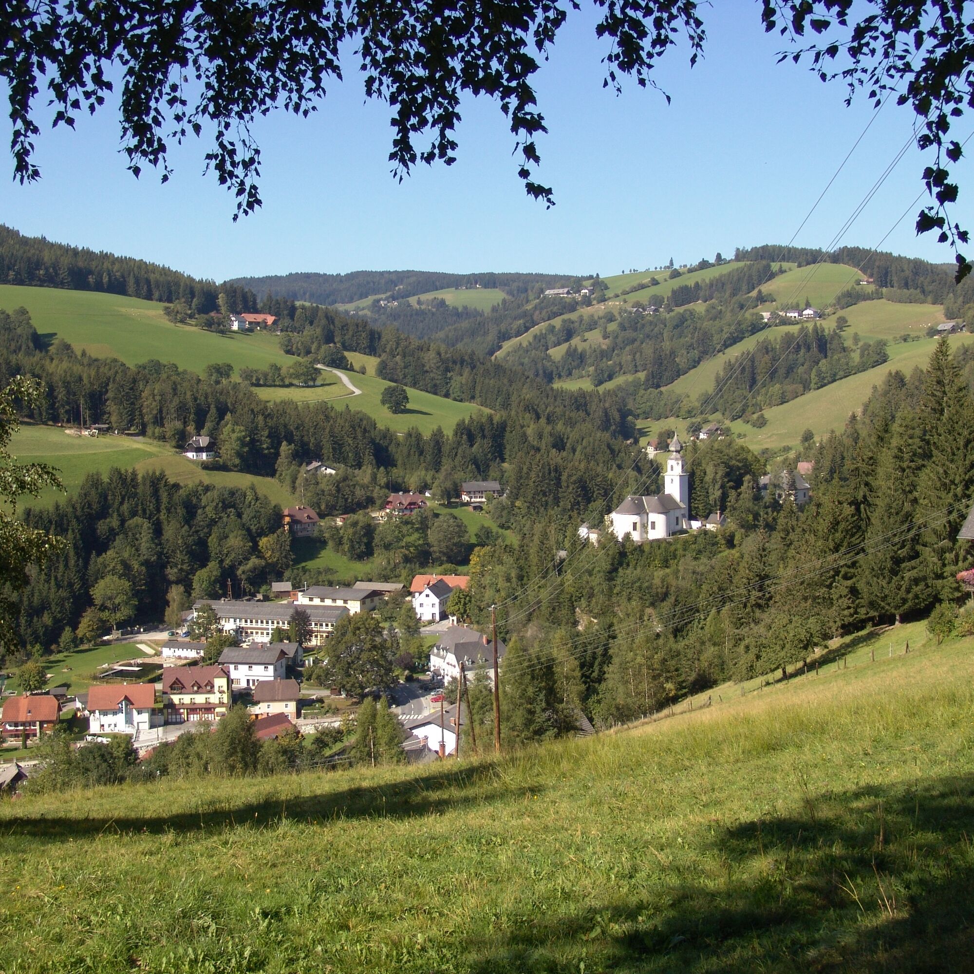
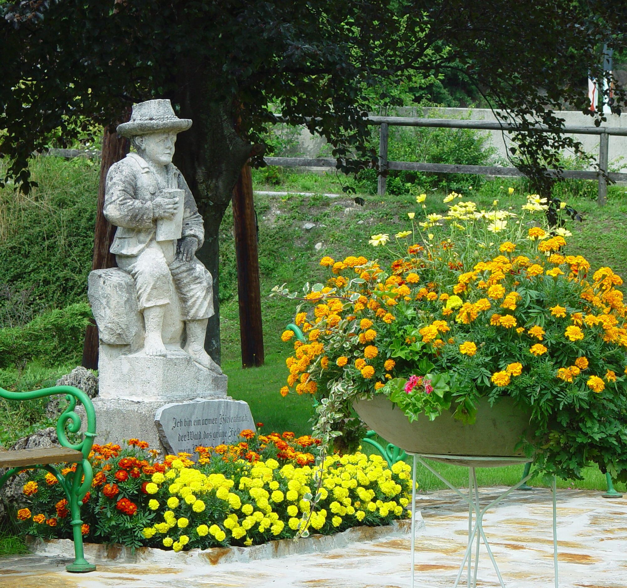
"I have seen the Cologne and Milan cathedrals and St. Peter's Church in Rome, but I have never found the sweet heavenly atmosphere as in the white, bright little church at Kathrein am Hauenstein" - this is what Peter Rosegger wrote about his favorite church in St. Kathrein am Hauenstein.This is exactly where the stage to the Hauereck starts, in the municipality of St. Kathrein am Hauenstein in Peter Rosegger's forest home. If you want to learn more about the life of the East Styrian poet, this is also the right place. In a great atmosphere in the culture house there is a permanent exhibition about Peter Rosegger.
Especially in winter St. Kathrein am Hauenstein is worth a visit, because the Christmettenweg leads from the Alpl to the village. Peter Rosegger also made his way along this path on the Holy Night to the Mette. Another winter highlight is the Hauereck ski resort. Here fun on the slopes is guaranteed for everyone.
- Directions
-
We start in the village center of St. Kathrein
We hike on trail no. 736 along the Zeilbach stream to the Willenshofer lift inn in the mining area.
We continue on trail no. 736 to the Hauereck mountain hut. - Highest point
- 1,301 m
- Endpoint
-
Hauereck hut on the Hauereck mountain
- Height profile
-

- Equipment
-
Small backpack with water bottle (+ provisions)
Sturdy shoes
Appropriate clothing - if possible several layers - "onion principle".
Rain and sun protectionWalking sticks as required
Mobile phone
Small first aid kit
Route description
Before starting the hike, check the possibilities for refreshments, including opening times, or pack appropriate food and drink.
- Safety instructions
-
European emergency call: 112
Emergency call mountain rescue: 140 (if possible please provide GPS data)
Rescue: 144
Fire brigade: 122
Police: 133
A few tips on correct and fair behaviour in the forest: (Source: www.bundesforste.at )
Hikers should avoid visits to the forest about 1.5 hours before sunrise and after sunset, as wild animals are particularly active during this time.
Plastic bottles, handkerchiefs, cigarette butts etc. have no place in the forest! Please make sure that you do not leave any rubbish in the forest.
Camping and lighting fires are strictly forbidden in the forest!
In principle, every person is allowed to pick 2 kg of mushrooms and berries per day for personal use. It is only prohibited if the forest owner expressly forbids it.
- Tips
-
Visit the Peter Rosegger exhibition in St. Kathrein am Hauenstein or the favorite church of the local poet.For all long-distance hikers, the alpannonia trail also offers a 6-day tour from Fischbach to Köszeg.
- Additional information
- Directions
- Public transportation
- Parking
-
Parking spaces in the municipality of St. Kathrein am Hauenstein


- Author
-
The tour "alpannonia" - feeder road: St. Kathrein am Hauenstein - Hauereck is used by outdooractive.com provided.