- Brief description
-
Great mountain tour to the Remsteinkopf, where you can stop at the Bichlalm - the panorama is magnificient.
- Difficulty
-
medium
- Rating
-
- Starting point
-
Parking lot Finsterwald farm
- Route
-
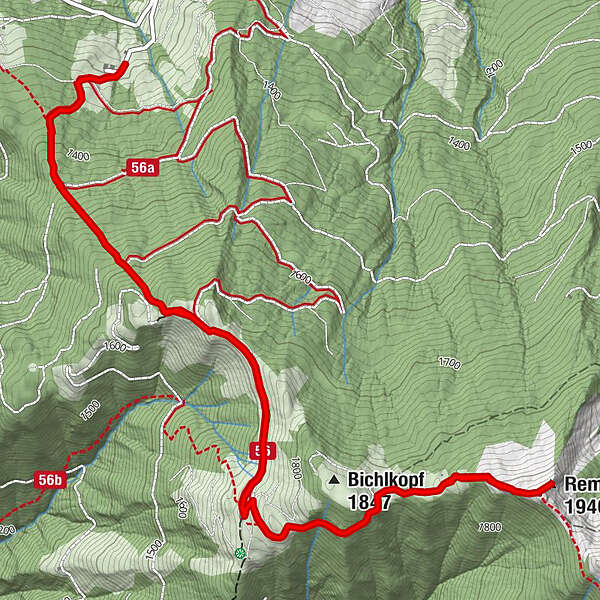
Bichlalm2.7 kmRemsteinkopf (1,946 m)4.4 kmBichlalm6.2 km
- Best season
-
JanFebMarAprMayJunJulAugSepOctNovDec
- Description
-
There are several ways to get to the Bichlalm: The easiest starts in the Ellmautal valley above the Hotel Lammwirt. It is a very leisurely walk along the goods road through the forest to the Bichlalm. Another option is to start directly from the centre of Grossarl via the Europatisch. And the sportier option, which we have chosen for this tour suggestion, goes from the Finsterwald farm via the Himmelsleiter to the Bichlalm. The Himmelsleiter leads through the forest and is very steep in places. Once you reach the top of the forest road, you need to pause for a moment, as the panorama up there is like something out of a picture book. Continue along the forest track to the Bichlalm.
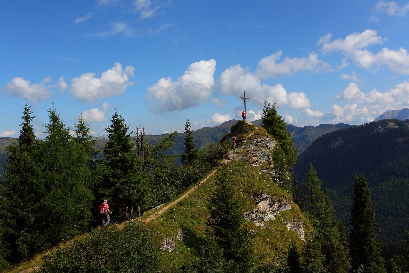
Continue uphill along a beautiful hiking trail to the Remsteinkopf. You must be free from giddiness for the last few metres to the cross, as the trail descends relatively steeply on the right-hand side towards Buchbachkar. The view from up here is simply unique. In autumn in particular, you may even spot deer or roe deer or hear a stag "rutting" (=roaring), as the Buchbachkar is one of the areas with the most game in our valley. Return along the same route. At the Bichlalm you can fortify yourself with a tasty alpine snack before returning to the starting point of the tour.
- Directions
-
Drive along the street of Ellmau - take the first right onto the Thalgau goods road, continue to the Finsterwald farm, where you can park your car. Ascent to the Bichlalm via the steep forest path "Himmelsleiter" (No. 56) to the forest road. Continue along the forest road to the Bichlalm, 1,731 m (approx. 1 3/4 h). Continue along trail no. 56 to the Remsteinkopf, 1,945 m (approx. 1 h). Descent on the same path back to the starting point (approx. 1 1/2 h).
- Highest point
- 1,933 m
- Endpoint
-
Remsteinkopf
- Height profile
-

- Equipment
-
Hiking boots with treaded soles, hiking map, rucksack with provisions, water bottle and first aid pack
- Safety instructions
-
The last few metres up the Remsteinkopf require a head for heights.
- Tips
-
The high-altitude hike from the Bichlalm and the Remsteinkopf via the Stangersattel, the Filzmooshörndl and the Filzmoosalm is a particularly beautiful tour.
- Additional information
- Arrival
-
You go by or hiking taxi to the Ellmautal and further on the Güterweg Thalgau on the right hand-side to the FInsterwald farm.
- Public transportation
- Parking
-
parking at Finsterwald farm


- Author
-
The tour Grossarl: Bichlalm - Remsteinkopf is used by outdooractive.com provided.