- Brief description
-
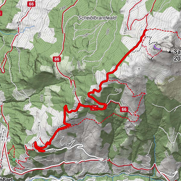
Hiking tour to the Saukaralm, which is one of the most beautiful view points in Grossarltal.
- Difficulty
-
medium
- Rating
-
- Starting point
-
Parking lot Vorderstadluck
- Route
-
Saukaralm3.9 km
- Best season
-
JanFebMarAprMayJunJulAugSepOctNovDec
- Description
-
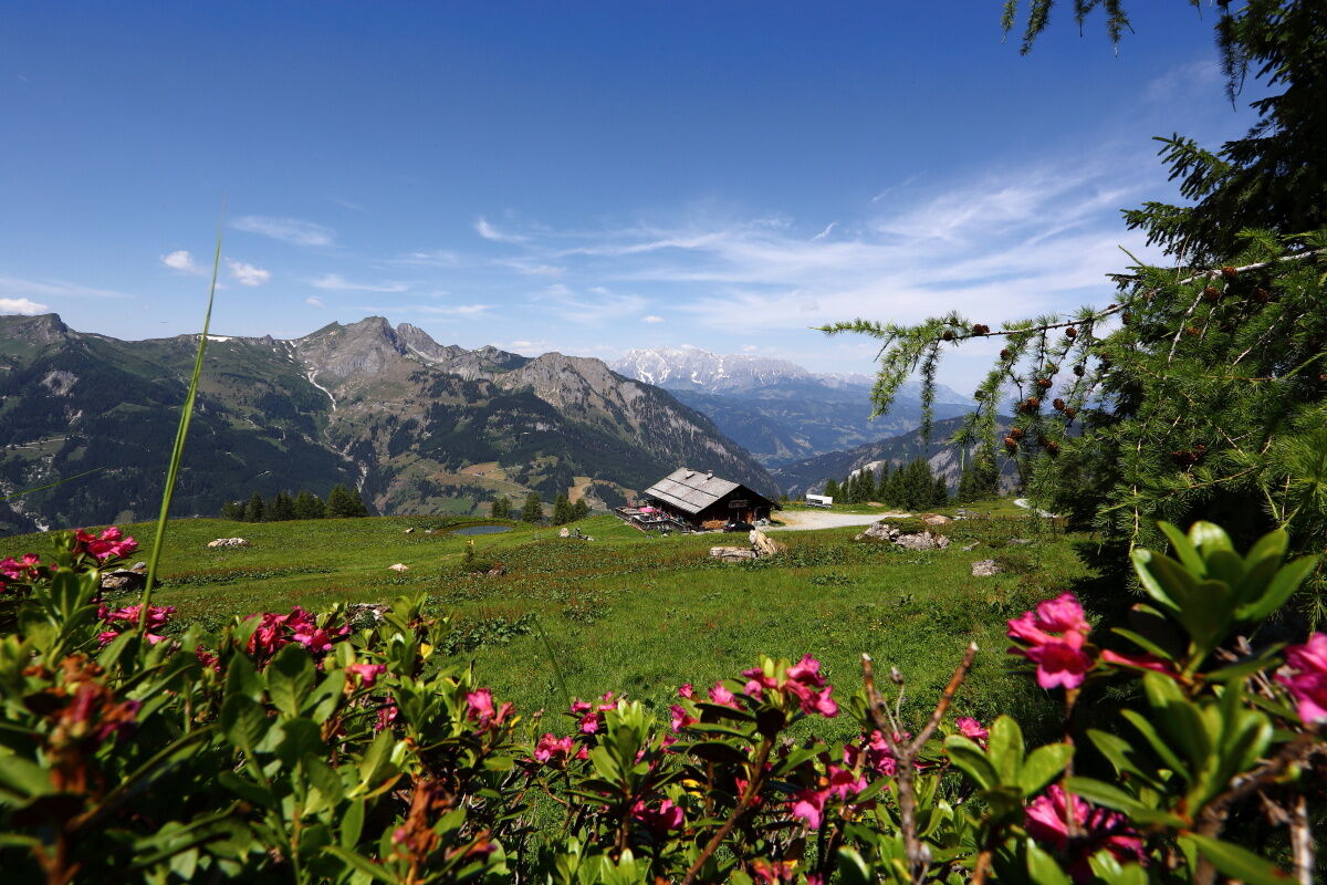
Go by car or hiking taxi to the parking lot Vorderstadluck and than walk up, past the Röschenbergalm (not managed) across beautiful alpine meadows to the Saukaralm. This is the highest mountain hut in Grossarltal. The view from here is simply unique. The Hohe Tauern, the Hochkönig and the Tennengebirge and Hagengebirge mountains make this alp one of the most beautiful vantage points in Grossarltal. If you are a little later on your way, you should definitely watch the sunset on the Saukaralm. Sunsets here are particularly impressive thanks to the unobstructed views to the south, west and north.
Other options:
From the centre of Grossarl, you can hike via Hertas Rast to the parking lot Vorderstadluck and up to the Saukaralm. Ascent by car or hiking taxi via the Sonneggweg to the parking lot Saukaralmweg. From there you can reach the Saukaralm via a forest path. - Directions
-
Ascent by car or hiking taxi to the parking lot Vorderstadluck (Alternatively: Ascent via Hertas Rast (trail no. 17, approx. 1 h). Ascent on trail no. 65 (or 65A via the Gerstreitalm, 1,575 m) to the Saukaralm, 1,850 m (approx. 1 h from the Gerstreitalm or approx. 2 h from the Vorderstadluck car park).
Alternative: parking lot Saukaralmweg
Go by car or hiking taxi via the Sonneggweg to the parking lot Saukaralmweg. From here, follow the forest road (trail no. 65B) to the Saukaralm, 1,850 m (approx. 2 1/2 h).
- Highest point
- 1,819 m
- Endpoint
-
Saukaralm
- Height profile
-

- Equipment
-
hiking boots with grip sole, hiking map
- Tips
-
Sunsets are really impressive on the Saukaralm.
- Additional information
- Directions
-
You go by car or public bus no. 540 into the village center of Grossarl (and further on the Sonnseitweg to the Vorderstadluck farm) OR you go on the Sonneggweg in the district of Au just before the Sonneggbrücke. Or go by car or hiking taxi via the Sonneggweg to the parking lot Saukaralmweg.
- Public transportation
- Parking
-
Parking lot Vorderstadluck, parking lot next to the Viehhauser petrol station or parking lot Saukaralmweg
- Author
-
The tour Grossarl: Saukaralm is used by outdooractive.com provided.