
- Brief description
-
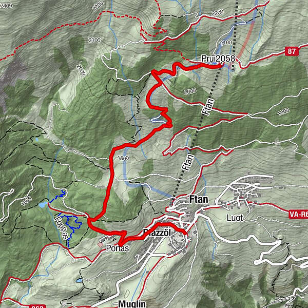
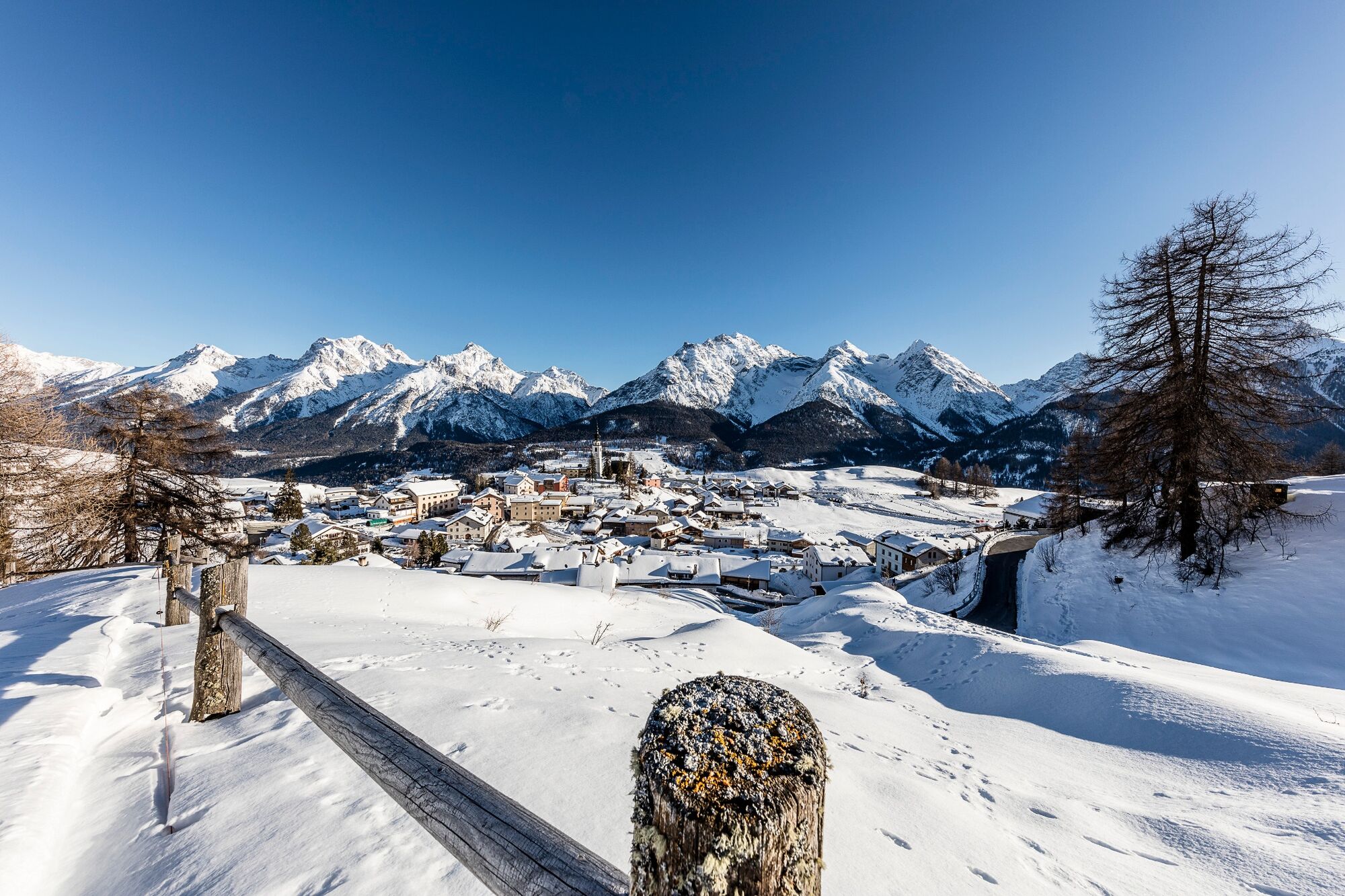
Descending tour from the Prui mountain station to the Engadine mountain village of Ftan.
- Difficulty
-
easy
- Rating
-
- Starting point
-
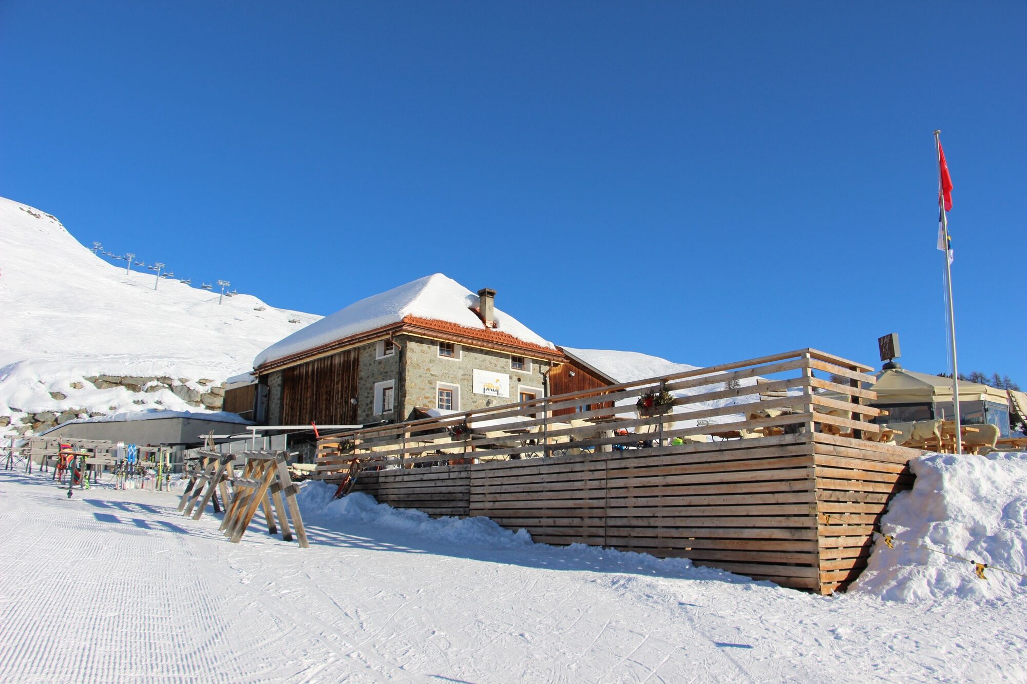
Prui mountain station
- Route
-
Prümaran PruiPlazzöl3.5 kmFetan (1,648 m)3.8 km
- Best season
-
AugSepOctNovDecJanFebMarAprMayJunJul
- Description
-
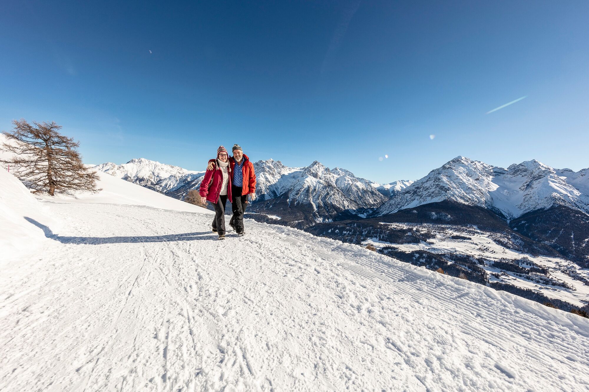
The short winter hike starts at the mountain station of the Ftan-Prui chairlift. Alternatively, you can also choose the ascent from the Scuol valley station with the gondola lift to Motta Naluns. From there it is two kilometres to Prui. At Prui there is a mountain restaurant with a sun terrace and a magnificent panoramic view of the Lower Engadine mountains.
This view accompanies us on the approximately four kilometres down to the mountain village of Ftan, alternating between open terrain and short, partly steep forest sections. At the beginning of the village, you pass the High Alpine Institute before descending and finally reaching the PostBus stop Ftan cumün or back to the valley station of the chairlift.
- Directions
-
Top station of the chairlift Ftan-Prui
Direction of the mountain restaurant
follow the toboggan run for a short distance
follow the signs to Ftan
- Highest point
- 2,060 m
- Endpoint
-
Ftan, cumün
- Height profile
-
 © outdooractive.com
 - Equipment
-
High and sturdy hiking boots or winter boots, warm clothing, sun cream, sunglasses, sunscreen, hiking poles.
- Safety instructions
-
The trail is groomed after each snowfall. Please note the condition reports in the winter sports report. The tour was assessed in favourable weather conditions, current snow and weather conditions must be noted before starting.
Emergency call:
144 Emergency call, first aid
1414 Mountain rescue REGA
112 International emergency call
- Tips
-
In Ftan, it is worthwhile to allow enough time and walk through the beautiful Engadine village, from fountain to fountain.
- Additional information
- Directions
-
- From the north: via Landquart - Klosters by car transport through the Vereina Tunnel (Selfranga - Sagliains) or via the Flüela Pass into the Lower Engadine on H27.
- From the east: via Landeck / Austria in the direction of St. Moritz on H27
- From the south: via Reschenpass (Nauders-Martina) or Ofenpass (Val Müstair-Zernez) on H27
- Ftan is situated on a sunny terrace and can be reached in 10 minutes by car from Ardez or Scuol on the Engadine road H27
- Public transportation
-
- By Rhaetian Railway (from Chur, Prättigau or Oberengadin) hourly to Scuol-Tarasp, direct PostBus connection to Ftan, cumün
- By PostBus (from Tarasp or Martina) hourly to Scuol-Tarasp, direct PostBus connection to Ftan, cumün
- With the chairlift Ftan-Prui to the mountain station Prui
- Parking
-
- Paid parking at the valley station of the chairlift Ftan-Prui
- Author
-
The tour Prui – Ftan is used by outdooractive.com provided.


General info
-
Engadin Scuol Zernez
109
-
Ftan
36