- Brief description
-
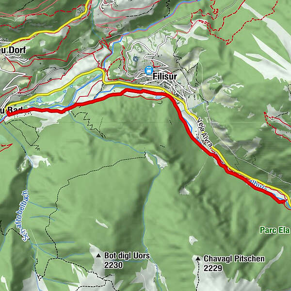
Winter hike Albula valley
- Starting point
-
Filisur
- Route
-
Filisur (1,032 m)3.0 kmZinols Isla5.6 kmAlvaneu Bad (957 m)6.0 km
- Best season
-
AugSepOctNovDecJanFebMarAprMayJunJul
- Description
-
Winter hiking path along the charming mountain stream Albula from Bellaluna to Alvaneu Bad.
- Directions
-
The trail starts in Bellaluna and leads along the Albula to Alvaneu Bad.
- Highest point
- 1,084 m
- Endpoint
-
Alvaneu Bad
- Height profile
-
 © outdooractive.com
 - Tips
-
Catering in the bistro Bognin in Bad Alvaneu

- Author
-
The tour Bellaluna – Filisur – Alvaneu Bad is used by outdooractive.com provided.
GPS Downloads


Other tours in the regions
-
Bergün Filisur
158
-
Filisur
55