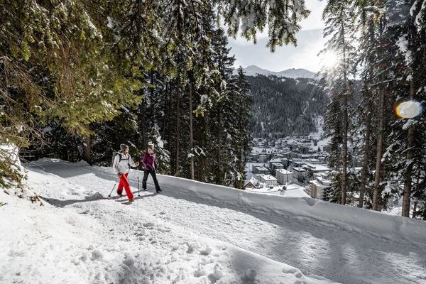
- Brief description
-
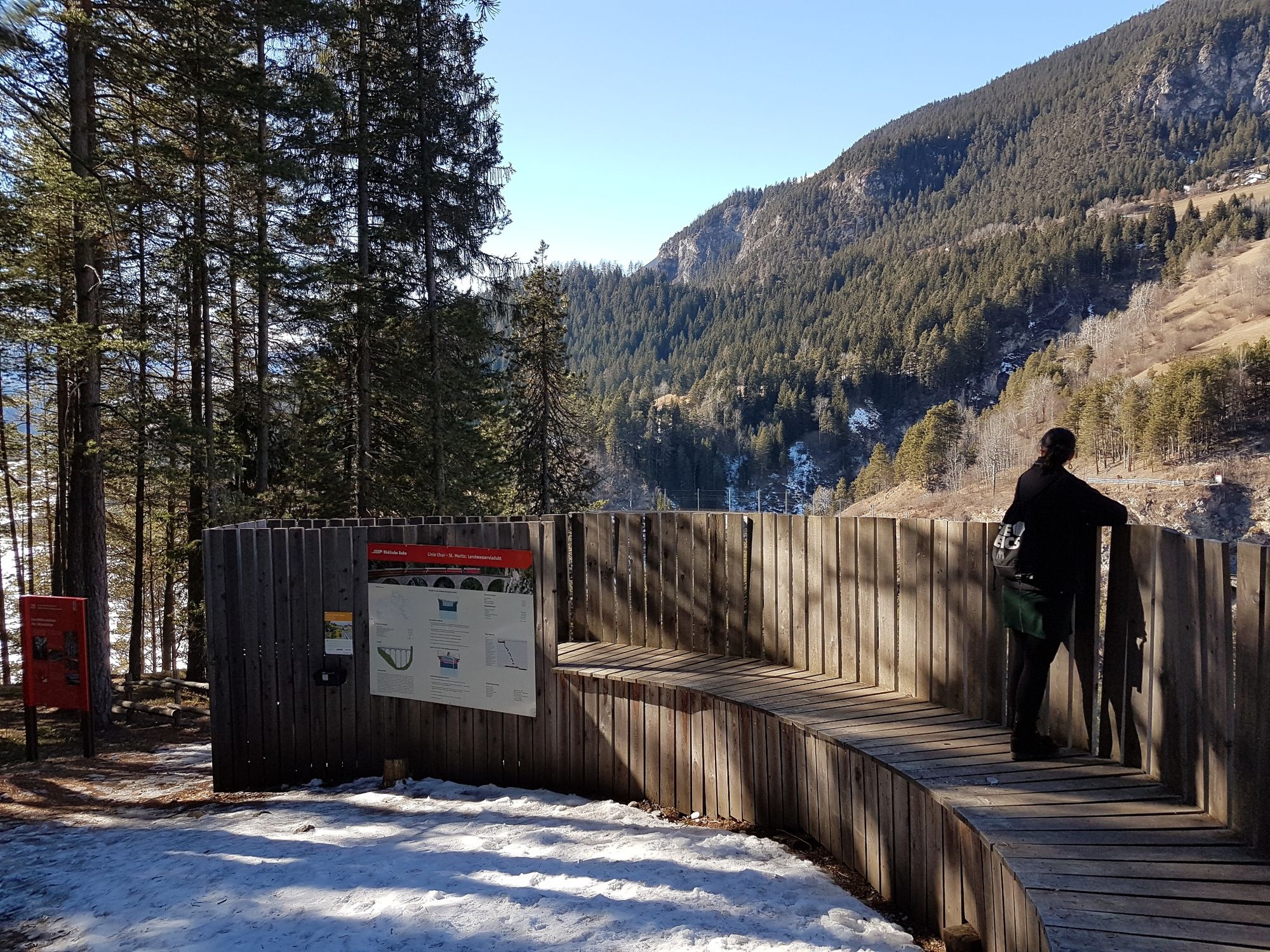
Pleasant winter hike through snowy forests to a viewing point with a dizzying view of the famous Landwasser Viaduct and down below to the Landwasser River. Take the same route back with firm ground underfoot.
- Difficulty
-
easy
- Rating
-
- Route
-
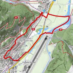
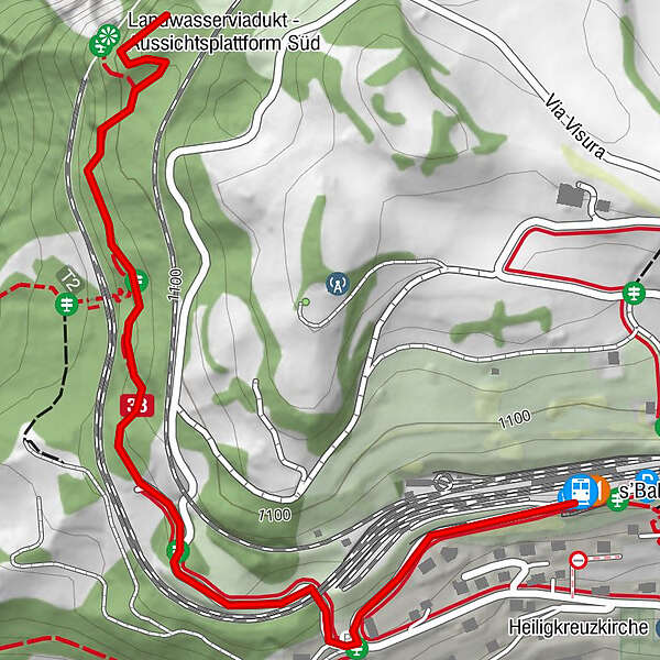
Filisur (1,080 m)s'BahnhöfliLandwasserviadukt - Aussichtsplattform Süd1.1 km
- Best season
-
AugSepOctNovDecJanFebMarAprMayJunJul
- Description
-
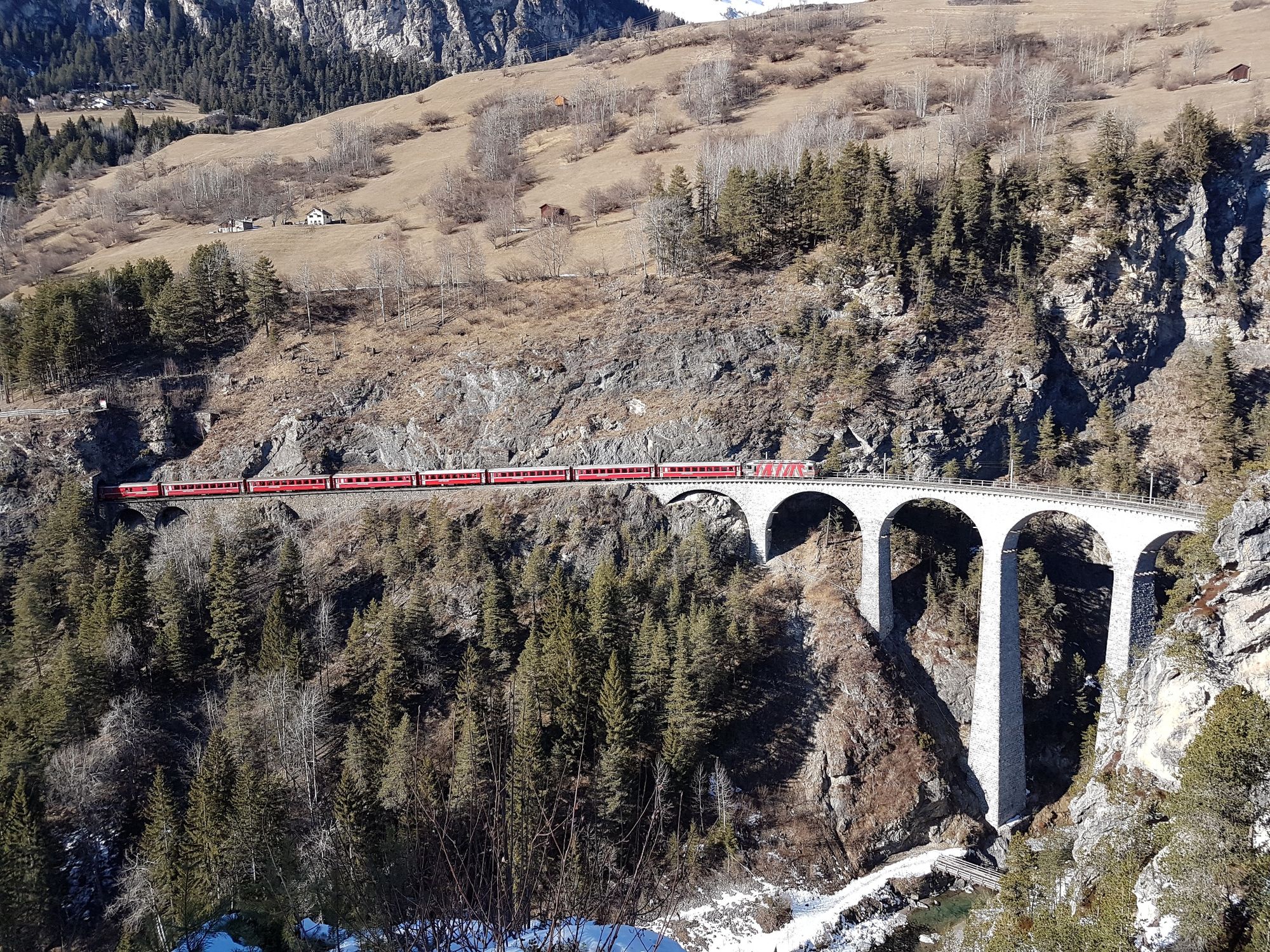
This short hike takes you from the Filisur train station along the road to the second railway underpass. The route then follows the railway line and goes through the forest to the viewing platform above the Landwasser Viaduct. From there you have a great view of the structure. Information panels provide information about the construction of the viaduct, which is regarded as a highlight of the UNESCO "Rhaetian Railway in the Albula / Bernina Landscapes" World Heritage site. The construction of the three main pillars of the viaduct in 1901/1902 was an architectural masterpiece, because they were built with the aid of 2 cranes but without a scaffold.
On every full hour you have the opportunity to take a photo of the Rhaetian Railway train as it crosses the 142m long and 65m high bridge and disappears into or emerges from the tunnel in the vertical rock face. You follow the same route on your way back to Filisur.
- Highest point
- 1,092 m
- Endpoint
-
Filisur
- Height profile
-
 © outdooractive.com
 - Directions
-
By car to the train station Filisur
- Public transportation
-
With the Rhaetian Railway to Filisur
- Parking
-
Large parking lot at the train station Filisur
- Author
-
The tour 215 Landwasser Viaduct Trail is used by outdooractive.com provided.


General info
-
Bergün Filisur
158
-
Filisur
55