- Brief description
-
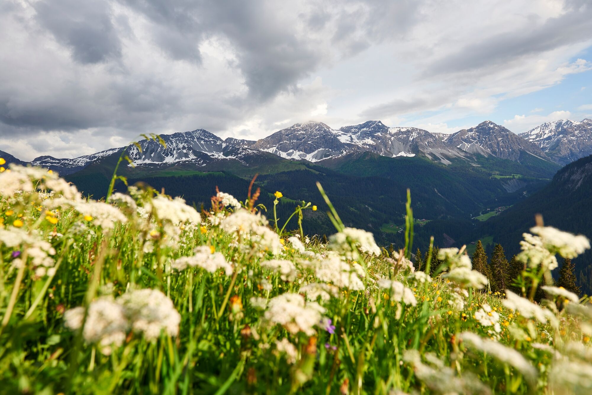
This is a real insider tip: the hike starting in Langwies promises impressive views of the valley and the tranquillity of nature.
- Difficulty
-
medium
- Rating
-
- Starting point
-
Langwies Train Station
- Route
-
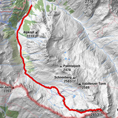
Langwies (1,317 m)0.0 kmReformierte Kirche0.5 kmLangwies (1,373 m)0.5 kmAn der Alpa6.2 kmBlackter Fürggli (2,140 m)7.3 kmCampadiel8.4 kmPirigen (1,773 m)9.7 kmPlatz10.3 kmBrochnen-Gada10.7 kmLangwies (1,373 m)11.8 kmReformierte Kirche11.9 kmLangwies (1,317 m)12.4 km
- Best season
-
JanFebMarAprMayJunJulAugSepOctNovDec
- Description
-
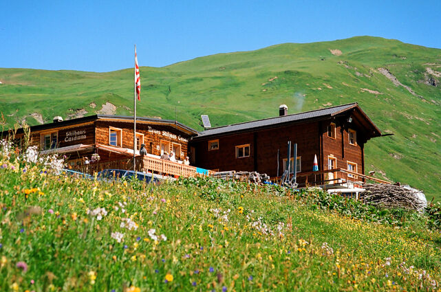
From the starting point at Langwies railway station, the walk starts through the village and then uphill to the Skihaus Casanna. Then it continues over lush green plateaus to Blackter Fürggli, the highest point of the hike. This is followed by a crossing that has been used for centuries and connects the Alps and higher-lying settlements. On the high trail you reach Fondei via alpine meadows. Follow the path down via Pirigen and the Fondei high valley until you reach the starting point in Langwies again.
- Directions
-
Train Staiton Langwies - Langwies Village - Skihaus Casanna - Blackter Fürggli - Pirigen - Langwies
- Highest point
- 2,126 m
- Endpoint
-
Langwies Train Station
- Height profile
-
 © outdooractive.com
 - Equipment
-
Sturdy shoes, clothing suitable for the weather and something to drink are recommended.
- Safety instructions
- Tips
-
Build an extension to the "Steinmännli" (stone man) on the Blackter Fürggli.
- Additional information
-
Arosa strives to provide hikers with a well-developed and marked network of hiking trails. Please take heed of the following wishes and suggestions:
Dogs must be kept on a leash Please take litter and leftovers from picnics home again You will often see game on your hikes. Enjoy the sight of these animals in their familiar surroundings but do not disturb them Do not remove trail markings Do not use closed paths Do not leave the officially marked hiking trails - Directions
-
Once you arrive in Chur, follow the sign posts Arosa. Langwies is located on the main road between Chur and Arosa and cannot be missed.
- Public transportation
-
Take the train from Chur to Arosa and get off in Langwies. The Rhaetian Railway leaves Chur to Arosa and back at hourly intervals. On the train it is "stop on demand", so make sure you press the button before you would like to get off.
- Parking
-
Parking spots in Langwies are well signposted.
- Author
-
The tour Langwies - Blackter Fürggli - Pirigen - Langwies is used by outdooractive.com provided.


General info
-
Heidiland
2201
-
Schanfigg
832
-
Fideriser Heuberge
278