
- Brief description
-
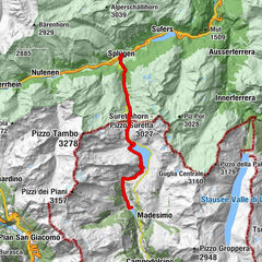
Easy yet almost high-alpine hike along the historical Splügen Pass route to the high plateau of the Suretta lakes.
- Difficulty
-
medium
- Rating
-
- Starting point
-
Splügen
- Route
-
SustenSplügen (1,457 m)Rustico0.1 kmSteina0.4 kmBodmastafel3.5 kmSeehütte7.0 kmSteina12.3 kmRustico12.7 kmSusten12.8 kmSplügen (1,457 m)12.8 km
- Best season
-
JanFebMarAprMayJunJulAugSepOctNovDec
- Description
-
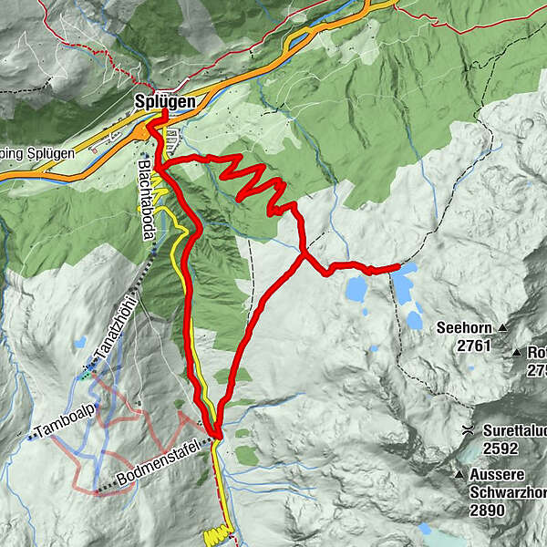
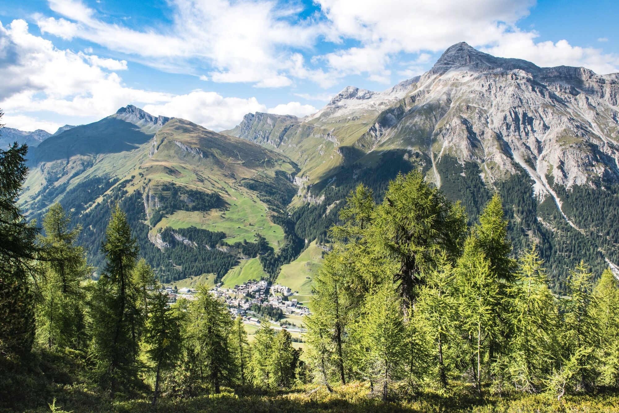
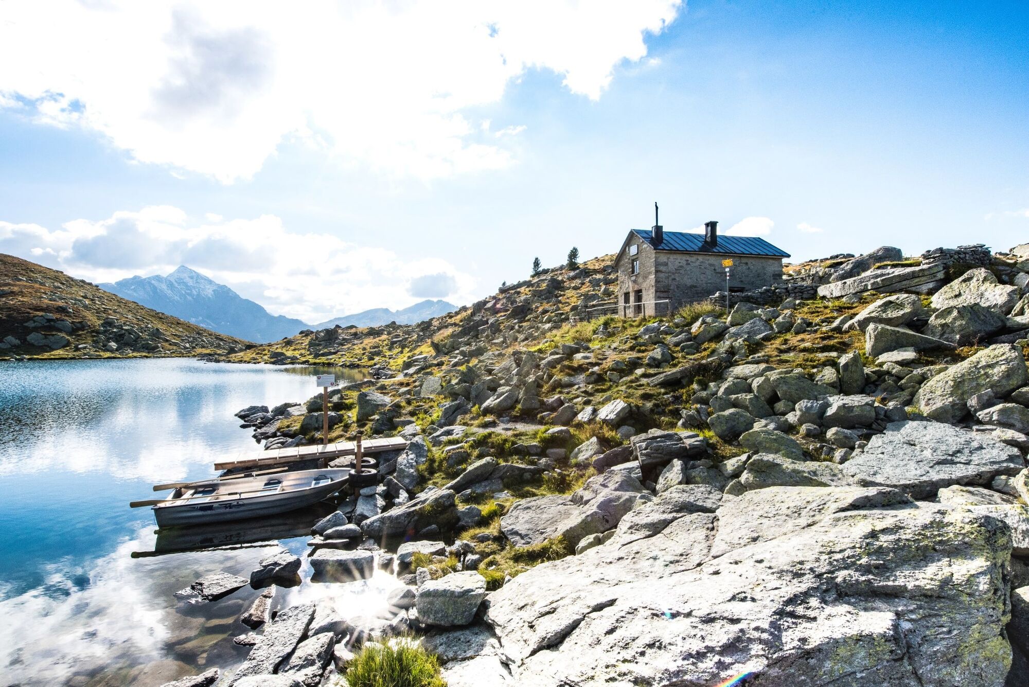
Our starting point is the pass village of Splügen at 1457 m. We exit the village and follow the historical transit route of the viaSpluga to Bodmastafel. Here the trail on the right-hand side of the valley ascends steadily along the mountain flank across the Rhäzünscher Alps. Where the view opens up out of the valley in the direction of the Schams valley, a mountain trail winds its way up to the high plateau of the Suretta lakes. The lake hut is situated at the upper Suretta lake at 2272 m, but is unmanned. Visitors to this spot can enjoy the soothing still atmosphere in the midst of very rocky mountain scenery. And when the surrounding mountain tops are reflected in the lake, from the Seehorn right through to the Surettahorn, the excursion turns into an unforgettable experience.
While the first leg of the descent retraces the ascent route, it descends down into the valley along the Rhäzünscher Alps in the direction of Splügen. At the Franzisch Grind vantage point we enter deep into the mountain forest to return to the pass village of Splügen via Fugschtwald.
In the old part of the village of Splügen, with its grand patrician houses, hikers with a keen interest in local folklore are certain to come across one or two precious finds. A visit to the Rheinwalder Talmuseum and the baroque Reformed church is a must.
- Directions
-
From Bodenplatz Splügen follow the signs for the viaSpluga to Bodmastafel. At Isabrüggli follow the signs for the Suretta lakes. At point 2066 ascend on the right up to the Suretta lakes. Initially the return route follows the same trail as the ascent, back to point 2066. From there follow the signs in the direction of Franzisch Grind and Splügen.
- Highest point
- 2,269 m
- Endpoint
-
Splügen
- Height profile
-
 © outdooractive.com
 - Tips
-
A rowing boat is at the disposal of hikers at the upper Suretta lake, to be used at their own risk.
- Additional information
-
Viamala Tourismus
Bodenplatz
7435 Splügen
+41 (0)81 650 90 30
info@viamala.ch
www.viamala.ch


- Author
-
The tour 759 Surettaseen is used by outdooractive.com provided.


General info
-
Safiental
717
-
Splügen / Rheinwald
102