
- Brief description
-
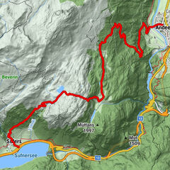
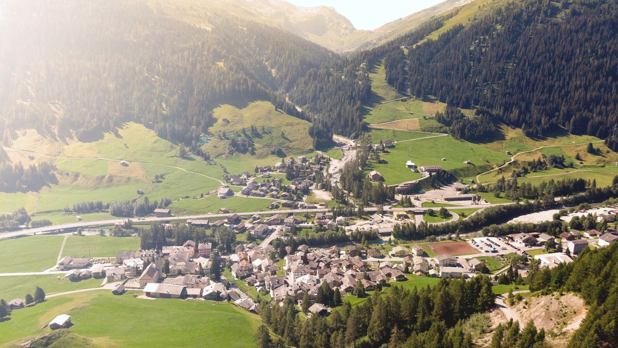
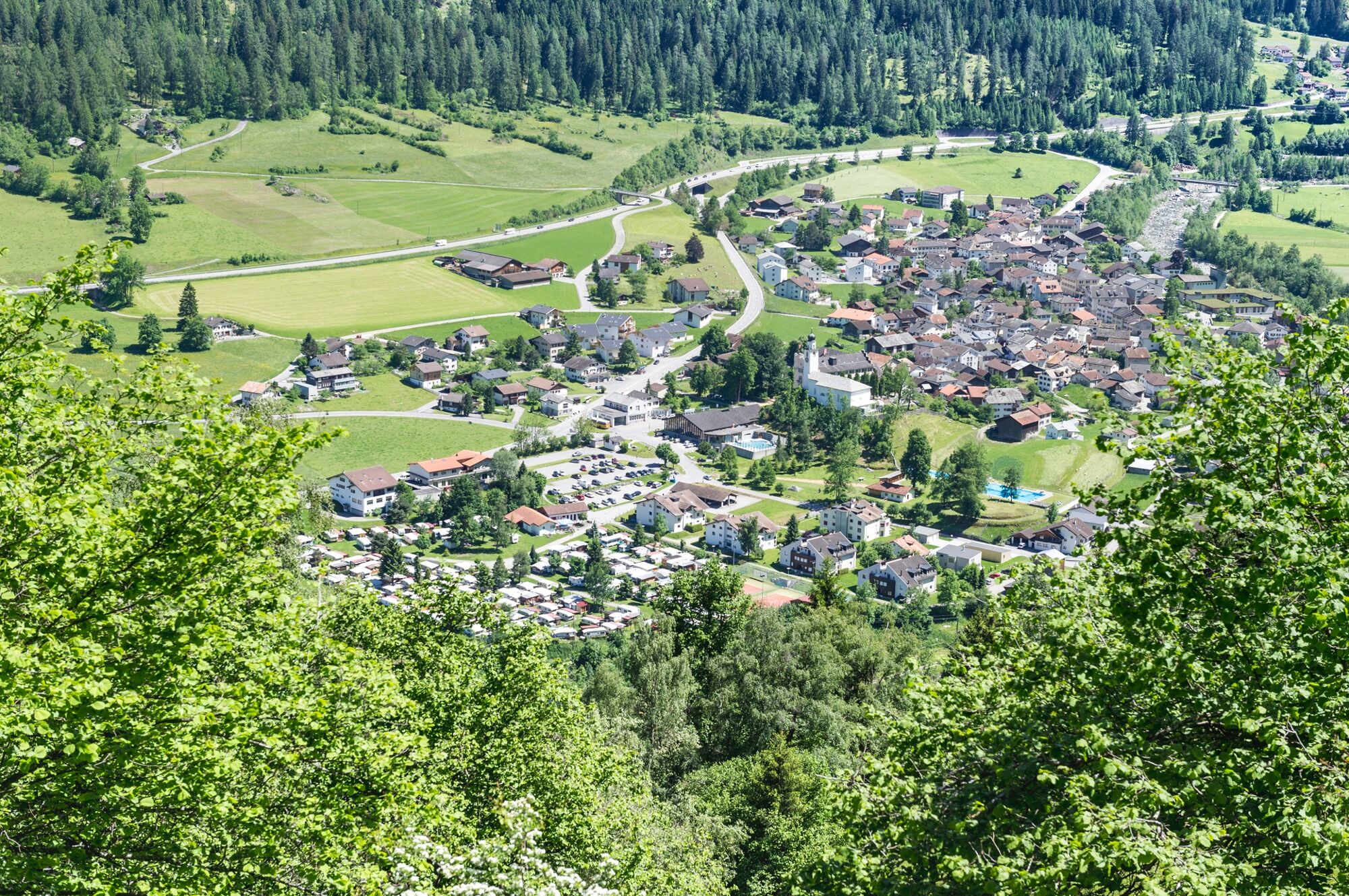
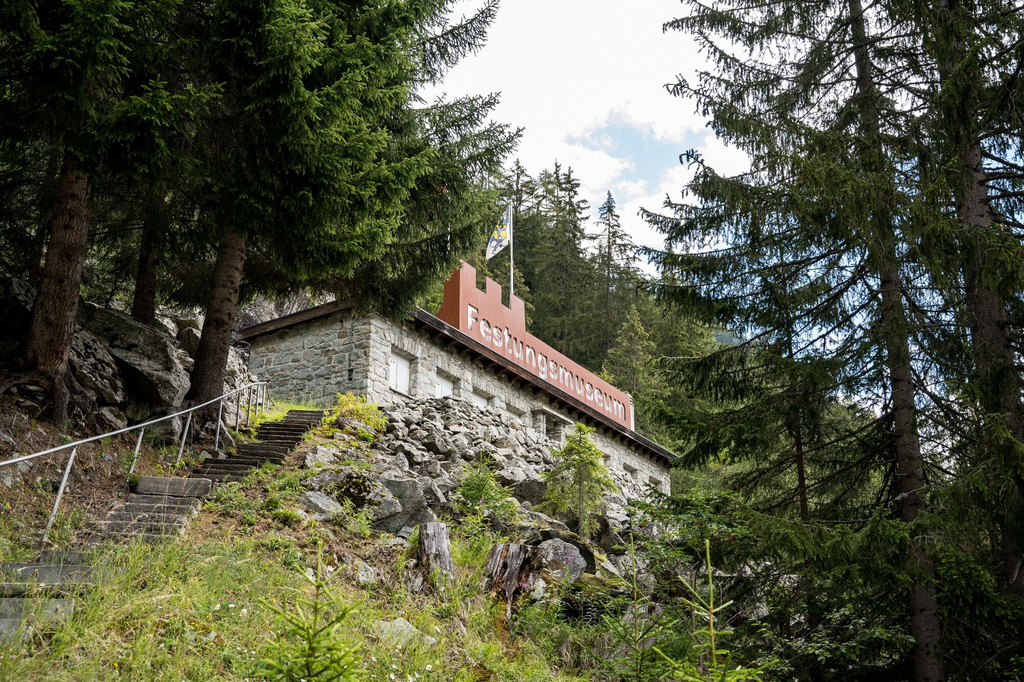
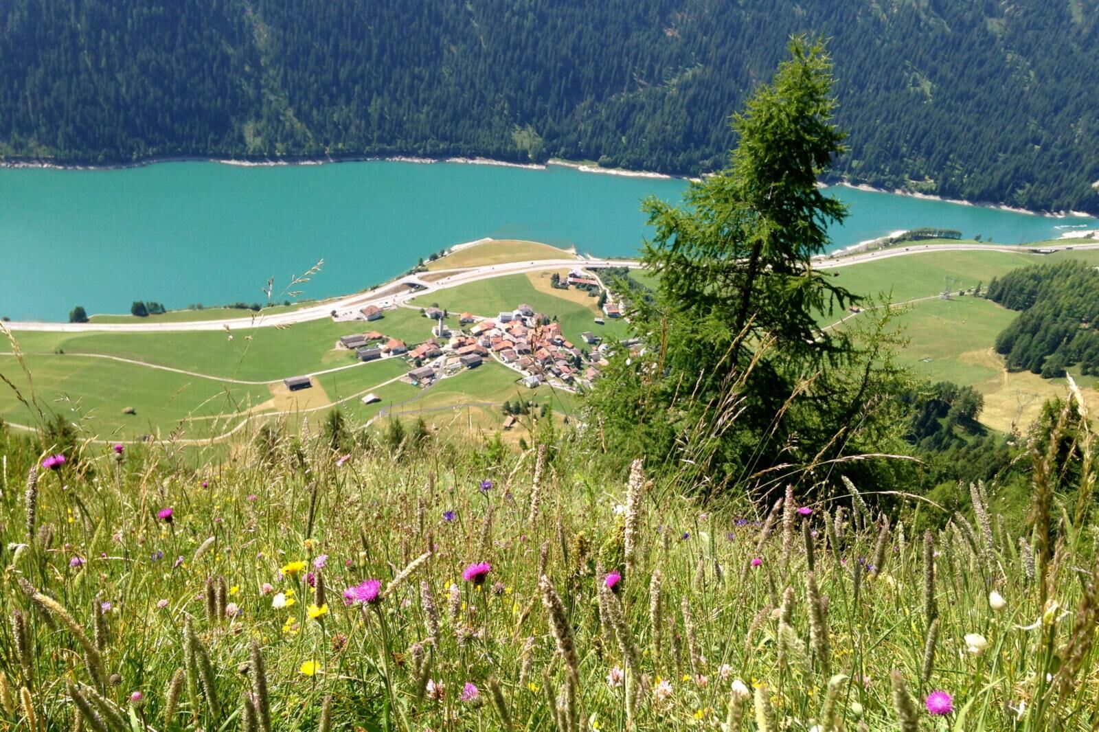
Stage two of the viaSpluga, the 65 km long classic cultural and long-distance hiking trail, takes you from Andeer to the Roffla Gorge and on past the Crestawald Fortifications Museum to Sufers. Sufers is the oldest village in the Rhine Forest. The trail continues to Splügen, one of the oldest and most typical mountain pass villages in the region of Graubünden.
- Difficulty
-
medium
- Rating
-
- Starting point
-
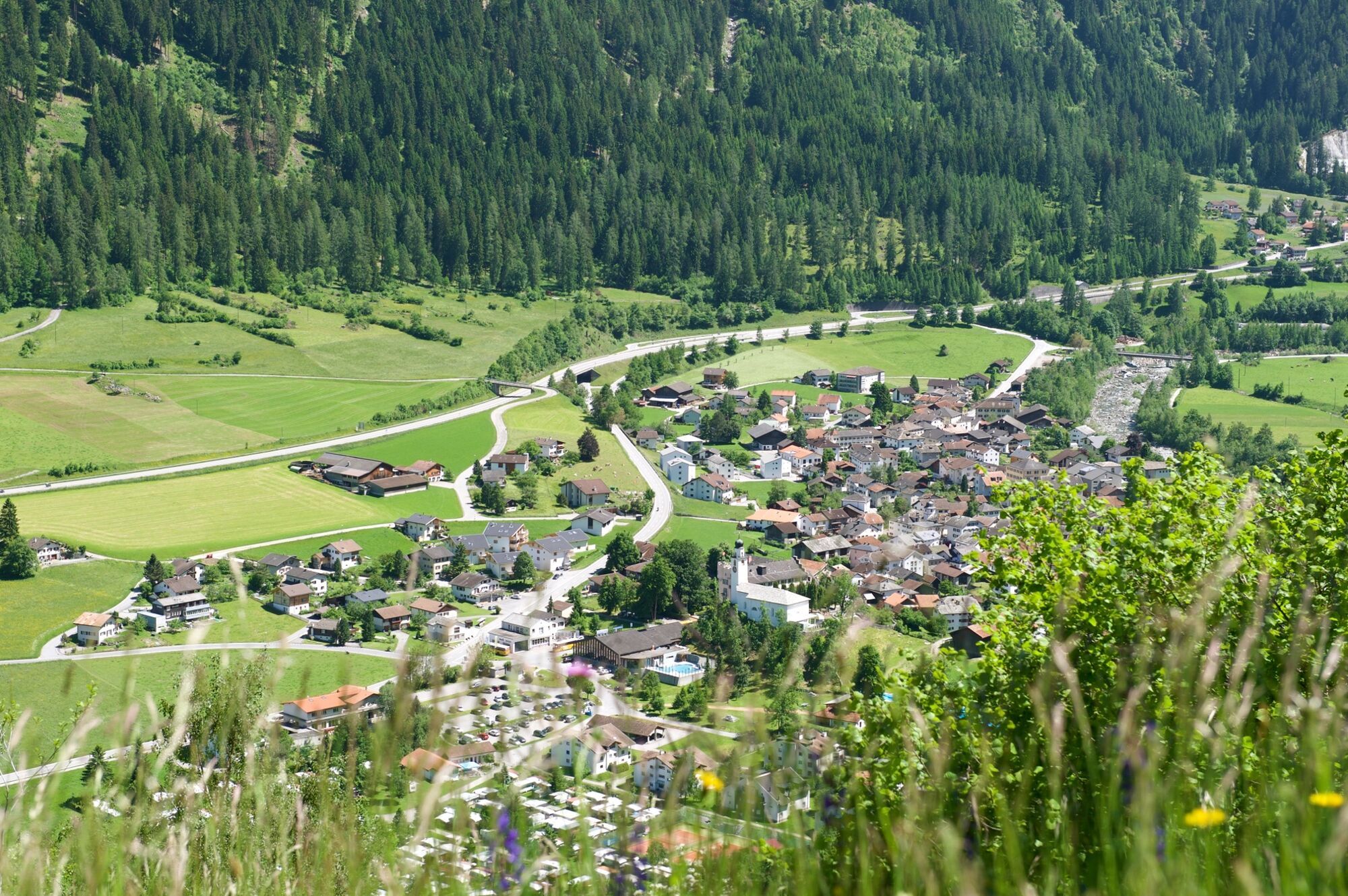
Zillis, village or Andeer, village
- Route
-
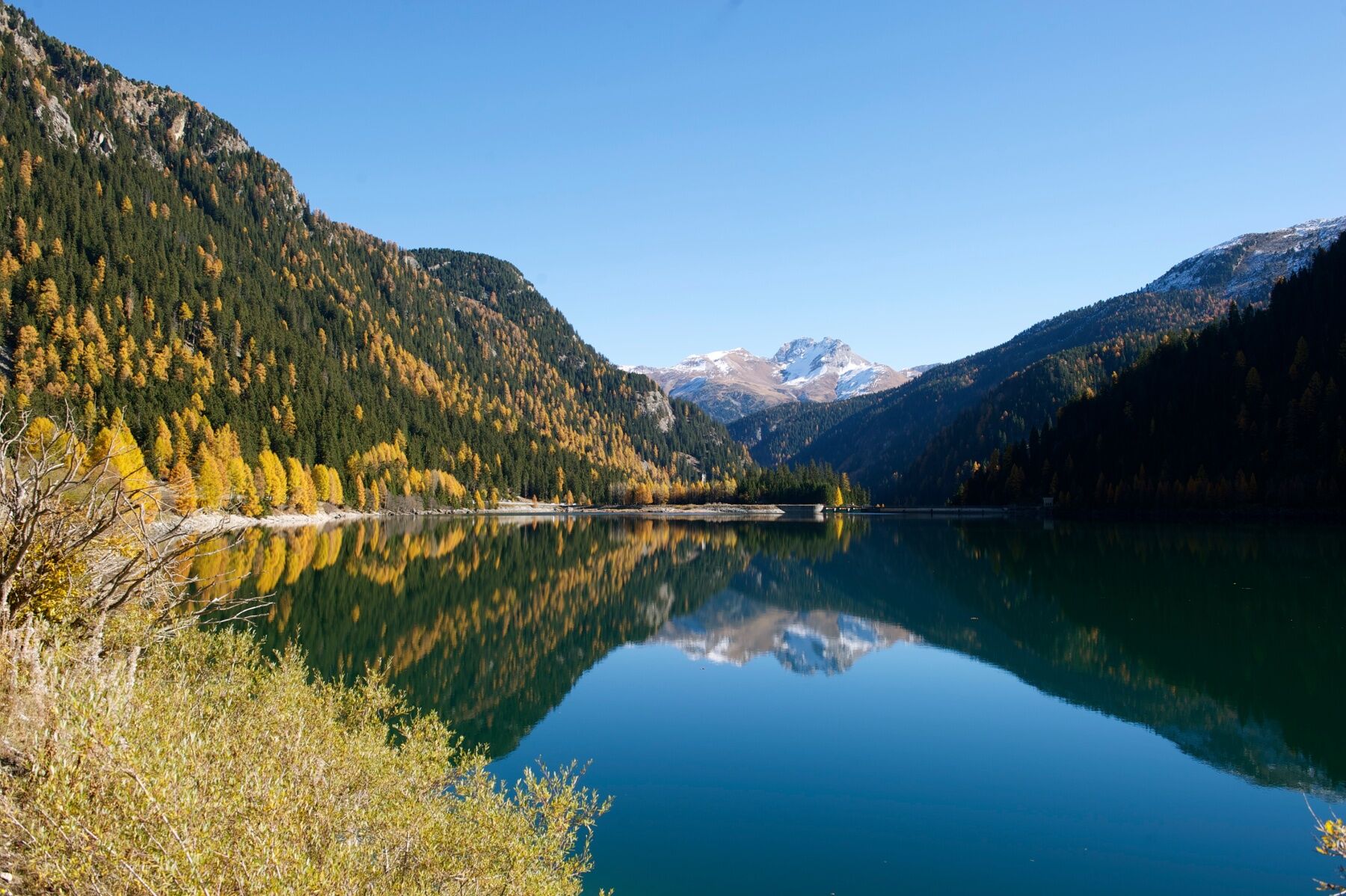
SchwertAndeer0.0 kmBärenburg1.0 kmPlanca Lumbarda (1,094 m)3.4 kmRofflafall3.8 kmReformierte Kirche Sankt Salvator9.7 kmMenn's Buurastübli (1,434 m)9.8 kmSufers (1,430 m)9.9 kmWissbach10.7 kmReformierte Kirche Splügen13.8 kmSusten14.0 kmAltes Zollhaus14.1 kmSplügen (1,457 m)14.2 km
- Best season
-
JanFebMarAprMayJunJulAugSepOctNovDec
- Description
-
The viaSpluga is a cultural and long-distance hiking trail in the central Alps which has linked the peoples of the German, Romansh, French and Italian-speaking regions, as well as the villages of Thusis and Chiavenna. The viaSpluga mainly follows historic mule tracks, whose original structures have largely been preserved or restored. The viaSpluga stretches for a total distance of about 65 km.
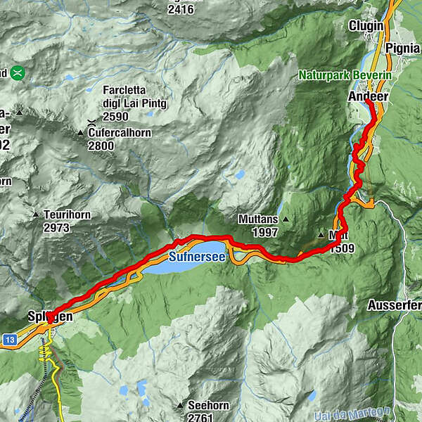
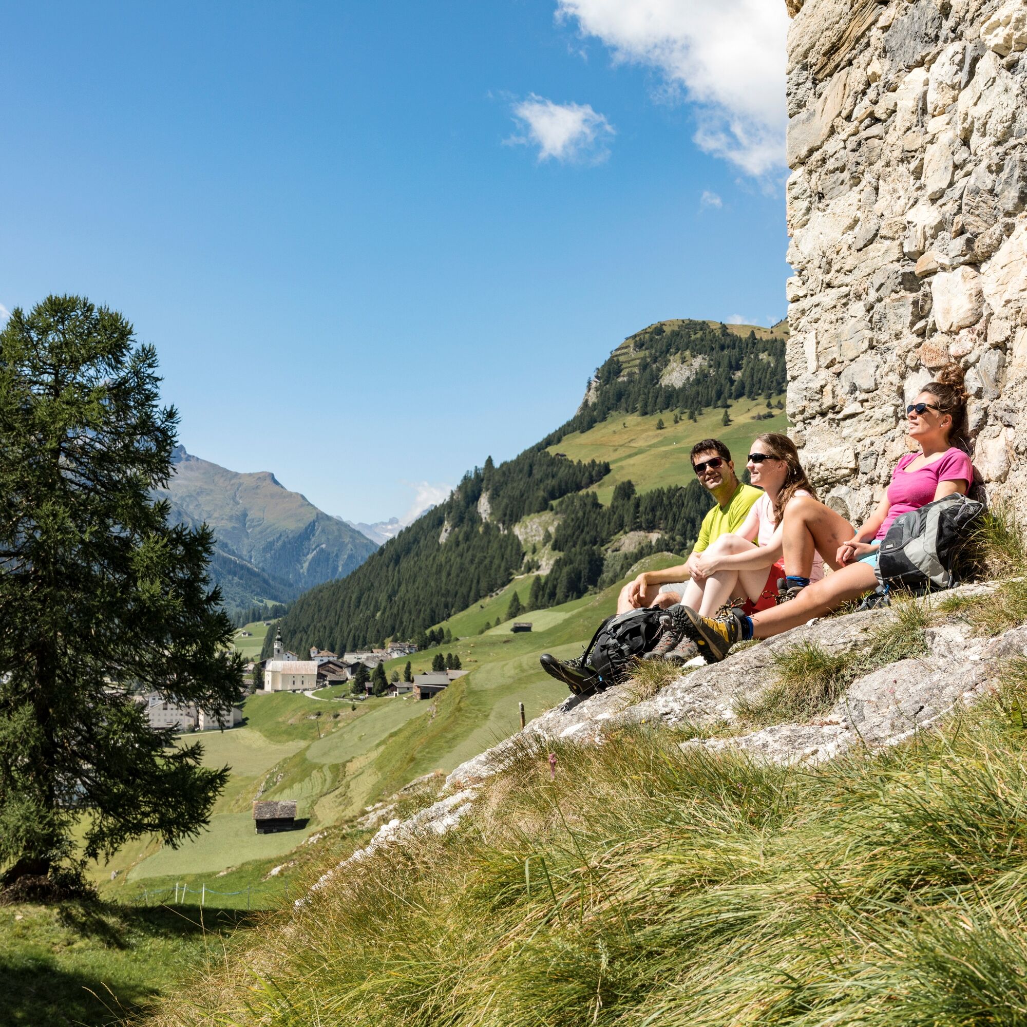
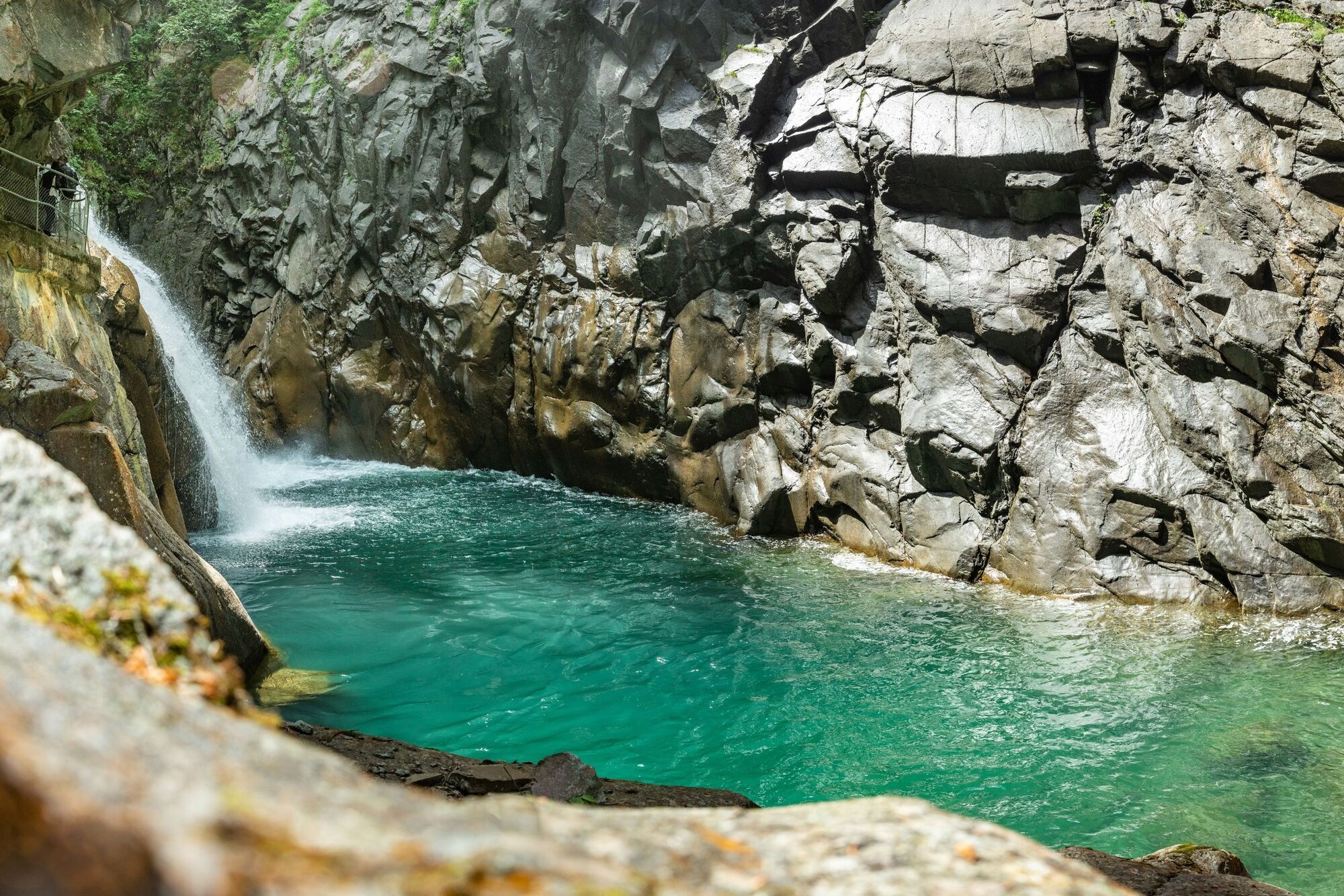
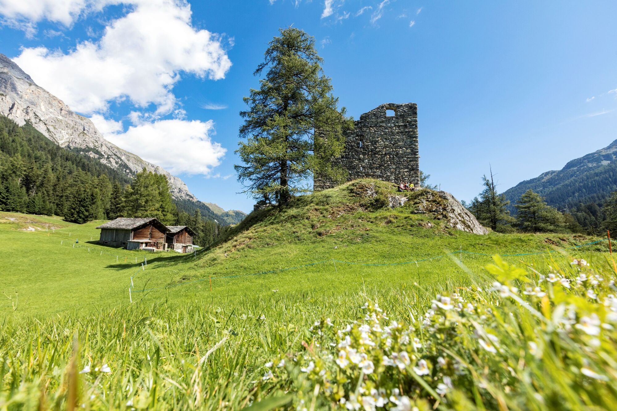
Stage 2 / Andeer-Splügen: There is also a gorge crossing on the itinerary for today's stage. The spectacular path, which was sunk into the rock with hand drills, is characterised by dry-stone walls, semi-galleries, unlined tunnels and walled galleries. After the Rofla Gorge we come to Sufers on the reservoir, which was mentioned in a list of the royal goods in Rätien as far back as 831, which makes it the oldest village in the valley. Today's stage finishes in the characteristic mountain pass village of Splügen. We recommend a visit to the Rhine Forest Local History Museum, which impressively documents the history of transport in the valley.
- Directions
-
The viaSpluga is marked throughout from Thusis to Chiavenna as regional hiking trail No. 50, as well as with brown viaSpluga signposts.
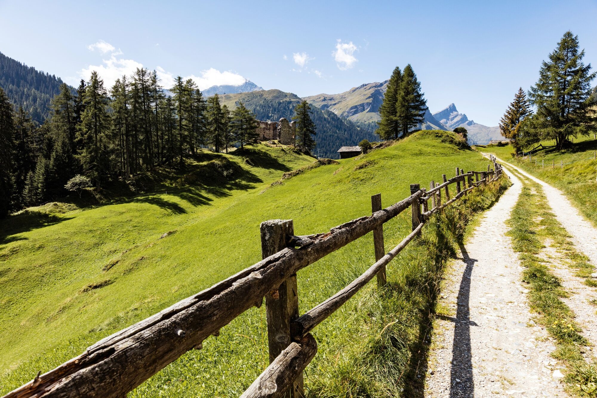
Stage 2: Andeer–Splügen: Heading south out of the village of Andeer, the trail takes you to the Roffla Gorge (sightseeing is possible). An intelligently created route steers you through the impassable landscape towards the clear valley of the Rhine Forest, past the Crestawald Fortifications Museum, which is a place of historic military interest, and on toSufers. The woodland passage between Sufers and Splügen, along what's known as the Roman Way, brings the second stage to a magnificent close.
- Highest point
- 1,517 m
- Endpoint
-
Splügen, village
- Height profile
-
 © outdooractive.com
 - Equipment
-
Appropriate, weather-proof equipment is strongly recommended.
- Safety instructions
-
The viaSpluga is a mountain hiking trail. You need to be sure-footed and have a good head for heights (bridges, Cardinello Gorge) along some sections.
- Tips
-
Today's route is fringed by two reservoirs belonging to the Posterior Rhine Power Company (Kraftwerke Hinterrhein AG). The entire system is described on information boards. Take the time to discover the history of the Roffla Gorge, and the Crestawald Fortifications Museum may be open, depending on which day you're passing. Incidentally, Splügen is one of the oldest and most characteristic mountain pass villages in Graubünden! The Rhine Forest Local History Museum in Splügen impressively documents the history of transport in the valley (take note of the opening times).
- Additional information
-
Viamala Visitor Information
Bodenplatz
7435 Splügen
Tel. +41 (0)81 650 90 30
info@viamala.ch
www.viamala.ch - Directions
-
Southbound on the A13/E43, in the direction of San Bernardino, "Zillis, Andeer" exit. Northbound on the A13/E43, in the direction of Chur, "Andeer-Zillis" exit.
- Public transportation
-
By Rhaetian Railway to Thusis, railway station
By postbus to Zillis, posta, Andeer- Heilbad, Andeer-Tgavugl or Andeer- posta
www.rhb.ch
www.postauto.ch (Switzerland) - Parking
-
Zillis, church car park on the banks of the Rhine Andeer, northern entrance to the village Splügen, diagonally opposite the post office.

- Author
-
The tour 50.02 Andeer - Splügen, ViaSpluga is used by outdooractive.com provided.