- Brief description
-
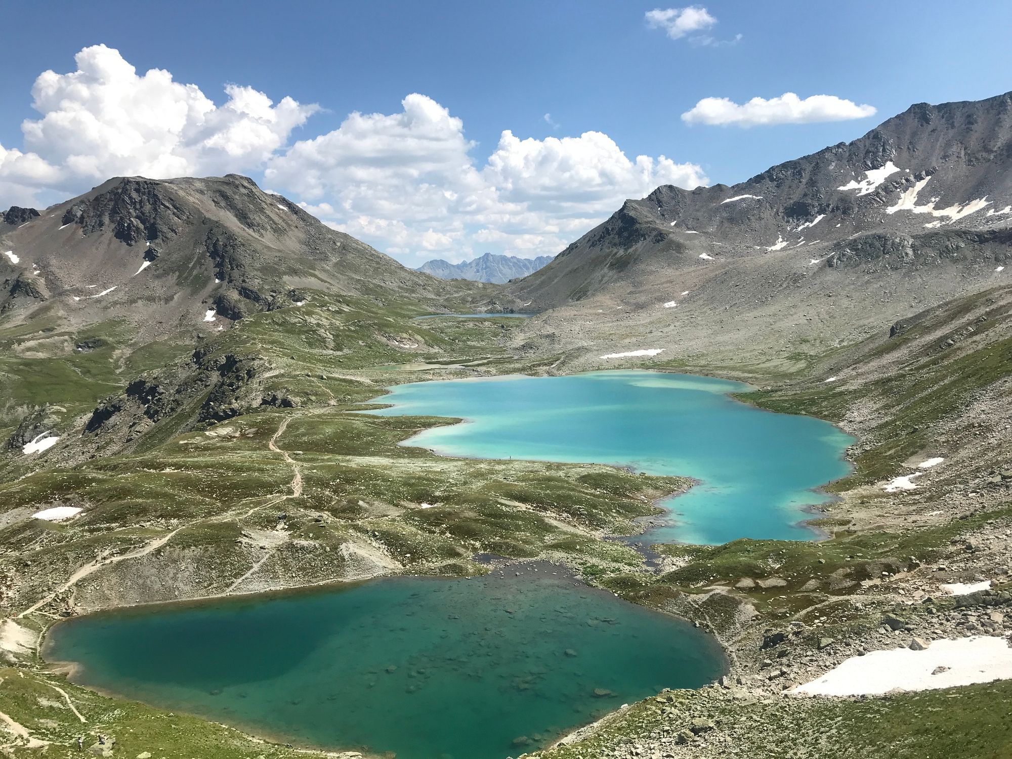
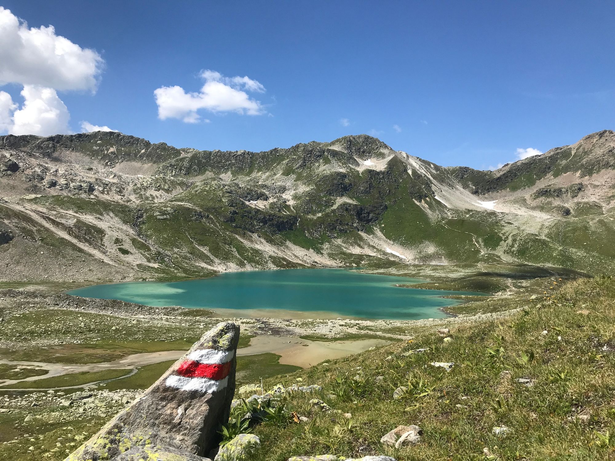
Day hike to the varicoloured Jöriseen lakes in the middle of the alpine landscape in Val Susasca.
- Difficulty
-
difficult
- Rating
-
- Starting point
-
Susch railway station
- Route
-
Susch (1,438 m)0.0 kmJöriflesspass (2,561 m)14.5 km
- Best season
-
JanFebMarAprMayJunJulAugSepOctNovDec
- Description
-
Your hike begins at the Susch railway station; before the bridge over Val Susasca, turn right and ascend along the river. From the start follow the signposts toward Jöriseen. The time indications on the signposts correspond to a different route, so you can disregard them. On the following metres leading up the mountain, you will pass two crossroads. Turn left at the first junction and right at the second. From here you continue on an alpine path towards Nudigls. At the crossroad at about 1700 metres above sea level, follow the Alpstrasse to the right (not left to the Jöriseen lakes). Here you will reach the Panoramaweg via Nudigls. On this section you can expect a unique view, which makes every step up to Alp Fless Dadoura worthwhile.
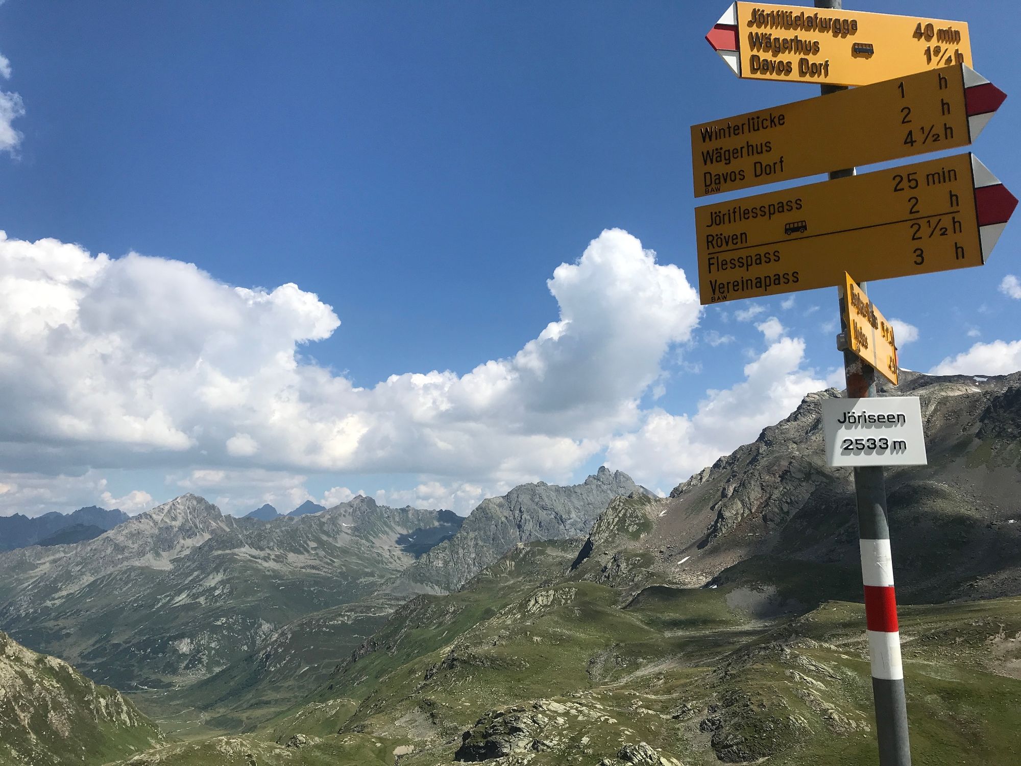
Now follow the mountain stream Aua da Fless for three kilometres to Alp Fless Dadaint. At this point you cross the stream. The path passes the alp and climbs up toward the Jöriflesspass. On the pass crossing the first lakes become visible. Along the impressive Jöriseen lakes you cross the high plateau before a further ascent to the Jöriflüelafurgga pass follows. You have now reached the highest point of the hike and you will see that the view back to the Jöriseen lakes is worth the climb. The 500-metre descent to the Wägerhus on the Flüelapass road now lies before you. The PostBus takes you from the Wägerhus bus stop back to Susch.
Alternatively, the first section to Prà Dadoura can be covered by PostBus.
- Directions
-
Susch railway station and
before the bridge over the Val Susasca, turn right up parallel to the river
follow the signpost Jöriseen
on the alpine path in the direction of Nudigls
via Nudigls onto the Panoramawegthree kilometres to Alp Fless Dadaint and across the stream
in the direction of the Jöriflesspass.
On the pass the first lakes are visible
through the high plateau
Ascent to the Jöriflüelafurgga passDescent to the Wägerhus - Highest point
- 2,734 m
- Endpoint
-
PostBus stop Wägerhus/Jöriseen
- Height profile
-
 © outdooractive.com
 - Equipment
-
Good shoes, rain and sun protection, water bottle, food, first aid kit
- Safety instructions
-
The tour has been assessed in favourable weather conditions, current weather conditions and weather forecasts are mandatory before starting the tour. This hike requires elementary Alpine experience and orientation skills, hiking boots are recommended.
Emergency call:
144 Emergency call, first aid
1414 Mountain rescue REGA
112 International emergency call
- Directions
-
- From the north: via Landquart - Klosters by car transport through the Vereina Tunnel (Selfranga - Sagliains) or via the Flüela Pass into the Lower Engadine on H27.
- From the east: via Landeck / Austria in the direction of St. Moritz on H27
- From the south: via Reschenpass (Nauders-Martina) or Ofenpass (Val Müstair-Zernez) on H27
Susch is located directly on the Flüela Pass and on the Engadine road H27 (5 minutes' drive from Vereina south portal).
- Public transportation
-
- With the Rhaetian Railway (from Chur, Landquart/Prättigau, from the Upper Engadine or from Scuol) hourly to Susch railway station.
The first stretch to the Susch, Röven stop can be shortened with the PostBus.
- Parking
-
- Paid parking at the railway station in Susch


- Author
-
The tour Susch – Jöriseen – Wägerhus is used by outdooractive.com provided.


General info
-
Davos Klosters
927
-
Susch
111