


- Brief description
-
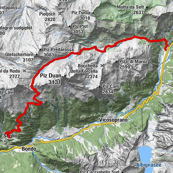
Rewarding tour from Casaccia over the Pass da la Duana with a long descent to Soglio.
- Difficulty
-
difficult
- Rating
-
- Starting point
-
Casaccia
- Route
-
Casaccia (1,458 m)0.3 kmMaroz Dent (2,035 m)4.9 kmPass da la Duana (2,691 m)11.7 kmCadrin (2,136 m)14.0 kmLöbbia (1,968 m)15.3 kmPlän Vest (1,822 m)16.4 kmTombal (1,545 m)17.4 kmCarnella19.0 kmLò19.3 kmSils im Bergell (1,097 m)19.4 km
- Best season
-
JanFebMarAprMayJunJulAugSepOctNovDec
- Description
-
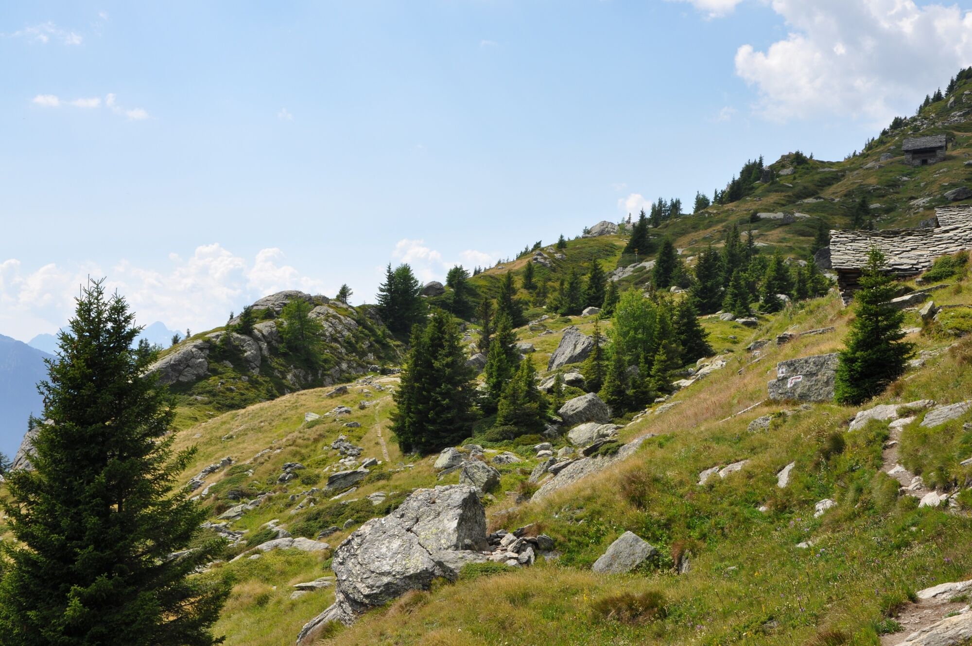
Ascent through Val Maroz to Alp Maroz Dent and from there in a south-westerly direction up the steep slope into Val da la Duana. On the plain we pass two small mountain lakes before the trail climbs again to the pass. At the top, a magnificent view opens up towards Bondasca and down into Bergell valley. The view remains with us during the descent to Soglio (1500 metres altitude).
With a bit of luck, there will be a restaurant open in Soglio for a well-deserved after-work beer or a fortifying snack. - Directions
-
From Casaccia - car park at the small cemetery - follow the road that climbs in bends up through the forest to the entrance into Val Maroz. The footpath takes a more direct course and repeatedly intersects the road, with which it later reconnects on a more level part.
Past the turnoff to the Septimer Pass and the huts of Maroz Dora (1799 m), the wide path leads to Maroz Dent (2035 m). Here the trail descends a little and crosses the Maira stream on a wooden bridge. At the junction on the other side of the stream, follow the path to the right, heading west along the Maira. About a kilometre later, the steep ascent begins, which takes us up to the saddle in front of the Val da la Duana after about 500 metres of altitude. Here the unmarked route to Piz Duan branches off to the left.
Our path leads us past the Lägh da la Duana, through the shallow valley on to a second small mountain lake, from which the Maira springs. From here, the path climbs another 400 metres until we reach the Pass da la Duana (2697 m).
The steep descent leads us to the huts of Cadrin (2136 m), where the path from Val da Cam joins us. A beautiful track leads through the forest and clearings to the terraces Plän West (1822 m) and Tombal until the final descent to Soglio (1090 m).
- Highest point
- 2,692 m
- Endpoint
-
Soglio
- Height profile
-
 © outdooractive.com
 - Equipment
-
Good mountain boots, snacks, sun cream, possibly walking sticks
- Safety instructions
-
For long distances, it is advisable to start early in the morning.
- Tips
-
there are no refreshments on the route bring sufficient provisions
- Public transportation

- Author
-
The tour The crossing of the Pass da la Duana is used by outdooractive.com provided.


-
Comer See
754
-
Val Bregaglia Engadin
460
-
Bregaglia
115


