
- Brief description
-
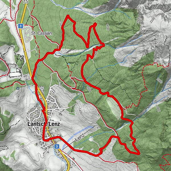
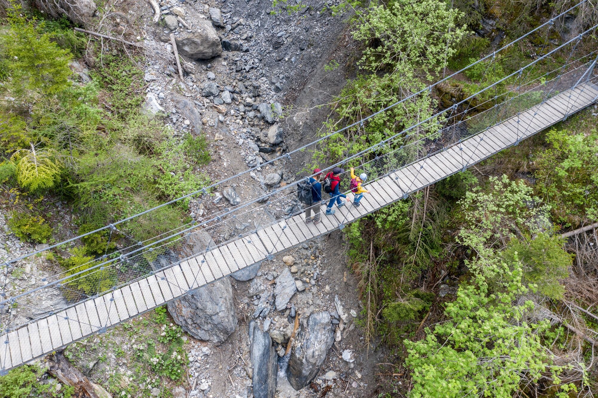
Hike to the Val Meltger suspension bridge in Lantsch/Lenz.
- Difficulty
-
medium
- Rating
-
- Starting point
-
Community centre Lantsch/Lenz
- Route
-
Lantsch/Lenz (1,328 m)0.2 kmAntoniuskirche0.5 kmLa Tgoma0.6 kmLantsch/Lenz (1,328 m)8.2 km
- Best season
-
JanFebMarAprMayJunJulAugSepOctNovDec
- Description
-
On this hiking-trail discover the formidable power avalanches; enjoy the quiet paths and distant views into the Oberhalbstein and Engadin.
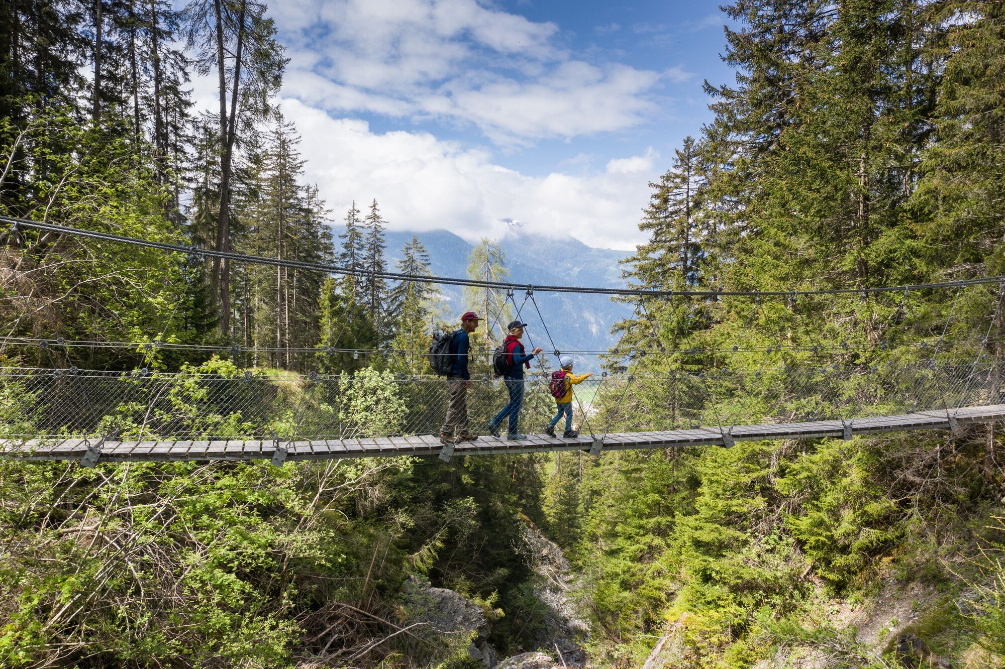
The route passes through the idyllic village Lantsch/Lenz down towards the restaurant Tgoma and then onto the end of the asphalt road. Following a steep climb through the woods you come to Val Meltger hanging-bridge. Here avalanches annually ripped the old bridges away, demonstrating just how much power they have. The solution to this problem is the hanging-bridge which is now suspended 12 metres above the ground. The tour continues on towards a lonely Alp hut. Taking a break here is ideal; a majestic view opens towards Savognin, the Julierpass and into the Engadin. The descent drops mostly through woodland, but don't miss the side tour to the romantic lake Lai la Villa. A thirst-quenching drink from the spring refreshes you before you make your way back to Lantsch/Lenz.
- Highest point
- 1,635 m
- Endpoint
-
Community centre Lantsch/Lenz
- Height profile
-
 © outdooractive.com
 - Additional information
-
After passing the village Lantsch/Lenz the ascent to the hanging-bridge at Val Meltger is very steep.

- Author
-
The tour 749 Hängebrücke Val Meltger is used by outdooractive.com provided.


General info
-
Arosa Lenzerheide
819
-
Albula / Alvra
180