
- Brief description
-
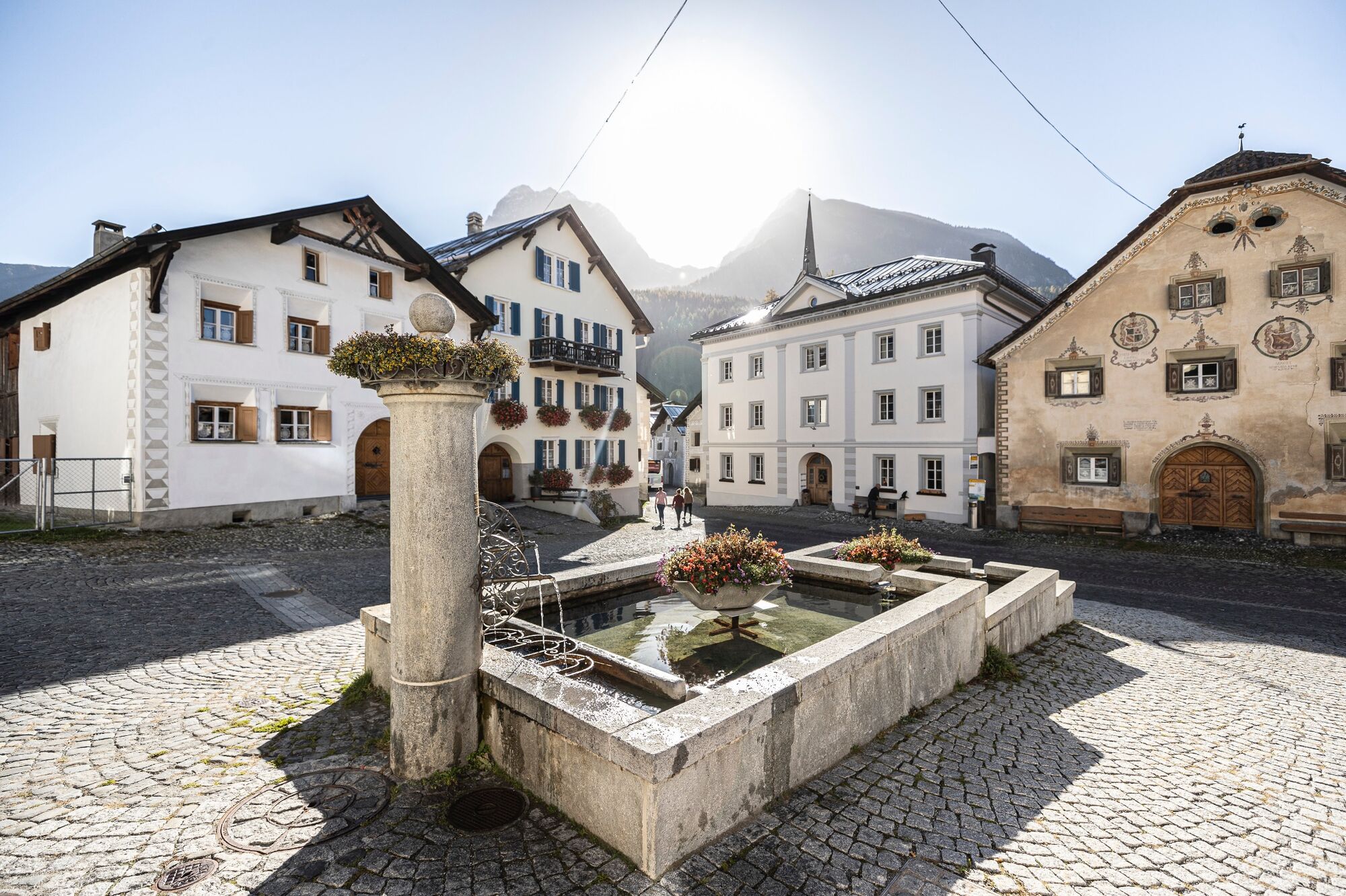
The Scuol fountain tour takes in five village fountains from whichyou can taste natural mineral water straight from the tap.
- Difficulty
-
easy
- Rating
-
- Starting point
-
Entrance Bogn Engiadina, PostBus stop «Scuol, Bogn Engiadina»
- Route
-
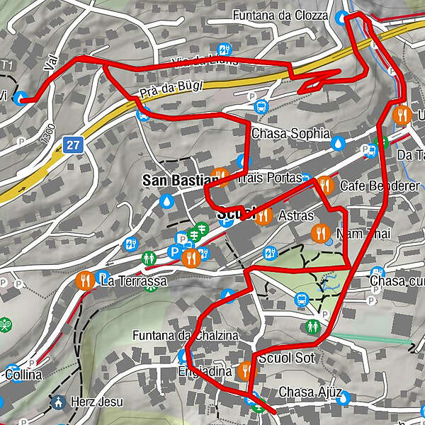
Scuol Sot0.8 kmSan Bastian2.8 kmScuol (1,250 m)3.0 km
- Best season
-
JanFebMarAprMayJunJulAugSepOctNovDec
- Description
-
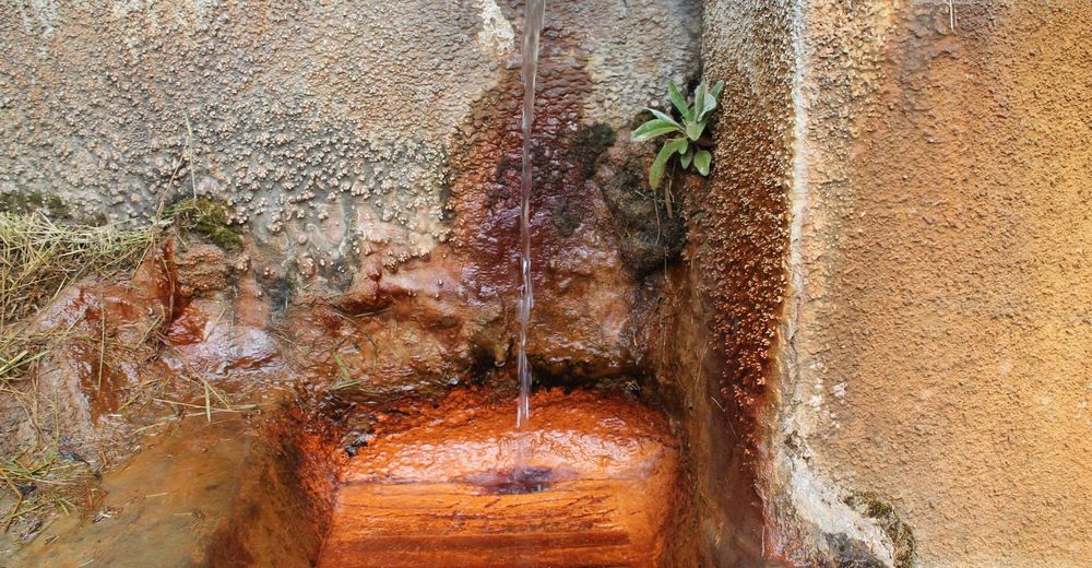
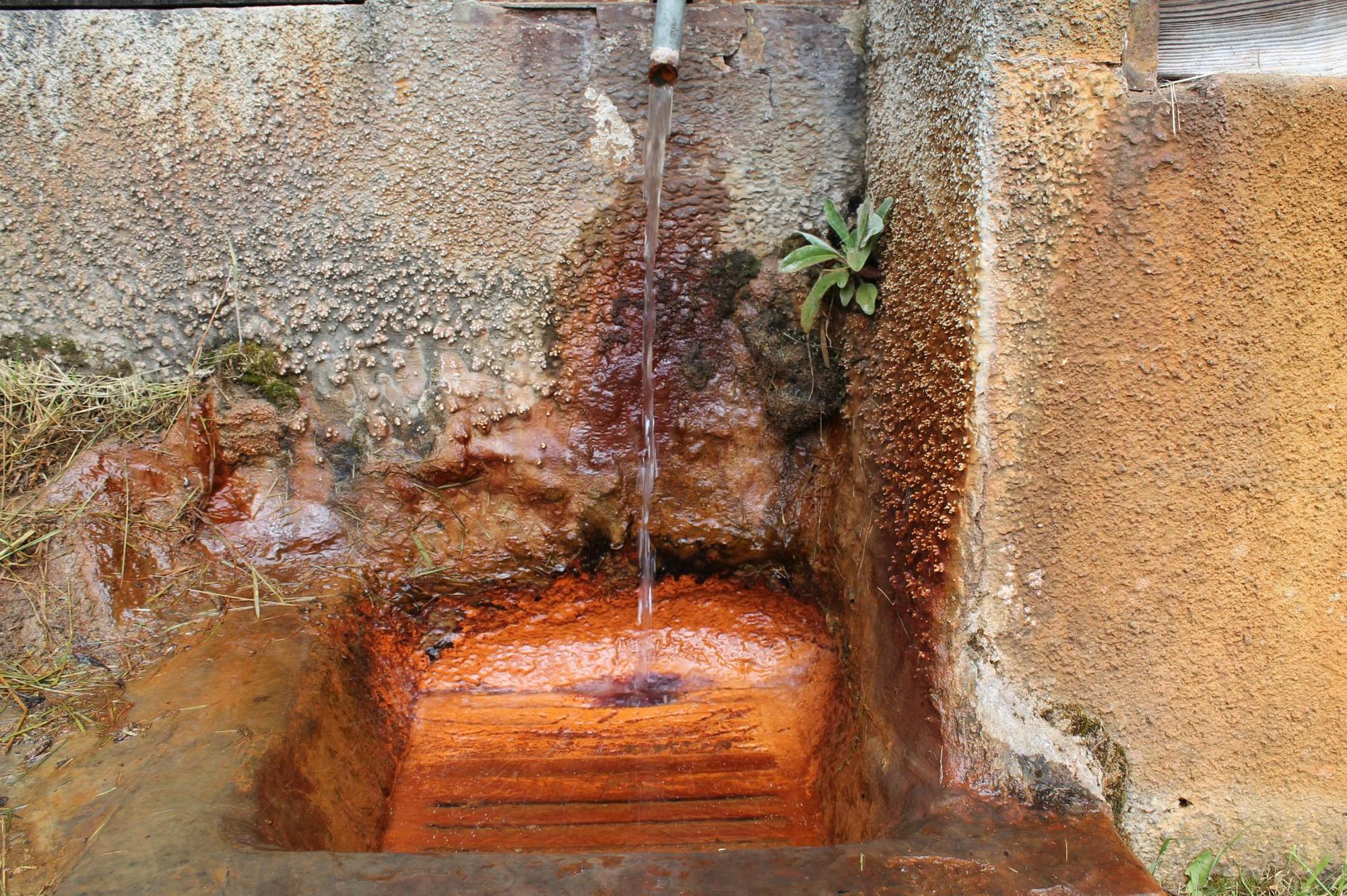
In total, more than twenty mineral springs have their source in the municipal territory of Scuol. They owe their diversity to the geological peculiarity of the Lower Engadine window. Since the first mention in 1369, the high-quality water has had a decisive influence on the history of Scuol and is still of central importance today.
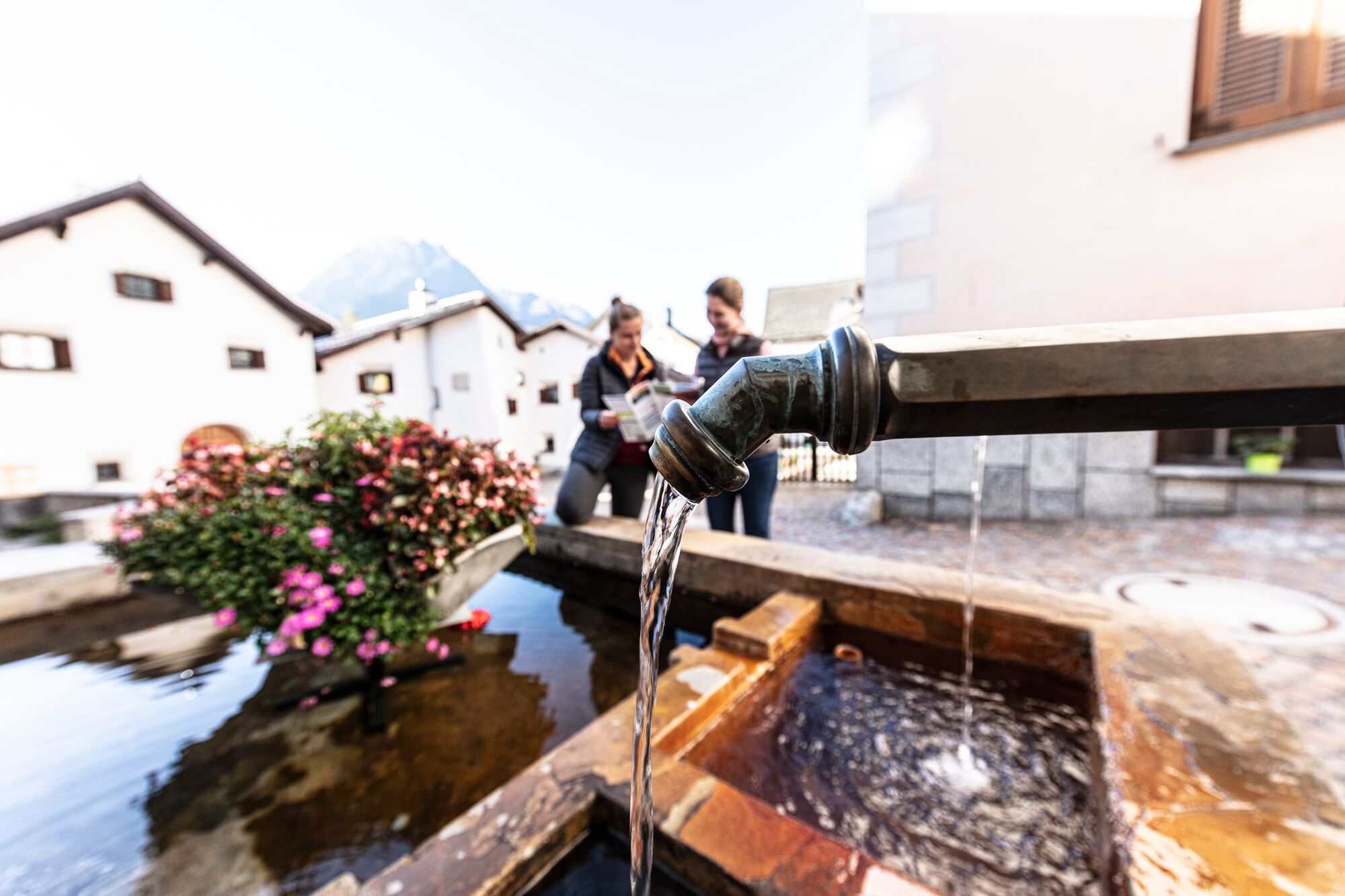
It is not necessary to go far to taste the water of various mineral springs. Mineral water flows constantly at five village fountains in Scuol. It is recommended to take a cup or a glass bottle with you.
- Directions
-
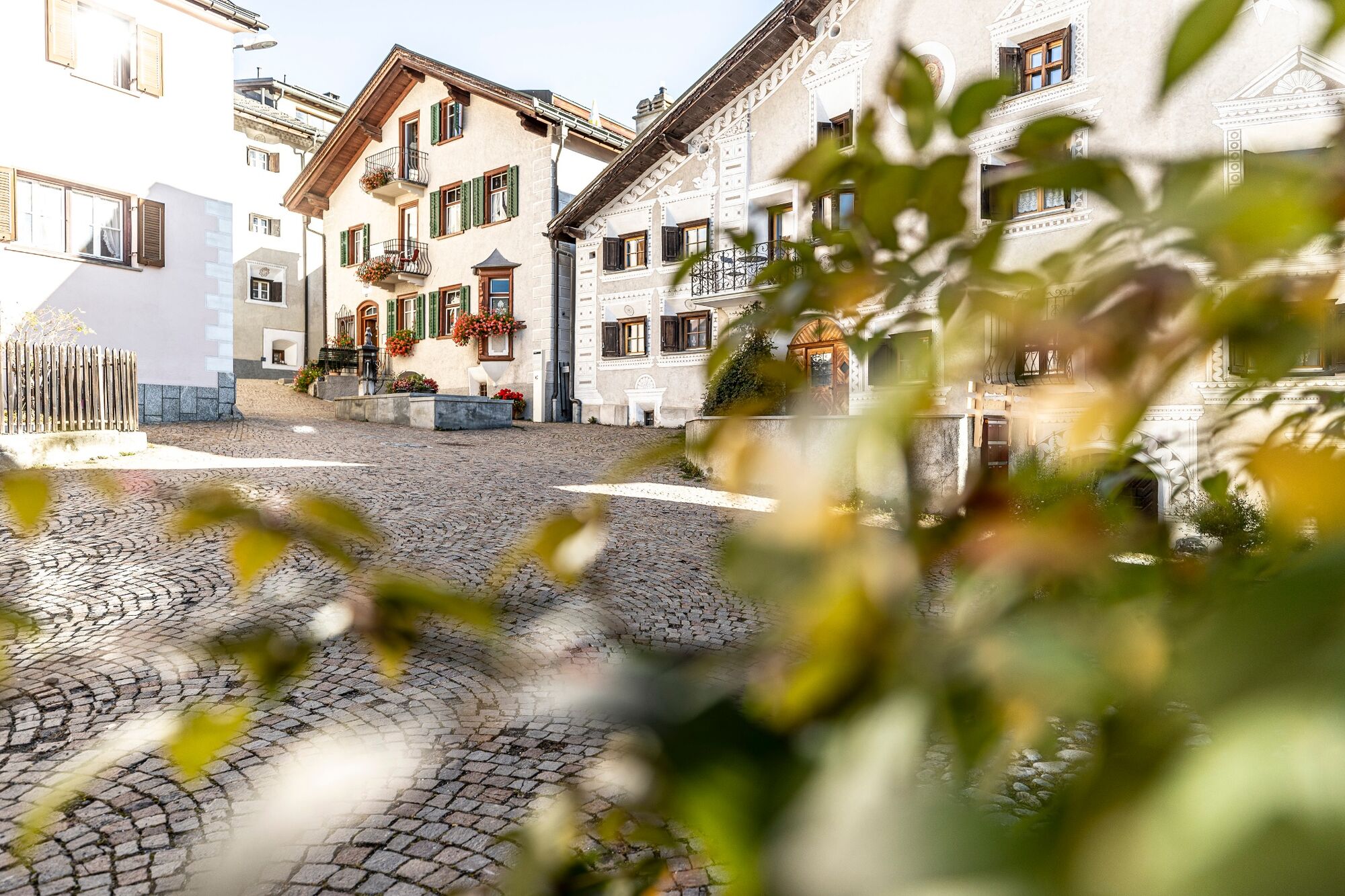
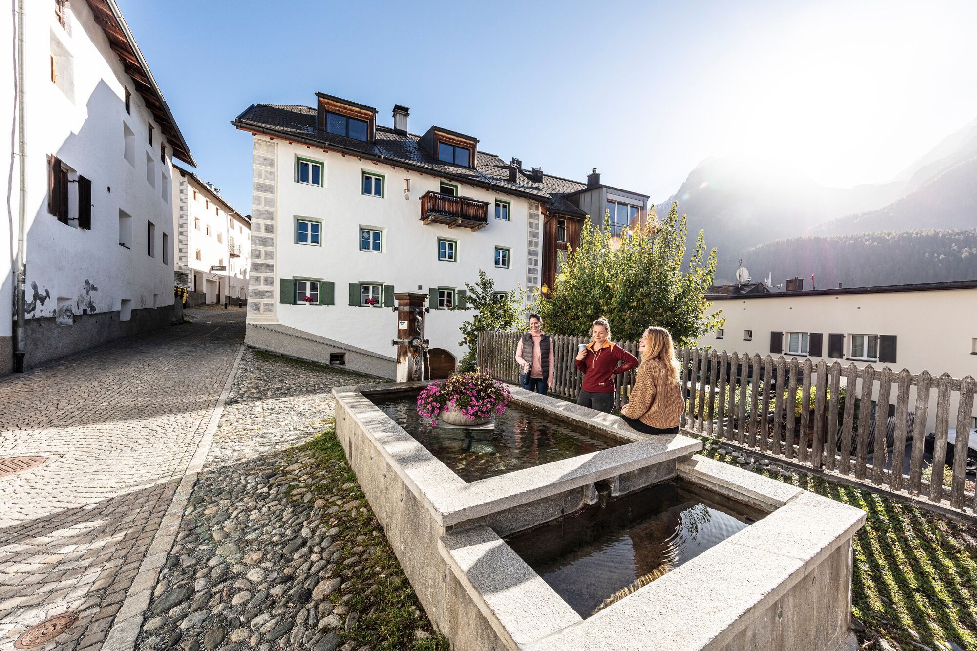
The Scuol fountain tour starts at the entrance of the Bogn Engiadina and leads through its brine tower, so that one gets to a water playground in a small park. After crossing the park, the old part of the village Scuol Sot is reached, where well-preserved Engadine houses can be admired. Finally, the first village fountain is reached and at the same time the largest of all, the Bügl Grond. The tour continues to the village fountain Plaz. From there it goes up, past the town hall to the village fountain Bagnera. Now the Clozza stream is crossed in quick succession, where one immediately encounters the fourth village fountain, the so-called squirrel fountain. Past the old people's home, the route crosses a bridge over the cantonal road and reaches the upper, new part of the village. Continuing slightly uphill, the fountain tour leads to the Vi spring, the only spring on the tour. After a short rest at the highest point, the tour continues to the old part of the village Scuol Sura, where the village fountain Plazzetta is located. From there, one descends to Stradun and soon reaches the entrance of the Bogn Engiadina again.
- Highest point
- 1,309 m
- Endpoint
-
Entrance Bogn Engiadina, PostBus stop «Scuol, Bogn Engiadina»
- Height profile
-
 © outdooractive.com
 - Equipment
-
Sturdy shoes, a bottle or cup, and protection against sun and rain are all recommended.
- Tips
-
We recommend that you bring a bottle or cup with you so you can taste the water from the tapped springs. From the following mineral springs the water is led to the fountains:
Chalzina spring to the village fountain Bügl Grond
Sotsass spring to the village fountain Plaz
Sotsass spring to the village fountain Bagnera
Clozza spring to the squirrel fountain
Vi spring to the village fountain Plazzetta
- Additional information
- Directions
-
- From the north: via Landquart – Klosters on the car transporter train through the Vereina tunnel (Selfranga – Sagliains) or via the Flüela Pass to Lower Engadin on the H27
- From the east: via Landeck / Austria towards St. Moritz on the H27
- From the south: via Reschen Pass (Nauders – Martina) or the Ofen Pass (Val Müstair – Zernez) on the H27
Scuol is located directly on Engadiner Strasse H27 (20-minute drive from the Vereina tunnel’s southern entrance).
- Public transportation
-
Public transport friendly
- Take the Rhaetian Railway (RhB), which leaves hourly from Chur, Landquart/Prättigau and Upper Engadin, and get out at Scuol-Tarasp.
- Take the Postbus, which leaves hourly from Martina, Sent, Ftan and Tarasp, and get out at the Postbus stop Scuol, Bogn Engiadina.
- Parking
-
Parking is available at the Scuol-Tarasp train station. Smaller parking spaces in the village and an underground car park at the Bogn Engiadina in Scuol.
- Author
-
The tour Scuol fountain tour is used by outdooractive.com provided.


General info
-
Engadin Scuol Zernez
734
-
Scuol
137