- Difficulty
-
easy
- Rating
-
- Route
-
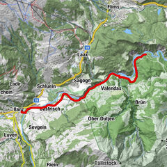
Isla2.2 kmVersam-Safien (635 m)4.4 km
- Best season
-
JanFebMarAprMayJunJulAugSepOctNovDec
- Description
-
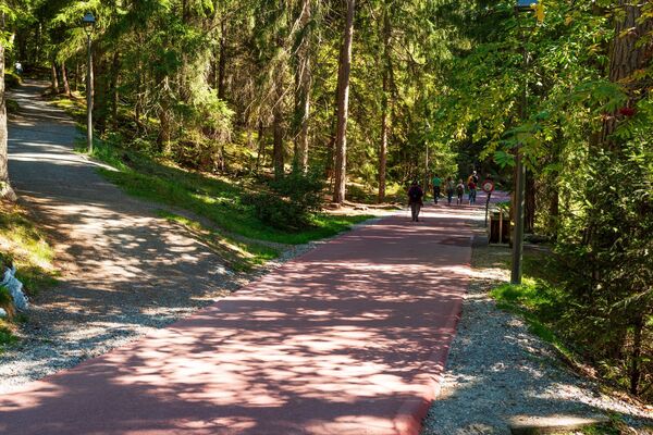
At Valendas Station, we first cross the railway line and walk along it for a short distance heading east, till the path goes down into the airy wood beside the branch of the young Rhine. This hike is particularly attractive in early summer, when the woods are resplendent in bright fresh green and the Rhine is carrying a torrent of water.
At the entrance to the Carrera ravine, we go under the railway line and climb upwards through the forest glade of Au. We make a wide circuit around the glade of Isla a little higher up. At the edge of the wood there is an inviting rustic bench. Here we can take a short break. We enjoy a beautiful panorama over the glade below us and over the whole western section of the Rhine Gorges.
Now the path drops down into the narrow floor of the valley. We find ourselves back at the Rhine. On fine summer days we will see plenty of canoeists trying their hand at river-rafting. Mostly, though, we are caught in admiration of the cleft cliff walls and outcrops on the heights opposite.
Our path now leads a bit up and down under the caverns, outcrops and gorges of this bizarre landscape shaped by erosion so long ago. Not without reason is this section considered the most interesting and adventurous gorge landscape in Europe – “Switzerland's Grand Canyon” it is called.
Rather suddenly we come upon the little station at Versam. There is a comfortable restaurant to receive us if we want to stay a while longer in this extraordinary place, till the train takes us back to Chur. - Directions
-
Valendas/Station - Ruinaulta - Versam/Station
- Highest point
- 724 m
- Height profile
-
 © outdooractive.com
 - Additional information
-
The Great Landslide: At the end of the last Ice Age, the period known as the Würm Glaciation, a tremendous mass of boulders fell from the slopes of Flims Mountain and Piz Grisch in a southerly direction down to the bottom of the valley. Across a distance of three kilometres, these masses of rock must have thundered down to the ground at high speed. Nowhere in the Alps has there been a landslide of such enormous proportions. One can imagine what a tremendous power the masses of rock must have had. This force knocked the displaced material on the other side of the valley, on the slope of Versam and Valendas, upwards again. Part of the landslide mass was pushed up-river, the other part was pushed out of the valley almost as far as Reichenau.
The glacier masses of the late Ice Age then spread once more into the present-day valley floor of Reichenau and Tamins, and covered the area of the landslide. When the Rhine Valley glacier finally shrank back, as well as the rock from the landslide there was a pile of moraine rubble. Behind this high, extensive mass of stone a great lake backed up. It stretched westwards as far as Tavanasa. One day it burst out to the east. It must have disappeared in a fairly short time. At this point, the young Rhine ate deep into the loose landslide rock.
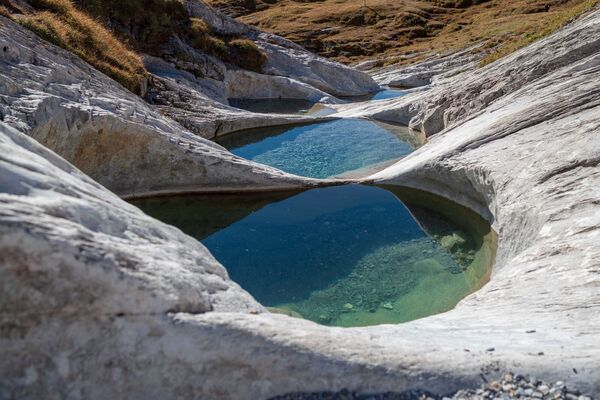
Today the bed of the Rhine lies up to 400 meters below the heights of Conn and Flims to the north and those of Versam and Valendas to the south. The fantastic rock formations of the bright stone in the steep gorges are unique and striking. We should also however pay some attention to the course of the Rhine itself, the greenish water of which flows in long loops through the valley floor. Almost untouched, fresh and airy, the woods invite us to go in. In the water meadows along the Rhine they are mostly deciduous trees and bushes, with conifers dominating on the upper slopes. No road goes through the gorge. Only the narrow-gauge railway line sticks to the curves of the right bank. This landscape was formed by a prehistoric cataclysm, and what is left reminds us of what happened here aeons ago. - Public transportation
-
Getting there: By train (RhB) to Valendas Station.
Getting back: By train (RhB) from Versam Station.

- Author
-
The tour In the Swiss “Grand Canyon” is used by outdooractive.com provided.
GPS Downloads


Other tours in the regions
-
Heidiland
2201
-
Flims Laax Falera
774
-
Castrisch
313