
- Difficulty
-
easy
- Rating
-
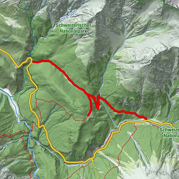
- Route
-
Champlönch1.5 kmGrimmels2.5 kmHotel Parc Naziunal Il Fuorn6.0 kmIl Fuorn6.0 km
- Best season
-
JanFebMarAprMayJunJulAugSepOctNovDec
- Description
-
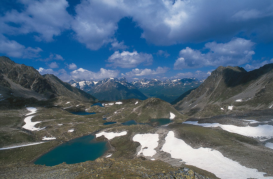
The Post-Bus brings us to Car Park 1 at Ova Spin on the edge of the Swiss National Park. From here, a hiking trail leads into the park, up into a little valley, which after an unstrenuous climb leads almost out to the southeast. The little valley is called Champlönch and has a quite unique character. It is a long-drawn-out flat clearing, varied by pines and bogland. It is like entering another world. The lonely and plaintive belling of stags on an October morning only serves to confirm the other-worldly atmosphere.
At the end of the clearing, the path divides: straight ahead it descends into the Ftur Valley, and to the right up into the clearing of Grimmels. The detour to Grimmels is well worthwhile. From this clearing one has a free and wide view of the Ofenpass area. In the morning and in the evening, if one is discreet, one can watch chamois and deer trotting out onto the meadow.
We retrace our steps to the turnoff and now follow the trail which brings us down into the Ftur Valley in wide loops. We cross the stream over a few tree trunks and walk through the wood called “God sur il Fuorn”. On the slopes of the Piz dal Fuorn we can often see chamois. Through a pure wood of mountain pines we walk up a hill called Plan Posa. On our way up to the Il Fuorn Inn we come across the remains of a furnace in which lime and mortar were burned once. Il Fuorn is a lovely Alpine inn where it is comfortable to stay the night. - Directions
-
Ova Spin - Champlönch - Grimmeis - Il Fuorn
- Highest point
- 2,064 m
- Height profile
-
 © outdooractive.com
 - Additional information
-
The Swiss National Park: The Swiss National Park is there in the first instance to protect nature in a comprehensive way. Nature is to develop here as it does when man does not interfere with the process. Sun and rain, heat and cold, snow and storm form and influence nature in this place. So there have arisen here in the past hundred years very interesting, unique, archaically attractive landscapes with a particularly rich flora and fauna. They distinguish themselves by a rough, unusual beauty, which fills the visitor with a feeling of freedom and eternity. Often, on hikes through the silent places of the park, the visitor feels caught up in a vague kind of aspiration towards plain living in closeness with nature.
The park also serves numerous scientific workers as an object of study for their research. Botanists, zoologists, geologists and climatologists watch with considerable interest the development and change in this place untouched by human hand.
So that the peculiarities of the park are maintained, there are national park rules which the visitor should observe. These rules are posted at every entrance to the park. You can get a closer view of the character, aim and running of the park from a visit to the National Park House in Zernez. - Public transportation
-
Getting there: By rail to Zernez. From there by Post-Bus to Ova Spin (Car park 1).
Getting back: By Post-Bus from Il Fuorn to Zernez. By rail from Zernez to Chur.
- Author
-
The tour Ova Spin - Champlönch - Grimmels - Il Fuorn is used by outdooractive.com provided.
GPS Downloads


Other tours in the regions
-
Engadin Samnaun Val Müstair
559
-
Zernez
138