
- Brief description
-
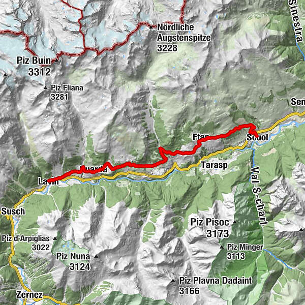
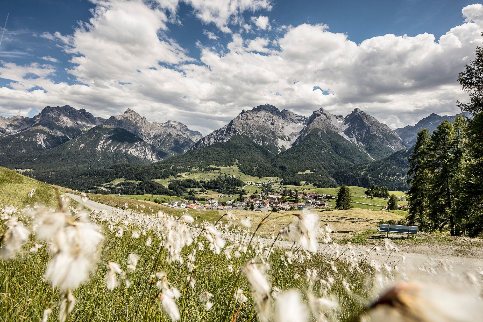
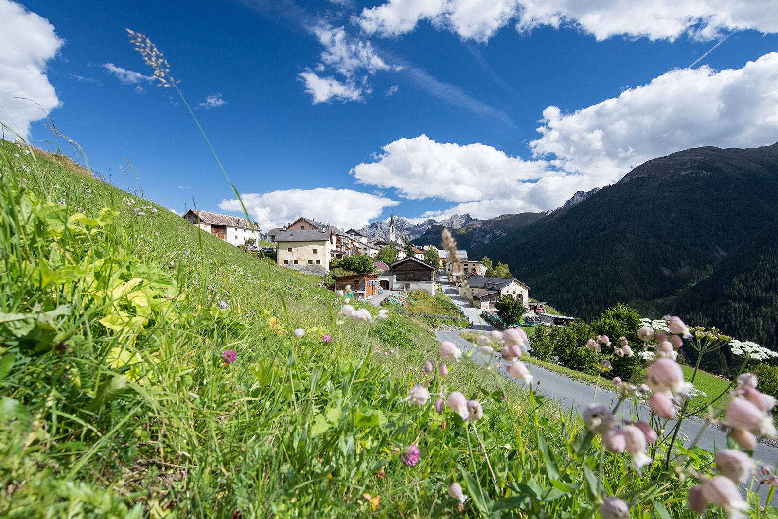
The panoramic hike on the sunny side of the Lower Engadine leads through original Engadine mountain villages and offers magnificent views of the mountain world.
- Difficulty
-
medium
- Rating
-
- Starting point
-
Lavin, staziun (station)
- Route
-
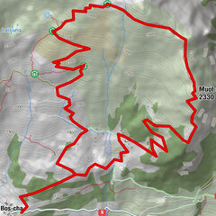
Lavin (1,412 m)Reformierte Kirche0.1 kmGuarda (1,653 m)3.7 kmReformierte Kirche3.7 kmPensiun Val Tuoi3.8 kmCrusch Alba3.9 kmMeisser Dalet4.1 kmBos-cha (1,664 m)5.3 kmArdez (1,467 m)8.2 kmChanoua9.3 kmParadies13.0 kmMuglin (1,600 m)13.2 kmReformierte Kirche13.8 kmFetan (1,648 m)14.4 kmMot Morel16.1 kmSan Bastian19.8 kmScuol (1,250 m)19.9 km
- Best season
-
JanFebMarAprMayJunJulAugSepOctNovDec
- Description
-
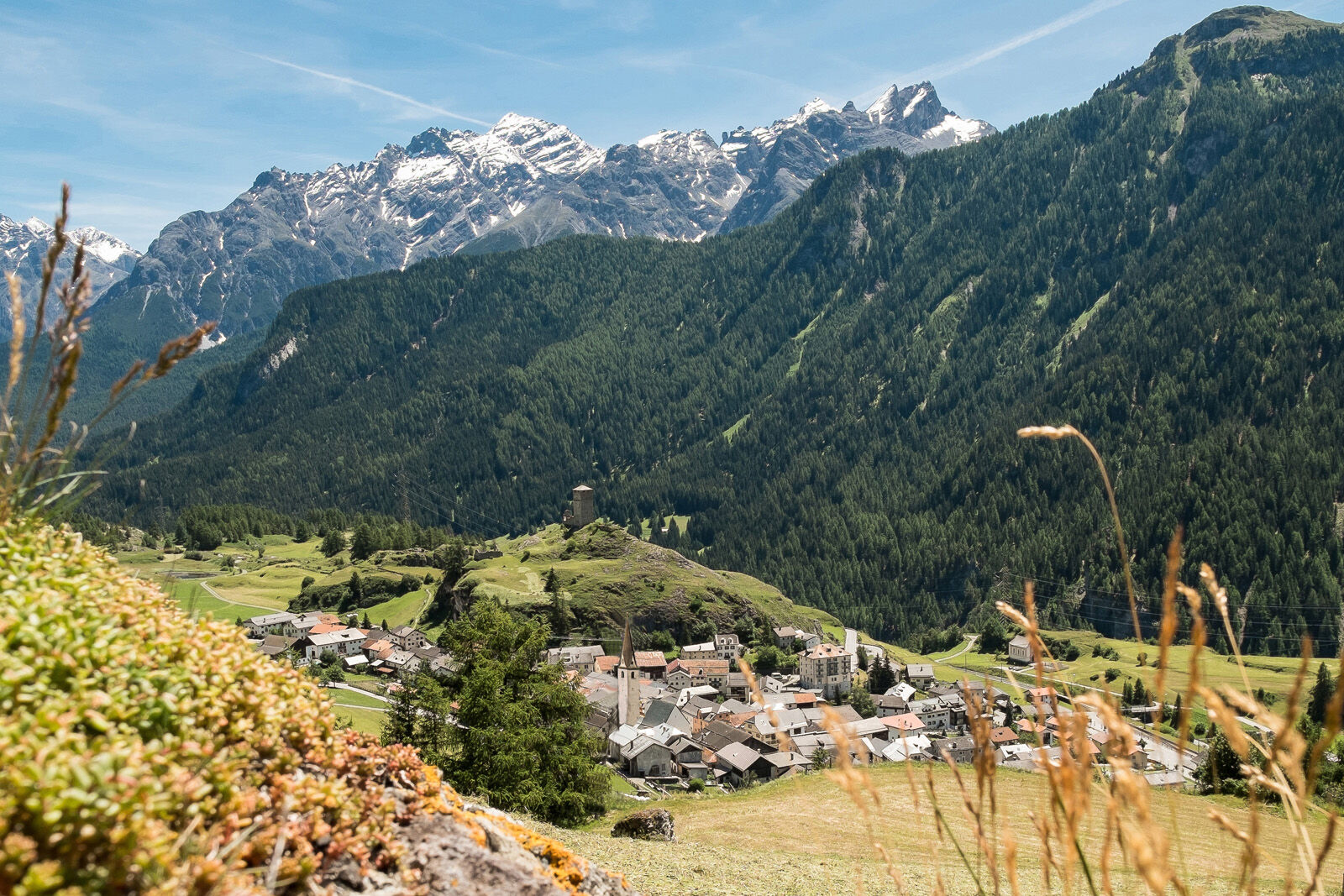
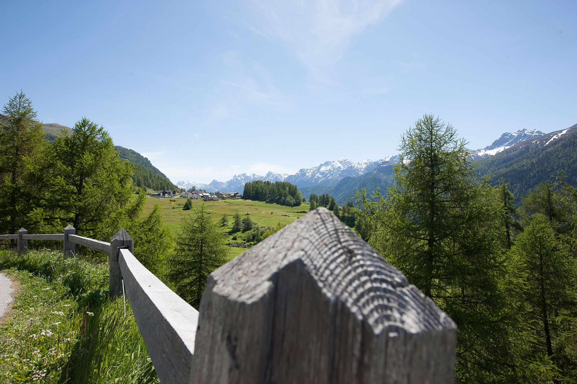
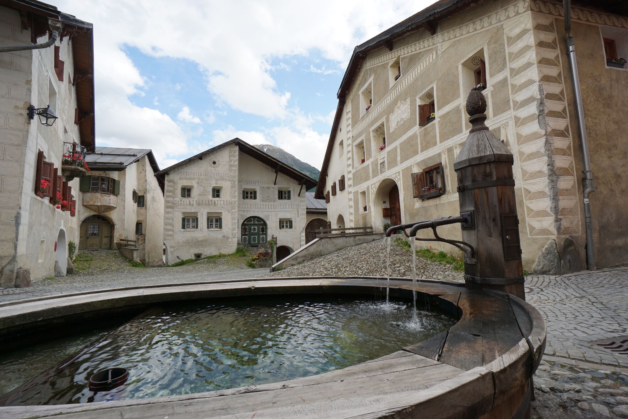
The panoramic hike on the sunny slopes of the Lower Engadine leads through striking Engadine villages such as Lavin, Guarda, Ardez and Ftan. Narrow alleys with sgraffito-decorated houses want to be explored. Between the villages, the rather easy trail runs through sections rich in nature with magnificent views of the Engadine mountains. In spring you can marvel at the diverse flora, in autumn at the golden splendour of colours.
- Directions
-
From the railway station in Lavin, follow the signposts to Guarda. The route climbs steadily to the village, high above the Inn. After crossing the village, a little road with little traffic leads to the hamlet of Bos-cha. Immediately beyond, you can follow the path in the direction of Ardez or choose a slightly higher variant on a mountain trail that offers more nature.
After a recommended detour in Ardez, follow the signs to Ftan. The trail climbs gently past the Chanoua ruins. Shortly afterwards, the trail goes slightly downhill for a short stretch on a road with little traffic. Immediately after the bridge over the Tasnan torrent, turn left and after a few metres follow the hiking trail towards Ftan. After a short stretch through the forest, you cross the road and go past the Hotel Paradies directly into the village. At the end of Ftan you have the option of following the lower or upper hiking trail down to Scuol. The upper variant takes a little longer and is a little steeper on the way down, but perhaps also a bit more scenic.
Of course, the hike can also be done wonderfully from Scuol to Lavin.
- Highest point
- 1,704 m
- Endpoint
-
PostBus stop Scuol, Belvédère
- Height profile
-
 © outdooractive.com
 - Equipment
-
Sturdy shoes, sun protection
- Safety instructions
-
La randonnée a été évaluée lorsque les conditions météorologiques étaient favorables. Les conditions météorologiques actuelles et les prévisions météorologiques doivent impérativement être prises en compte avant le départ de la randonnée.
Appel d'urgence:
144 Appel d'urgence, premiers secours
1414 Sauvetage en montagne REGA
112 Numéro d'urgence international
- Tips
-
Near Ardez, it is worth visiting the Steinsberg ruins, which tower over what is perhaps the most unspoilt Engadine village.
- Additional information
- Directions
-
- From the north: via Landquart – Klosters by car transport through the Vereina Tunnel (Selfranga - Sagliains) or via the Flüela Pass into the Lower Engadine on H27
- From the east: via Landeck / Austria in the direction of St. Moritz on H27
- From the south: via Reschenpass (Nauders-Martina) or Ofenpass (Val Müstair-Zernez) on H27
- Public transportation
-
- By Rhaetian Railway (from Chur, Landquart/Prättigau or Upper Engadine) hourly to Lavin
- Parking
-
- Paid parking at the railway station in Lavin
- It is recommended to travel by Rhaetian Railway, as this is a long-distance tour

- Author
-
The tour Lavin – Guarda – Ardez – Ftan – Scuol is used by outdooractive.com provided.


General info
-
Engadin Scuol Zernez
734
-
Ardez
153
 Lucas Tiefenthaler / Vorarlberg Tourismus")