
- Brief description
-
Beautiful and challenging hike from Sardasca via Schlappin to Klosters Dorf, passing four picturesque mountain lakes.
- Difficulty
-
difficult
- Rating
-
- Starting point
-
Sardasca, Monbielerstrasse
- Route
-
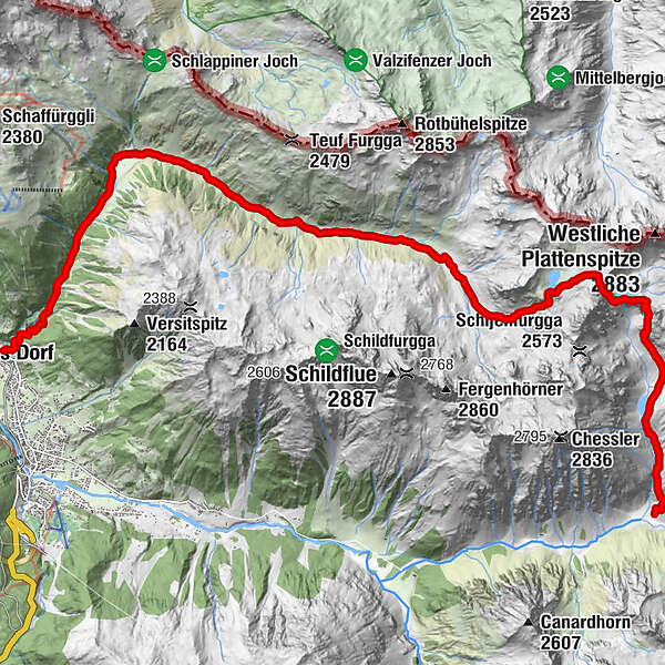
Seetalhütte (2,065 m)1.7 kmSchottenseefürggli (2,644 m)5.0 kmSchlappin (1,658 m)14.4 kmSchlappin See14.7 kmBerghaus Erika14.7 kmPizzeria Madrisa-Mia18.5 kmKlosters Dorf18.5 km
- Best season
-
JanFebMarAprMayJunJulAugSepOctNovDec
- Description
-
A tour for hikers in good shape, who will be rewarded all the more for it. The bus (by appointment, tel. +41 (0)81 422 11 97) runs daily to Sardasca, the starting point of the hike. From here the trail climbs steadily up to the Seetalhütte SAC hut above the lake and on to the Schottensee lake at an altitude of just under 2,500 m. The highest point is reached on the Schottenseefürggli and the descent follows in the direction of Schlappin, past the Hüenersee lake and the Kübliser Alp. The cosy restaurants "Erika" and "Gemsli" invite you for a stopover before you set off on the last four kilometres to Klosters Dorf. Alternatively, there is a bus from Schlappin to Klosters on request.
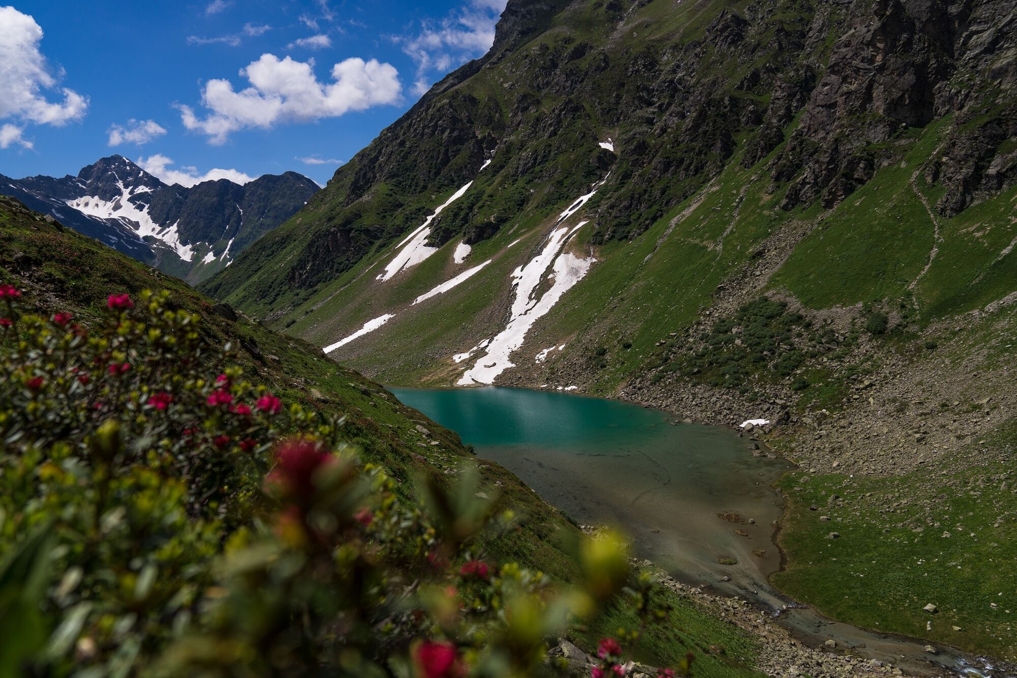
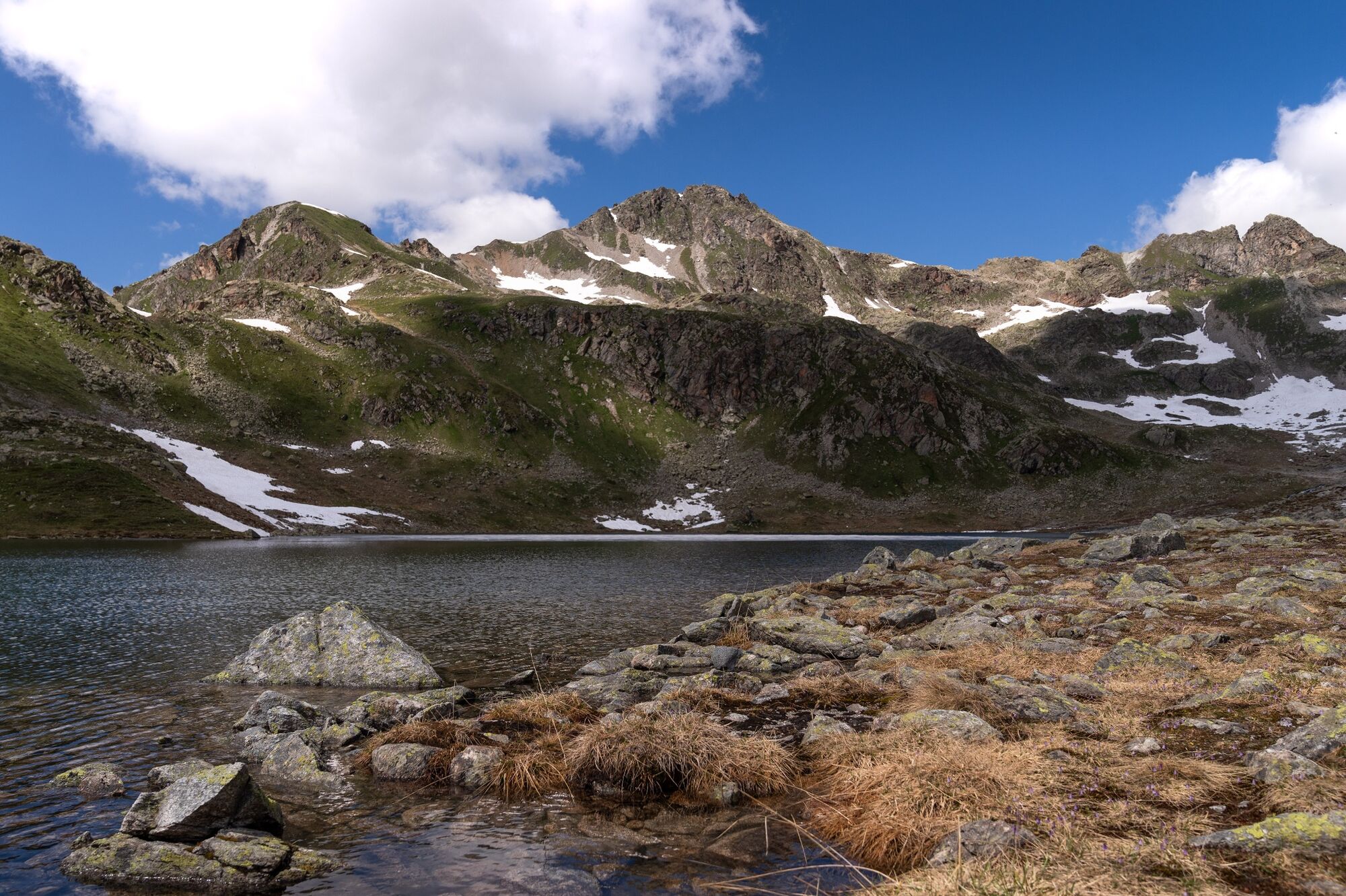
Seetalsee
Beautiful mountain lake next to the Seetalhütte SAC.
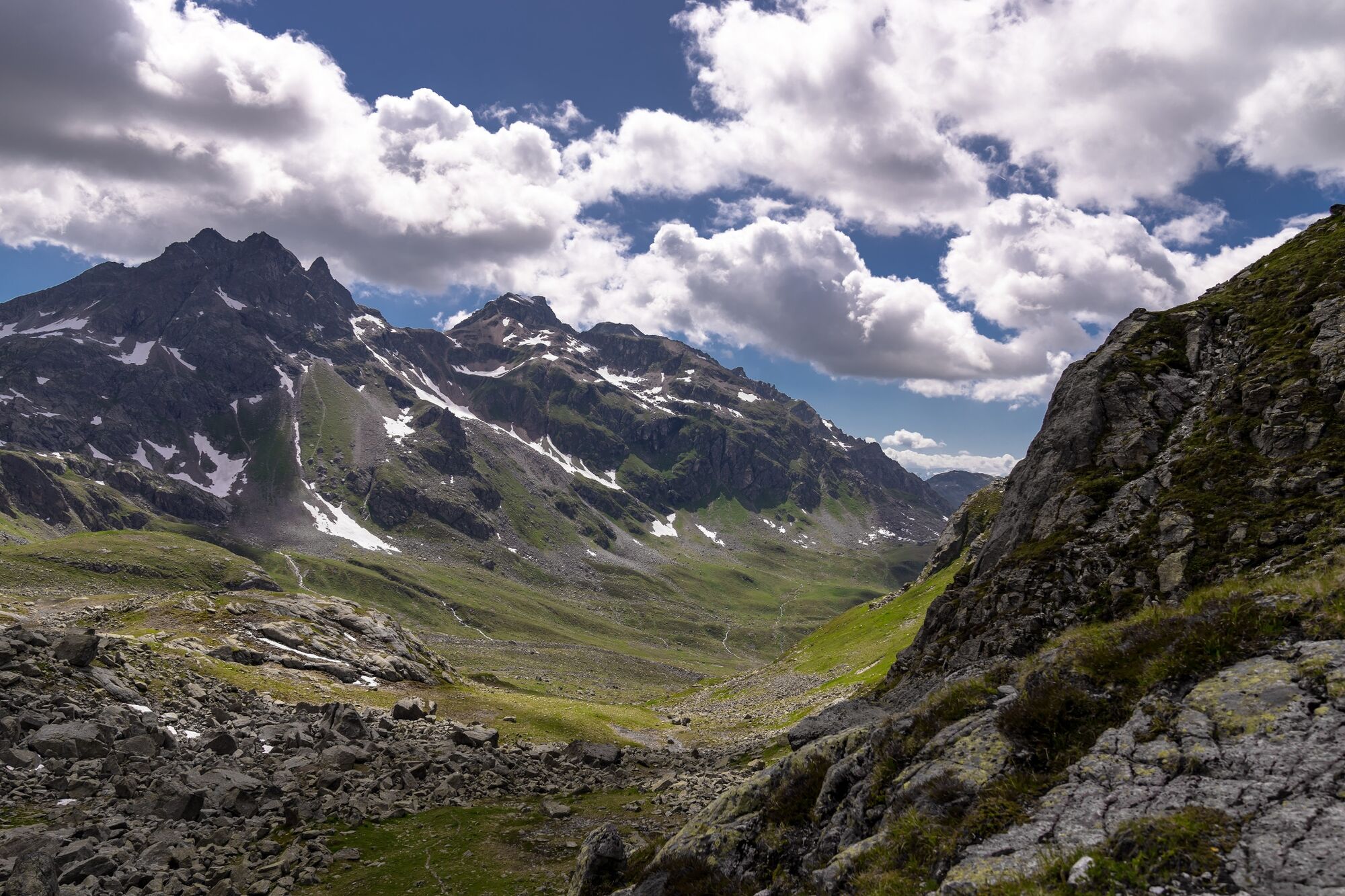
Schottenseefürggli
The highest station on this tour is also a great vantage point.
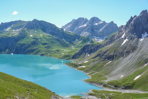
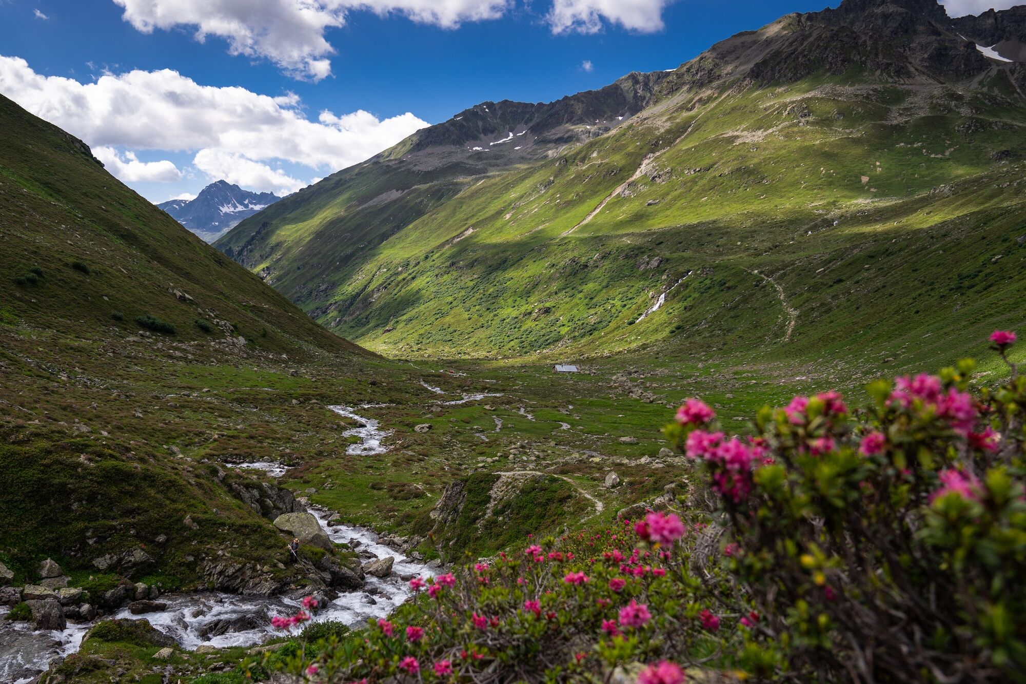
Hüenersee
Wonderful mountain lake with turquoise-blue water surrounded by a fascinating mountain world.
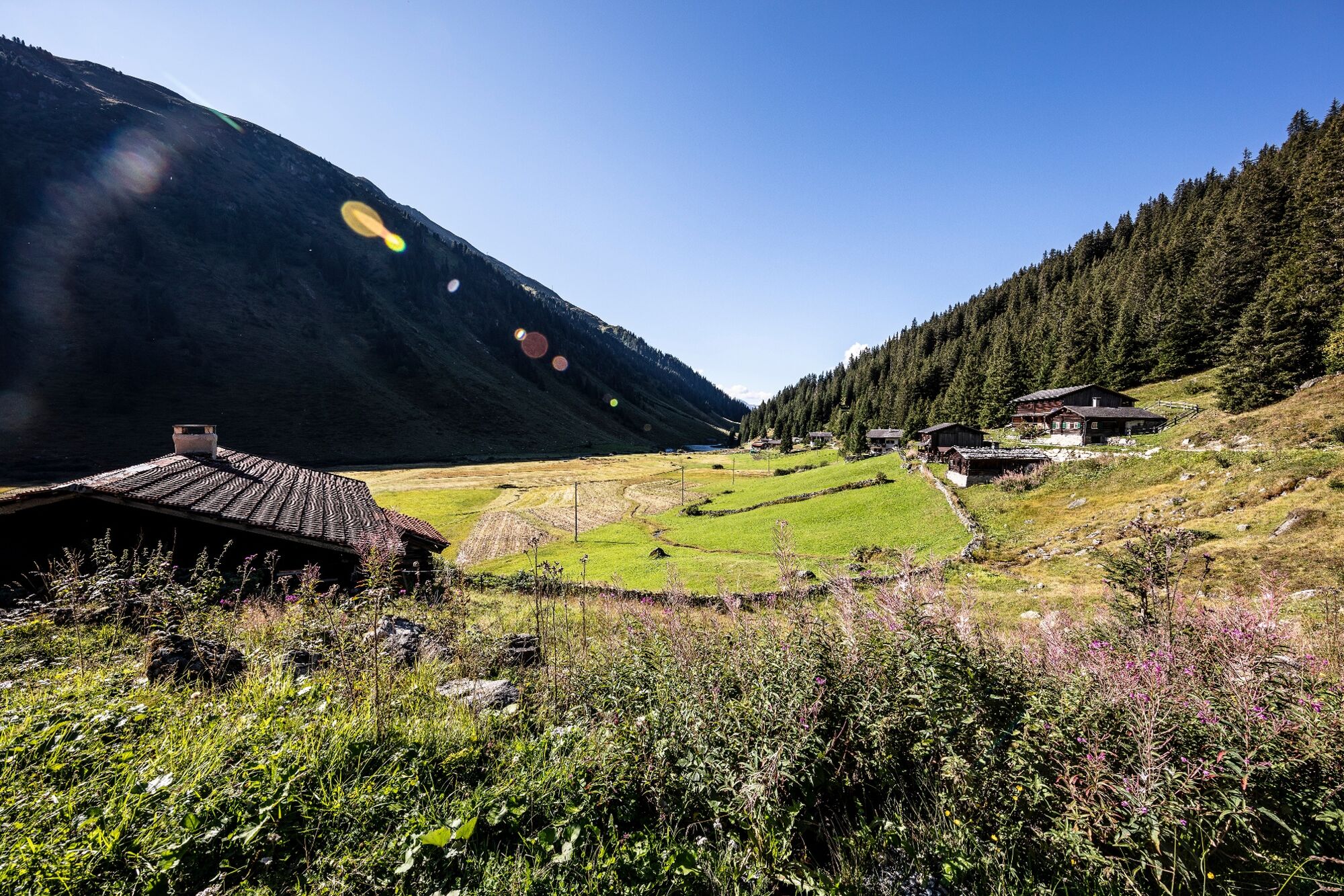
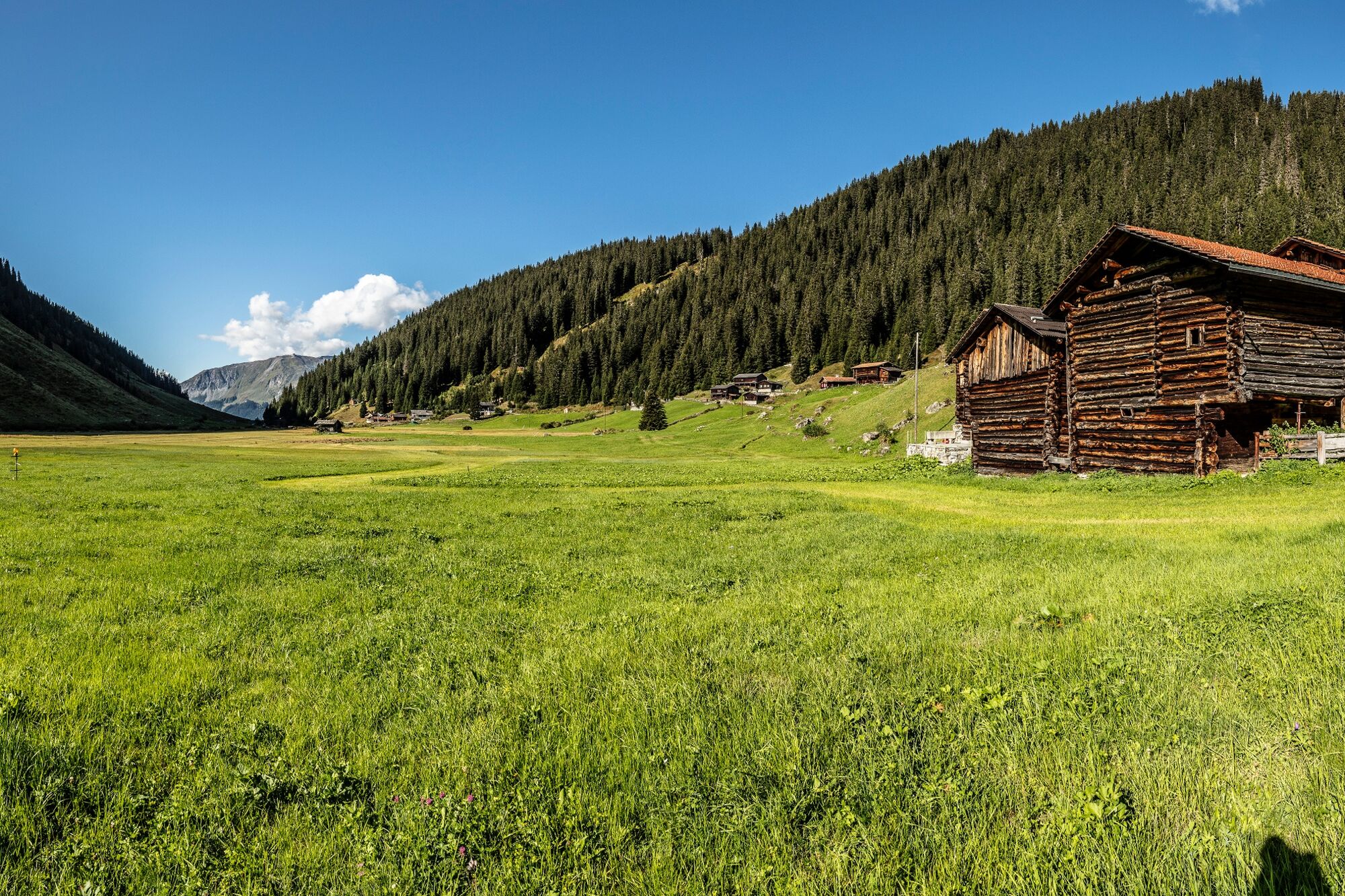
Schlappin
In the small Walser settlement of Schlappin, which borders on the Madrisa area, there are two restaurants offering overnight accommodation as well as food and drink. The beautiful lake and picnic areas invite you to linger.
Note(s)
In Davos Klosters, hikers and mountain bikers use the same paths without restrictions. This applies to the whole of Canton Graubünden and is unique in the Alps.
See also
Destination Davos Klosters
Talstrasse 41
CH-7270 Davos Platz
Tel: +41(0)81 415 21 21
E-mail: info@davos.ch
Internet: www.davos.ch
- Directions
-
Sardasca - Seetal valley - Lake Schottensee - Schottenseefürggli - Lake Hüenersee - Schlappin - Klosters Dorf
- Highest point
- 2,625 m
- Endpoint
-
Klosters Dorf
- Height profile
-
 © outdooractive.com
 - Safety instructions
-
In Davos Klosters, hikers and mountain bikers use the same paths without restrictions. This applies to the entire canton of Graubünden and is unique in the Alps.
- Tips
-
The cosy restaurants "Erika" and "Gemsli" invite you for a stopover before tackling the last four kilometres to Klosters Dorf.
- Directions
-
From Zurich, take the A3/A13 motorway (look for the green signs) in the direction of Chur as far as Landquart. From Landquart, continue on the A28 cantonal road to Klosters and then on to the Monbiel car park.
Please note that you need a motorway vignette (CHF 40.-) for the motorways in Switzerland. This is available at all border crossings, petrol stations and post offices. Further information on the Swiss motorways: www.autobahnen.ch
- Public transportation
-
Arrival via Landquart with the RhB to Klosters Platz station.
Take bus line 232 in the direction of Monbiel to the "Monbiel Parkplatz" bus stop. The bus leaves every 30 minutes.
From the Monbiel car park it is approx. 2km to the starting point of the hike.
Alternatively, you can take the Alpine Taxi to Alp Garfiun or Alp Sardasca.
- Parking
-
Use public parking spaces in Monbiel or Klosters.

- Author
-
The tour 4-lakes-hike Klosters is used by outdooractive.com provided.


General info
-
Davos Klosters
927
-
Gargellen im Montafon
352