


© Outdooractive – 3D Videos

- Brief description
-
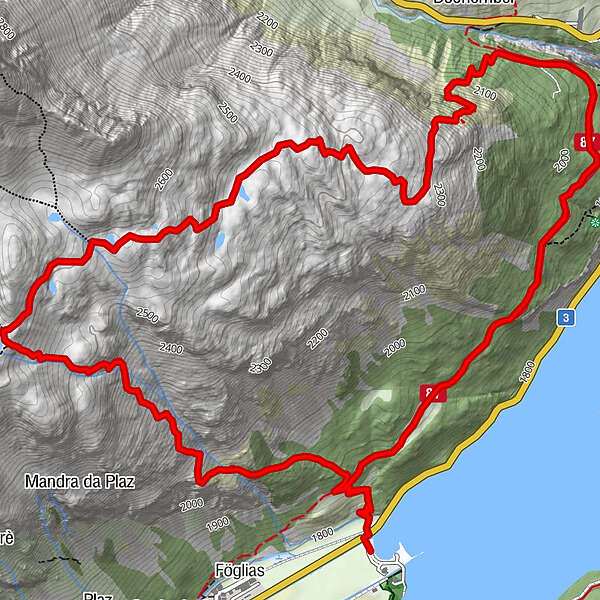
A scenic hike high above the Silvaplaner lake with a steep ascent to a hidden jewel, the enchanting mountain lake Lej da la Tscheppa.
- Difficulty
-
medium
- Rating
-
- Starting point
-
Sils, Restaurant Beach Club
- Best season
-
JanFebMarAprMayJunJulAugSepOctNovDec
- Description
-
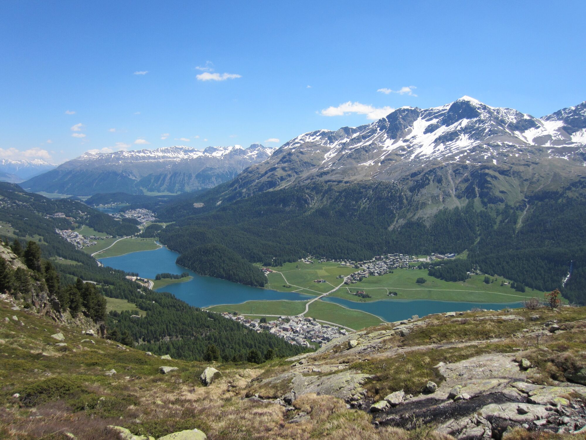
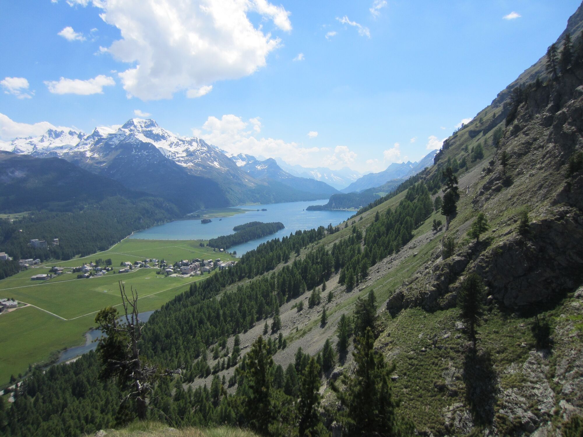
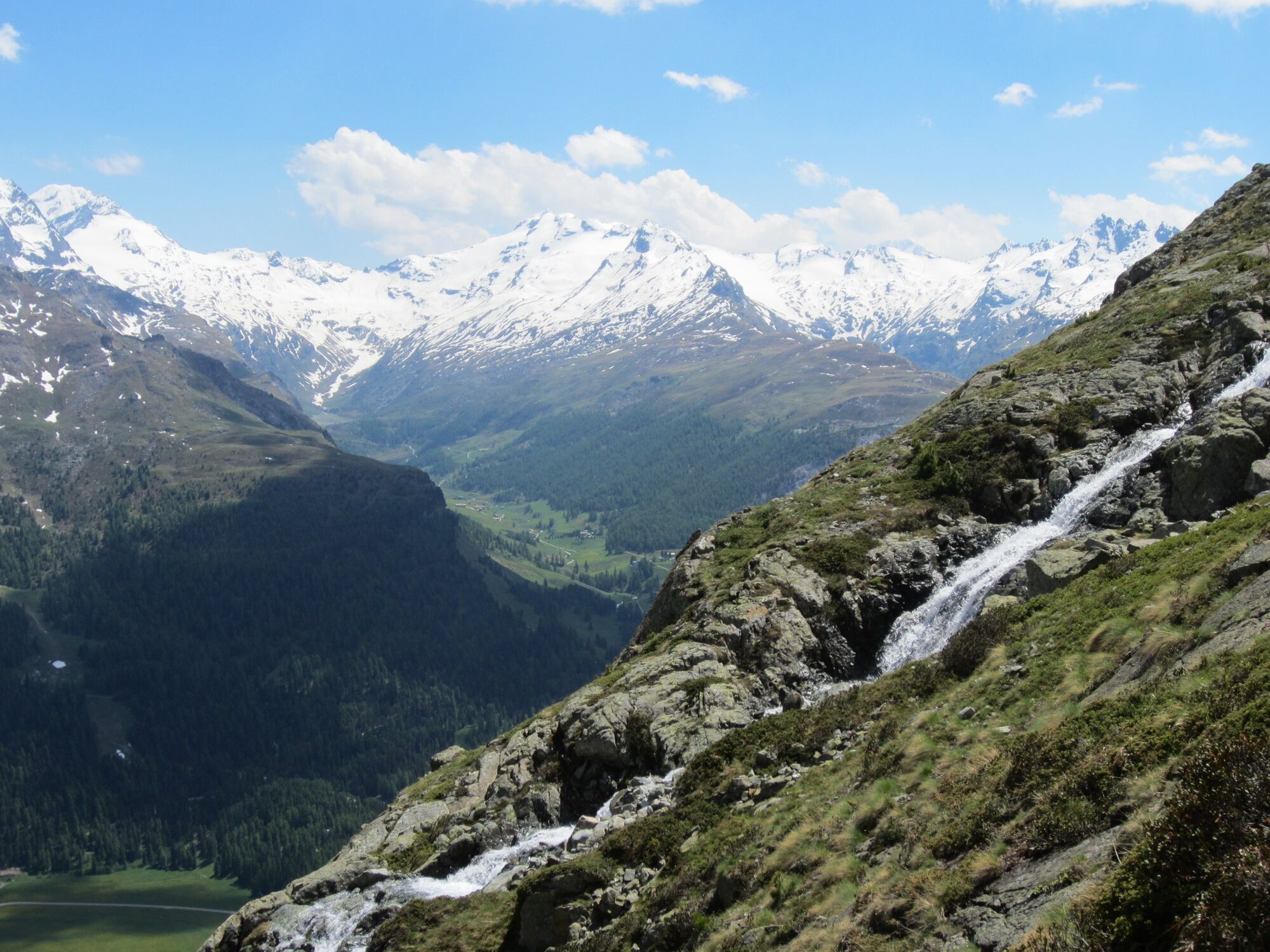
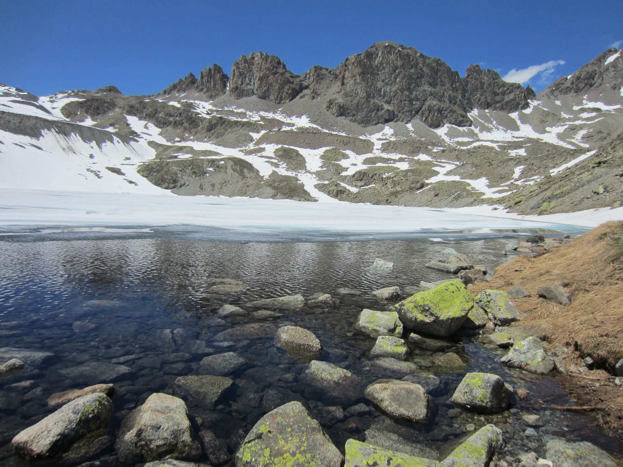
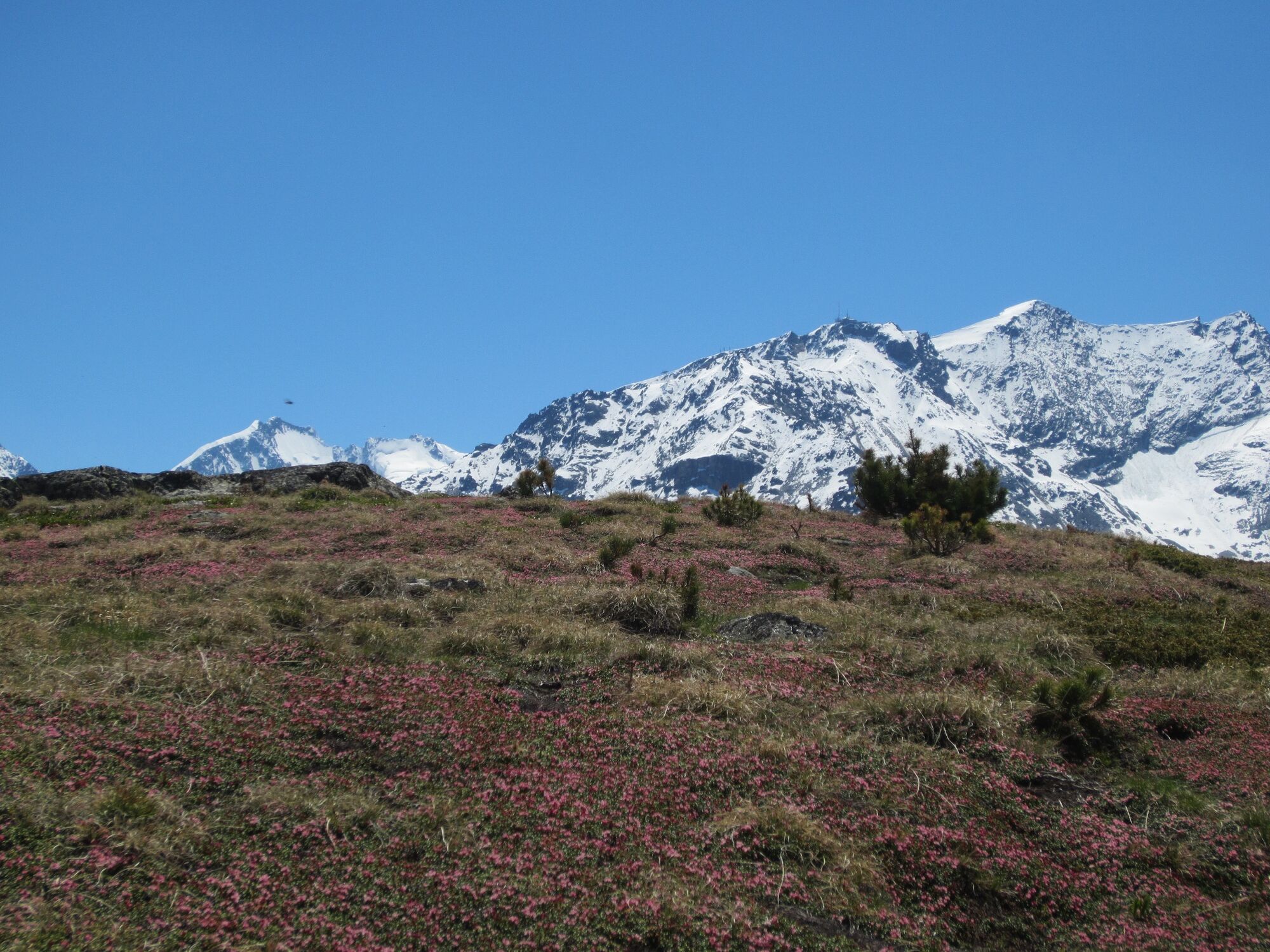
This splendid hike beside romantic mountain lakes is primarily suitable for experienced mountain hikers - because the demands that the trail makes of hikers are just as numerous as the impressive sights, which come in quick succession. The route starts in Sils, on the opposite side of the road from the Beach Club Restaurant. From the very start, the trail climbs towards the heavens, first through the forest and then across Alpine meadows strewn with colourful flowers. The view becomes ever more impressive - first across the Engadin lakes, then more and more mountain peaks come into view on the horizon. With a little tenacity, you reach Lej de la Tscheppa, high above Sils. You might spot a chamois or, if you are very lucky, a ptarmigan on the screes of Piz Polaschin. After a well-earned rest, you first follow an easy route alongside the many little lakes and enjoy a superb view of the lake plateau and St. Moritz before tackling the steep descent to the Julier Pass road. Now you walk back along the muleteer's path to Sils. During the latter, you can delight in the view of Lake Silvaplana's myriad shades of blue, which constantly vary as the light changes.
More information
Engadin Tourismus AG
Via Maistra 1
Phone: +41 81 830 00 01
E-mail: allegra@engadin.ch
Internet: www.engadin.ch - Directions
-
Sils - Lej da la Tscheppa - Silvaplana - Sils
- Highest point
- 2,622 m
- Endpoint
-
Sils Maria
- Height profile
-
 © outdooractive.com
 - Equipment
-
Hiking boots, rain jacket and sun protection are recommended.
- Tips
-
The hike can also be done in the opposite direction by taking the post bus to the Lej da La Tscheppa stop (Julier route).
- Directions
-
Sils/Segl, Beach Club
- Public transportation
-
With post bus or Engadin bus to Sils/Segl Maria, Seglias. From there about 15 minutes walk to the Beach Club.
- Parking
-
car parc Beach Club
- Author
-
The tour Sils - Lej da la Tscheppa - Sils is used by outdooractive.com provided.
GPS Downloads


General info
Refreshment stop
Cultural/Historical
A lot of view
Other tours in the regions
-
Veltlin / Valtellina
852
-
Engadin St. Moritz
782
-
Silvaplana
338


