© Pontresina Tourismus


- Brief description
-
The hike starts easily, by taking the bus or train to Bernina Diavolezza.
- Difficulty
-
difficult
- Rating
-
- Starting point
-
Bernina Diavolezza
- Route
-
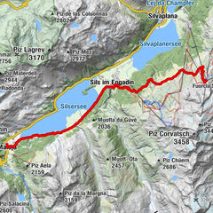
Paradieshütte9.0 kmRöntgenplatz12.4 kmPontresina (1,805 m)13.4 km
- Best season
-
JanFebMarAprMayJunJulAugSepOctNovDec
- Description
-
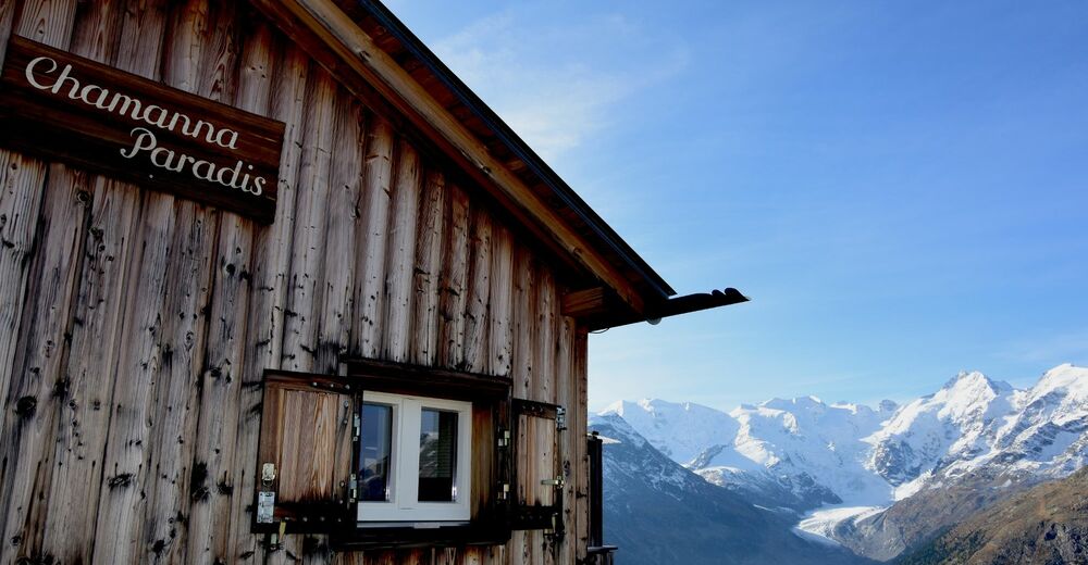
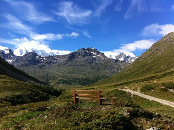
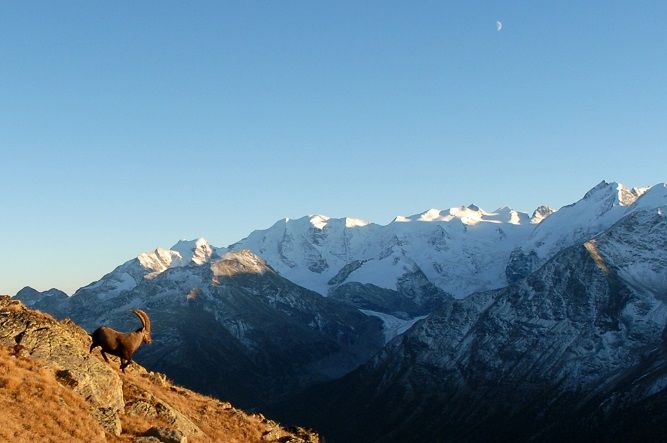
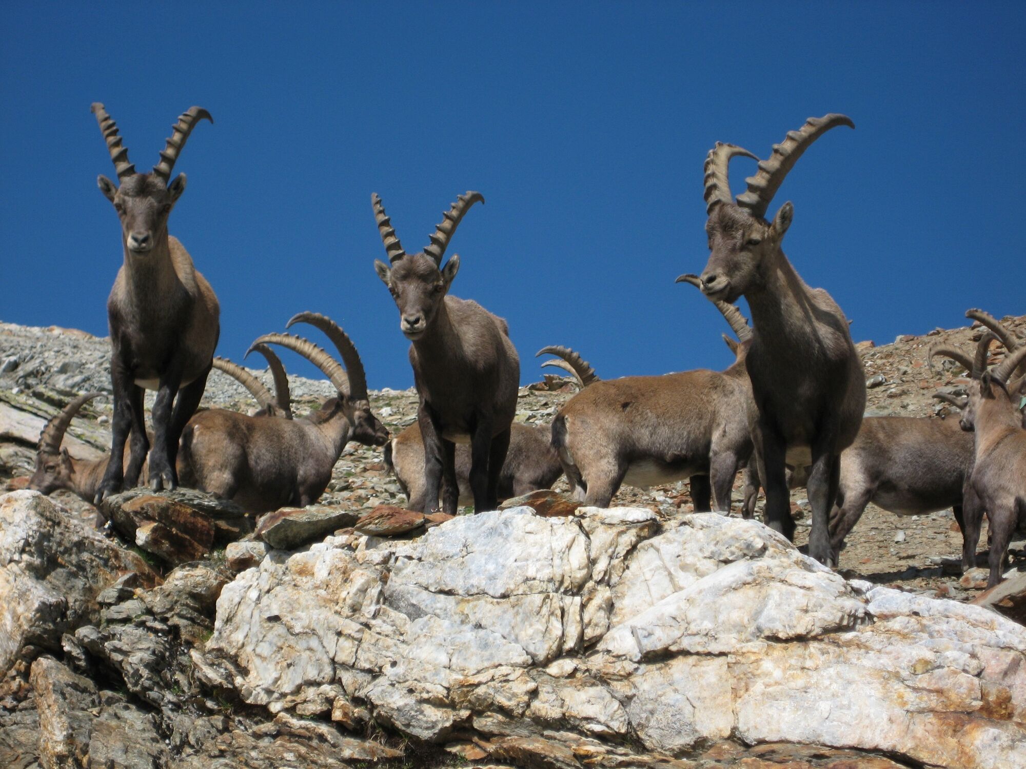
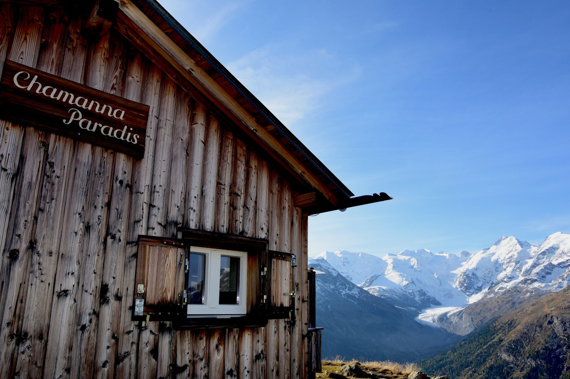
From Bernina Diavolezza walk a short distance along the pass road before an gravel road turns off to the right towards the bridge and continues on the other side into the Val da Fain. The Val da Fain is famous for its wonderful Alpine flowers, and practically every square metre is inhabited by marmots. After a good half-hour, the trail forks off. You now follow a steep zigzag path across Alpine meadows and past marmot burrows to the rocky terrain of the Giand'Albris. After traversing the slope via the narrow path, the route, which is secured by ropes, takes you in the direction of Fuorcla Pischa. You will have earned a rest after all this exertion, and during your break you might spot an ibex on the rocks. There is a good chance that you will, because Piz Albris is home to one of the biggest ibex colony in Switzerland. The route continues across scree and over Fuorcla Pischa. Towards the middle of Crasta Languard, the road branches off to the left. After traversing the corrie, the trail descends steeply to Lej Languard. From here, it is only 30 minutes to the Paradise hut, where delicious cakes await you. These should give you sufficient energy to tackle the descent to Pontresina. Remember to discover Pontresina's Ibex Paradise. www.pontresina.ch/ibex-paradise
More information
Engadin Tourismus AG
Via Maistra 1
CH-7500 St. Moritz
Phone: +41 81 830 00 01
E-mail: allegra@engadin.ch
Internet: www.engadin.ch - Directions
-
Bernina Suot - Val da Fain - Fuorcla Pischa - Lej Languard - Pontresina
- Highest point
- 2,852 m
- Endpoint
-
Pontresina post office
- Height profile
-
 © outdooractive.com
 - Safety instructions
-
This hike is only suitable for the sure-footed and those with a head for heights.
- Tips
-
Remember to discover Pontresina's Ibex Paradise. www.pontresina.ch/ibex-paradise


- Author
-
The tour Val da Fain - Fuorcla Pischa - Paradis Hut is used by outdooractive.com provided.
GPS Downloads


General info
Refreshment stop
Flora
Fauna
A lot of view
Other tours in the regions
-
Veltlin / Valtellina
851
-
Engadin St. Moritz
782
-
Diavolezza
278