
© Engadin Tourismus AG - Marina Schneider

© Engadin Tourismus AG - Marina Schneider

© Engadin Tourismus AG - Marina Schneider

© Engadin Tourismus AG - Laura-Maria Engel

- Brief description
-
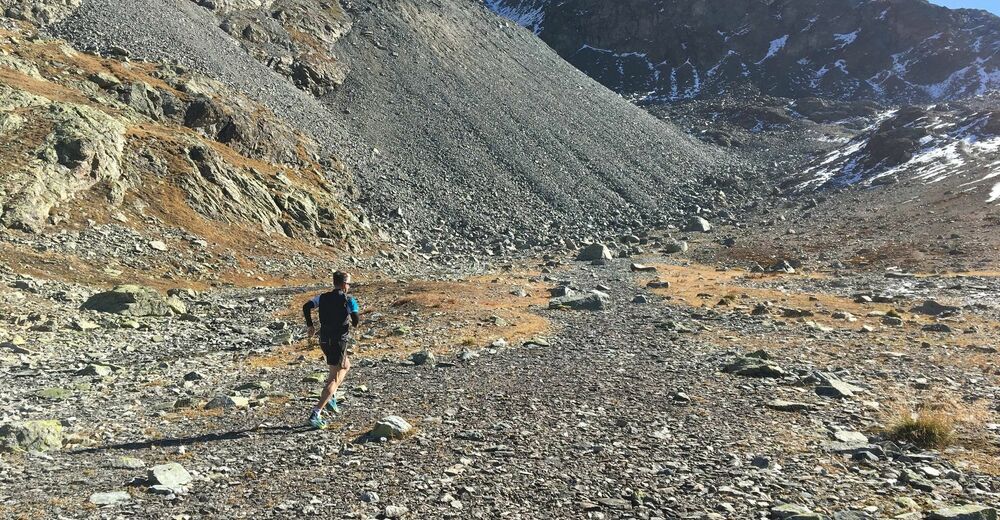
If you want to test your abilities as a mountain trail runner, this is the route to you. The efforts of the ascent are rewarded by the stunning natural beauty of the Lej Muragl and breathtaking views of the Upper Engadin. And to round it off, there is a technically challenging descent.
- Difficulty
-
medium
- Rating
-
- Starting point
-
Promulins Arena, Samedan
- Route
-
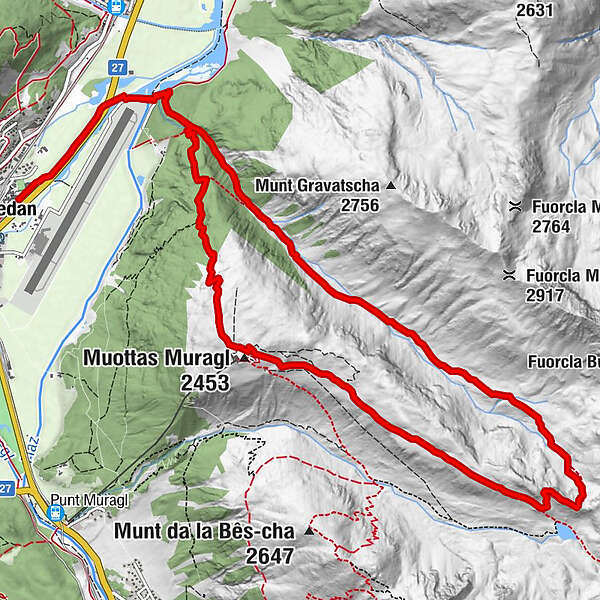
Samaden (1,721 m)Piste 211.6 kmMuottas Muragl (2,453 m)11.3 kmPiste 2115.0 kmSamaden (1,721 m)16.6 km
- Best season
-
JanFebMarAprMayJunJulAugSepOctNovDec
- Description
-
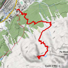
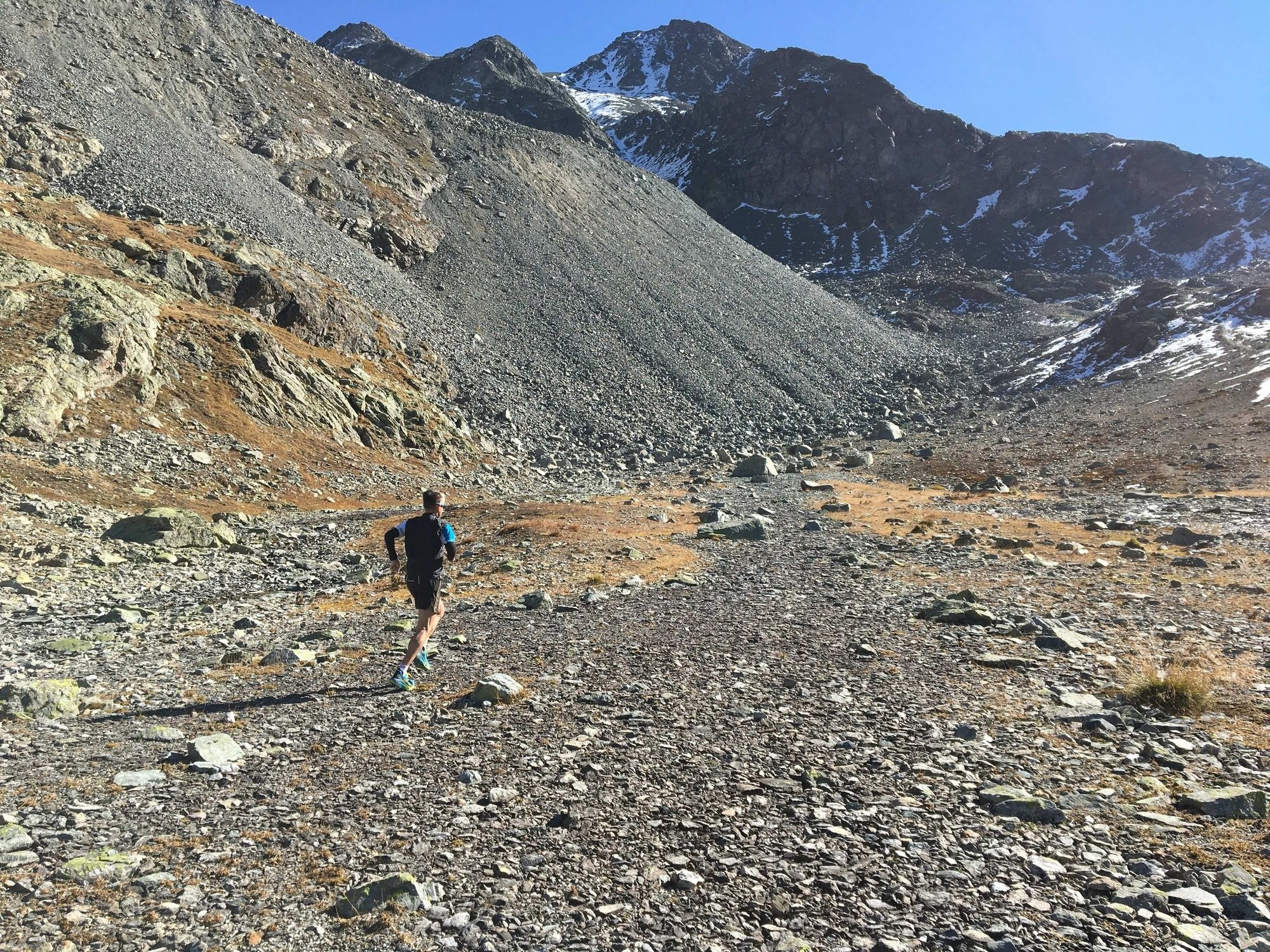
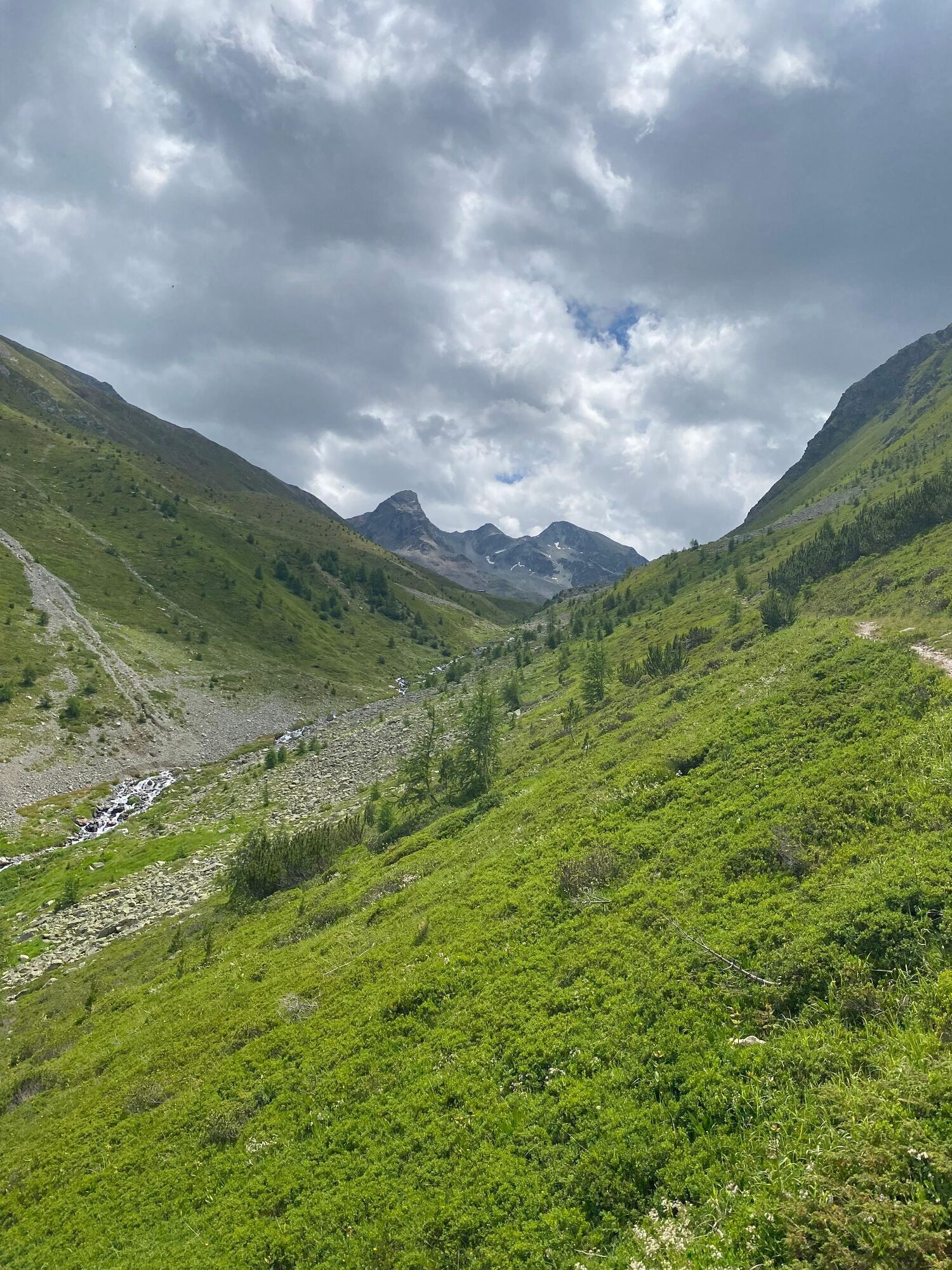
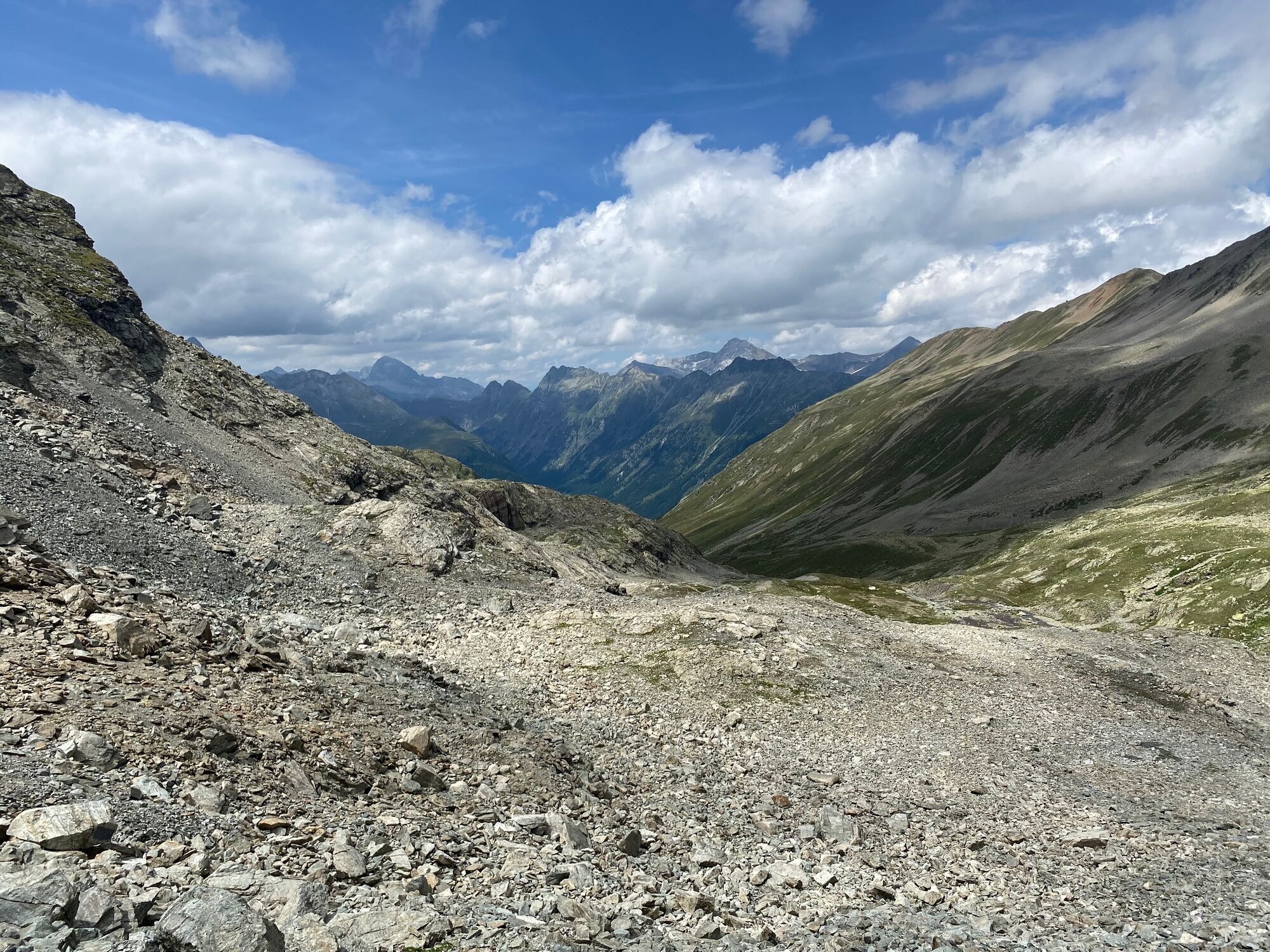
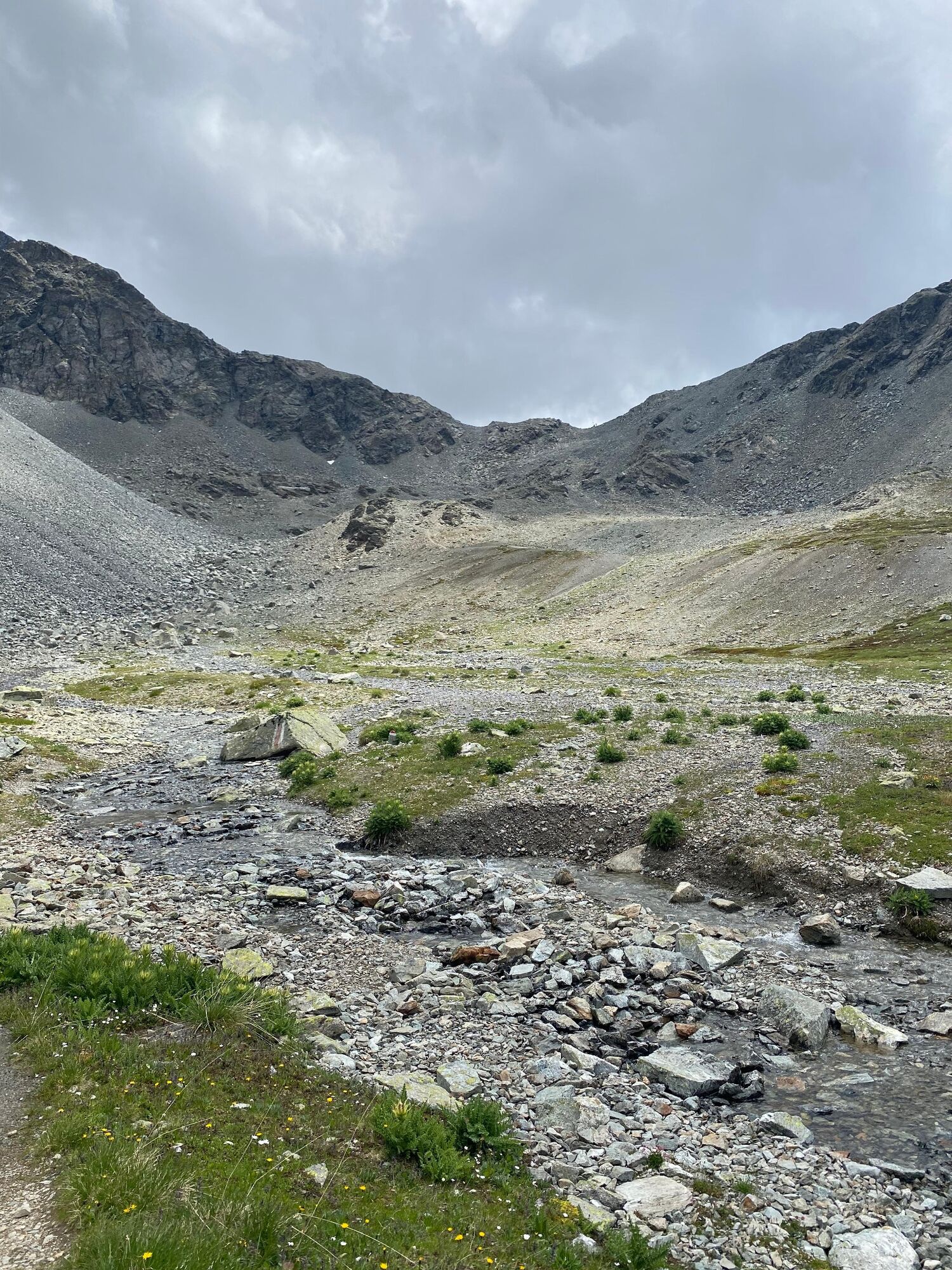
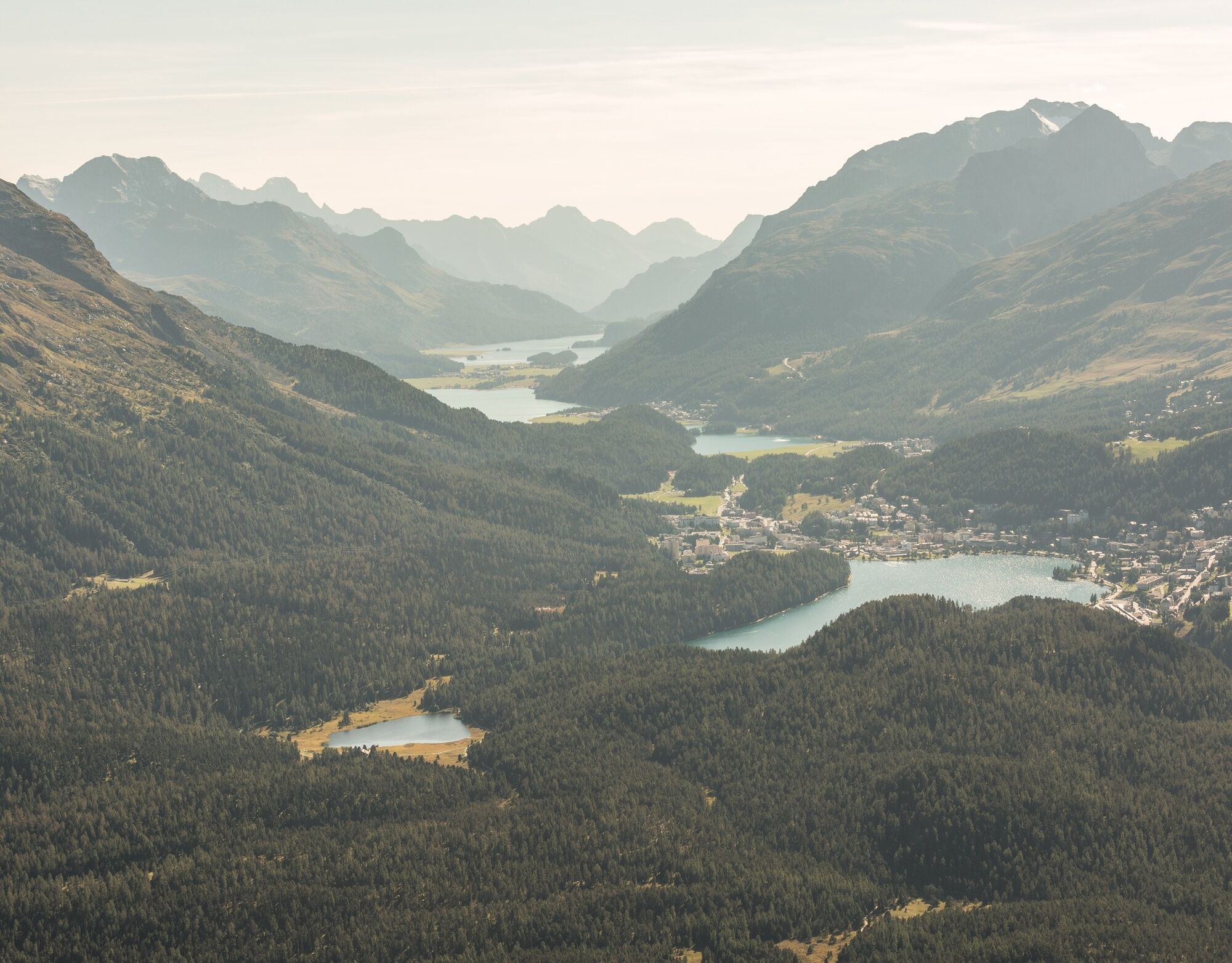
From the Promulins Arena, the trail follows the River Inn to Gravatscha, where you turn right at the Gravatschasee in the direction of the Val Champagna. The Val Champagna is probably one of the least frequently visited valleys in the Upper Engadin. The route continues along the Ova da Val Champagna, where you are immediately confronted with steep gradients. Before reaching the highest point, a total of 1,100 vertical metres need to be overcome in one go over a distance of 5.6 kilometres. Passing the water catchment area of the small Val Champagna power station, you gradually leave the forest behind you and soon reach the Chamanna Val Champagna, where the terrain briefly becomes less steep. The path initially leads through a somewhat swampy area before becoming upwardly steeper and more demanding again. The last ascent before reaching the Fuorcla is stony and demands seemingly every last ounce of energy. As soon as you reach the Fuorcla, you can see on the other side the Lej Muragl, a beautiful mountain lake situated slightly lower down from the path. On the high Alpine trail, where the popular Philosophers’ Trail is laid out in winter, the route descends slightly to Muottas Muragl, accompanied by a breathtaking view. However, it is advisable not to focus too much on the fantastic panorama, for the trail requires your full attention. Passing the Berghotel Muottas Muragl, the last steep descent of the day begins. The last section below Chaunt da Luf, in particular, again demands full concentration before you return along the Gravatschasee and the River Inn to the Promulins Arena.
More information
Engadin Tourismus AG
Via Maistra 1
CH-7500 St. Moritz
Phone: +41 81 830 00 01
E-mail: allegra@engadin.ch
Internet: www.engadin.ch - Directions
-
Promulins Arena, Samedan - Lej Gravatscha - Val Champagna - Fuorcla Val Champagna - Muottas Muragl - Lej Gravatscha - Promulins Arena, Samedan
- Highest point
- 2,811 m
- Endpoint
-
Promulins Arena, Samedan
- Height profile
-
 © outdooractive.com
 - Tips
-
If you don't have that much endurance yet, you can also take the Muottas Muragl railway up and run down the Val Champagna.
- Author
-
The tour Fuorcla Val Champagna (signeposted trail 722) is used by outdooractive.com provided.
GPS Downloads


General info
Refreshment stop
A lot of view
Other tours in the regions
-
Engadin St. Moritz
104
-
Muottas Muragl
58