
- Brief description
-
The tour over the Fuorcla Valletta offers fabulous panorama views of the Bernina massif, particularly on the ascent over the Alp Muntatsch and the Padella panorama trail. After reaching the highest point, the Fuorcla Valletta, the trail continues under the Piz Ot through the Valletta da Samedan to Margunin. The return stretch to Samedan once again offers superb views over the Upper Engadin and makes you forget all the exertion.
- Difficulty
-
difficult
- Rating
-
- Starting point
-
Samedan, Promulins Arena
- Route
-
Samaden (1,721 m)0.3 kmSamedan (1,705 m)0.3 kmSamedan Staziun (1,706 m)0.4 kmMuntarütsch (1,772 m)1.4 kmAlp Muntatsch (2,186 m)4.7 kmFuorcla Valletta (2,858 m)11.8 kmMargunin14.7 kmGekoppelte Schaukel16.7 kmPeidra Grossa (1,950 m)16.7 kmReformierte Kirche San Peter17.5 kmReformierte Kirche Samedan18.0 kmSamedan Staziun (1,706 m)18.3 kmSamedan (1,705 m)18.4 kmSamaden (1,721 m)18.5 km
- Best season
-
JanFebMarAprMayJunJulAugSepOctNovDec
- Description
-
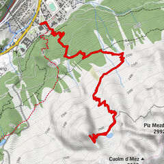
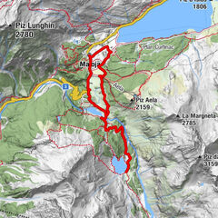
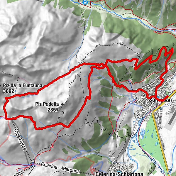
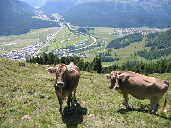
From the Promulins Arena, the route leads through Samedan to Muntarütsch, where the alpine path to the Alp Muntatsch presents you with the first ascent of the day. Even before you reach the alp, you are treated to wonderful views of the Bernina massif and across St. Moritz to the Piz da la Margna. From the Alp Muntatsch, the path is relatively flat as far as the Alp Munt, from where it continues along the panorama trail below the Piz Padella to the Munt da la Bês-cha da Schlarigna. Here the trail branches off to the right and the path becomes steeper and stonier. It then continues via Selin towards the distinctive serrated peaks of the Trais Fluors to the top station of the chairlift of the same name. From here, it is another 100 vertical metres up to the Fuorcla Valletta, which you reach after traversing an area of scree. On the Fuorcla Valletta, the view opens out towards the Valletta da Samedan, the valley between the distinctive Piz Ot and Samedan’s local mountain, the Piz Padella – which, however, is not as beautiful from the back as it is from Samedan. Initially, the descent through the Valletta is very steep. Once you have reached the valley floor, you pass the Funtauna Fraida, which springs from the stream that flows from the Piz Ot side. Here the trail is flat and flowing, and leads past the weather station under Sass Alv to Margunin. In front of the shepherd’s hut in Margunin there is a fountain where you can taste the wonderful water of the Funtauna Fraida. From Margunin, you can also once again admire the beautiful panorama of the Bernina massif, while down towards the valley you can see almost as far as Zernez. Now the path becomes somewhat steeper as it heads down towards the Alp Munt. If you have time, you can turn off from the Alp Munt towards the Alp Muntatsch and take a short break; here you will find cured meat and cheese and, as an absolute insider tip, home-made Kasierschmarrn. With this variant, you then continue from the Alp Muntatsch directly down to Samedan. The Fuorcla Valletta route leads from the Alp Munt via a highly technical trail directly through the God da Muntatsch to the San Peter cemetery above Samedan. The path then heads via Chiss through the village and back to the Promulins Arena.
More information
Engadin Tourismus AG
Via Maistra 1
CH-7500 St. Moritz
Phone: +41 81 830 00 01
E-mail: allegra@engadin.ch
Internet: www.engadin.ch - Directions
-
Samedan, Promulins Arena - Muntarütsch - Alp Muntatsch - Munt da la Bês-cha - Trais Fluors - Fuorcla Valletta - Valletta - Margunin - San Peter church - Samedan, Promulins Arena
- Highest point
- 2,851 m
- Endpoint
-
Samedan, Promulins Arena
- Height profile
-
 © outdooractive.com
 - Tips
-
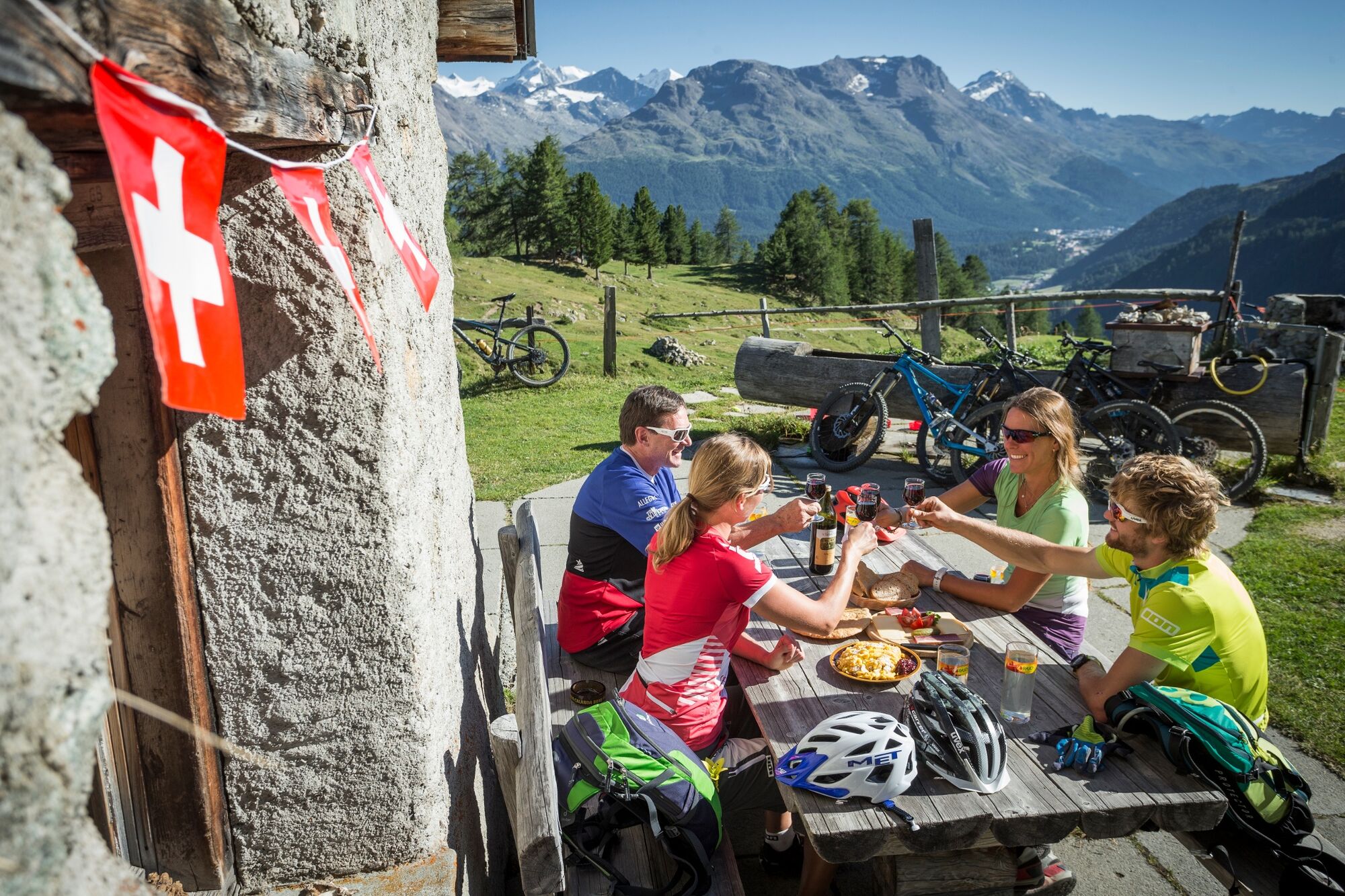
Do not miss a stop on Alp Muntatsch.
- Author
-
The tour Fuorcla Valletta is used by outdooractive.com provided.


General info
-
Engadin St. Moritz
104
-
Samedan
56