
- Brief description
-
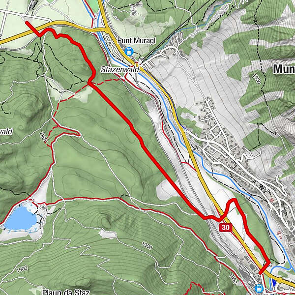
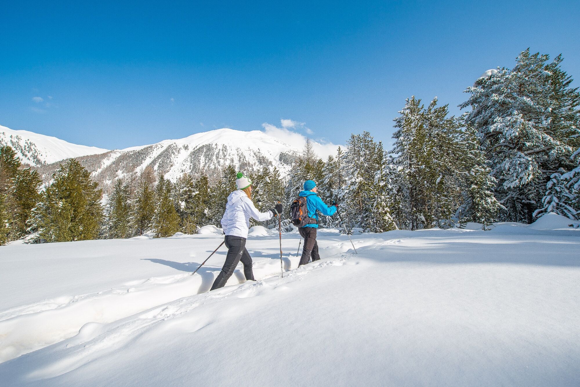
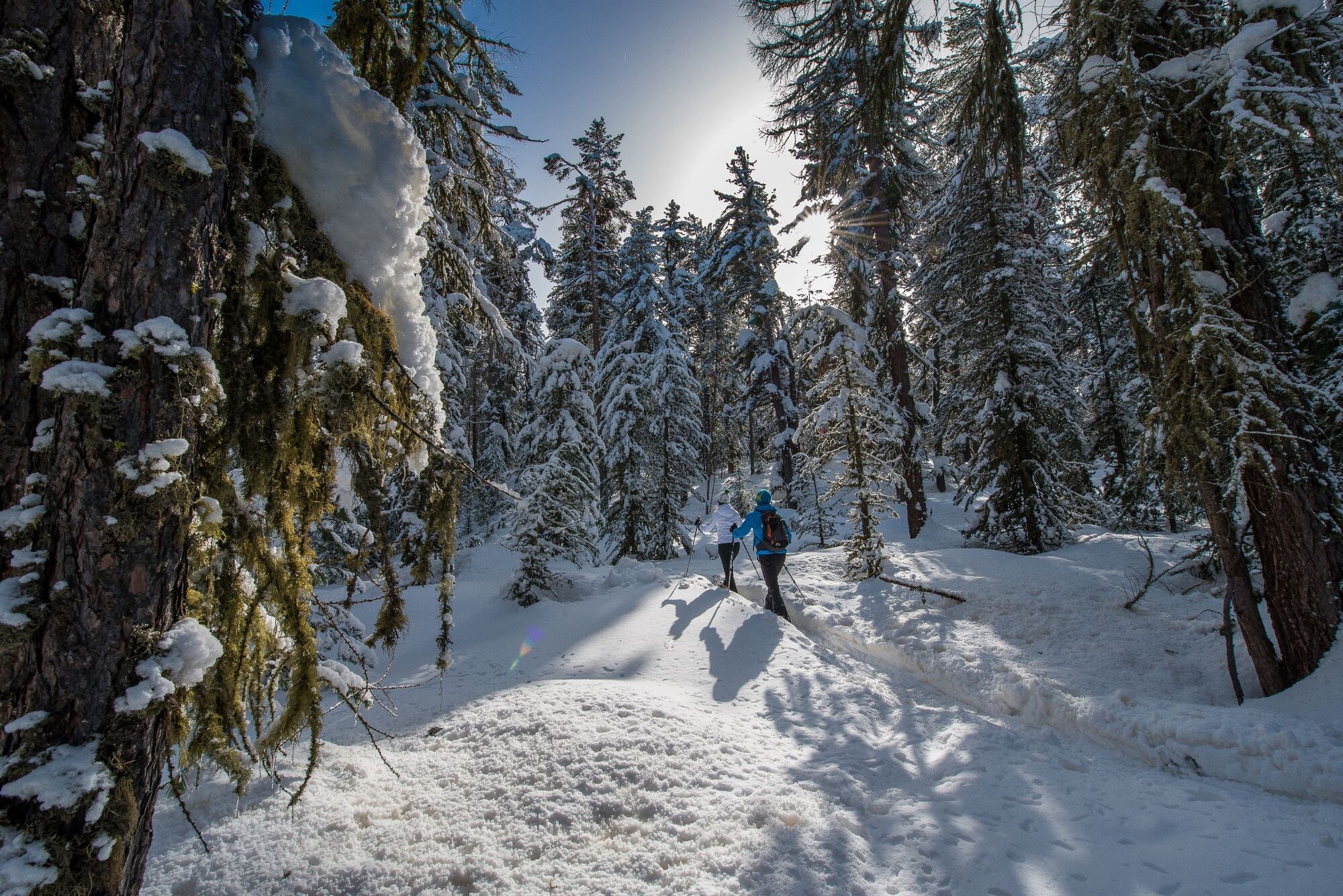
Between Pontresina and Celerina this signposted snowshoe trail takes you through the enchanting, snowy Forest of Staz and across moorland clearings covered in deep snow.
- Difficulty
-
easy
- Rating
-
- Starting point
-
Pontresina cross-country ski centre
- Best season
-
AugSepOctNovDecJanFebMarAprMayJunJul
- Description
-
No matter what direction you set off in, wherever you look the Forest of Staz is certain to delight with its ancient stands of gnarled trees and its fabulous moorland clearings. The landscape is a legacy of the Ice Age, shaped by the glaciers of old that created damp hollows, high moors and fens. The area of moorland covers 35 hectares, but it is not continuous; instead, it is scattered across the entire area. At its heart is Lake of Staz, surrounded by stands of larch, pine, and Swiss pine.
It is always well worth stopping now and again along the relatively flat snowshoe trail as it winds its way through this natural monument of national importance, and to listen out. Even now, in winter, the forest is inhabited, and if you listen carefully, you will hear birds chirping and squirrels darting up the tree trunks.
It is possible to start the snowshoe tour either at the Pontresina railway station (cross-country skiing centre) or in Celerina at the bridge that leads to the Forest of Staz (Church of San Gian), and to complete the trail either in one direction or as a tour there and back.
More information
Engadin Tourismus AG
Via Maistra 1
CH-7500 St. Moritz
Phone: +41 81 830 00 01
E-mail: allegra@engadin.ch
Internet: www.engadin.chwinter hiking trail report: www.engadin.ch/en/slopes-tracks/winter-hiking-trails/
- Directions
-
Pontresina cross-country ski centre - Staz forest - Celerina San Gian church
- Highest point
- 1,771 m
- Endpoint
-
Celerina, San Gian church
- Height profile
-
 © outdooractive.com
 - Safety instructions
-
Please stay on the marked trail.
- Tips
-
The trail can be started from both sides.
- Public transportation
-
Take the train or the Engadin Bus to Pontresina railway station. Or the Engadin Bus to the bus stop Celerina Trais Fluors, if you prefer to walk from Celerina.
- Parking
-
Parking spaces at Pontresina railway station or near the San Gian church in Celerina.
- Author
-
The tour Celerina - Pontresina (SwitzerlandMobility Route 564) is used by outdooractive.com provided.