


- Brief description
-
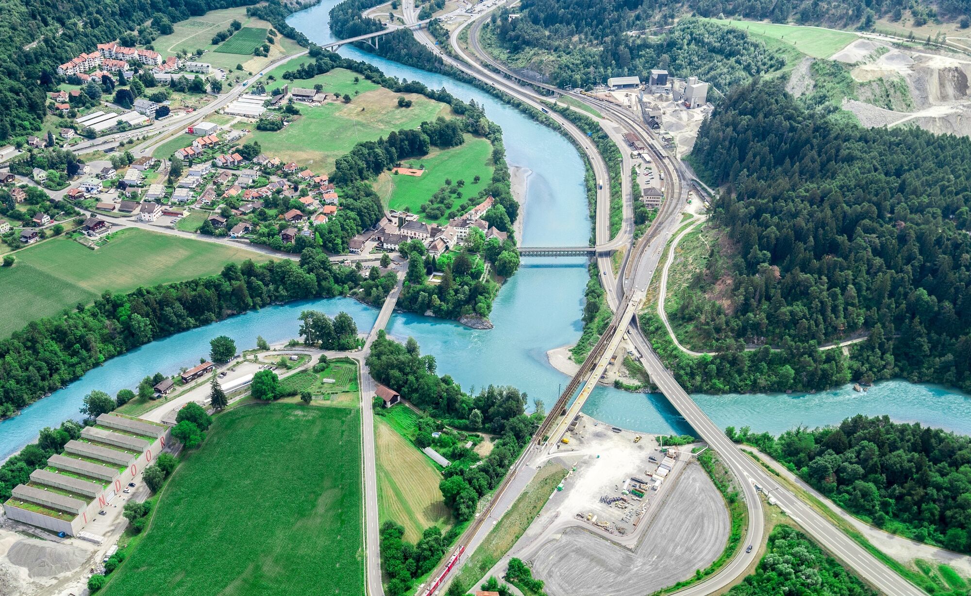
Deep ravines, impressive panoramic views and witnesses to the history of Graubünden’s transport routes await discovery at the Posterior Rhine.
- Difficulty
-
medium
- Rating
-
- Route
-
Chur (593 m)0.6 kmFelsberg (569 m)3.5 kmEms (586 m)6.3 kmRavetg15.2 kmReformierte Kirche Rothenbrunnen17.1 kmRothenbrunnen (625 m)17.2 kmPaspels (778 m)20.7 kmAlmens (787 m)22.3 kmRodels (684 m)23.0 kmPratval (687 m)23.2 kmFürstenau25.0 kmSchauenstein Andreas Caminada25.0 kmEvangelische Kirche25.2 kmTosanna (720 m)28.5 kmReformierte Kirche29.2 kmDalaus31.0 kmUrmein (1,264 m)34.2 kmReformierte Kirche34.3 kmUntertschappina (1,384 m)35.6 kmTschappina36.0 kmSunnaheim36.1 kmObertschappina (1,577 m)36.9 kmUsser Glas40.1 kmBerggasthaus Beverin40.1 kmOber Gmeind42.4 kmCaral42.8 kmOberurmein45.8 kmSaloms54.5 kmVerms55.3 kmDalin56.8 kmPräz (1,205 m)57.6 kmReformierte Kirche Präz57.7 kmRaschlegnas59.6 kmSt. Agnons60.7 kmTartar62.7 kmMasein (865 m)65.3 kmTosanna (720 m)66.9 kmRongellen (1,003 m)69.6 kmBesenbeiz zur alten Post69.9 kmFoto-Spot Viamala-Schlucht71.1 kmRania72.8 kmZillis (945 m)74.5 kmDonat76.3 kmReformierte Kirche76.3 kmPazen77.6 kmLaone (1,585 m)81.6 kmBiohof Taratsch81.7 kmPizzeria Orta81.9 kmOrta81.9 kmRestaurant Muntsulej83.4 kmMathon (1,527 m)83.7 kmFardün84.2 kmFaros86.0 kmHotel Restaurant Capricorns86.1 kmWergenstein86.2 kmEvangelische Kirche86.2 kmSegl86.3 kmProsalur88.0 kmCasti88.9 kmCurtgegns89.0 kmTurclagn89.7 kmDonat89.8 kmClugin91.5 kmAndeer93.6 kmLarisch102.7 kmVal digl Artegl103.3 kmSufers (1,430 m)110.4 kmMenn's Buurastübli (1,434 m)110.4 kmWissbach111.2 kmReformierte Kirche Splügen114.3 kmSusten114.6 kmSplügen (1,457 m)114.7 kmPfarrei Unsere Liebe Frau von Fatima, Andeer und Christkönig114.8 kmMedels im Rheinwald (1,519 m)117.4 kmChiesa riformata di Nufenen121.7 kmNufenen (1,569 m)121.9 kmBrennhof122.5 kmHinterrhein (1,624 m)125.6 kmReformierte Kirche Hinterrhein125.7 kmJannagada126.2 kmIndergada126.3 kmSandruota126.6 kmSteihus130.3 kmSandruota132.3 kmIndergada132.6 kmJannagada132.7 kmReformierte Kirche Hinterrhein133.2 kmHinterrhein (1,624 m)133.2 kmNufenen (1,569 m)137.0 kmBi da Hüschera140.5 kmSusten144.1 kmSplügen (1,457 m)144.2 kmRustico144.2 kmSteina144.5 kmRofflafall156.0 kmPlanca Lumbarda (1,094 m)156.8 kmBärenburg158.3 kmAndeer159.2 kmCaltgera160.5 kmPignia160.6 kmReformierte Kirche160.7 kmZillis (945 m)163.4 kmReformierte Kirche Reischen164.6 kmReischen (1,020 m)164.7 kmRania166.6 kmFoto-Spot Viamala-Schlucht168.4 kmBesenbeiz zur alten Post169.4 kmRongellen (1,003 m)169.9 kmTosanna (720 m)172.6 kmSogn Martegn175.3 kmFürstenau175.3 kmRodels-Realta (640 m)177.4 kmRothenbrunnen (625 m)181.7 kmReformierte Kirche Rothenbrunnen182.0 kmRavetg183.8 kmStation Reichenau190.1 kmReichenau-Tamins (604 m)190.4 kmBahnhöfli Reichenau190.5 kmReichenau190.9 kmTamins191.6 kmKrone191.7 kmAsella193.1 kmEms (586 m)195.4 kmReformierte Kirche197.0 kmFelsberg (572 m)197.5 kmRestaurant Calanda198.0 kmChur (593 m)201.3 km
- Best season
-
JanFebMarAprMayJunJulAugSepOctNovDec
- Description
-
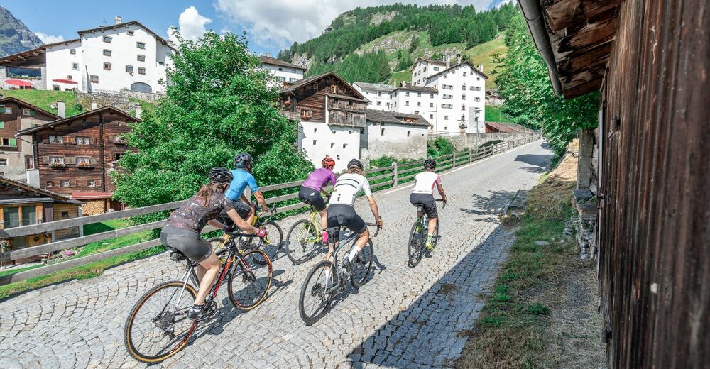
Your journey starts in Chur where you’ll discover the rolling hills of the Domleschg fruit and castle country. The Glaspass is an insider tip that will take you to the Beverin Nature Park. The slope is long, but not too steep. A beautiful panorama tour takes you over the Heinzenberg back to the historic trading town of Thusis. The journey continues through the natural monument of Viamala Gorge, where 300-meter high cliffs will have you in awe. The route to Andeer leads through the villages of Schamserberg, which tower high above the valley and score points for their panoramic views. The route climbs up towards Lai da Vons. Here you’ll be able to enjoy the tranquility of nature and an epic panorama. You can ride down the hill until you reach Sufers, and through the valley floor of the Rheinwald you’ll reach Splügen, Graubünden's oldest pass village. From Medels via Nufenen and Posterior Rhine you’ll continue following the young Rhine towards its source. On the other side of the Rhine, the route leads down into the valley again and you’ll ride through the idyllic landscape passing the Posterior Rhine through the valley floor of the Rheinwald back to Splügen. The ascent through the Fugscht forest is short but steep. A rapid descent brings you to Sufnersee and on the Northern shore; you ride along a little-used road towards Roflaschlucht (gorge), which guarantees breathtaking views into a wild gorge. Via Bärenburg and Pignia, the route leads to Zillis, where the Capuns Swiss champion invites you to lunch at the hotel Post. Via Reischen you ride through the Viamala to Thusis and along the Posterior Rhine through the Domleschg. From Reichenau, where the Anterior Rhine and the Posterior Rhine merge, you have a comfortable ride back to Chur.
Stages
Stage 1: Chur – Thusis
Stage 2: Thusis – Glaspass - Thusis
Stage 3: Thusis - Andeer
Stage 4: Andeer – Lai da Vons – Splügen
Stage 5: Splügen – Splügen
Stage 6: Splügen – Chur
- Directions
-
Chur - Thusis: 29.8 kilometers - 404 altitude
You start the journey in Chur (593 m above sea level) and get on bike path no. 6 on the Polenweg to the imposing fortification Porta Rhaetica. From Rothenbrunnen the route makes its way over the gentle hills of the Domleschg fruit and castle country. In Paspels (757 m above sea level), you can marvel at the art works by the well-known artist Robert Indermaur. Lake Canova invites you to take a break, especially to cool down during summer. From here, it’s not far to Thusis, the historical trading place (680 m above sea level).
Thusis - Glaspass - Thusis: 36.1 kilometers - 1659 altitude
The Glaspass is an insider tip. The MTB route no. 90 takes you from Thusis (680 m above sea level) past the villages of Urmein and Tschappina into the Beverin nature park. The ascent to the Glaspass (1846 m above sea level) is long, but in addition to steep ramps, there are always flat roads where you can relax a little. Once you arrive at the pass, it’s worthwhile to ride a few meters further to the Beverin mountain inn. You definitely deserve to take a little break here! You only follow the road down the valley for a little while longer now, and then turn onto MTB route no. 623 "Heinzenberger Maiensäss Route". This will lead you high above the Domleschg over an impressive panoramic path. From Obergmeind (1813 m above sea level) via Plau to Prau da l'Alp, you’ll encounter several short steep slopes, but the great view makes up for it. The rapid descent to Präz (1170 m above sea level) and Raschlegnas will definitely put a smile on your face. The trail leads you through Cruttis Tobel and Tartar back to Thusis (680 m above sea level).
Thusis - Andeer: 27.1 kilometers - 983 altitude
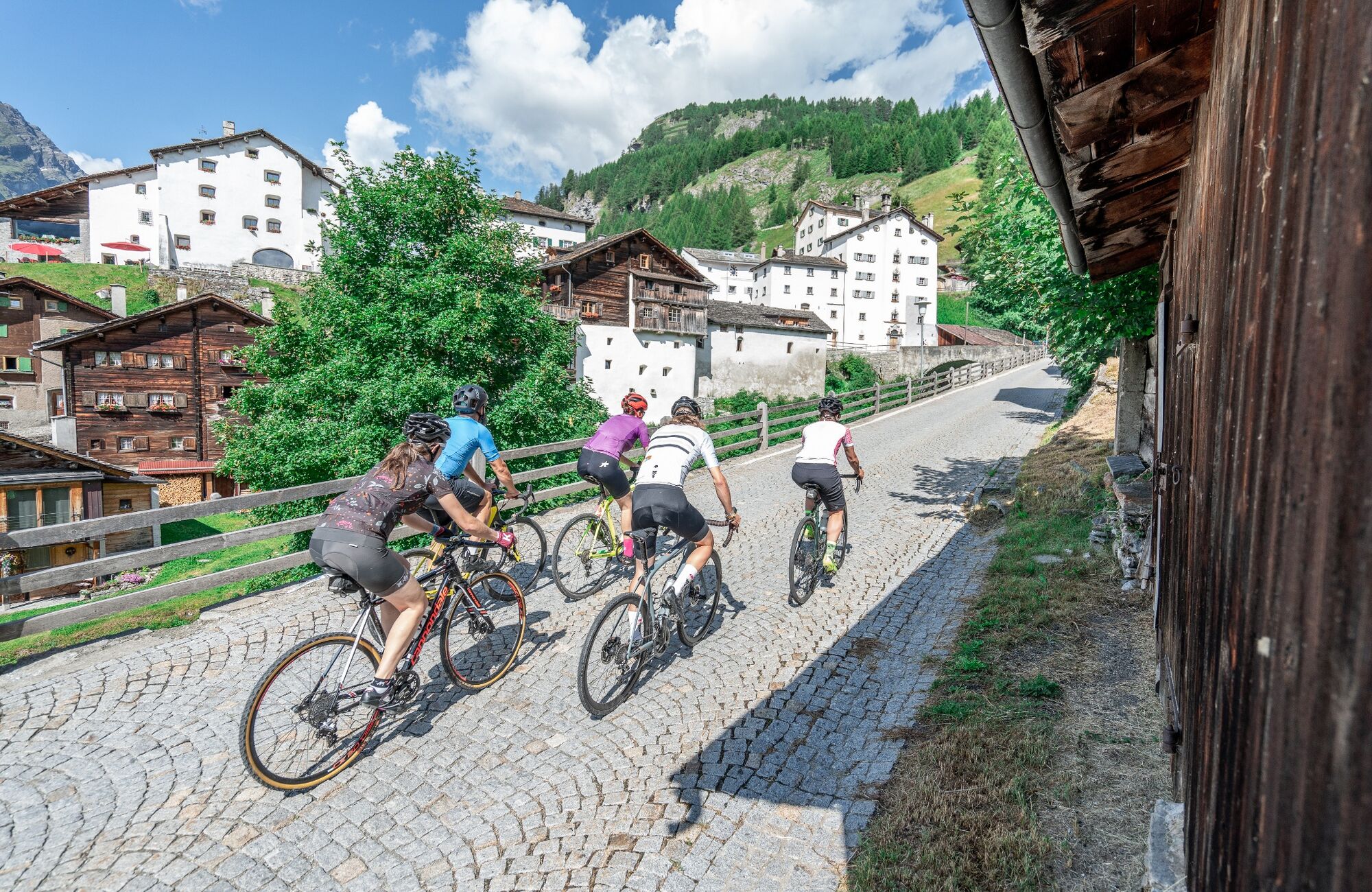
From Thusis (680 m above sea level), the old Viamala road leads through the "lost hole" to Rongellen. The 300-meter high cliffs of the Viamala Gorge natural monument will amaze you. The road runs high over the Viamala and looking into the gorge is worth it. A stop at the Visitor Center not only gives you a chance to rest, but also brings you closer to the AlpTransit’s history. The route continues in the direction of the Muntogna da Schons and Schamserberg villages. Through Zillis (945 m above sea level) and Donat you’ll reach Lohn (1585 m above sea level), Mathon and Wergenstein. A great view over the whole valley, including the fantastic road to Wergenstein, which towers high above the Schamsertal will be your reward. A nice descent on an agricultural road brings you to Casti. An imposing wooden bridge takes you to Clugin, before you start the last stretch of the journey riding on a dirt road to Andeer (982 m above sea level). Andeer is known for its healing spring. Enjoy the mineral bath with a wellness area – it’s a guaranteed rest for your sore muscles.
Andeer - Lai da Vons - Splügen: 22 kilometers - 1237 altitude
The road from Andeer (982 m above sea level) in the direction of Lai da Vons ascends without mercy. As you climb higher and higher through the forest of the Tranter Tschaingel, you’ll get to enjoy wonderful views over the whole valley. At Pastgaglia, you have almost already climbed up one thousand meters and will leave the tree line behind you. There will hardly be any flat roads to offer a chance to take a breath. You do have to persevere for a bit. Turn left once you reach Larisch. The natural road is now a bit bumpy. Shortly after the highest point of the climb (2050 m above sea level), you’ll be able to see the Lai da Vons (1994 m above sea level). In the tranquility of nature, enjoy the epic panorama, pat yourself on the back and roll down the mountain to Sufer's. The cycle route no. 505 "Rheinwaldroute" takes you through the valley floor of the Rheinwald to Splügen (1458 m above sea level), the oldest pass village in Graubünden.
Splügen - Splügen: 33.2 kilometers - 361 altitude
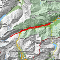
From Splügen (1458 m above sea level) follow the Rhine towards its source. Via Medels and Nufenen you’ll ride through the Rheinwald to the Posterior Rhine (1620 m above sea level), the oldest Walser settlement in Graubünden. From the Posterior Rhine it’s not far to the shooting range. During the week, the trip ends here, but on the weekends, you can reach the valley via a natural road in the direction of the Rheinquellhorn. On the other side of the Rhine, the route leads down the valley on a dirt road. Via the old Landbrugg, you’ll return to the village Posterior Rhine. If you like taking the easy path, take bicycle route no. 6 to Nufenen. Riders who are interested in a more technical road should tackle the meadow path on the other side of the Rhine. From Nufenen the cycle route no. 505 "Rheinwaldroute" leads down into the valley. You’ll make your way back to Splügen (1458 m above sea level) while riding along the Posterior Rhine through the valley floor of the Rheinwald.
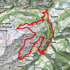
Splügen - Chur: 58.6 kilometers - 580 altitude
You’ll leave Splügen (1458 m above sea level) on cycle route no. 505 "Rheinwaldroute" down the valley. At first, the road heads a few meters in the direction of Splügen Pass.
In the first bend, you’ll turn left and reach a short but steep climb through the Fugscht forest (1589 m above sea level). A rapid descent brings you to the Sufnersee, whose water shines turquoise. On the Northern shore of the lake, you’ll take the little-traveled road in the direction of Roflaschlucht (gorge). Even from the road, you’re guaranteed great views of the wild canyon. Through Bärenburg (1040 m above sea level), you’ll take a side road to Pignia. From here, a nature trail leads to Zillis (945 m above sea level). An insider's tip is Capun's, a local specialty - prepared by the Swiss Capuns champion at the hotel Post. Strengthened from the food the route leads you over Reischen (1024 meters) through the Viamala gorge to Thusis (680 m above sea level). Cycle route no. 6 takes you along the Posterior Rhine through the Domleschg. In Reichenau, where the Anterior Rhine merges the Rhine Anterior, change onto the Rheinrad route no. 2 and a comfortable ride back to Chur (593 m above sea level).
- Highest point
- 2,069 m
- Endpoint
-
Chur
- Height profile
-
 © outdooractive.com
 - Tips
-
Tip: Gravelbikers with lots of leg power will manage stages 1 and 2 in one day.
Tip: Don’t worry about carrying your luggage on this trip multi-day trip. Book the luggage transfer from hotel to hotel - convenient and easy.


-

-
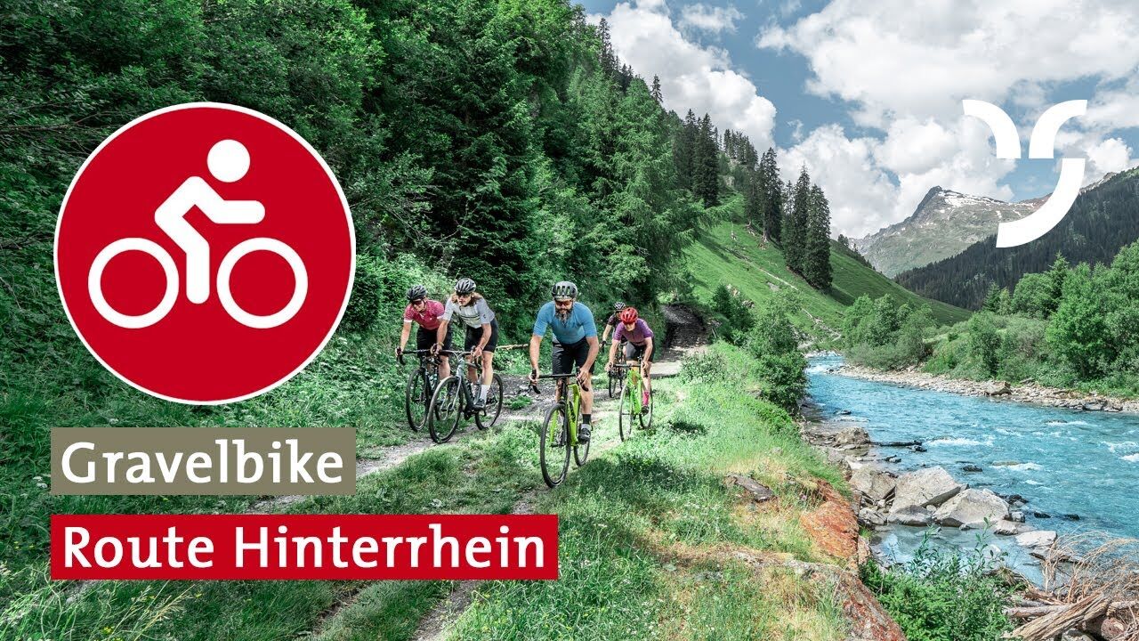
AuthorThe tour Gravel Bike Route Hinterrhein is used by outdooractive.com provided.


-
Viamala
79
-
Thusis / Heinzenberg
18