
- Brief description
-
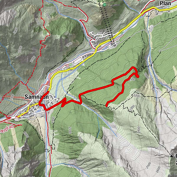
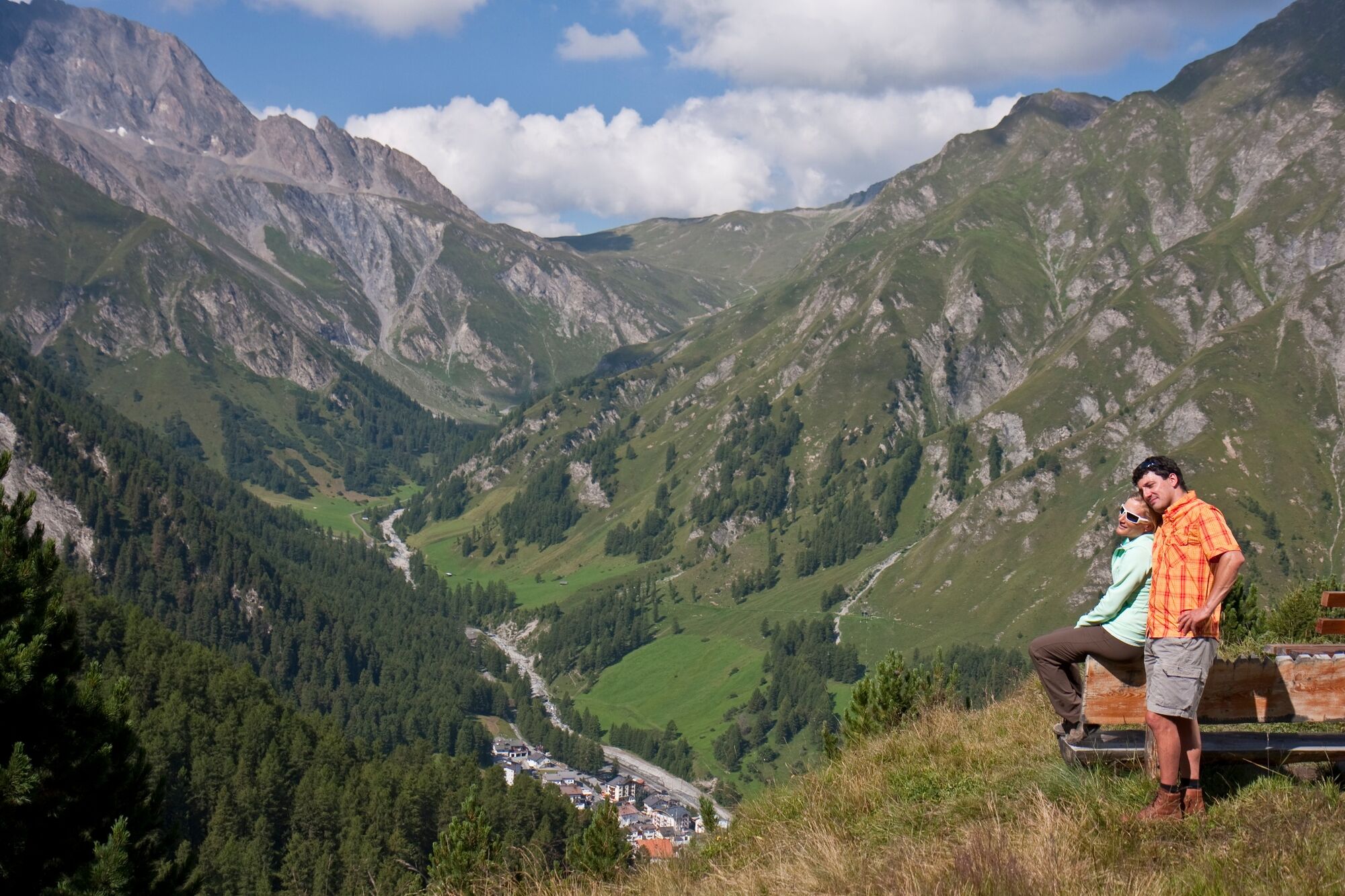
Steadily ascending tour through the Inner Forest to Motta Saltuorn and on to Val Motnaida. Beautiful view of Samnaun Dorf at the destination. Afterwards take the same route back again.
- Difficulty
-
easy
- Rating
-
- Starting point
-
PostBus stop Samnaun-Compatsch, Post
- Route
-
El Rico0.1 kmSamnaun (1,846 m)0.2 km
- Best season
-
JanFebMarAprMayJunJulAugSepOctNovDec
- Description
-
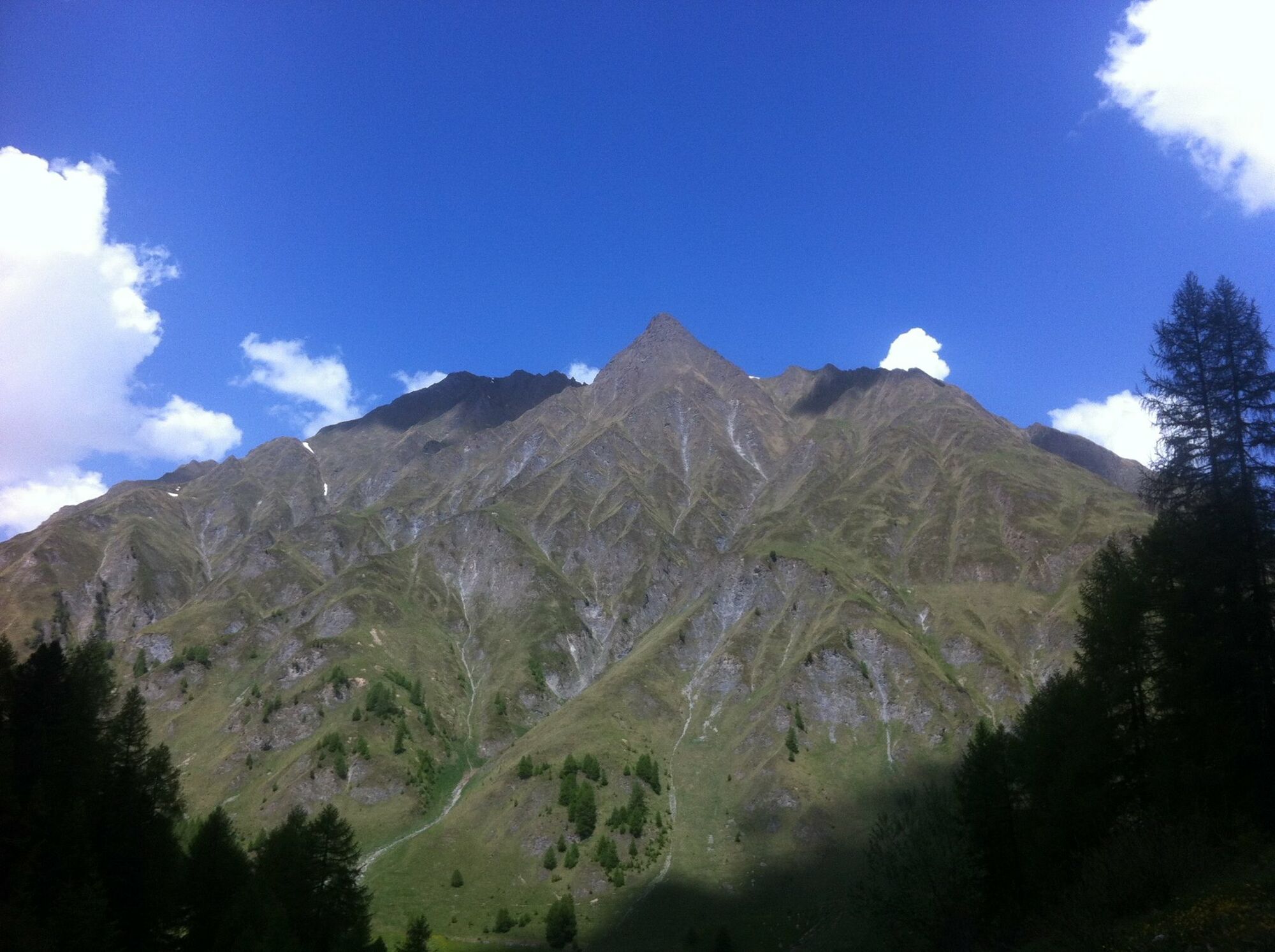
The tour begins with the steady ascent from Samnaun Dorf (1840 m) along a forest path toward Motta Saltuorn. The forest cabin is closed, but nevertheless the surroundings with fountain, small pond, tables and benches invite you linger. From here it is not far to Val Motnaida, where the forest path ends (2,147 m). There are further benches a few metres above the forest path which offer beautiful vistas of Samnaun Dorf, Piz Ot and toward Zeblasjoch. The return journey takes the same route back to Samnaun Dorf.
- Directions
-
Start in Samnaun village (1840m) past the Bündnerhof hotel.
Via a forest path towards Motta Saltuorn
Continue to Val Motnaida, to the end of the forest path (2147m)
Return journey same as approach - Highest point
- 2,143 m
- Endpoint
-
PostBus stop Samnaun-Compatsch, Post
- Height profile
-
 © outdooractive.com
 - Equipment
-
Helmet, gloves, good shoes, glasses, rain and sun protection, water bottle, repair kit, first aid kit
- Safety instructions
-
The tour was evaluated in favourable weather conditions, the current weather conditions and weather forecasts must be imperatively observed before the tour start. This tour does not make any special demands on driving safety and technique.
Emergency call:
144 Emergency call, first aid
1414 Mountain rescue REGA
112 International emergency call
Show consideration when crossing and overtaking hikers. Most of the mountain bike routes in Graubünden run on single trails that are also signposted as hiking trails. Hikers always have the right of way.
- Directions
-
- From the north: via Landquart - Klosters by car transport through the Vereina tunnel (Selfranga - Sagliains). Then take the H27 in the direction of Scuol and Martina to Vinadi. At the Vinadi junction continue to Samnaun (approx. 1 hour from Vereina south portal).
- From the east: via the Inntalstrasse B180 via Landeck to Pfunds, junction Kajetansbrücke and via Spiss to Samnaun.
- From the south: via Reschenpass (Nauders) on B180 to Pfunds, junction Kajetansbrücke and via Spiss to Samnaun.
Please note: If you are travelling to Samnaun, you will need a valid travel document (passport, ID), as you will pass through customs in Martina or Spissermühle.
- Public transportation
-
- By Rhaetian Railway (from Chur, Landquart/Prättigau or from the Upper Engadine) hourly to Scuol-Tarasp station.
- Continue by PostBus (from Scuol-Tarasp or Martina, Cunfin) hourly to PostBus stop Samnaun-Dorf, Post Office.
- In Samnaun, during the day, hourly service with the Samnaunbus to the PostBus stop Samnaun-Dorf, Riva.
- Parking
-
Free parking Votlas, Musella and Riva in Samnaun village

- Author
-
The tour Samnaun Dorf – Motta Saltuorn – Val Motnaida is used by outdooractive.com provided.