


- Brief description
-
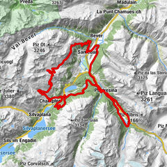
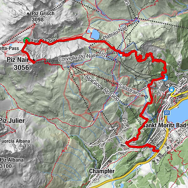
From Piz Nair all on single trails down to Chantarella.
- Difficulty
-
medium
- Rating
-
- Starting point
-
St. Moritz Signal valley station
- Route
-
Piz Nair0.0 kmWhite Marmot Restaurant & Bar3.9 kmCorviglia3.9 kmCorviglia (Bergstation)4.0 kmChantarella8.2 kmSankt Moritz (1,822 m)8.2 kmSur Chaunt8.3 kmSpielplatz Salastrains8.8 km
- Best season
-
JanFebMarAprMayJunJulAugSepOctNovDec
- Description
-
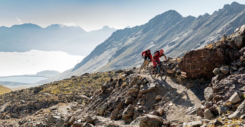
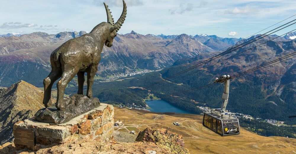
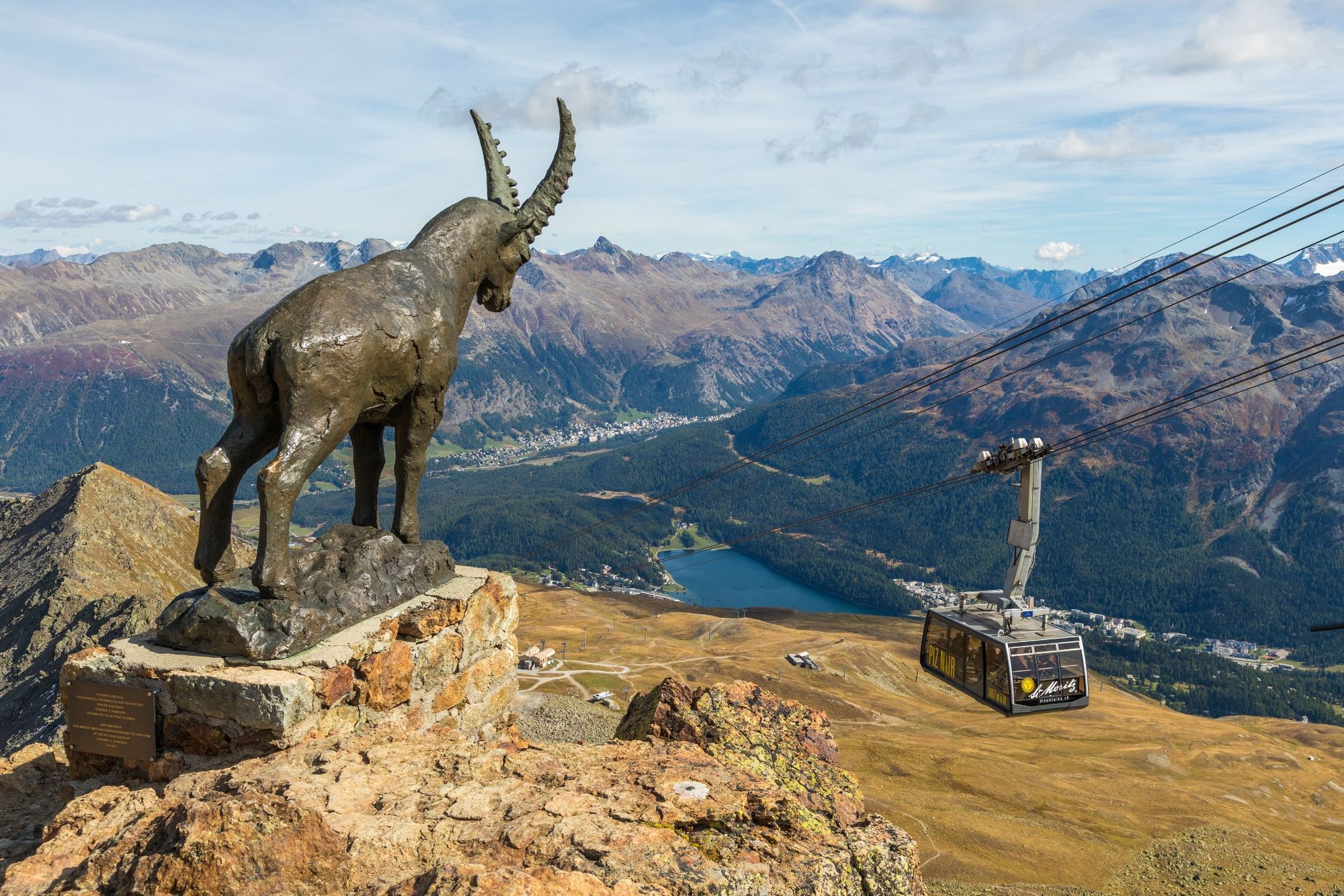
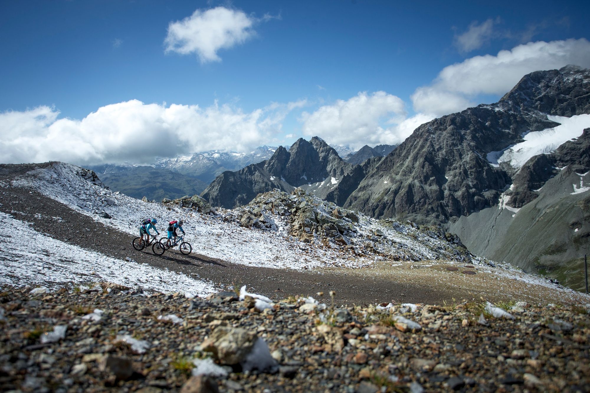
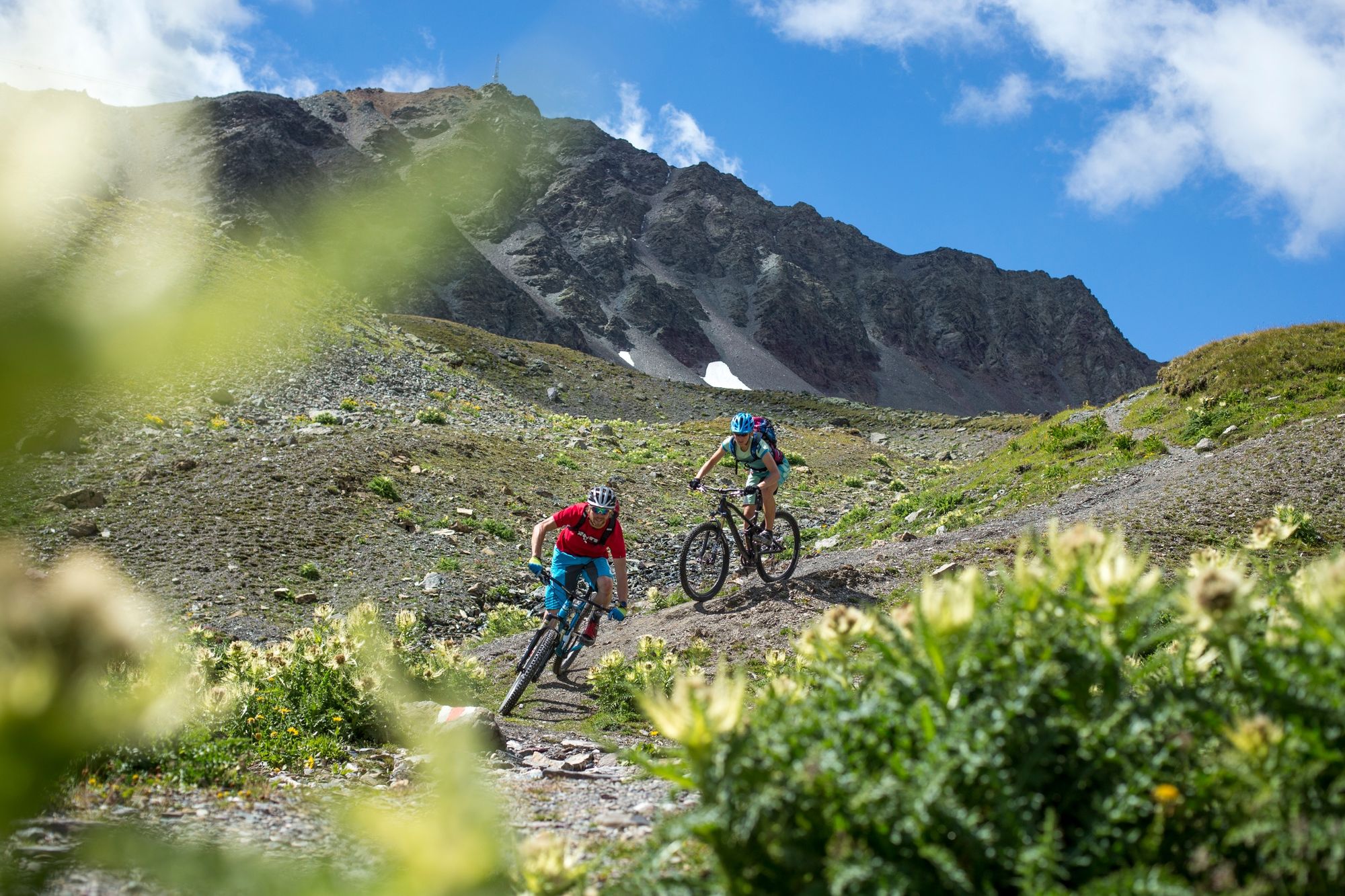
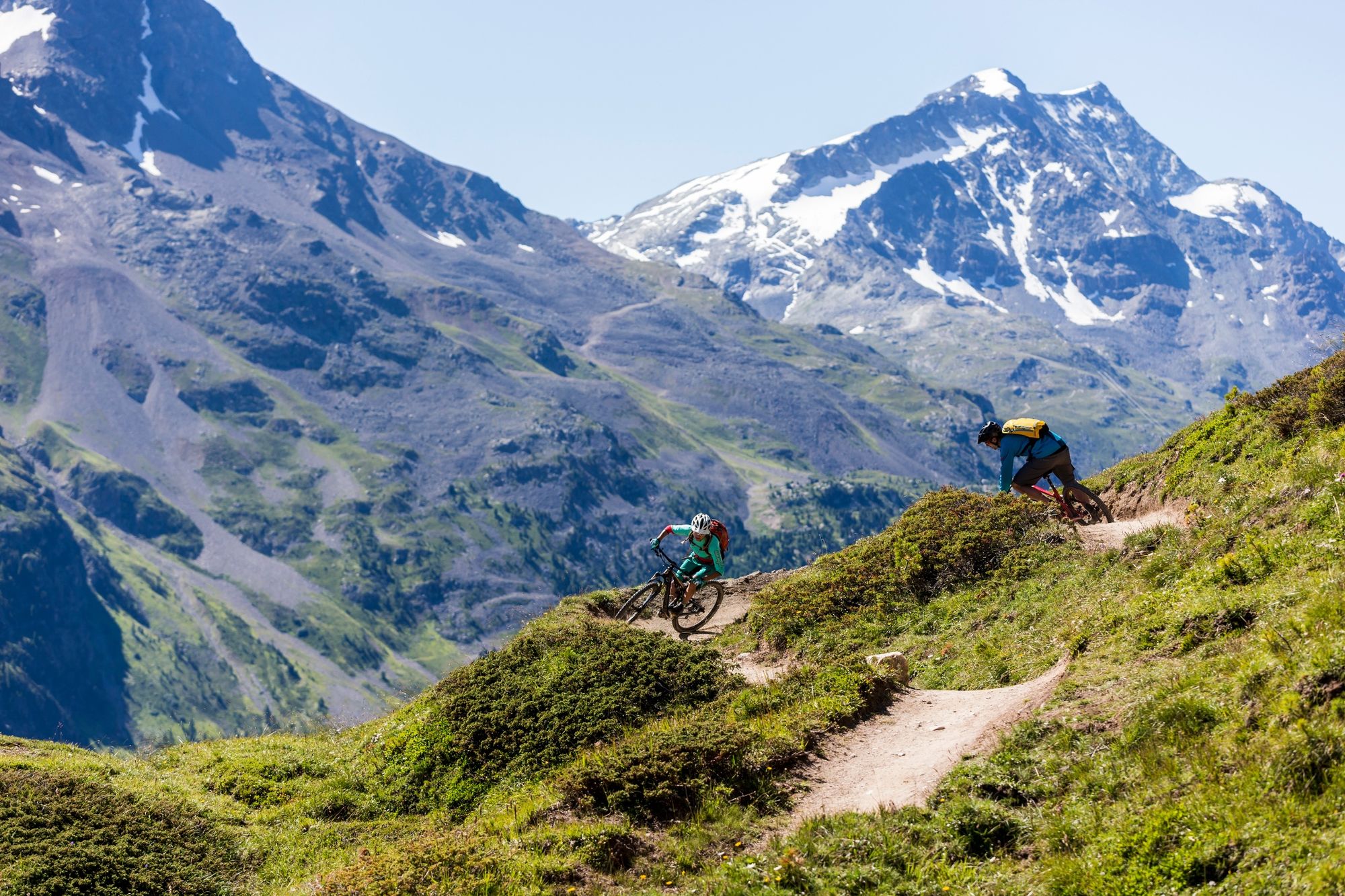
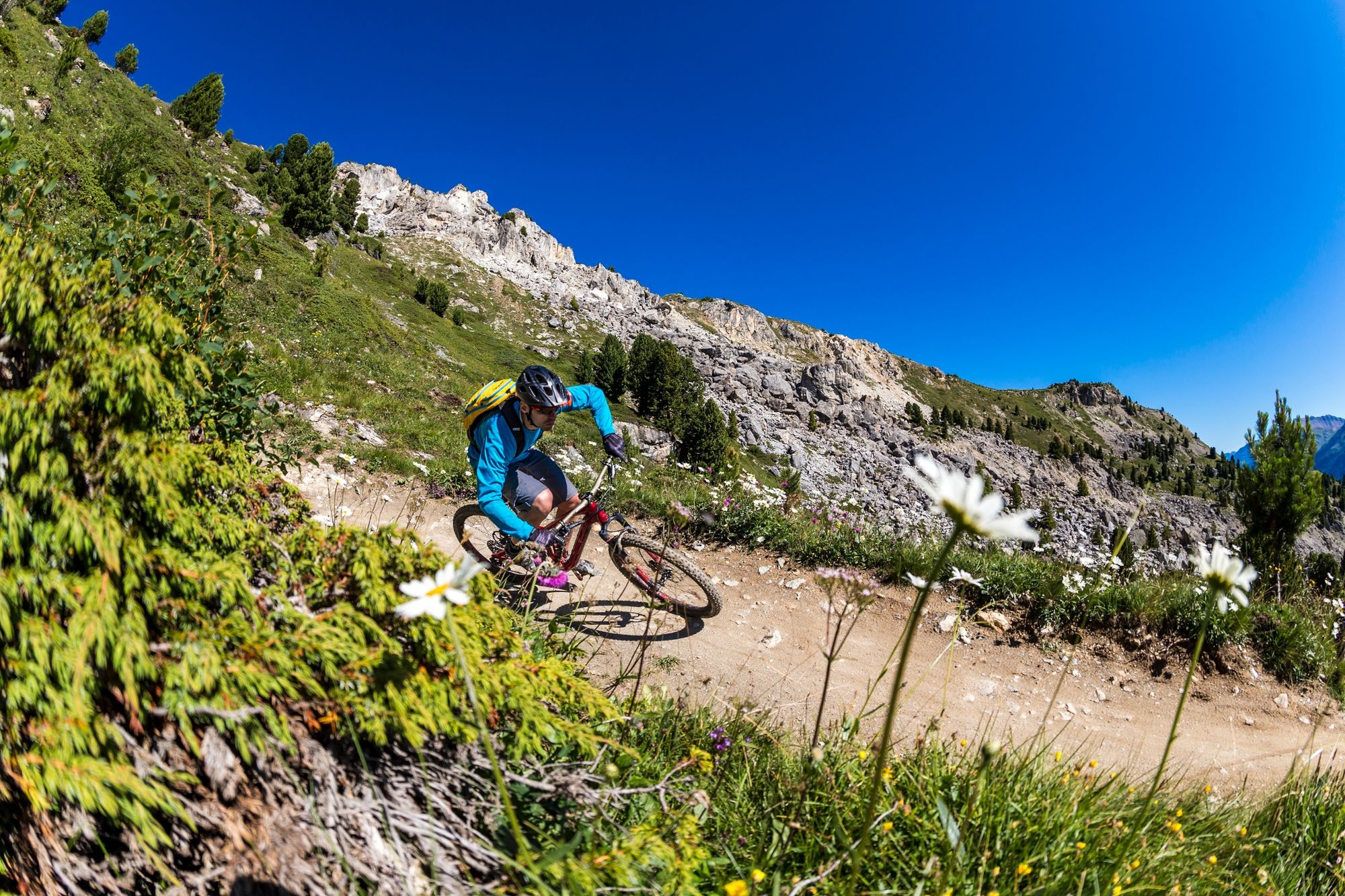
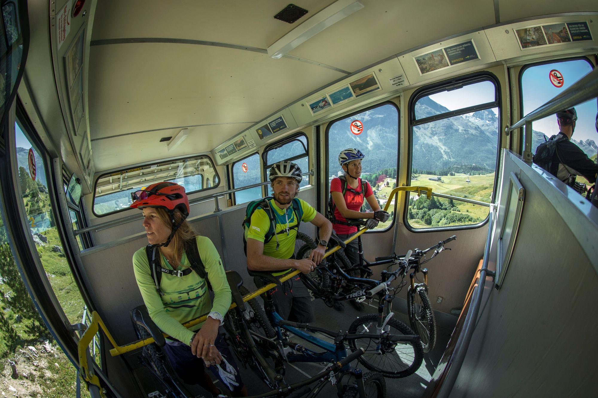
Ride in complete comfort on board the mountain railways & cableways from Signal valley station up to Piz Nair, St. Moritz’s local mountain at 3,059 metres above sea level. A short break at the Panorama Restaurant is definitely worthwhile, not just for the fantastic panoramic views of the 3,000 metre peaks all around you and the Bernina Group, but also to acclimatise; after all, the superlative single-trail fireworks are just about to begin!
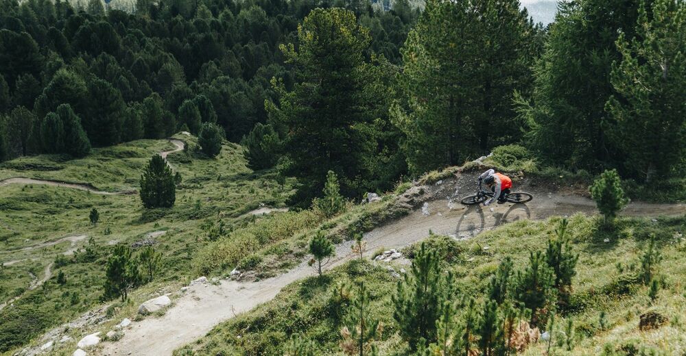
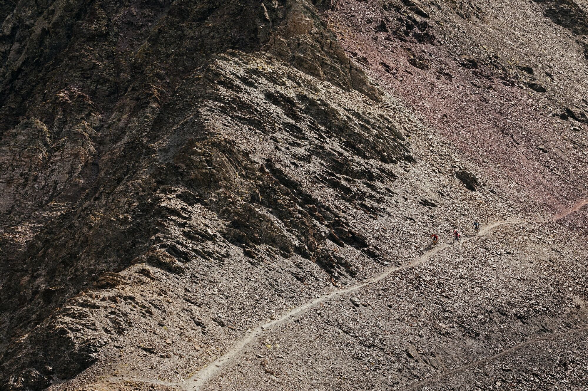
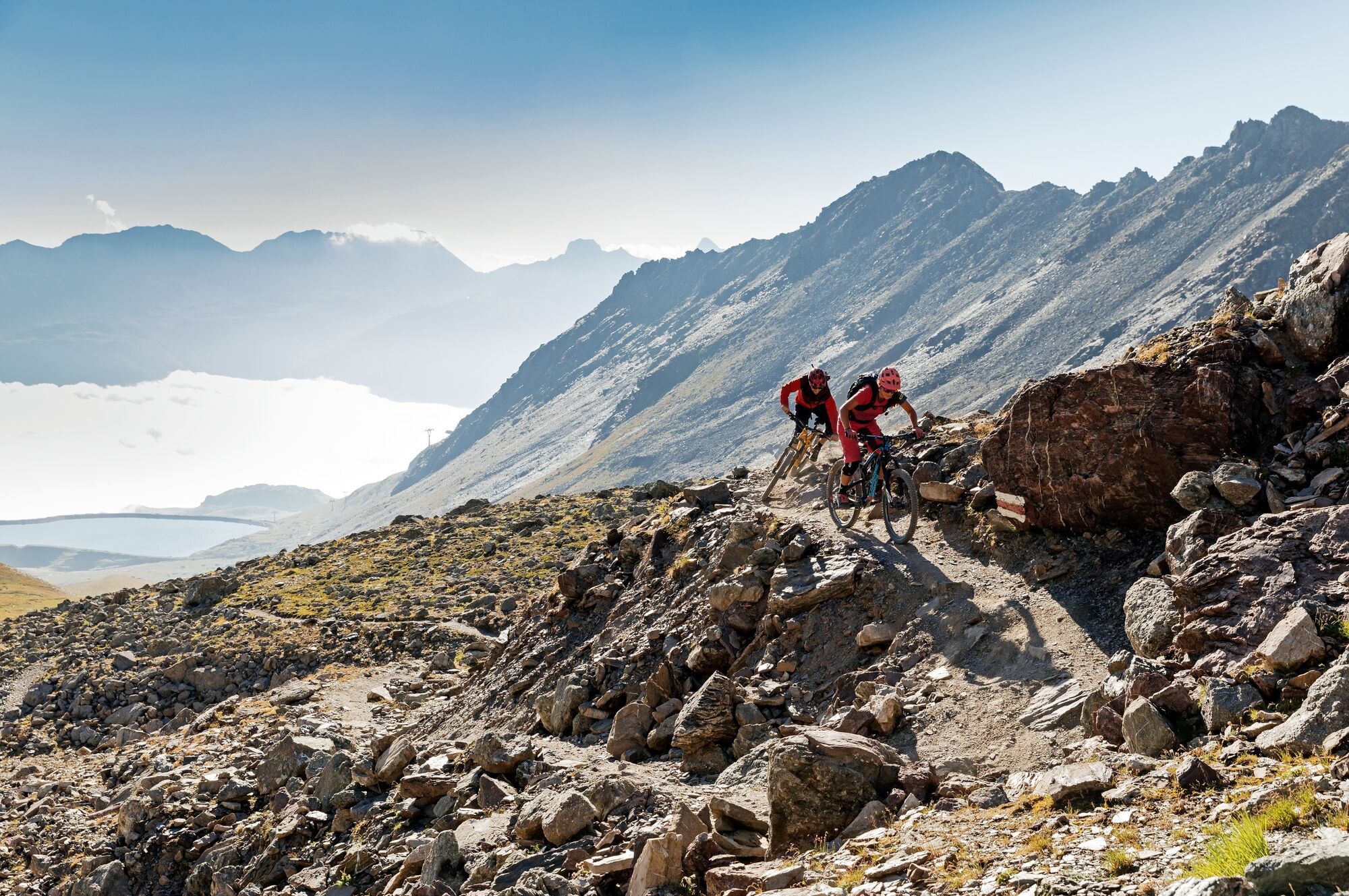
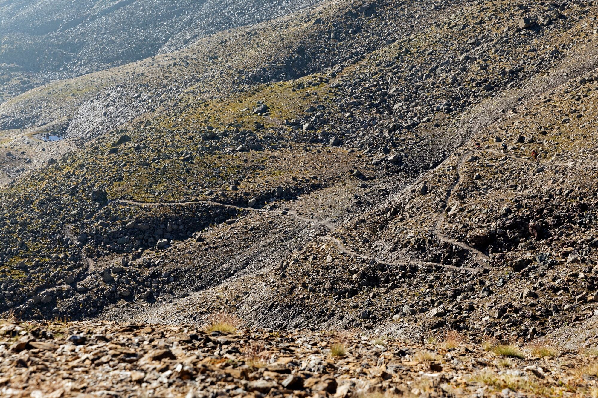
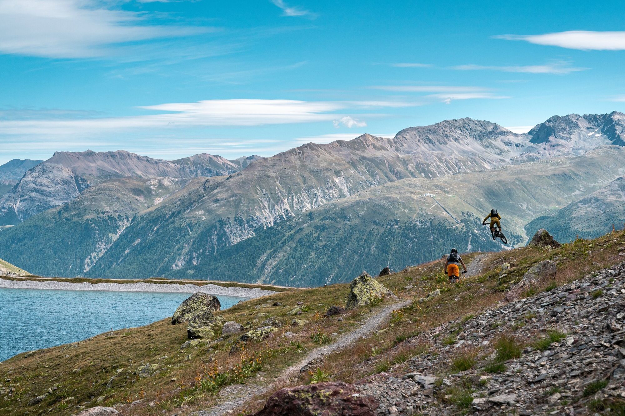
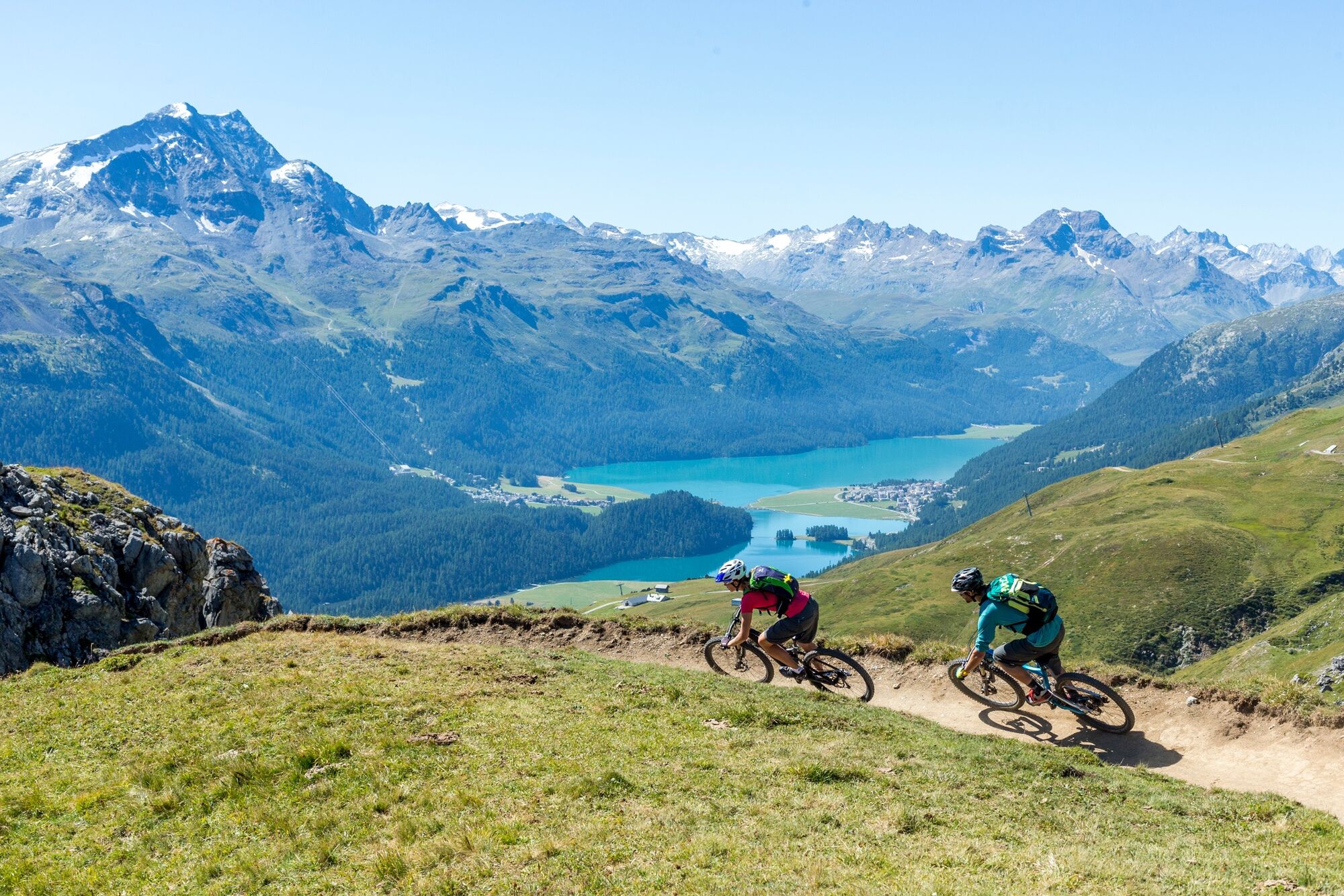
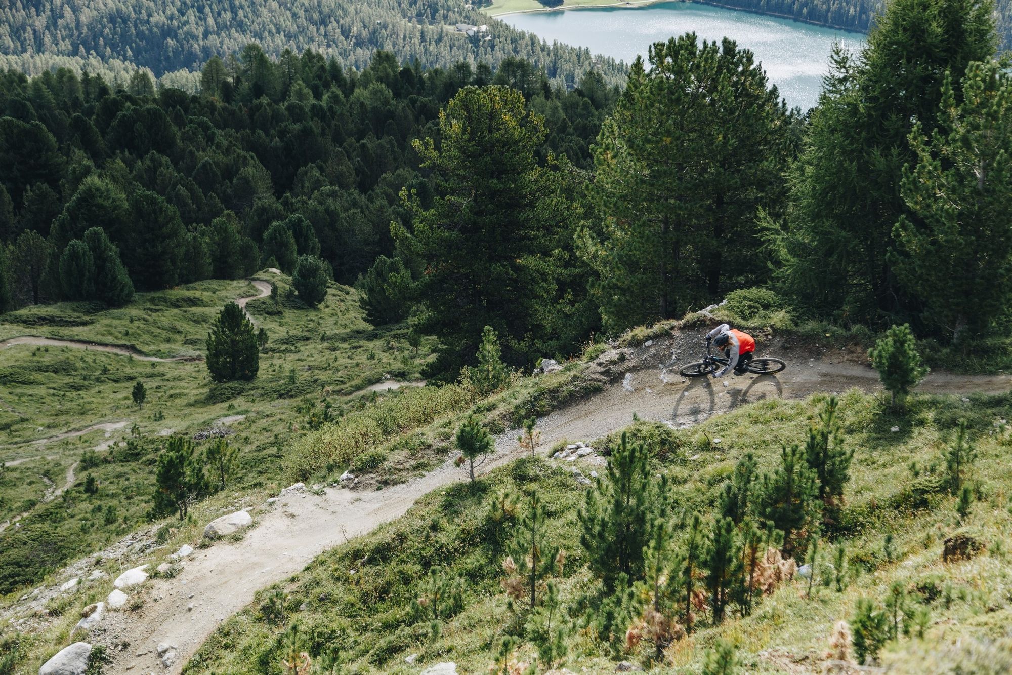
After an 800 m warm-up across the piste run, the trail leads off to the right to Furocla Schlattain and via Val Schlattain down to Corviglia. The trail features free-flowing sections and numerous challenges guaranteed to test a rider’s biking skills. By the time you reach Corviglia, all your muscles will definitely be up to temperature and ready to tackle the Olympic Trail down to Chantarella. This 4 km trail designed strictly in accordance with mountain bike criteria is unique and cannot be described: you simply have to ride it! From Chantarella follow the road back to Signal valley station.
HOME OF TRAILS
Incidentally, Danny MacAskill and Claudio Caluori started their road trip through Graubünden on Piz Nair. See it in the "Home of Trails" video.
Discover Piz Nair
More information
Engadin St. Moritz Tourismus AG
Via Maistra 1
CH-7500 St. Moritz
Phone: +41 81 830 00 01
E-mail: allegra@engadin.ch
Internet: www.engadin.ch - Directions
-
St. Moritz Signal valley station - Piz Nair - Val Schlattain - Corviglia - Chantarella - St. Moritz Signal valley station
- Highest point
- 3,018 m
- Endpoint
-
St. Moritz Signal valley station
- Height profile
-
 © outdooractive.com
 - Safety instructions
-
The upper section of the tour takes you through high-alpine terrain. It should not be attempted in thick fog or snow. Warm clothing, rain protection and gloves are essential basic equipment. Never bike alone!
- Tips
-
The tour can also be started in St. Moritz Dorf and go up with the Chantarella mountain railway.
- Author
-
The tour Piz Nair-Val Schlattain-Chantarella is used by outdooractive.com provided.


General info
-
Veltlin / Valtellina
204
-
Engadin St. Moritz
171
-
St. Moritz
81