© Unbekannt - Nico Schärer
© Unbekannt - Nico Schärer

© Unbekannt - Nico Schärer
© Unbekannt - Nico Schärer
© Unbekannt - Nico Schärer

© Unbekannt - Nico Schärer
- Brief description
-
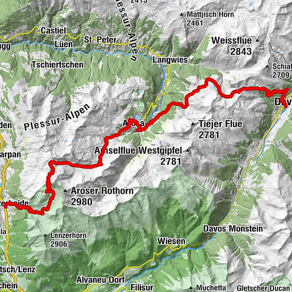
This tour offers an interesting cross section from Lenzerheide through the Schanfigg to Davos. Geology takes priority on the first section, whilst the second follows the footsteps of the Walser settlers. And in the middle, the tourist resort of Arosa beckons.
- Difficulty
-
medium
- Rating
-
- Starting point
-
Lenzerheide
- Route
-
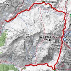
Lenzerheide (1,476 m)0.1 kmAlp Sanaspans3.5 kmParpaner Rothorn8.6 kmRothorn (2,857 m)8.6 kmRestaurant am Parpaner Rothorn8.6 kmGredigs Fürggli (2,615 m)10.6 kmInnerarosa (1,820 m)17.5 kmArosa20.3 kmArosa (1,739 m)20.7 kmFurggaalp (1,695 m)23.6 kmTieja (1,986 m)26.5 kmTschuggen27.0 kmAlpenrose28.4 kmMedergen (2,000 m)28.4 kmSchatzalp38.0 kmSchatzalp (1,861 m)38.2 kmDavos Platz40.1 kmMarienkirche40.1 kmDavos (1,560 m)40.2 kmDavos Platz40.8 km
- Best season
-
JanFebMarAprMayJunJulAugSepOctNovDec
- Description
-
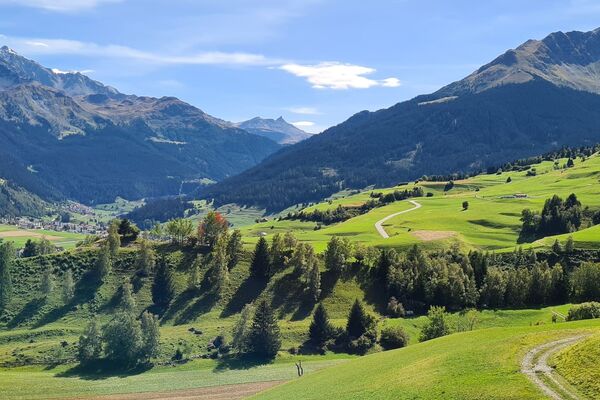
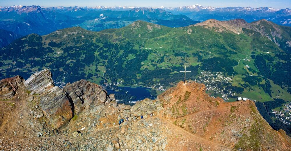
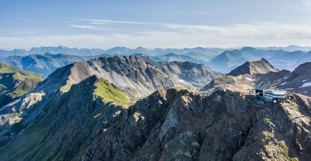
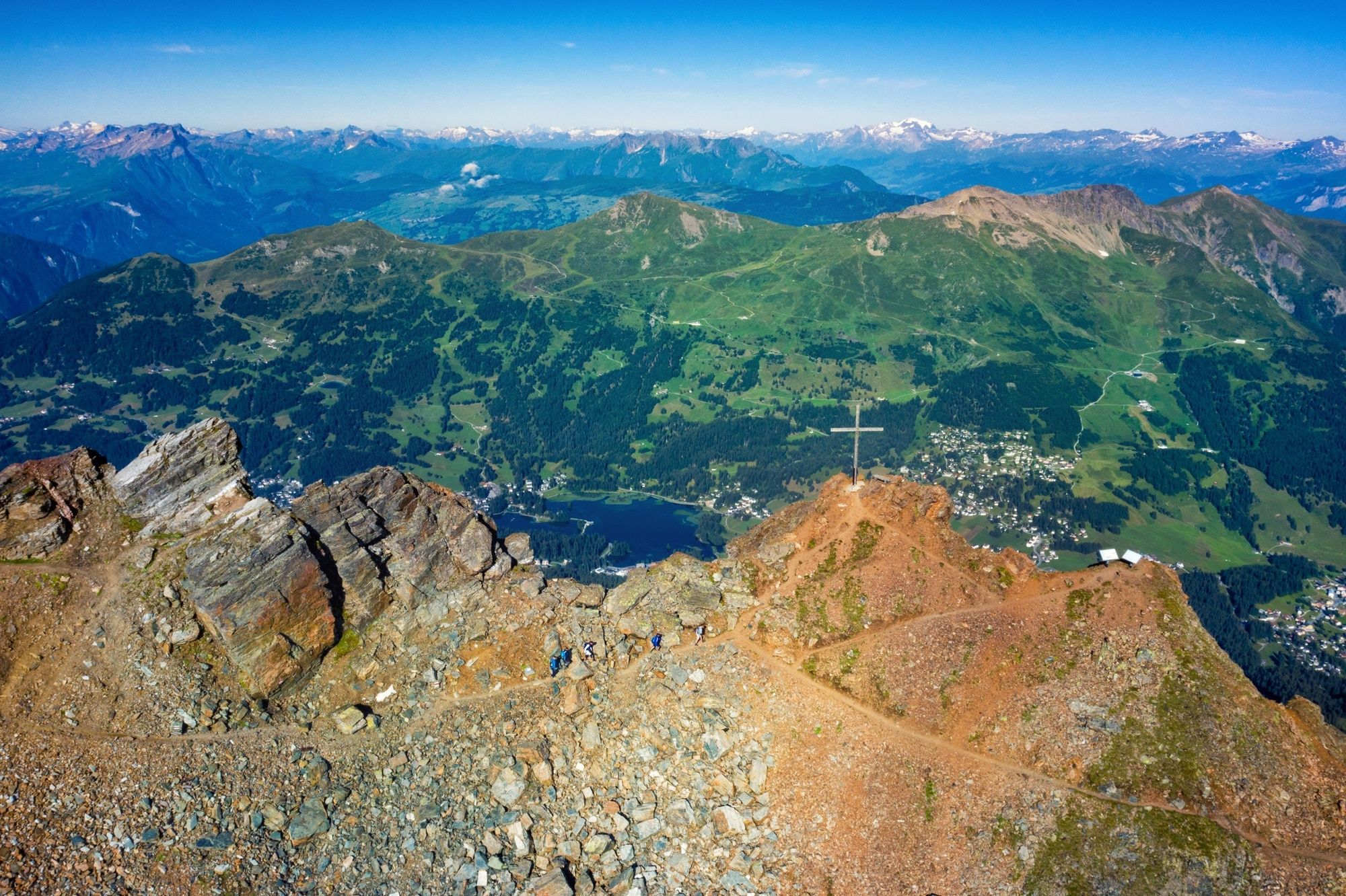
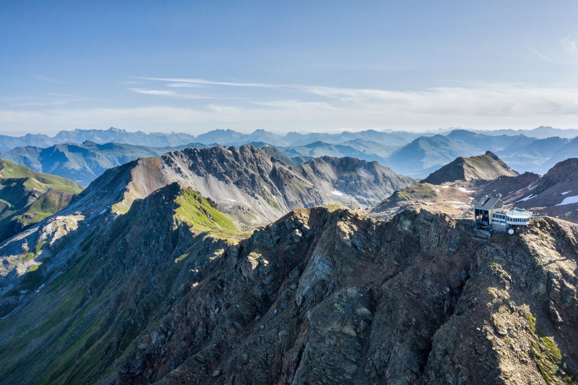
This two-day hike starts at Lenzerheide with the glistening Heidsee lake and lush green Alpine pastures. The focal point of the tour is clearly Arosa – which grew from a Walser settlement into today’s tourist destination, at the end of a valley that curves in a semi-circle down to Chur. It’s particularly fascinating to discover Arosa from above, on the Parpaner Rothorn. On the descent you cross an almost moon-like landscape. Up above rust-red ferruginous cliffs dominate (Arosa has a history of ore mining), lower down, by the latest at the Älplisee lake, limestone grey mixes with green fields.
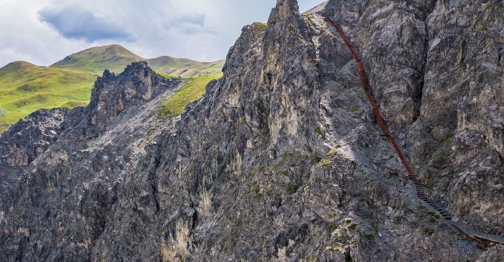
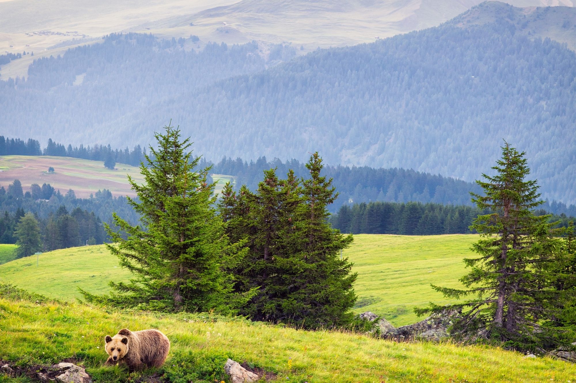
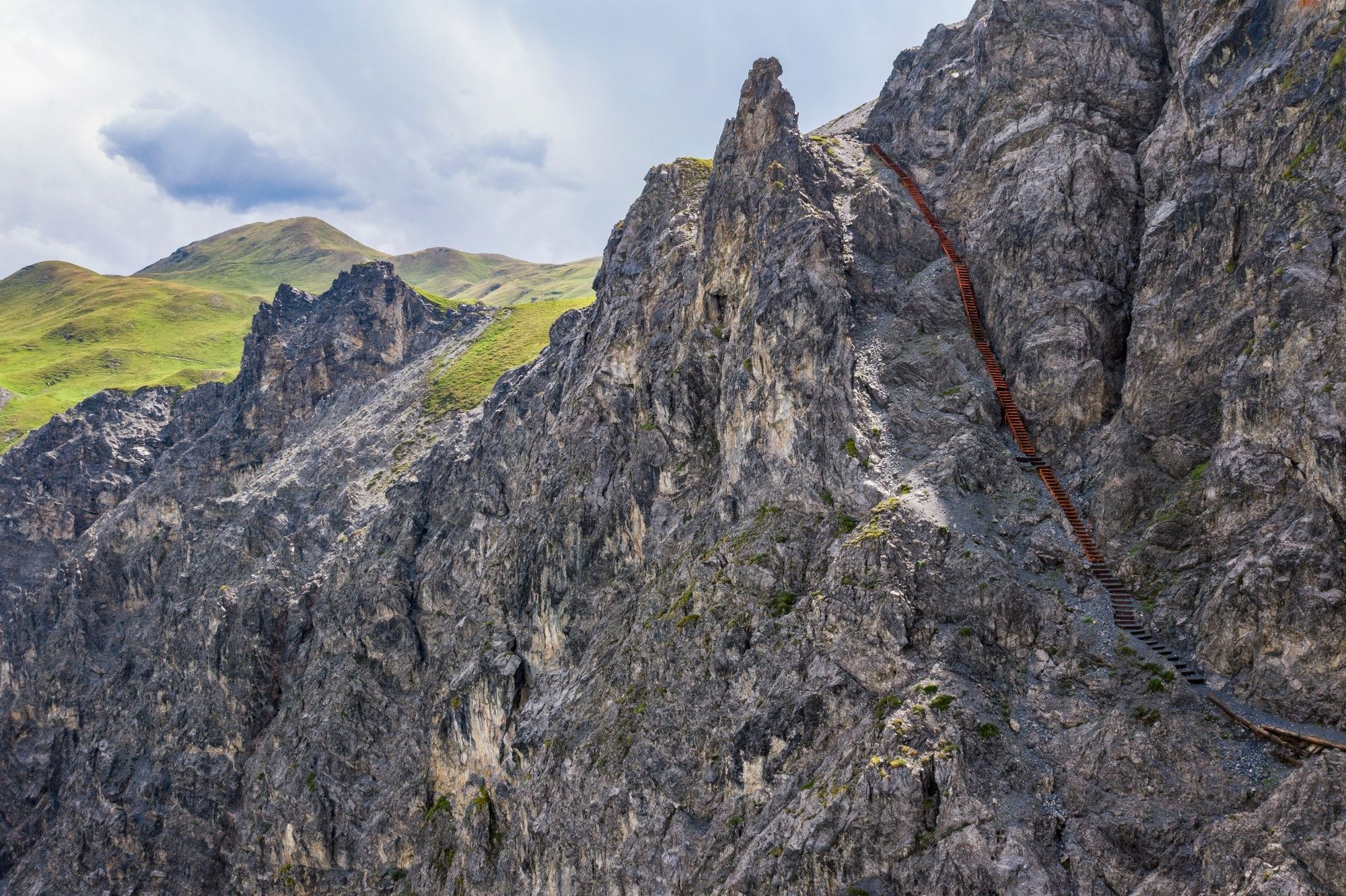
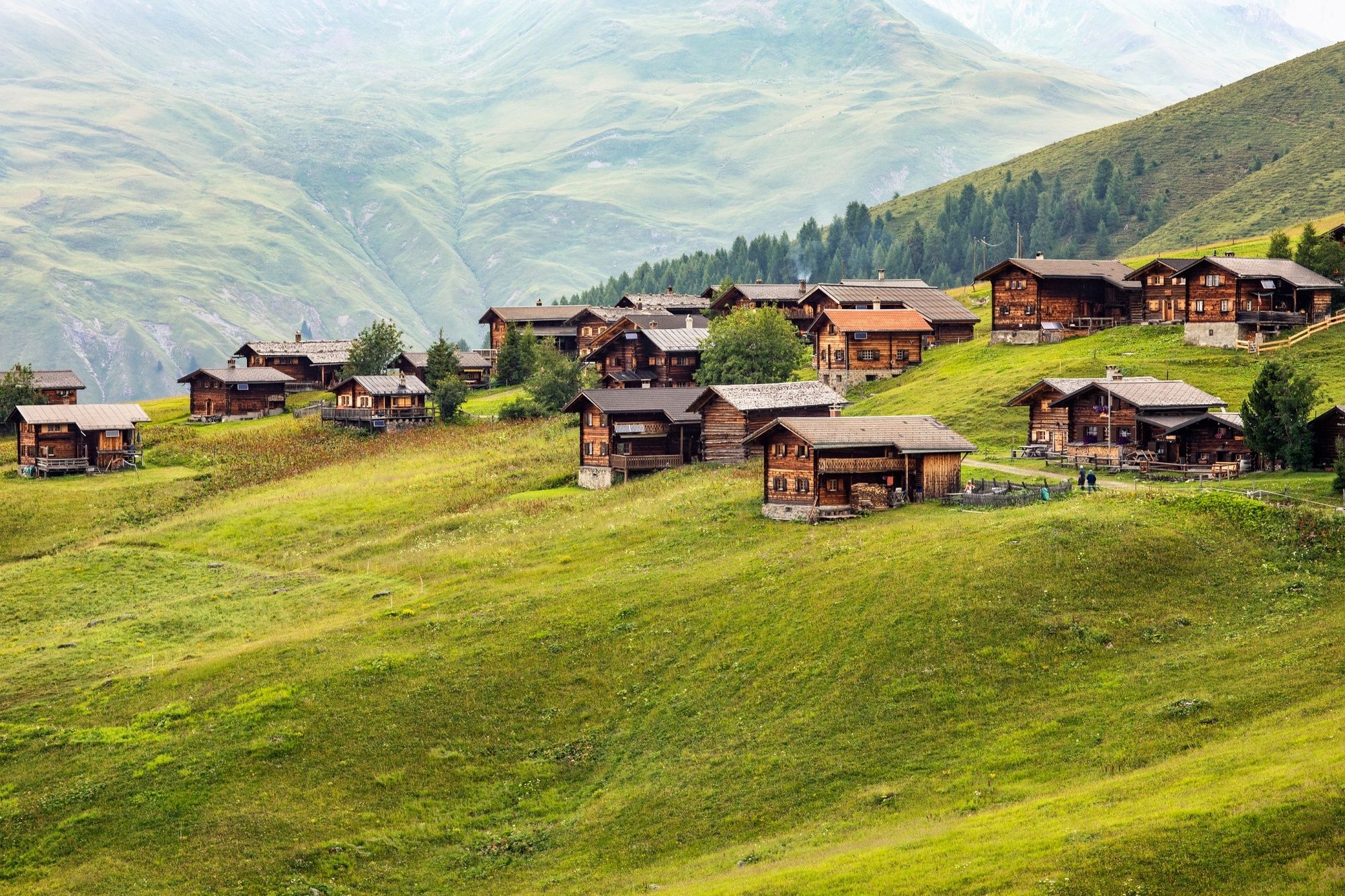
The character of the second stage is very different: traditionally-kept Walser alps are surrounded by pastures which in early summer glow Alpine-rose red with every ray of sunshine. After Alp Medergen and before the key point of the tour – a long metal stairway – views stretch down to Sapün, the link between Schanfigg and Davos, once not only of major importance for trading cattle and other goods but also for the free movement of people between the two valley communities. - Directions
-
Stages:
54.1 Lenzerheide–Arosa
54.2 Arosa–Davos - Highest point
- 2,827 m
- Endpoint
-
Davos
- Height profile
-
 © outdooractive.com
 - Tips
-
Online Booking
- Additional information

- Author
-
The tour 54 Mittelbünden Panoramaweg is used by outdooractive.com provided.
GPS Downloads


General info
Refreshment stop
Flora
A lot of view
Other tours in the regions
-
Arosa Lenzerheide
816
-
Hochwang
281