- Brief description
-
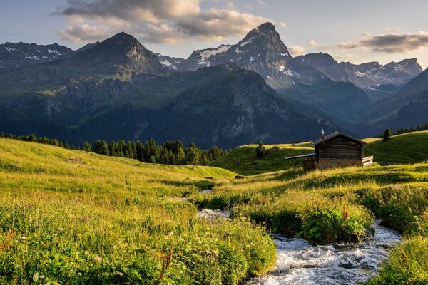
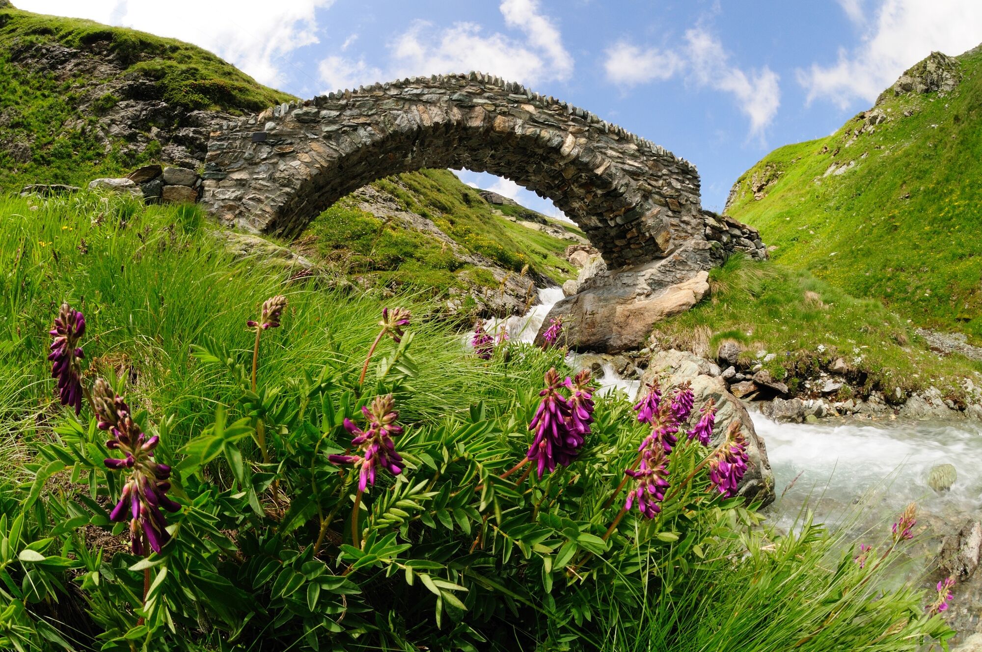
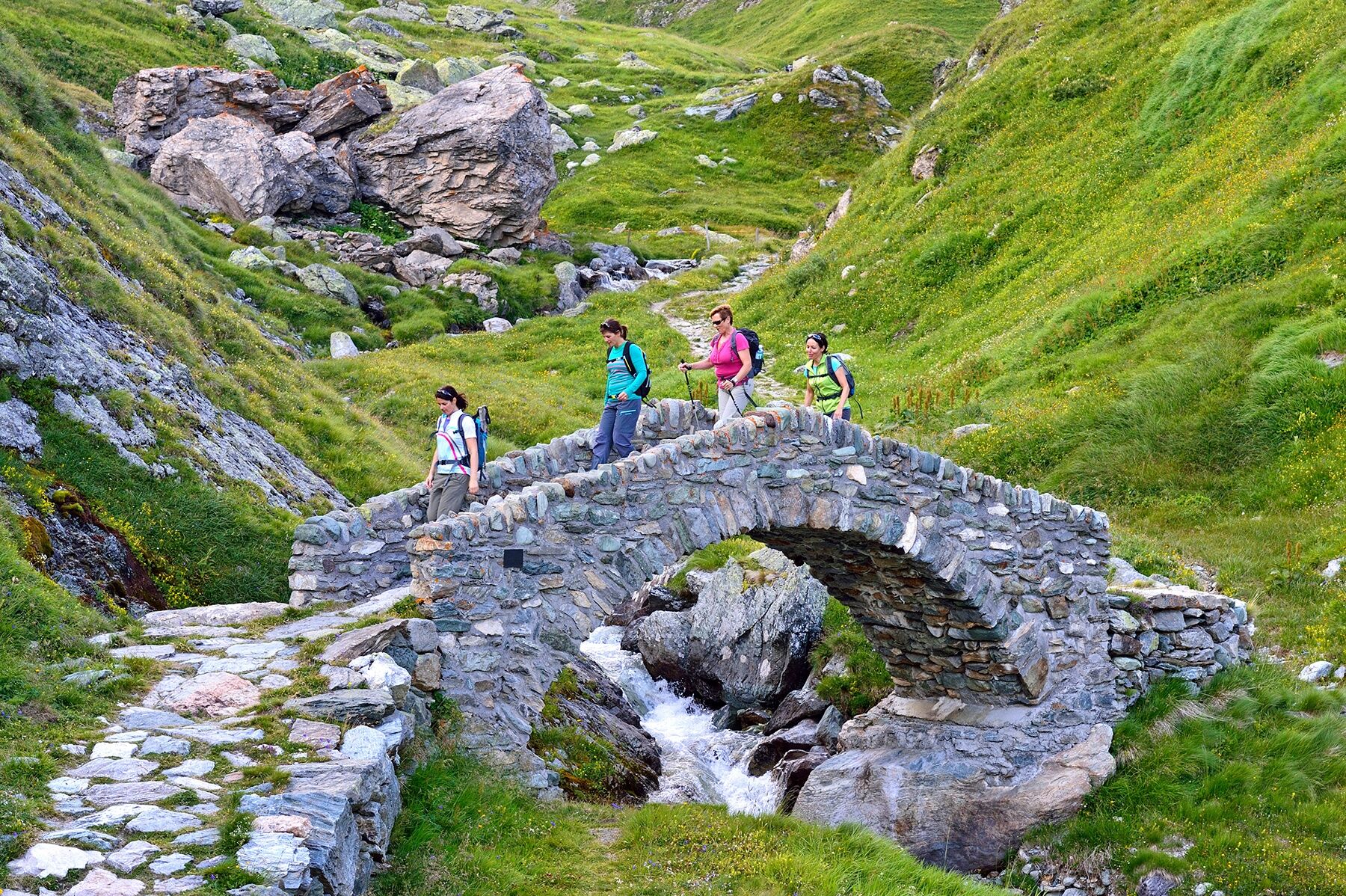
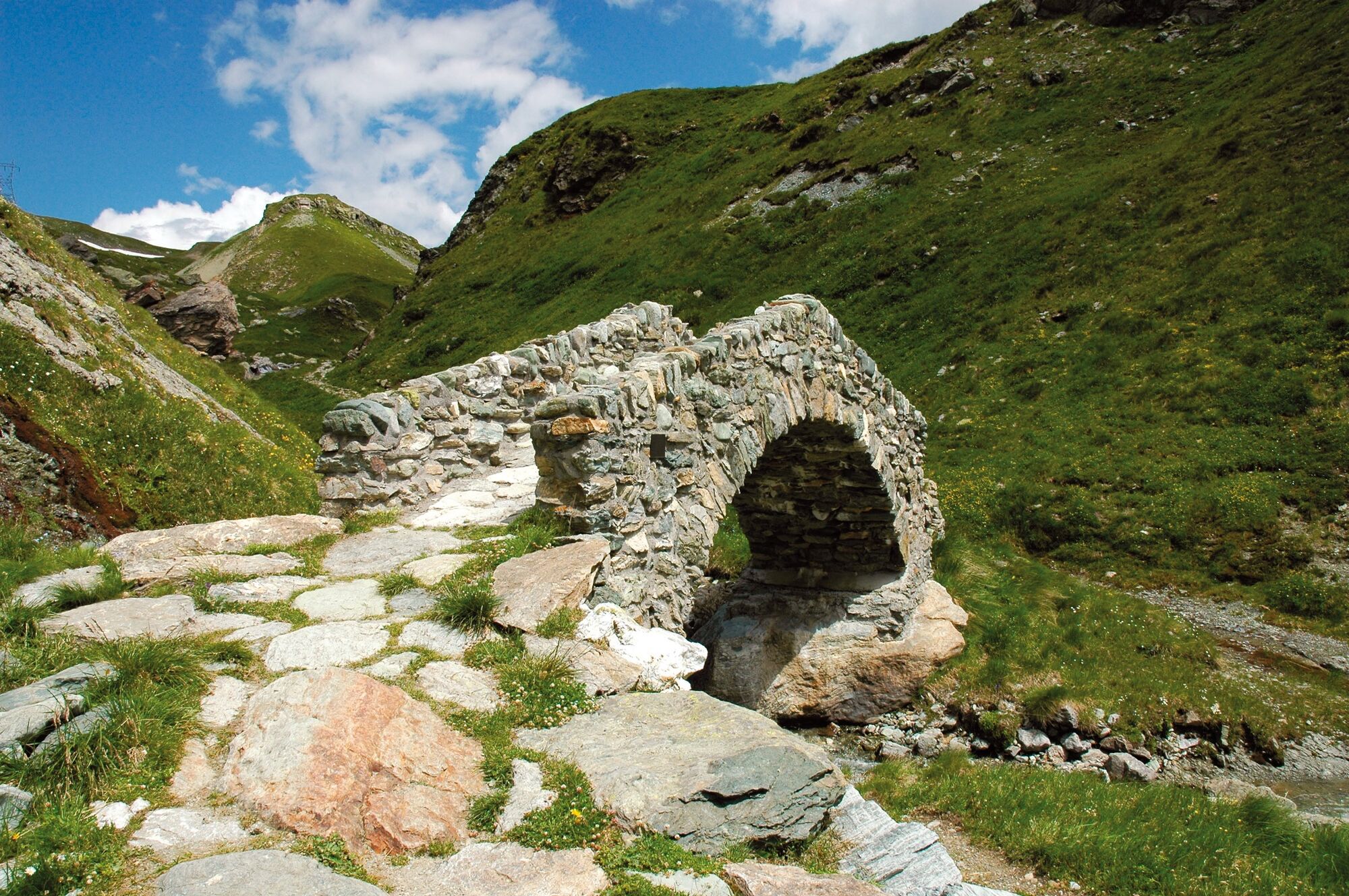
It was considered to be one of the most important Alpine passes in Roman times - the Septimerpass. The focus of this cultural and long-distance trail is on the different linguistic cultures and diversity of natural scenery in the three valleys.
- Difficulty
-
medium
- Rating
-
- Route
-
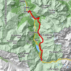
Chur (593 m)Martinskirche0.6 kmKapelle Alterssiedlung Bodmer0.9 kmAraschgen2.0 kmMeiersboden2.9 kmPassugg3.7 kmGasthaus zur Mühle3.8 kmRiedwisli4.2 kmMalix (1,116 m)6.8 kmLax9.5 kmChurwalden (1,240 m)11.7 kmParpan (1,493 m)14.7 kmValbella (1,535 m)16.9 kmCanols17.3 kmLido19.0 kmLenzerheide (1,476 m)20.2 kmKapelle St. Cassian24.3 kmLantsch/Lenz (1,328 m)25.6 kmSt. Maria26.2 kmAlvaschein (1,001 m)29.3 kmAlpenblick29.3 kmMistail31.5 kmSt. Peter Mistail31.7 kmBistro Casti32.9 kmTiefencastel (884 m)32.9 kmTiefencastel (859 m)33.4 kmMon (1,231 m)36.1 kmDel (1,373 m)37.7 kmKatholische Kirche Son Gieri39.2 kmGasthaus Alpina39.7 kmSalux (1,258 m)39.7 kmParsonz42.1 kmBaselgia San Luregn42.9 kmRiom43.0 kmConters (1,182 m)43.6 kmSavognin (1,207 m)45.5 kmSon Mitgel45.5 kmTinzen (1,232 m)48.4 kmLa Ruigna56.8 kmCuorts (1,963 m)57.9 kmCotti Agricultura58.1 kmTgalucas58.3 kmTga d'Meir59.1 kmTigias59.3 kmHotel Piz Platta59.3 kmSalategnas59.9 kmPardeala62.9 kmAlp d'Iert63.1 kmAlp Natons (1,963 m)63.7 kmPlaz67.1 kmGravella67.5 kmBivio (1,769 m)67.5 kmReformierte Kirche Bivio67.6 kmCurtinfess67.8 kmTgavretga68.7 kmNagrign69.3 kmPrevostign69.6 kmFranca's Beizli - Besenbeiz69.9 kmFumia69.9 kmSeptimer Pass (2,310 m)74.3 kmSeptimerhütte74.7 kmChiesa riformata di San Giovanni80.4 kmCasaccia (1,458 m)80.4 kmRistorantino Bar Sett80.4 kmLöbbia82.3 kmRöivan83.6 kmTognaca83.7 kmPravaqual83.9 kmPranzaira85.0 kmPungell85.8 kmCadalpena87.0 kmReformierte Kirche S. Trinità87.2 kmVicosoprano (1,067 m)87.3 kmSur Albigna87.7 kmBorgonovo88.9 kmAua Marcia89.6 kmStampa (995 m)90.1 kmMartinenga90.2 kmSturäl90.5 kmLa Stala90.8 kmValär90.8 kmColtura90.9 kmDulezi91.8 kmCaccior (929 m)92.4 kmCiävra92.8 kmCamplan92.9 kmTurisc93.4 kmLa Porta94.1 kmPromontogno (832 m)94.4 kmLa Val94.6 kmKatholische Kirche Maria Immacolata94.7 kmRunch94.7 kmPlev Lavia94.8 kmI Crott94.8 kmBondo (823 m)95.2 kmReformierte Kirche Sankt Martino95.4 kmNortacc95.5 kmDimvich95.6 kmCaltüra95.9 kmPrä Bell96.2 kmBregan d'Zott96.3 kmFarzett96.8 kmPlän Mäira99.5 kmBrentan99.6 kmCastasengen (690 m)99.7 kmChiesa riformata di San Giovanni Battista99.7 kmValico di Castasegna (685 m)100.2 kmVecchia Dogana101.3 kmRistorante Pizzeria Altavilla101.6 kmCase Fornari101.6 kmCrotto Ghiggi102.1 kmVilla di Chiavenna (640 m)103.2 kmSpecchi103.4 kmMotta103.5 kmRistorante Tavernella104.1 kmPunt (513 m)106.4 kmSanta Croce (512 m)106.6 kmChiesa dell'Invenzione della Croce106.6 kmPè del Rovano107.8 kmStalle dei Ronchi (592 m)107.9 kmBorgonuovo108.8 kmCrotti della Canoa (520 m)109.7 kmCortinaccio (440 m)110.3 kmRovedè110.3 kmProsto (380 m)110.6 kmCà Basciàn110.6 kmGiüpéet110.8 kmCascata del Cavrii111.1 kmCà de la Pòšta111.2 kmCà di Cént111.2 kmCappella di San Cassiano111.2 kmChiesa parrocchiale della Beata Vergine Assunta111.3 kmCrotti di Belvedere111.4 kmOrelli112.5 kmBottonera112.8 kmLadranio112.9 kmSaliceto113.0 kmCantòn113.1 kmCläven (333 m)113.1 kmSanta Maria113.2 km
- Best season
-
JanFebMarAprMayJunJulAugSepOctNovDec
- Description
-
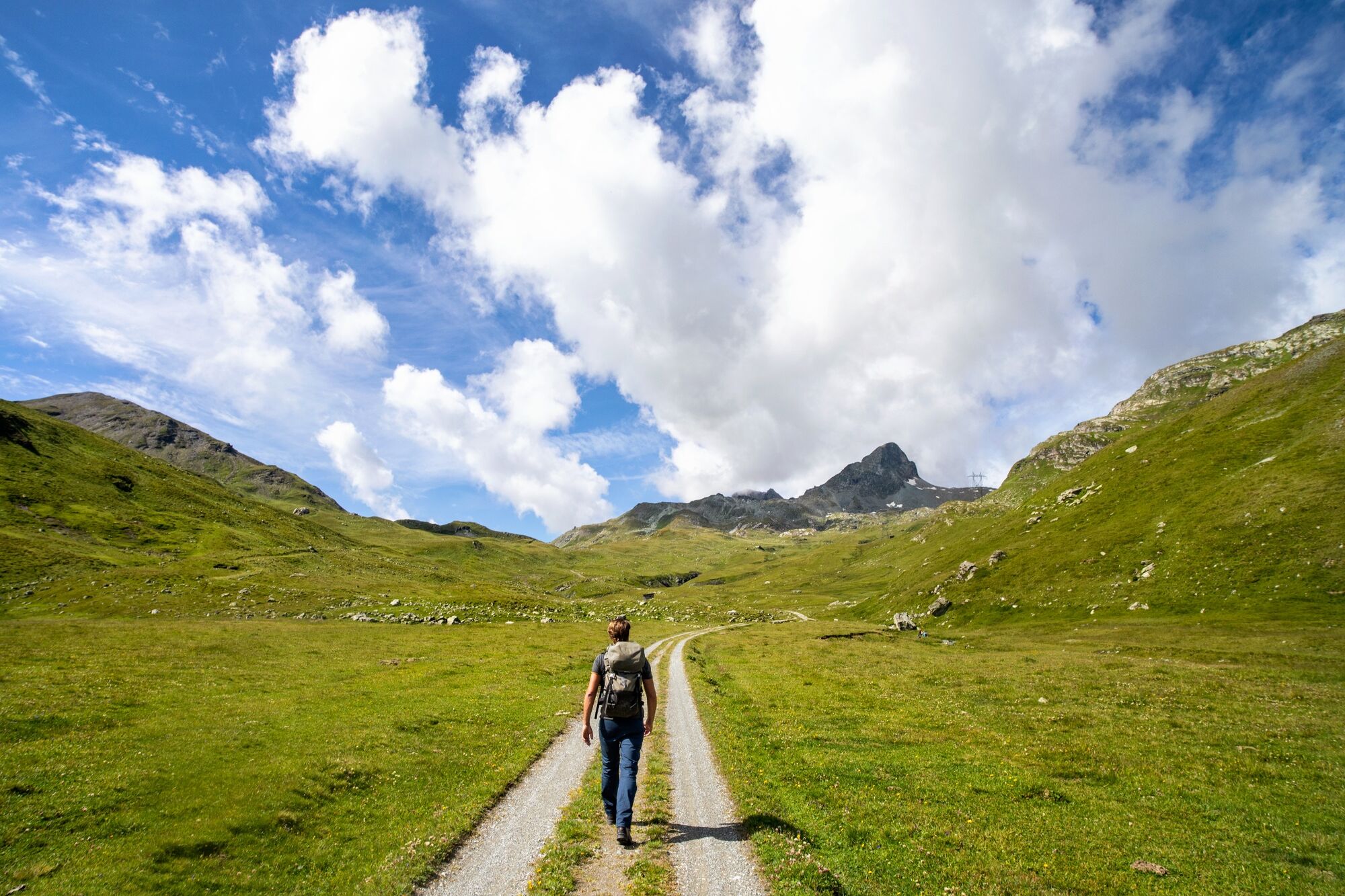
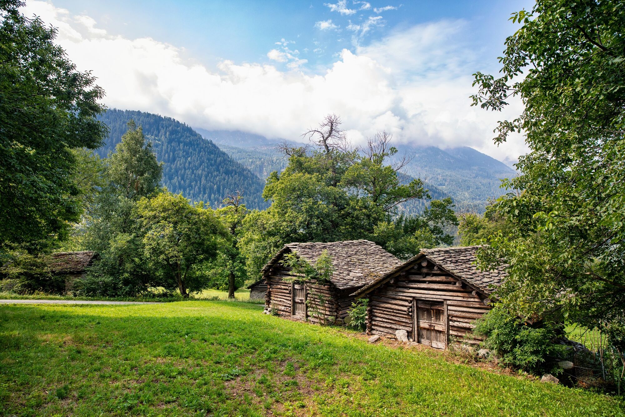
Traders, armies, kings and emperors all crossed the Alps via the Septimer route. Its advantages were the convenient location with a direct north-south link and ideal topographical conditions. Finds of lead slingshot on the Septimer bear witness to the fact that the Roman army made early use of the pass. Above all in the High Middle Ages, the Septimerpass was one of the most important trading routes and brought wealth to the Bishop of Chur. Today, one of Switzerland's most diverse cultural and long-distance hiking routes travels over what was once an arduous Alpine crossing. From Chur to Chiavenna in Italy, it gradually traces a chequered history and leads through three different cultural regions. The natural setting is just as varied. There is plenty to discover, the open space of the high plateau in the Surses, the rocky landscape at the head of the Septimerpass and the Mediterranean mountain valleys of Bergell and Valchiavenna.
- Directions
-
64.01 Chur - Lenzerheide, ViaSett
64.02 Tiefencastel - Savognin, ViaSett
64.03 Savognin - Bivio, ViaSett
64.04 Bivio - Vicosoprano, ViaSett
64.05 Vicosoprano - Chiavenna, ViaSett
64.06 Vicosoprano - Chiavenna (I), ViaSett
- Highest point
- 2,309 m
- Endpoint
-
Chiavenna (IT)
- Height profile
-
 © outdooractive.com
 - Additional information
- Public transportation
-
All stage destinations Via Sett are accessible by public transport (train or bus). Partial Reservations are required. The return from Chiavenna can be done via Splügenpass or Maloja to St. Moritz.


-

-
AuthorThe tour 64 Via Sett is used by outdooractive.com provided.


General info
-
Val Surses
827
-
Savognin
136