
- Brief description
-
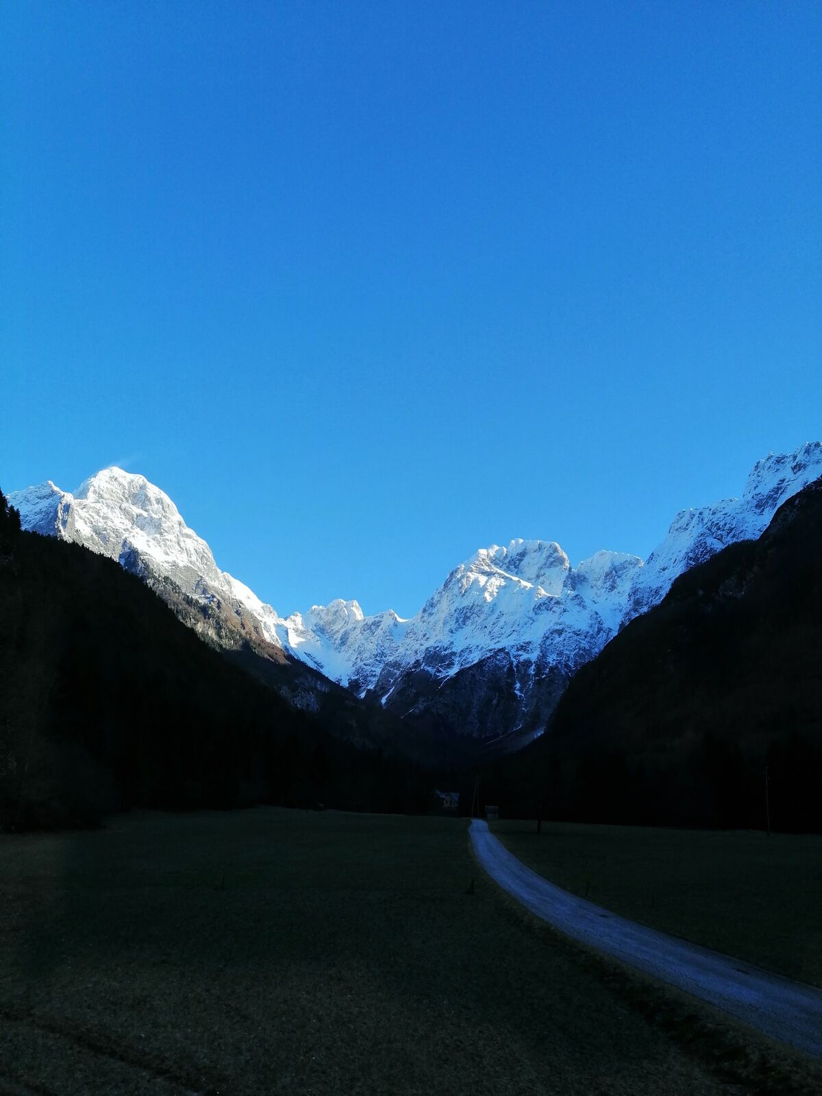
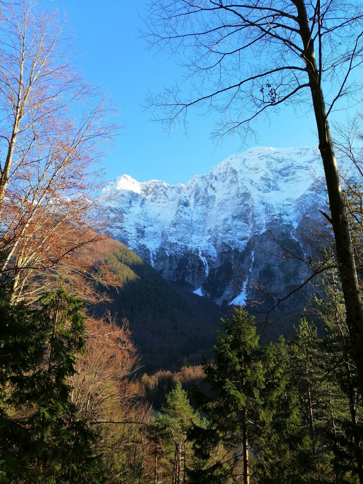
Hiking trail to the village of Strmec – the finest sightseeing point with a view of the Loška stena Mountain wall rising above the valley of the Koritnica River.
- Difficulty
-
medium
- Rating
-
- Starting point
-
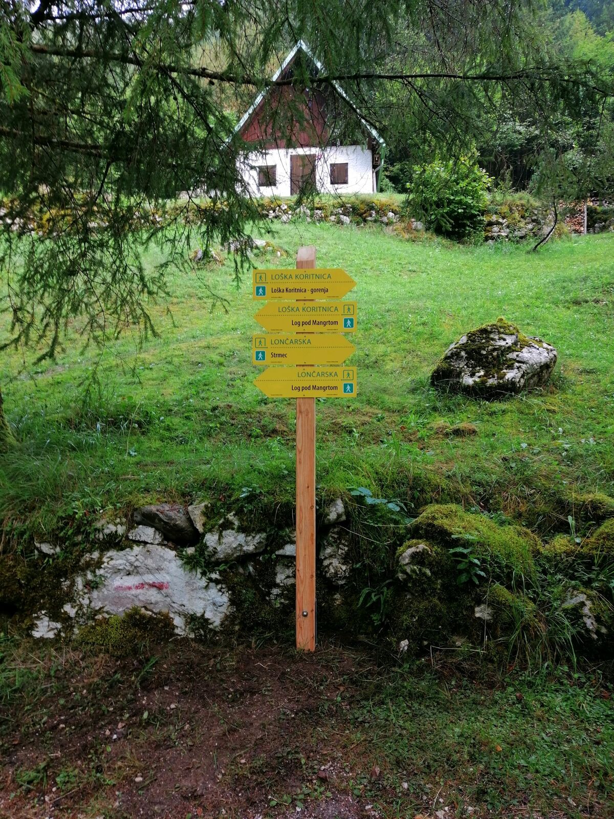
Parking lot behind the new bridge in the upper part of the village of Log pod Mangartom at the entry into the Loška Koritnica Valley
- Route
-
BrettendorfOberbreth3.5 kmBrettendorf4.8 km
- Best season
-
JanFebMarAprMayJunJulAugSepOctNovDec
- Description
-
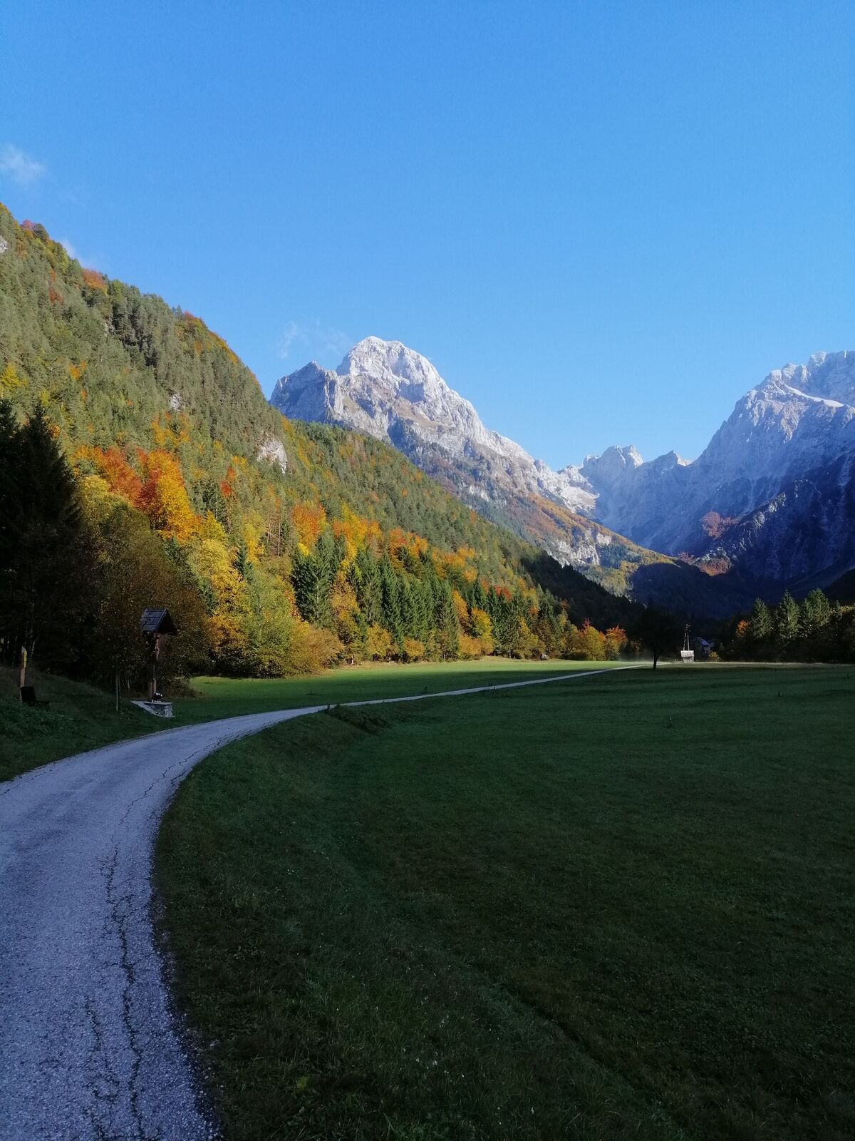
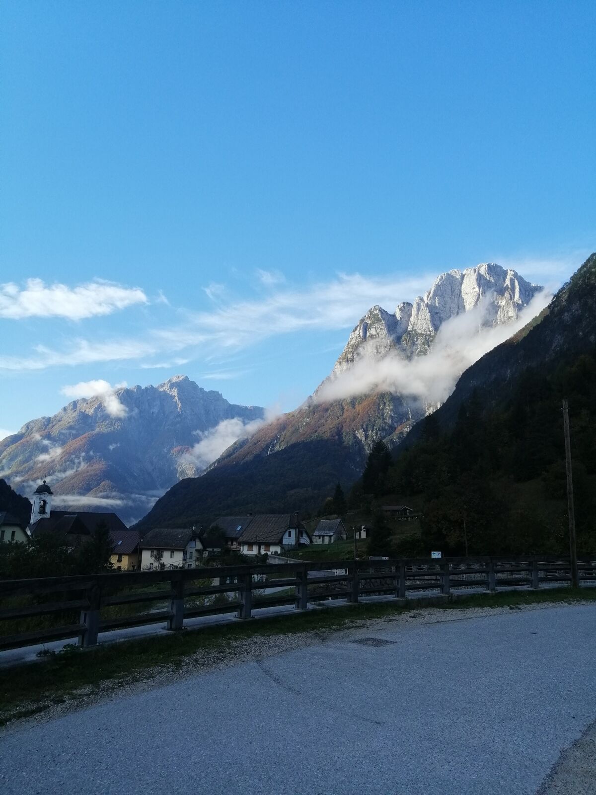
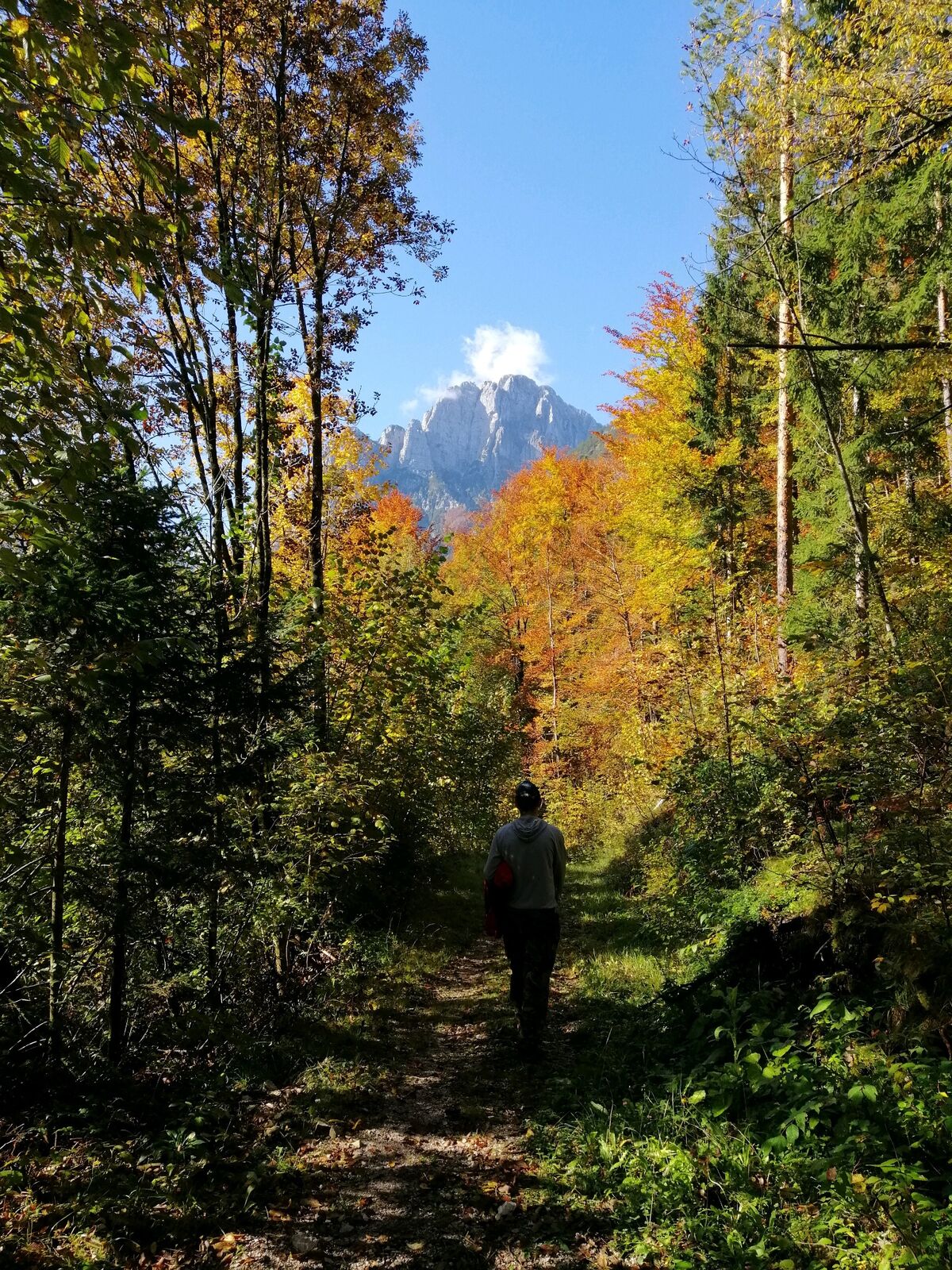
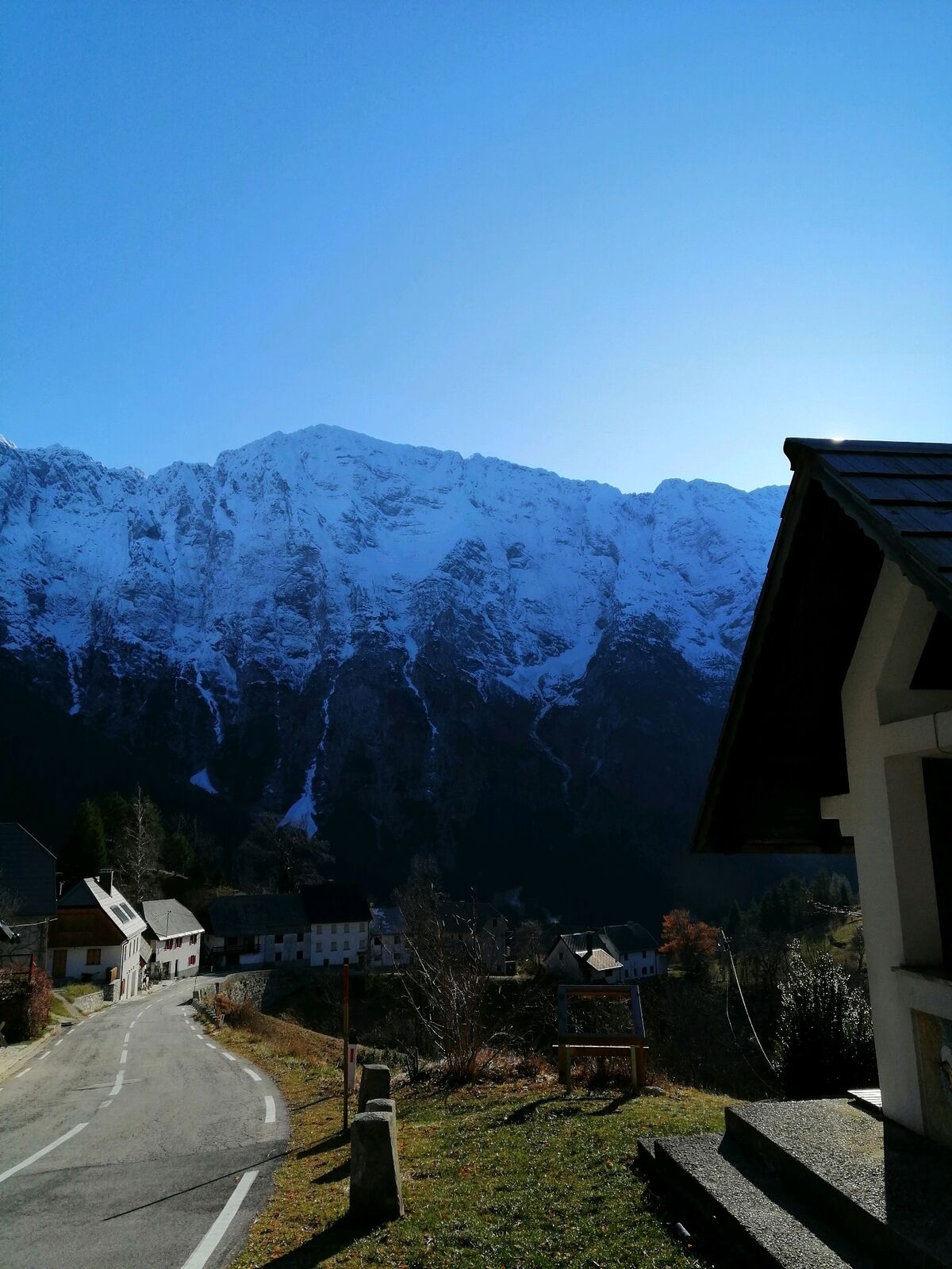
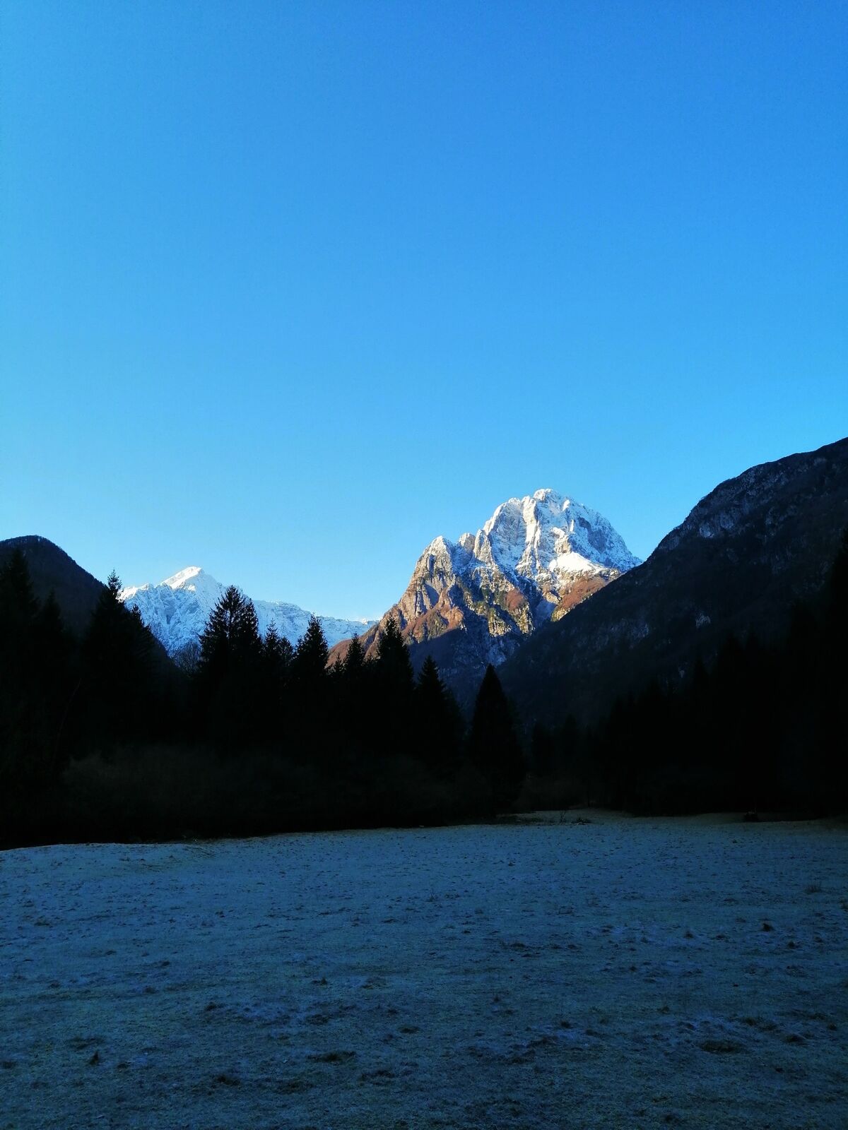
This hiking trail, which starts in a gently sloping Loška Koritnica Valley, will gradually take you to the village of Strmec on the Predel Mountain pass, i.e. to the finest sightseeing point with views of Mt. Jalovec and the entire Loška stena Mountain wall. The descent is somewhat steeper, however, it is routed through a cool forest beneath Mt. Strmška glava, and will quickly take you back to a gentler section of the trail where you already hiked during your ascent. There are several versions of this trail because you can leave it in the village of Strmec and descend along the Juliana Trail, which is less steep than the “Po mostiču” trail.
- Directions
-
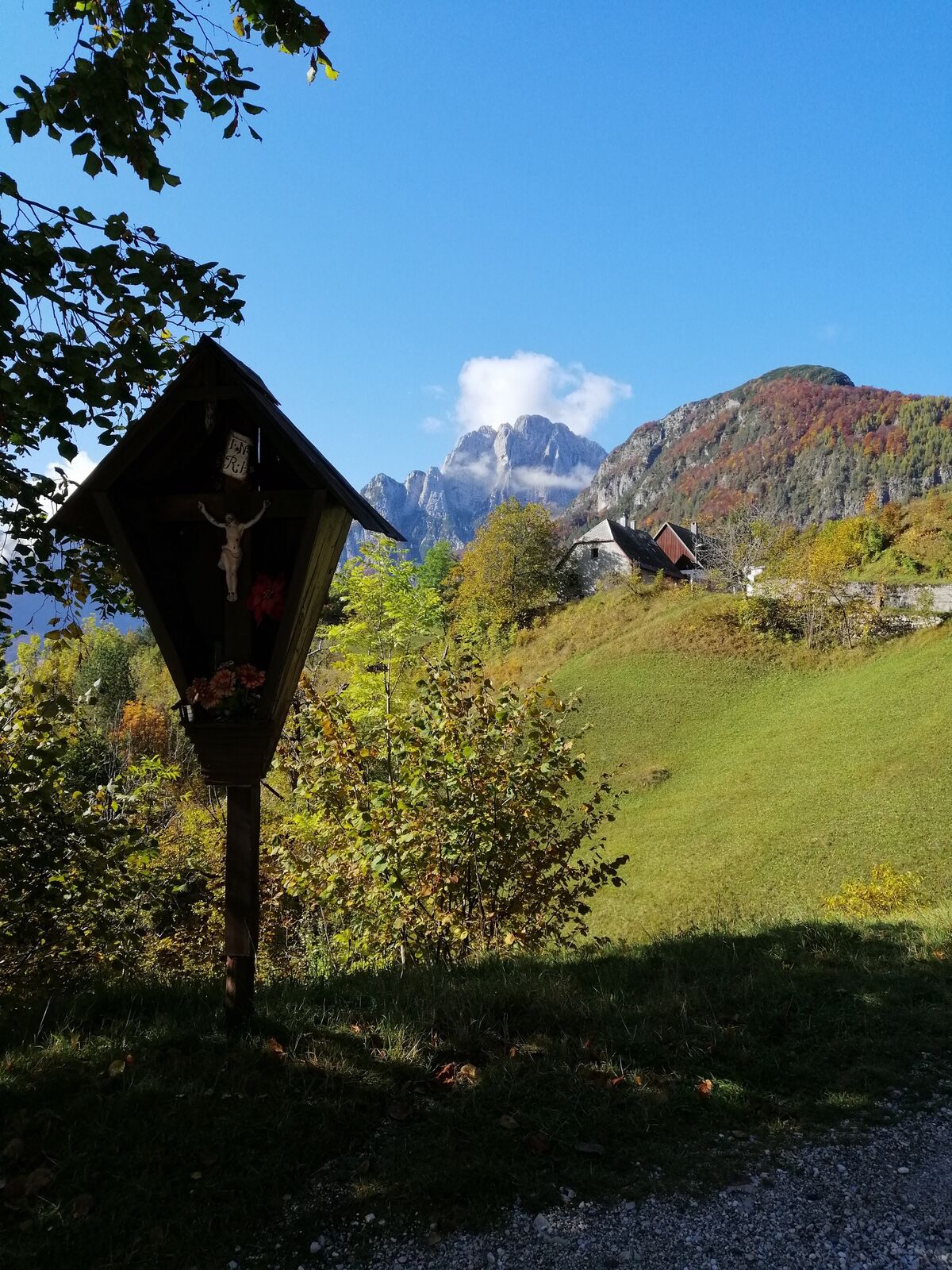
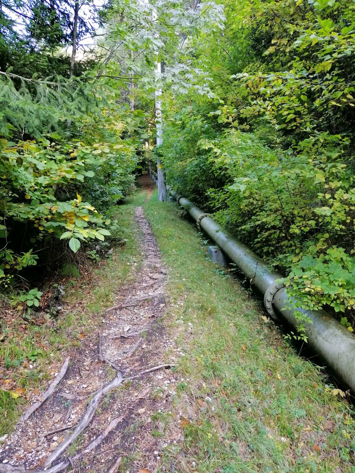
This historical hiking trail starts at the parking lot in the upper part of the village of Log pod Mangartom where a road starts leading to the gable end of the Loška Koritnica Valley. After 200 metres of walking, when you arrive to the church sign, turn on a well-worn forest road and gently ascend into the valley. Down below, you will quickly be able to notice the Log pod Mangartom hydroelectric power plant. The trail continues in a gentle ascent and passes several vacation houses. At the last vacation house, just in front of the small concrete bridge, turn in the direction of the sign and proceed uphill through the forest. This section of the trail is somewhat historical because, many years ago, merchants used to carry clay pots along this trail towards the Predel Mountain pass (hence the name “Lončarska”). After a couple of hundreds of metres, the trail steeply turns to the left and starts to gradually ascend towards the village of Strmec. At a certain point, the trail crosses the national road Bovec-Predel, which is why greater caution is required due to heavy traffic (especially during the summer). After crossing the road, the trail becomes somewhat steep, particularly in the section after you cross the pipeline for the hydroelectric power plant. After approximately 300 metres, you will return to the main road in front of the village of Strmec. From the point where you join the main road all the way to the beginning of the village, the trail follows the main road, which is why caution is required due to the oncoming vehicles.
Just in front of the village, at the finest sightseeing point overlooking Mt. Jalovec and the Loška stena Mountain wall, you can notice a sign directing you down a steep pasture. The section of the trail from this point onwards is called “Po mostiču”. You can decide to enter the small village of Strmec where you can enjoy in the typical Alpine house architecture and visit the historical monument dedicated to male residents of the village killed during World War II. If you believe that the “Po mostiču “ trail is too steep, you can find a turn at the other end of the village of Strmec leading to a mostly gradual Juliana Trail which will take you back to your starting point. If you decide to continue along the “Po mostiču” trail, you will enter the forest immediately after crossing the pasture and continue along a steep descent into the Loška Koritnica Valley. In the lower section, you will cross the main road again and continue along small hairpins to the bottom where you will return to the trail where you were ascending uphill just hours ago. Here, turn to the right and continue along a practically flat section of the forest back to your starting point.
- Highest point
- 946 m
- Endpoint
-
Strmec
- Height profile
-
 © outdooractive.com
 - Equipment
-
Hiking footwear, trekking footwear, trekking poles.
- Safety instructions
-
Before you reach the village of Strmec, you have to hike along the main road for approximately 300 metres, which is why greater caution is required especially during the summer when the volume of traffic is heavy. Caution is also required when descending from the village of Strmec, because certain sections of the trail are somewhat steep and slippery in wet weather. Caution is also required in the lower section where the trail crosses the main road Bovec-Predel a couple of times. The trail is passable in dry winters, however, certain sections can get covered with ice.
- Tips
-
This trail is especially appropriate during the summer because it is mostly routed through the forest.
- Additional information
-
In the village of Strmec, the physically well-prepared hikers can continue hiking along the “Senarska” trail to the Mangart Mountain pass, however this will delay the return back into the valley at least for 5-6 h. You can also decide not to descend along the “Po mostiču” section from the village of Strmec, which is pretty steep, but to hike along the Juliana Trail routed along the other side of Mt. Strmška glava, which is somewhat longer, but gentler. In any event, you will return to the same starting point. It is more appropriate for photographers to take this trail in the afternoon when Mt. Jalovec and the Loška stena Mountain wall are basking in the late afternoon sunlight. In the autumn, you can find plenty of mushrooms along the trail.
- Directions
-
From the town of Bovec, drive along the national road 203 towards the former border crossing. After approximately 10 kilometres you will arrive to the village of Log pod Mangartom. At the end of the village, drive across the new bridge and, immediately after crossing, turn to the right onto a small parking lot where parking is available.
From the former border crossing Predel, descend along the national road 203. After approximately 7 kilometres you will arrive to the village of Log pod Mangartom. In front of the new bridge, turn sharply to the left onto a paved road leading to the Loška Koritnica Valley. Here, you will find a small parking lot where you can park.
- Public transportation
-
During the summer months (July 1 – August 31) there are three bus lines connecting Bovec and Kranjska Gora (Ljubljana).
- Parking
-
Free parking lot just in front or behind the new bridge in the upper part of the village of Log pod Mangartom.

-

-
AuthorThe tour Hiking along the trails “Lončarska” and “Po mostiču” is used by outdooractive.com provided.