
- Brief description
-
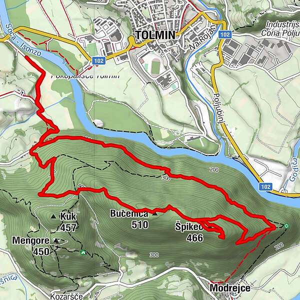
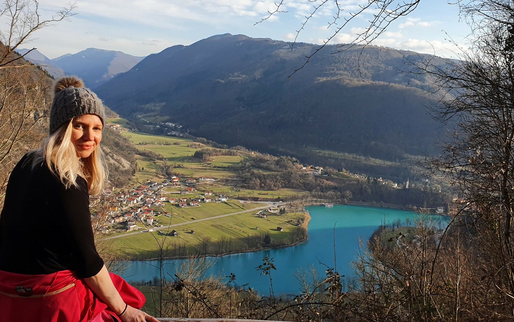
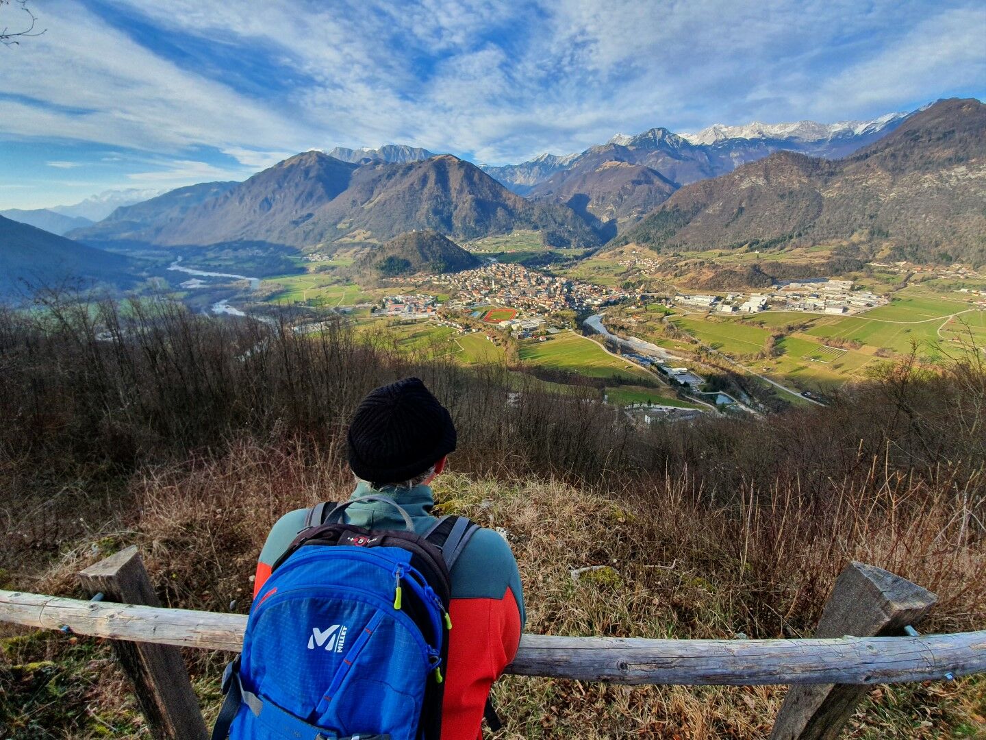
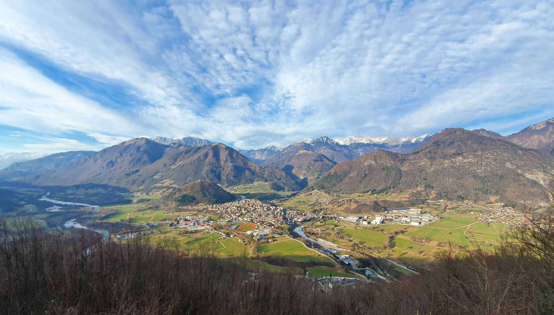
A gentle ascent around the steep slopes of Mt. Bučenica above the Soča River to the splendid sightseeing point on the top. On the eastern side of Mt. Bučenica, you can take in the view of the lake, whilst on the western side, you can take in the view of the town of Tolmin and the mountain chain in the background stretching all the way to Mt. Krn and Mt. Kanin.
- Difficulty
-
easy
- Rating
-
- Starting point
-
Labrca – parking lot in front of the building is the property of the restaurant, which is why you should park your car closer to the bridge
- Route
-
Modreuzza3.8 kmViewing point4.9 kmŠpikec (466 m)5.1 kmBučenica (510 m)5.7 km
- Best season
-
JanFebMarAprMayJunJulAugSepOctNovDec
- Description
-
This tour starts at the Labrca Restaurant and continues along the Walk of Peace to an isolated farmhouse at the foothills of Mt. Bučenica. From here, you continue along a tractor trail which gradually narrows and turns into a footpath. Follow this gently ascending footpath along the ridges high above the Soča River all the way to the junction with the trail routed from the Most na Soči area. Turn up the hill, and when the footpath levels up, find a turn to the left leading to the sightseeing point overlooking the lake and the town of Most na Soči. Just a little bit further, you will be able to enjoy in magnificent panoramic views of the town of Tolmin and the mountain chain in the background that open to the opposite side. The descent will initially take you to the ridge between Mt. Bučenica and Mt. Mengore (Walk of Peace information boards) and further down to the farmhouse where your ascent started.
- Directions
-
From the restaurant, follow the narrow paved road. When the road starts to ascend and turns to the right, continue to the left and cross the stream. At the foothills of Mt. Bučenica you will find a footpath leading uphill to the right to an isolated farmhouse. Just behind this farmhouse, you will be able to continue along a tractor trail which gradually ascends uphill to the left. Gently ascend along this trail and continue around the slopes of Mt. Bučenica. Except for a bit less demanding short hairpin section opposite of the town of Tolmin, the trail constantly ascends to the west all the way to the junction with the trail routed from the village of Modrejce. Continue along the trail until you reach the sightseeing points on the top. From the top, continue along or rather on the side of the occasionally rocky tractor trail until you reach information boards standing on the mountain pass. From here, descend to the right to the farmhouse where the ascent started and end the tour at Labrca.
- Highest point
- 509 m
- Endpoint
-
Mt. Bučenica
- Height profile
-
 © outdooractive.com
 - Equipment
-
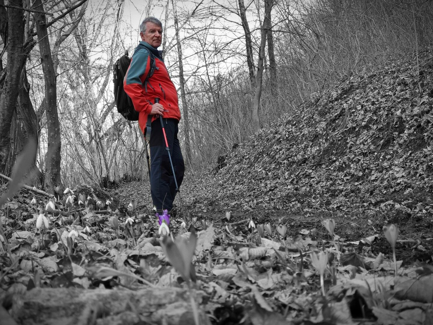
Usual hiking equipment; we advise you to use mountaineering footwear instead of sports shoes.
- Safety instructions
-
Certain sections of the trail along the steep slopes above the Soča River are quite narrow and require special caution in wet weather.
- Tips
-
This tour can end quite pleasantly at Labrca.
- Additional information
-
This tour can end quite pleasantly at Labrca.
- Directions
-
Turn left to the Labrca Restaurant just after the bridge.
- Public transportation
-
There is public transportation available to the town of Tolmin. You will reach the Labrca Restaurant most comfortably by car, however, you can also start the tour in Tolmin where you start following the Alpe Adria signs which will take you to the Labrca Restaurant – this version will prolong the tour for approximately 30 minutes.
- Parking
-
It is most appropriate to park your car just behind the bridge.


-

-
AuthorThe tour Tour to Mt. Bučenica from Labrca is used by outdooractive.com provided.