

- Brief description
-
This stage heads from Porezen to the Lower Bohinj mountains of the Julian Alps, whose ridges are visible ahead. First it descends to Podprdo before heading up to Črna Prst.
- Difficulty
-
difficult
- Rating
-
- Starting point
-
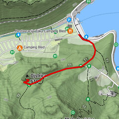
Porezen (mountain hut)
- Route
-
Petrovo Brdo5.2 kmŠance (1,350 m)10.4 kmKobla (1,498 m)11.3 kmKrevl (1,515 m)11.8 kmPlanina Kal (1,362 m)12.3 kmNa Kalu (1,362 m)12.5 kmČez Suho (1,760 m)15.1 kmDom Zorka Jelinčiča15.3 kmČrna prst (1,844 m)15.4 km
- Best season
-
JanFebMarAprMayJunJulAugSepOctNovDec
- Description
-
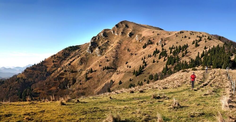
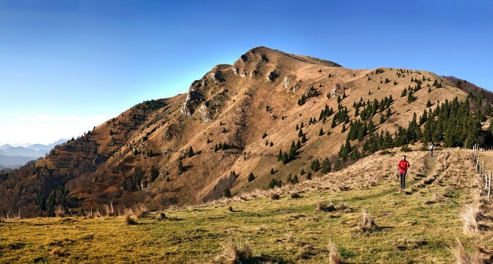
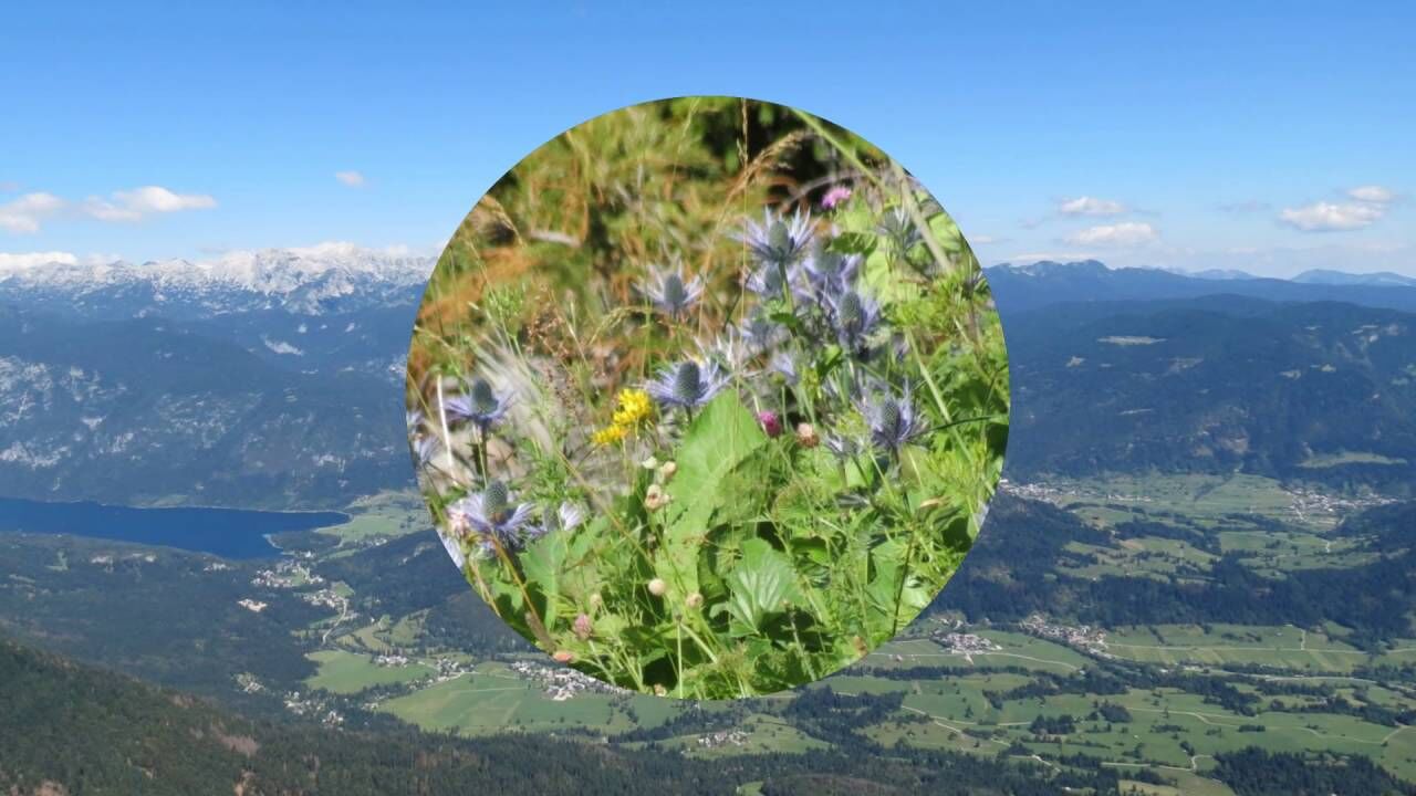
At 1,630 metres, Porezen is the tallest and most picturesque of the peaks of the Cerklje hills. The grass-covered peak offers a very good view. The Porezen peak can be climbed throughout the year but the best climbs are in late June when the grassy slopes transform into a flowery carpet. There are many partisan memorials in the area, so have your eyes open while descending towards Bača.
The waters of Porezen's northern slopes drain into the Bača stream 1,000 m below, where the trail heads, but it doesn't go to the bottom. A small settlement, Petrovo Brdo, lies on a pass in the ridge and is connected to Baška grapa and the Selška dolina valley by a winding road. There is a cosy hut there, for refreshment and overnight if necessary.
The ascent goes on Kobla, which used to be a popular ski resort, and you can still see slopes waiting for snow, and from there up to Črna Prst.
- Directions
-
Take the dirt track heading north for a few metres then cross the open ridge towards the Trtniška planina meadow. You will pass the former Italian barracks below Pohoški kup (1,542 m) then follow the ridge down to the Trtniška planina meadow. 30 minutes.
The path down from the meadow is at first of good quality but gives way to a forest path when it reaches the steep slopes. Follow the path down the northern rock face of the Hoč peak. There will be a dirt track leading to a farmstead and which you will cross at the bottom. You will then climb down another steep slope through the forest for a few minutes to reach the road leading to the Podhočar tourist farmhouse. Walk left along the road, following the footpath to cut across the turns in the road, until you reach the settlement of Petrovo Brdo (803 m). 1h 30 min. This is the border between the Cerklje hills and the Julian Alps, which is your goal.
From the pass, go north to the forest and follow the very steep forest road running on a ridge between two ravines until you reach a crossroads. Here, a path goes left to the peak of Kup (1,046 m), but the path that you will follow goes straight ahead. After about 5 minutes, leave the path and climb the footpath up the wooded ridge to reach the road again. From the road, climb up to the Ravan meadow. 1 h 30 minutes.
There is a crossroads at the beginning of the meadow. One road branches off to the right and leads to Soriška planina meadow. Your path leads to the hunting lodge, where you may take a rest. From the meadow, climb up the mule track, at first through forest, then across meadows on the southern slope of Slatnik (1,609 m) to the crossroads just below the Vrh Bače pass (1,273 m).
A path leads up to Soriška planina meadow to the right, and down to the village of Podbrdo to the left. Continue walking up to the pass. 30 minutes. The Vrh Bače pass was once the main link between Bohinj and the Primorska region. From the pass, climb up the northern slope of the ridge. You will pass meadows and pine forest along the way before reaching the main ridge of the lower Bohinj mountains, then follow the ridge west to the peak of Kobla (1,498 m). 40 minutes.
Kobla is renowned for the ski slopes overlooking Bohinjska Bistrica, which, however, are not on Kobla itself. From Kobla, go north down the path to the pass between Kobla and Kravja Črna gora, and from there past several springs to the Na Kalu pass. Closeby is the upper station of the chair lift. Continue walking down through the forest to the marshy and overgrown floor until you reach a crossroads where a path descends down to Planina za Črno goro. 50 minutes.
From the crossroads, climb up the northern slope of Kontni vrh (1,646 m), at first through forest, to the crossroads with the balcony trail coming from the left. There is now another climb through a narrow gully called Žrelo which will lead you to the small Škrbina pass. Descend to the nearby Čez Suho pass (1,760 m), where there is a crossroads. Yet another short climb brings you to Dom Zorka Jelinčiča na Črni prsti (1,835 m). From the crossroads, 1h 30 minutes. The hike from Porezen takes 7h.
- Highest point
- 1,813 m
- Endpoint
-
Črna Prst mountain hut
- Height profile
-
 © outdooractive.com
 - Equipment
-
Headlamp is strongly recomended.
- Safety instructions
-
If you are planning to visit the bunkers, make sure you have headlight with you.
- Tips
-
The Vrh Bače pass is a very nice photo destination, it also has some military fortification still preserved that you can explore.
- Additional information
-
You can have lunch about halfway, in the hut at Petrovo Brdo.
- Directions
-
The start of the stage is on top of Porezen. You can join the trail from Bohinjska Bistrica, to where you can come by train, bus or car. You can also reach Petrovo Brdo by car.
- Public transportation
-
This is mountain stage, with no public transfer.
- Parking
-
Parking in Bohinjska Bistrica (railway station)
- Author
-
The tour Via Alpina Slovenia: Red trail Stage 8 (Porezen-Črna Prst) is used by outdooractive.com provided.