Mt. Rombon (2208 m), the finest sightseeing hill of the Bovec area


- Brief description
-
This long hiking tour with the ascent of 1800 metres leads to the most important points where the battles of World War I took place.
- Difficulty
-
difficult
- Rating
-
- Starting point
-
Bovec – centre of the town
- Route
-
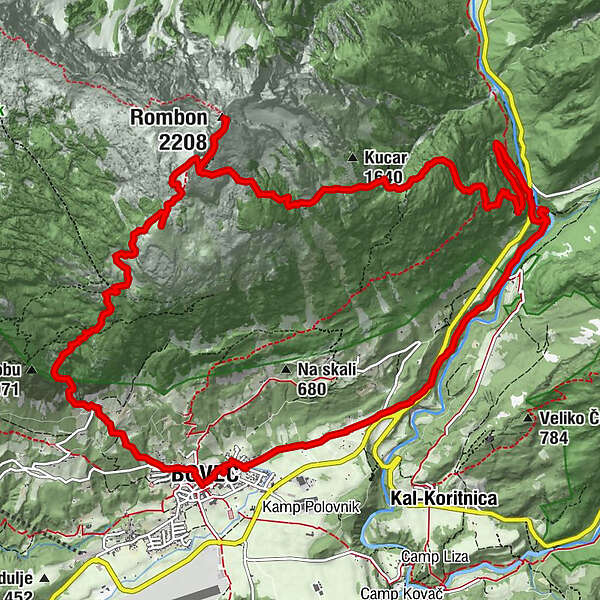
Flitsch0.0 kmCerkev svetega Urha0.2 kmKaninska Vas0.5 kmPlanina Goričica3.3 kmČukla (1,765 m)5.0 kmMonte Rombon (2,208 m)6.7 kmVrh Nakla (2,000 m)7.4 kmFlitsch18.7 km
- Best season
-
JanFebMarAprMayJunJulAugSepOctNovDec
- Description
-
You can take a short version of this tour (return along the same way) or turn to the left approximately 200 metres beneath the summit and continue along the trail descending to the former military observation post Kota 1313, Fort Hermann and the Kluže fortress where you continue along a nice and level footpath to the town of Bovec. In both cases, the tour starts and ends in the centre of Bovec. If you would like to descend more gradually you have to turn to the Historical Trail above Fort Hermann which will take you to the centre of Bovec.
- Directions
-
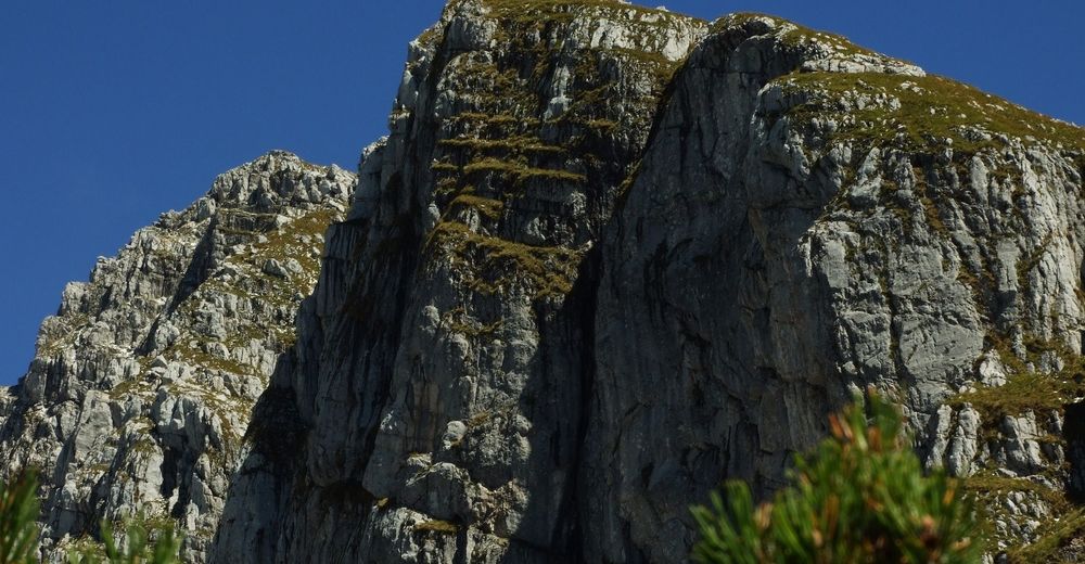
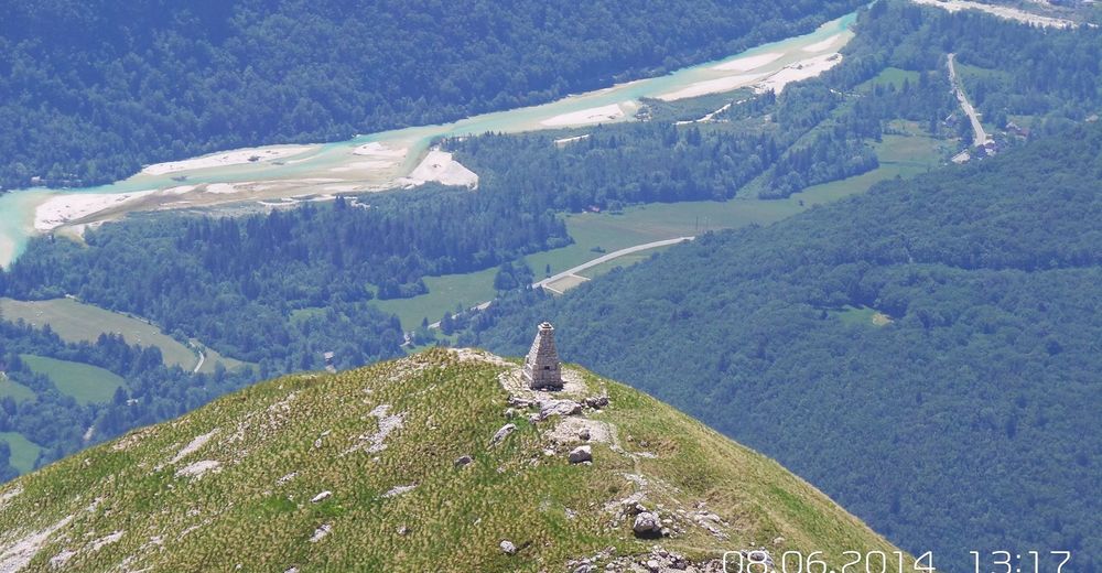
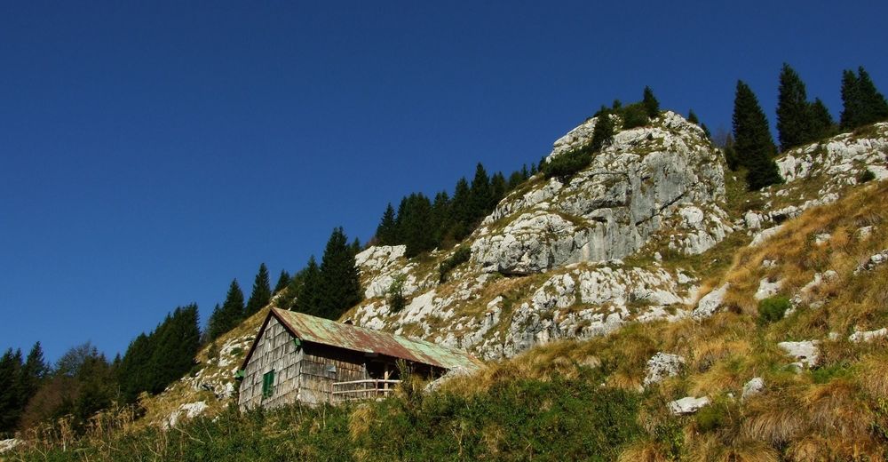
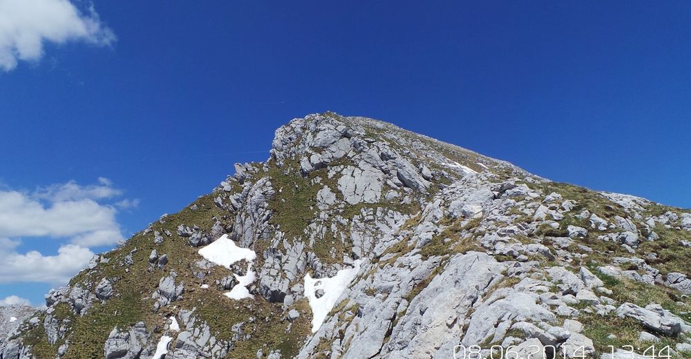
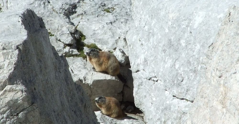
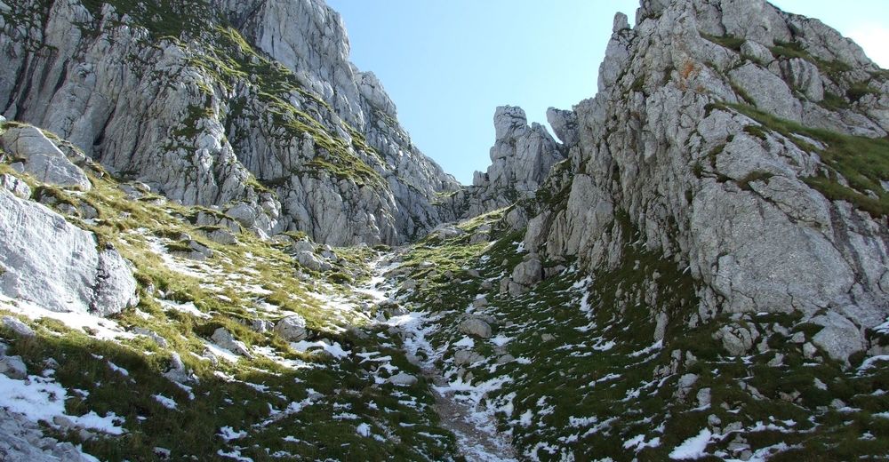
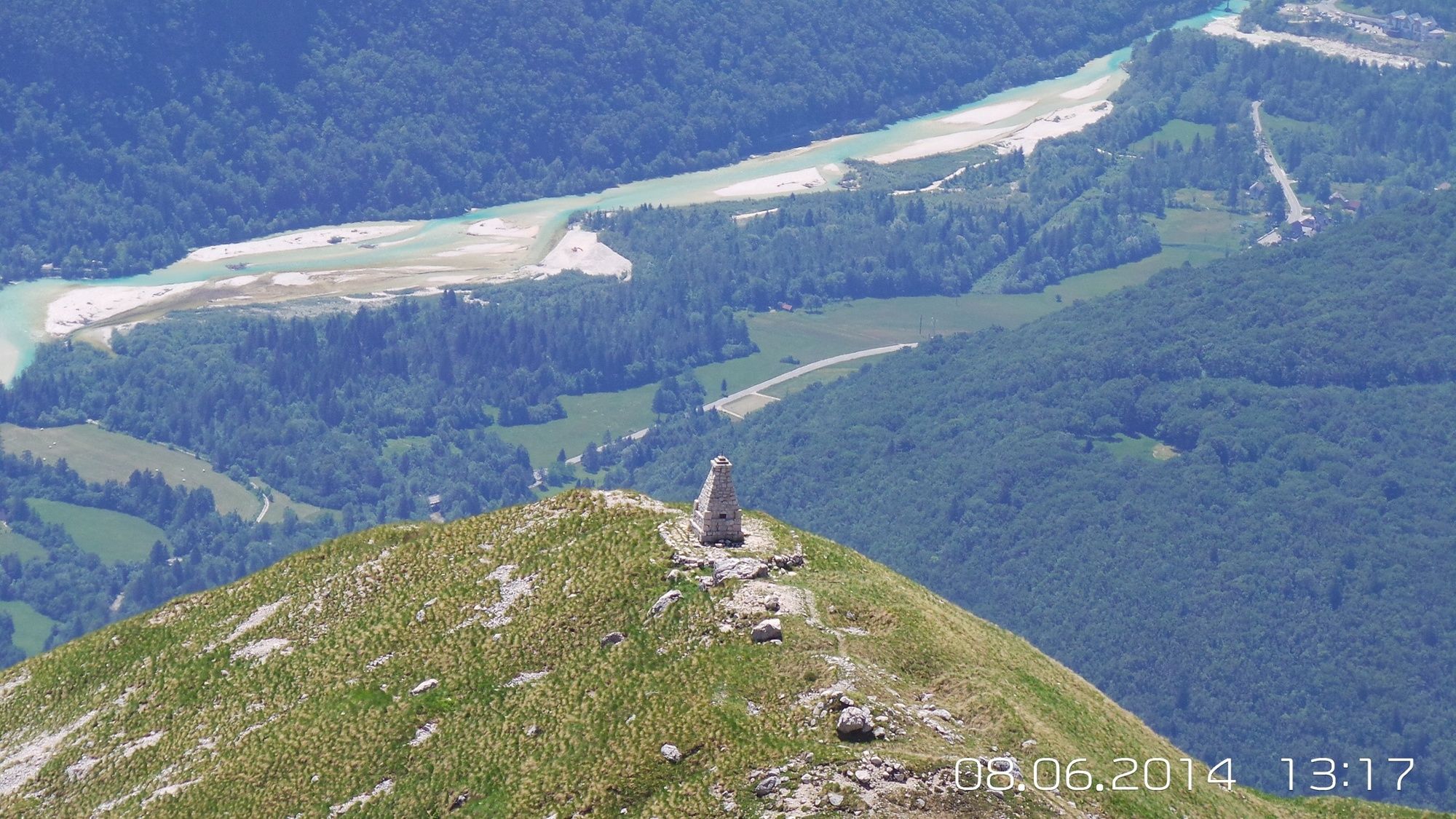
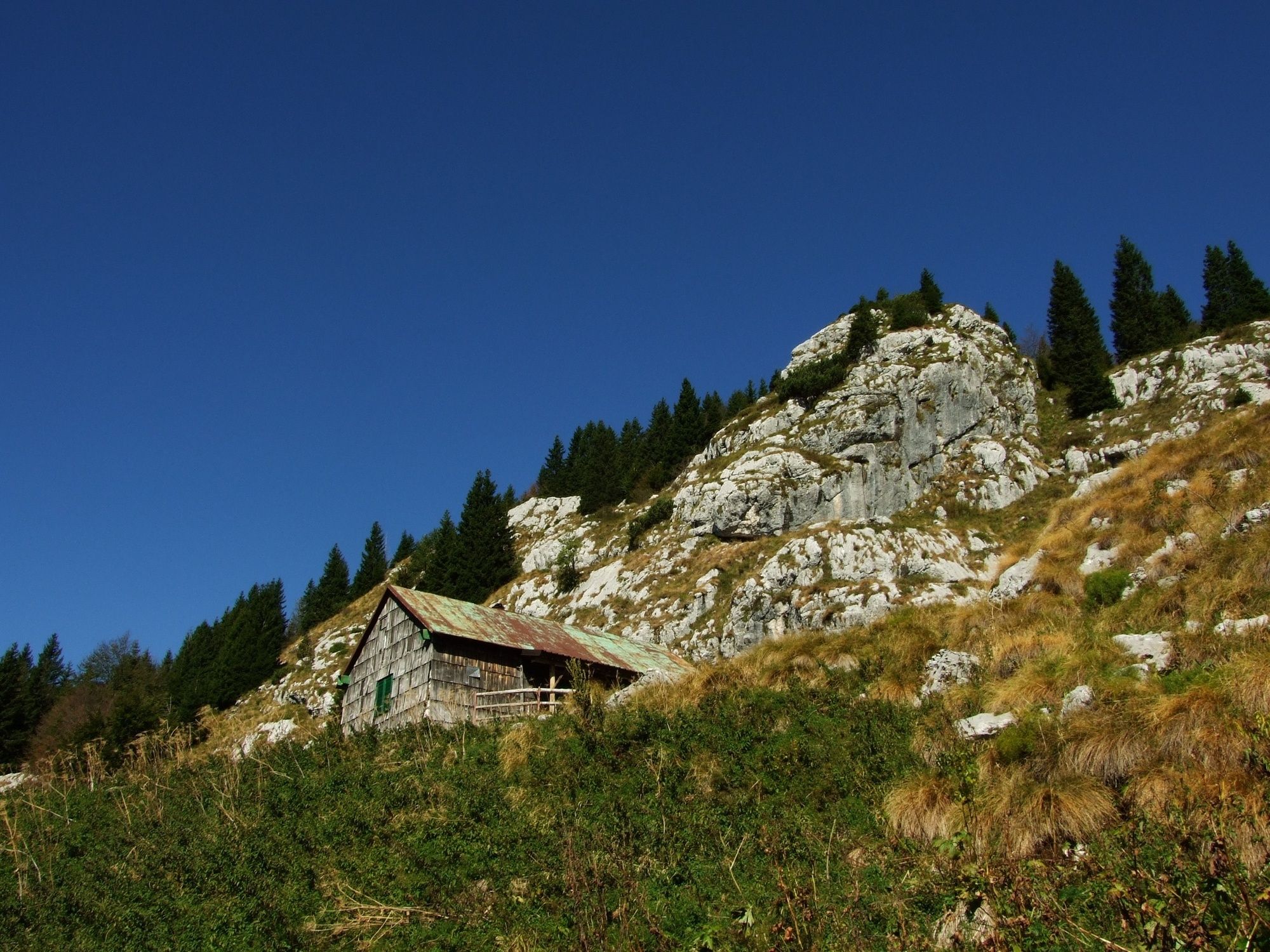
This long and beautiful hiking trail with historical points starts in the centre of Bovec. If you decide to take the shorter version from the start of the tour, we recommend you to drive to the last farm Pri Zajcu at the location called na Visni. There are usually no problems with parking there. You will gain approximately 30 minutes by doing so. From there, the trail immediately turns to the rocky terrain but is not routed along precipitous terrain. After approximately 60 minutes of walking and enjoying in splendid views of the town of Bovec the trail turns into an old beech forest which you exit only a few dozen metres in front of the hunting lodge on the Goričica Mountain pasture. This hunting lodge is not intended for external visitors and is closed for a large part of the year. From here, the trail ascends more gradually and, on you right, you can soon notice the first historical memorials, the remnants of the old military cemetery and the caverns of the Italian military hospital from World War I. You will be accompanied by various caverns and the remnants of that period will accompany you almost the entire way. When you reach the altitude of approximately 1700 metres we recommend you to make a short detour to the top of Mt. Čukla where you will come across an obelisk. Physically less prepared hikers can end their ascent here because even this intermediate peak offers plenty of splendid views of the Bovec Basin and the chain of Mt. Kanin and Mt. Rombon peaks above the Rombonski podi Plateau. Other hikers can continue along the former military positions from the bloody history. You soon arrive to the northern vertical wall of Mt. Rombon. Because of the occasional falling rocks and icicles during the winter months we recommend you to use the safety helmet here and crampons and the ice-axe at the foothills of the steep slope called Naklo. This place is more pleasing during the summer months because of the chance of watching marmot families basking in the sun in front of their burrows and on the rocks. Information for winter mountaineers: Inclination of the slope here is 45 ° and the slope is usually covered with ice if the snow is hard and already changed its form. Exit from the steep slope is especially demanding. After overcoming this most demanding part of the trail (during the summer or winter months) you will usually not encounter any other problems until you reach the top. The top of Mt. Rombom offers a wonderful 360 ° view of almost all of the Western Julian Alps and a special view of the enchanting Loška Koritnica Valley with the village of Log pod Mangartom in the centre and the two sentinels Mt. Mangart and Mt. Jalovec. A well prepared hiker needs over 5 hours to reach the top during the summer months. Descent along the same way you came from is significantly shorter (approx. 3 h). If you would like to make a circular tour, turn to the left at the top of the steep slope called Naklo (in front of the steepest section) and start following the marked descending trail across the grassy-rocky slopes of Mt. Veliki vrh (alternative name for Mt. Rombon). By descending down the trail you will arrive to well-preserved battle positions which were used by the Austro-Hungarian army. From here, the trail rapidly descends and soon after it reaches the tree line it arrives to the legendary military observation post Kota 1313 (approx. 100 metres from the main trail). After you return to the main trail, you will rapidly descend along a relatively steep slope towards Fort Hermann. We advise caution especially during the autumn months because the otherwise well-marked trail often gets covered with dead leaves. There is a nice and renovated mule trail leading from Fort Hermann to the Kluže fortress which is routed through a 150-metre-long lighted tunnel just above the fortress. During the summer months, there is a bar open at the Kluže fortress where you can quench your thirst with different drinks, If you are too exhausted from the descent, you can call a taxi here because there is still approximately 60 minutes of walking in front of you until you reach the centre of Bovec. You first have to walk along the main road to the Kluže entry-exit point (for kayakers) and then descend along the slope to river Koritnica. The trail from this spot to the centre of Bovec is routed across an almost level terrain and your tour ends after approximately 8 - 9 hours.
- Highest point
- 2,125 m
- Endpoint
-
Mt. Rombon (2208 m)
- Height profile
-
 © outdooractive.com
 - Equipment
-
Mountaineering footwear, trekking poles.
During the winter months this tour requires the use of the safety helmet, ice-axe, warm clothing, gaiters and crampons.
- Safety instructions
-
This trail is appropriate for regular hikers throughout the year. During the winter months the entire top of the mountain gets covered with ice and snow. In snow-rich winters we absolutely advise you not to descend to the Kluže fortress because the trail is routed along very slippery terrain. During the winter months, the long and steep slope called Naklo (just beneath the northern wall of Mt. Rombon) requires special caution because it is prone to avalanches and often covered with ice. The descent from the former military observation post Kota 1313 towards Fort Hermann also requires caution because it is routed along a steep slope which is often covered with dead leaves. We advise hikers with less experience with orientation not to descend along an unmarked trail from the former military observation post Kota 1313 to the Plajer Homestead. Because the major part of the trail is routed along the sunny side of the mountain we recommend you to start the tour early in the morning.
This is an easy hiking trail. Use of hiking trails is at your own risk!
- Tips
-
This hiking trail is appropriate for physically well-prepared hikers. There is no drinking water on the mountain.
- Additional information
-
We advise physically less prepared hikers not to take this tour because of its length.
There is practically no drinking water along the entire route. Make sure to bring a sufficient supply of water before you start the tour.
- Directions
-
From the town of Kranjska Gora along the national road 206, and from the former border crossing Predel along the national road 203 and the same applies for arrivals from the city of Nova Gorica.
- Public transportation
-
There are several daily bus lines connecting the town of Bovec with the city of Ljubljana and the nearby local centres.
- Parking
-
There is a free parking lot available at Žaršče, north of the town of Bovec.


-

-
AuthorThe tour Mt. Rombon (2208 m), the finest sightseeing hill of the Bovec area is used by outdooractive.com provided.


General info
-
Region Villach - Faaker See - Ossiacher See
2064
-
Soča-Tal
393
-
Bovec
111


