

- Brief description
-
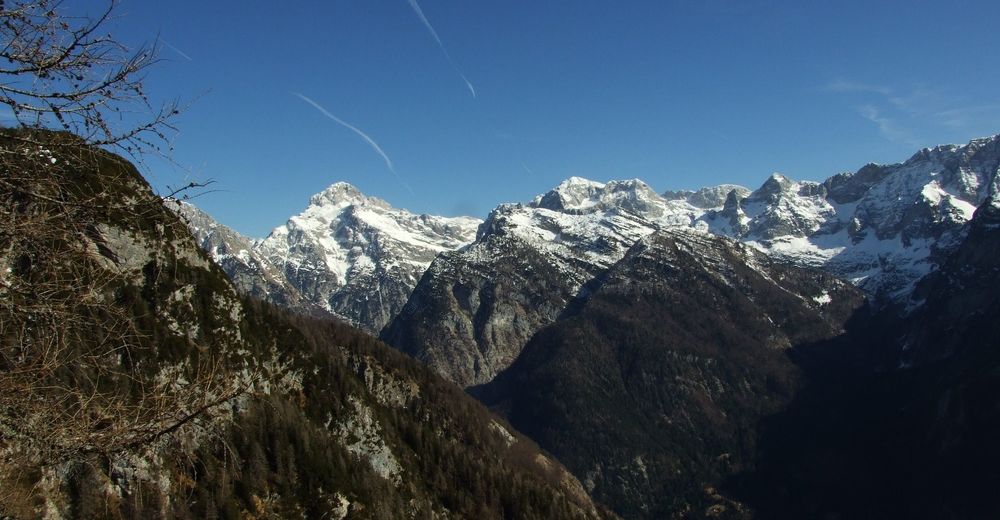
This pleasant hiking trail takes you above the Trenta Valley along an old winding military mule trail.
- Difficulty
-
medium
- Rating
-
- Starting point
-
y roaApproximately 150 m behind the onld gallery in the Trenta Valley (Fačar)
- Best season
-
JanFebMarAprMayJunJulAugSepOctNovDec
- Description
-
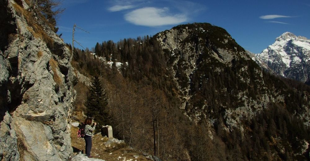
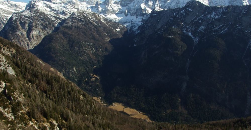
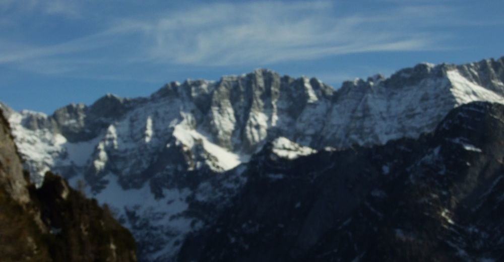
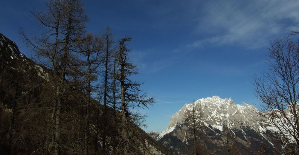
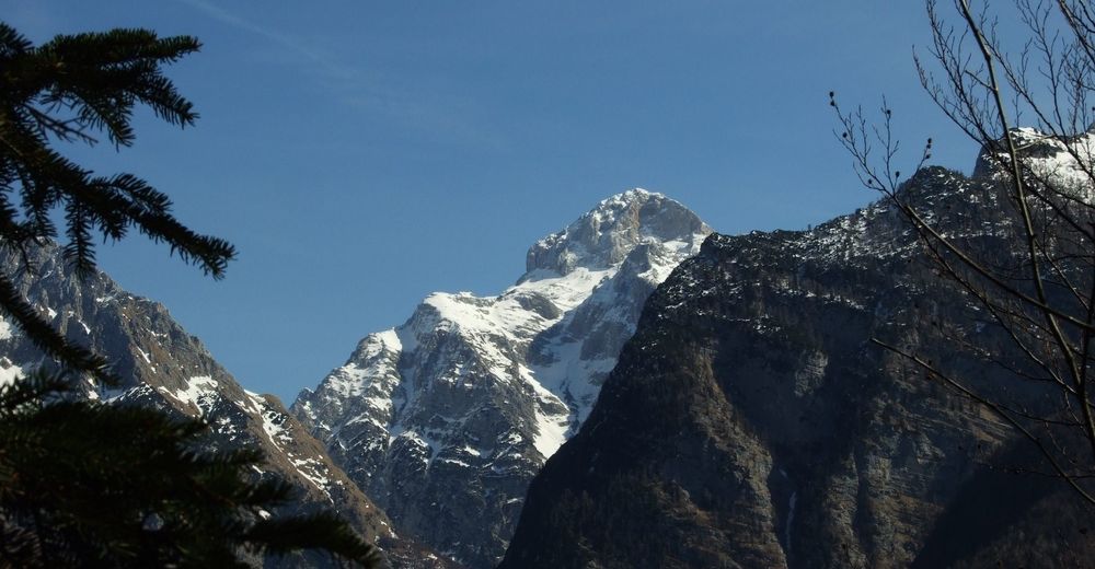
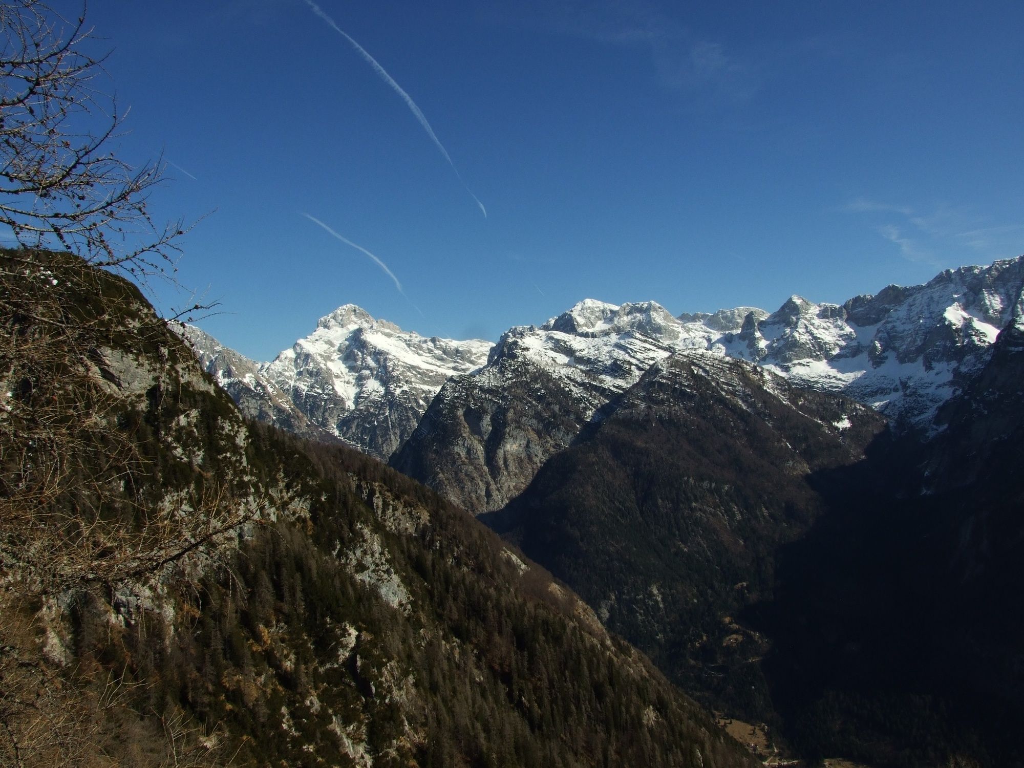
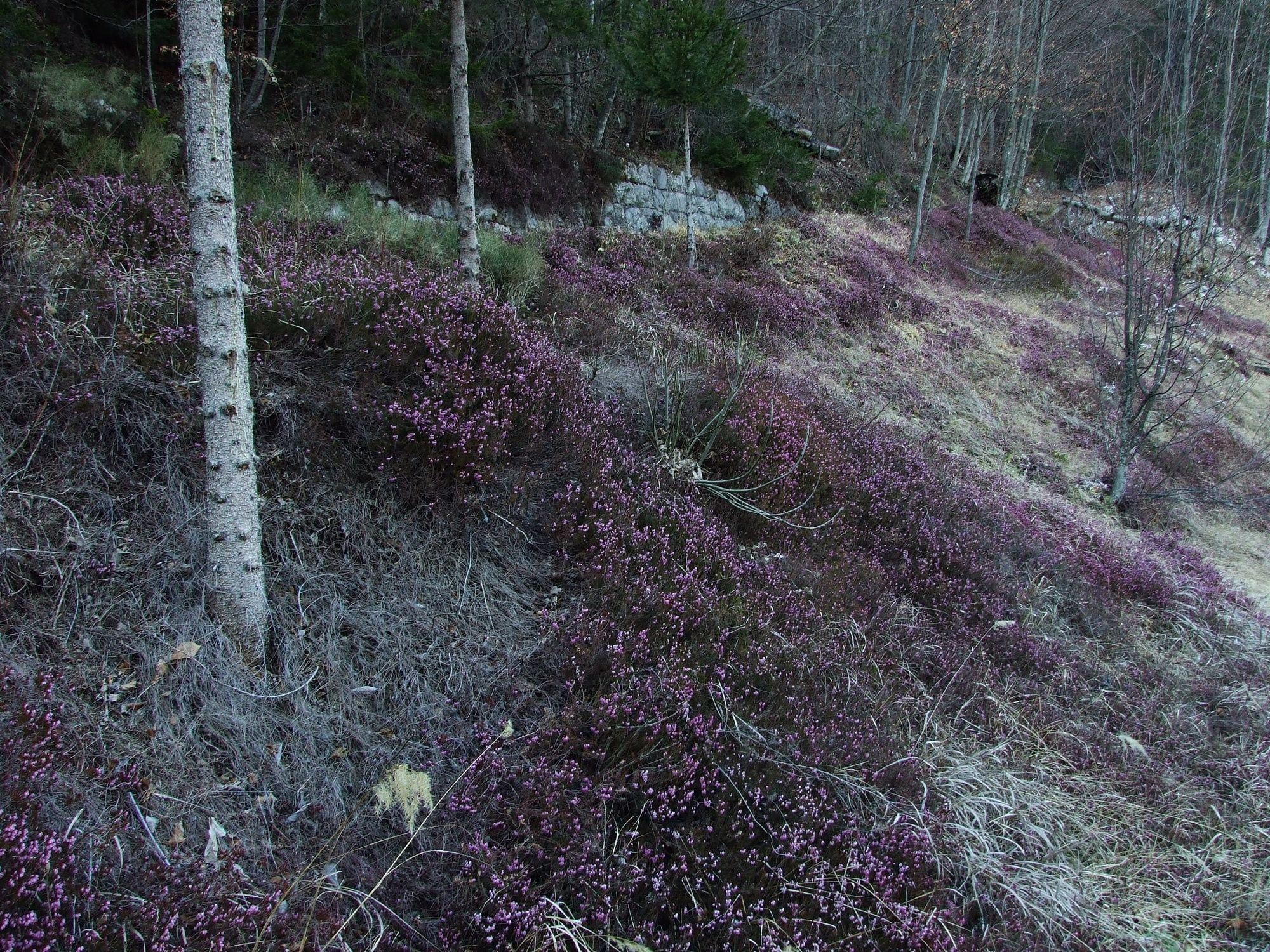
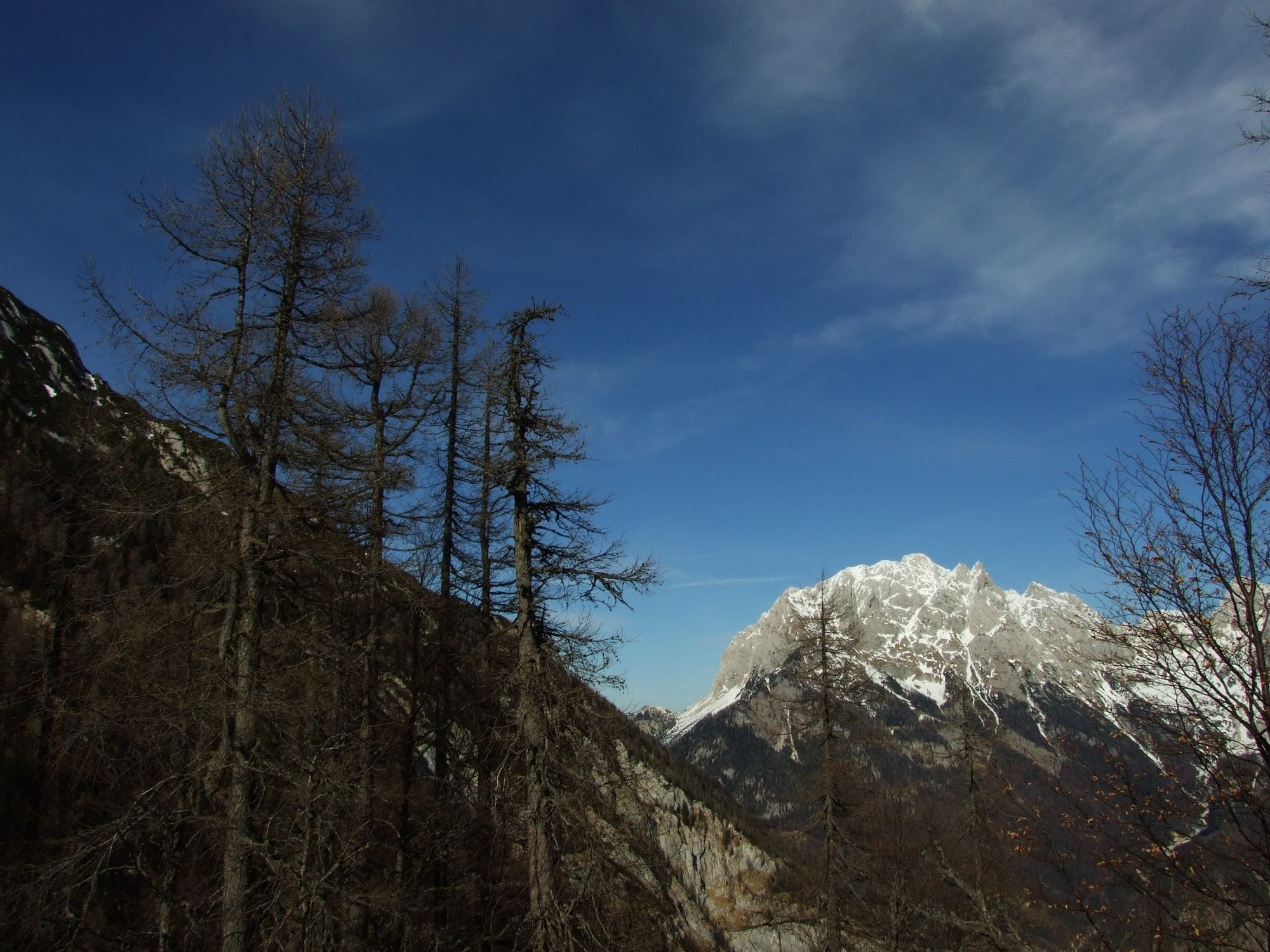
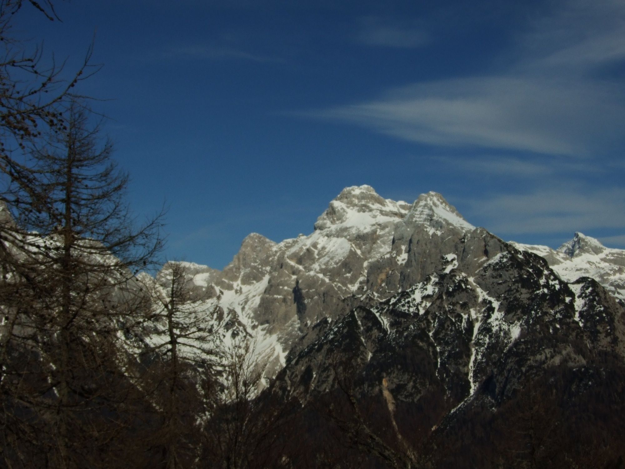
This nice and wide trail is a genuine work of art constructed by military constructors during World War I and leads along the numerous stone-constructed bends from the bottom of the valley to the hunting lodge beneath the Stara Utra Mountain pass approximately 1000 metres higher. This trail is some kind of a copy of the Vršič Mountain pass road because it includes a similar number of bends and because of the similar construction. Several sections of this road offer splendid views of the surrounding mountains and the valley below.
- Directions
-
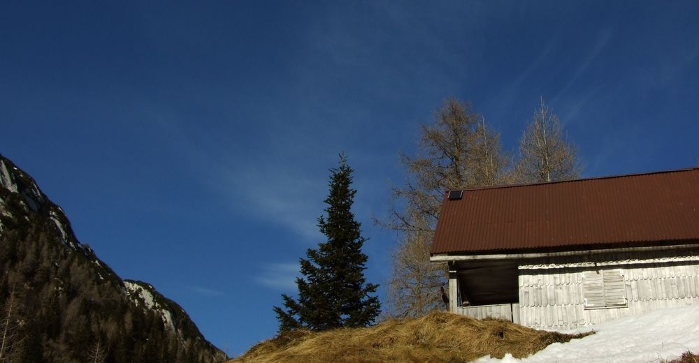
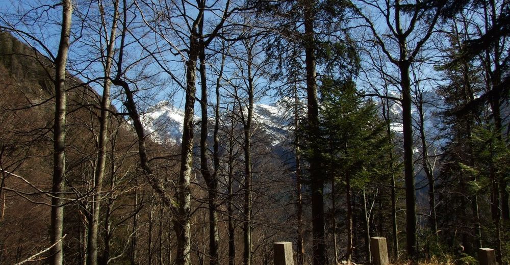
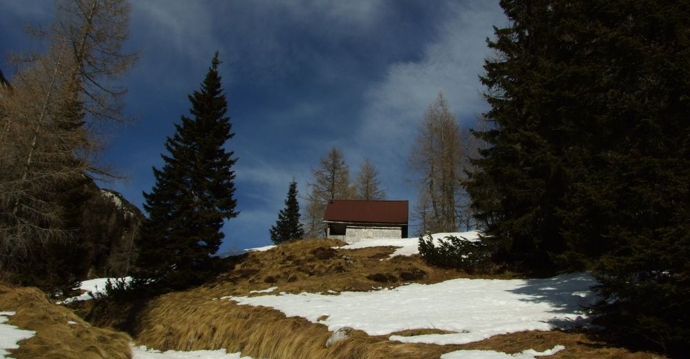
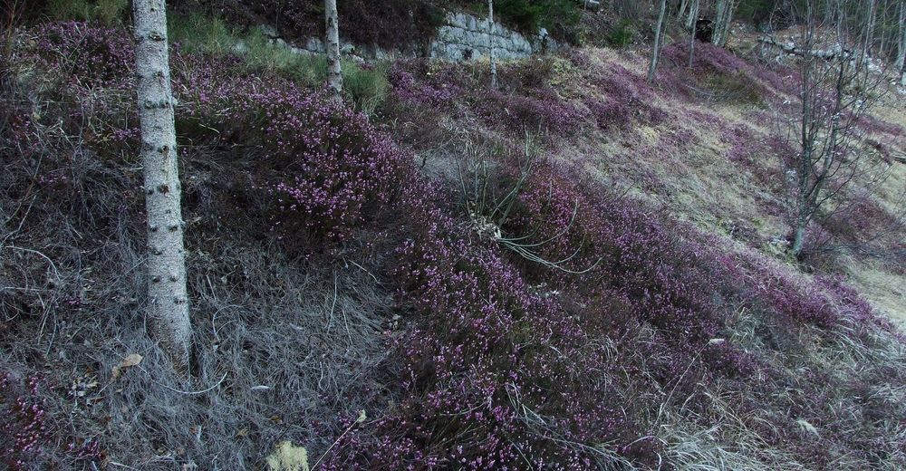
The trail starts approximately 150 metres behind the "Fačar" road gallery in the Trenta Valley and leads uphill to the left (important for hikers coming from the town of Bovec). Because of the limited number of parking spaces we recommend you to park your vehicle on the left side of the road in front of the gallery or at the resting place next to the Soča River located at a certain distance from the starting point on the right. The first section of the trail is usually worn by rainwater. After a couple of hundred metres of walking, you begin to notice the masterpieces constructed by military constructors during World War I. The trail (mule trail) is nicely routed along more than 20 hairpin bends and gradually ascends towards your destination, the hunting lodge beneath the Stara Utra Mountain pass. During the spring months, the views of the mountain chain above the Trenta Valley and the valley below are initially obstructed by the mighty beech forests, however, when you arrive above the tree line, all of the efforts put into the approximately three-hour-walk are generously repaid by the splendid views of Mt. Triglav and the surrounding summits. This trail is not marked with hiking markings. There is practically no need for such markings because the trail is extremely logically routed along the slope. Just before you come to the end of the trail, there is a shorter section which requires caution. This applies in particular during the spring and winter months because this section is located in the heart of the active avalanche.
We recommend you to return along the same trail you came from.
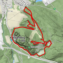
- Highest point
- 1,582 m
- Endpoint
-
Berebica Mountain pasture
- Height profile
-
 © outdooractive.com
 - Equipment
-
Mountaineering or trekking footwear, trekking poles and crampons and ice-axe during the winter.
- Safety instructions
-
This trail is completely undemanding in normal conditions. Caution is only advised during the winter months at the upper section where the mule trail crosses several potential avalanche areas.
- Tips
-
The start of the trail is indicated by a yellow sign on the post located approximately 100 metres from the road gallery in the Trenta Valley.
- Additional information
-
The trail is mostly routed through the forest and provides shade even though it is routed on the southern side of the mountain. There are several sources of drinking water along the trail. From the hunting lodge beneath the Stara Utra Mountain pass you can continue to the eastern side of the mountain by descending along the hunting trail to the foothills in the vicinity of the Church of the Virgin Mary of Loreto but we advise you not to take this trail because it is difficult to follow.
- Directions
-
National road 206, Bovec – Vršič – Kranjska Gora.
- Public transportation
-
During the summer months there are several Bovec - Kranjska Gora – Bovec bus lines available.
- Parking
-
Parking is limited to small parking lots beside the national road.


-

-
AuthorThe tour Hiking trail to the Berebica Mountain pasture is used by outdooractive.com provided.


General info
-
Region Villach - Faaker See - Ossiacher See
2058
-
Goriška
388
-
Trenta
152