
- Brief description
-
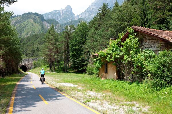
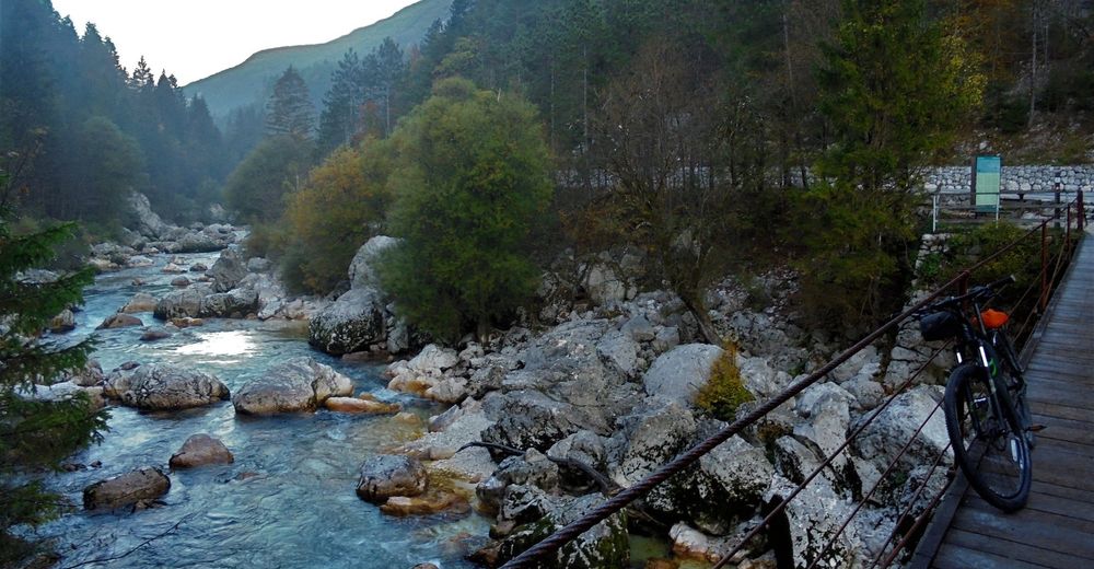
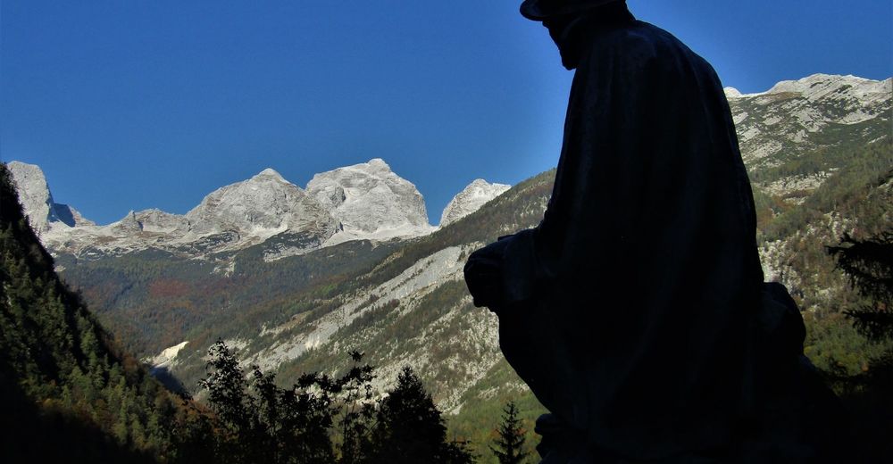
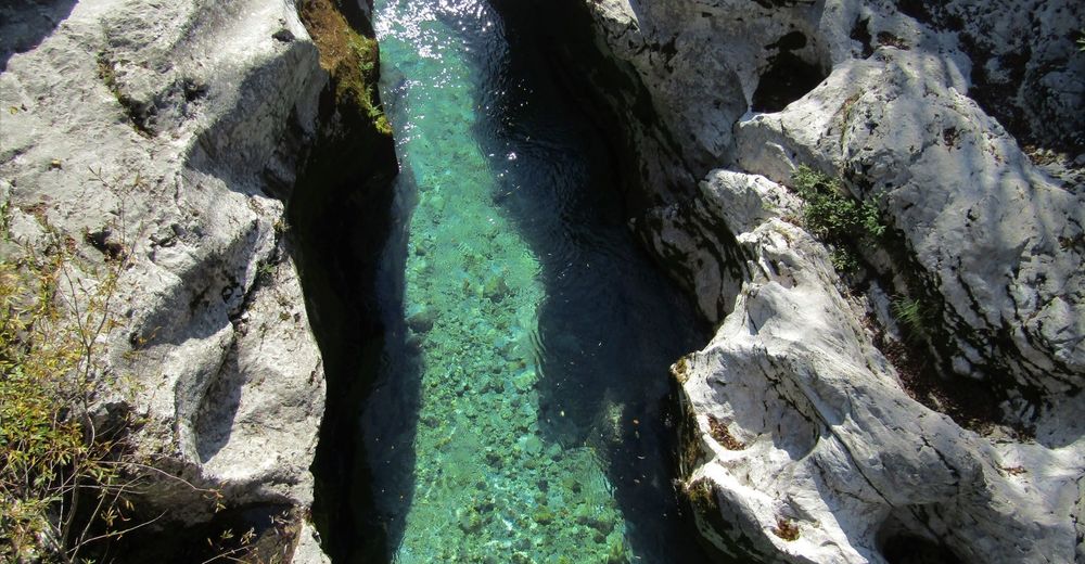
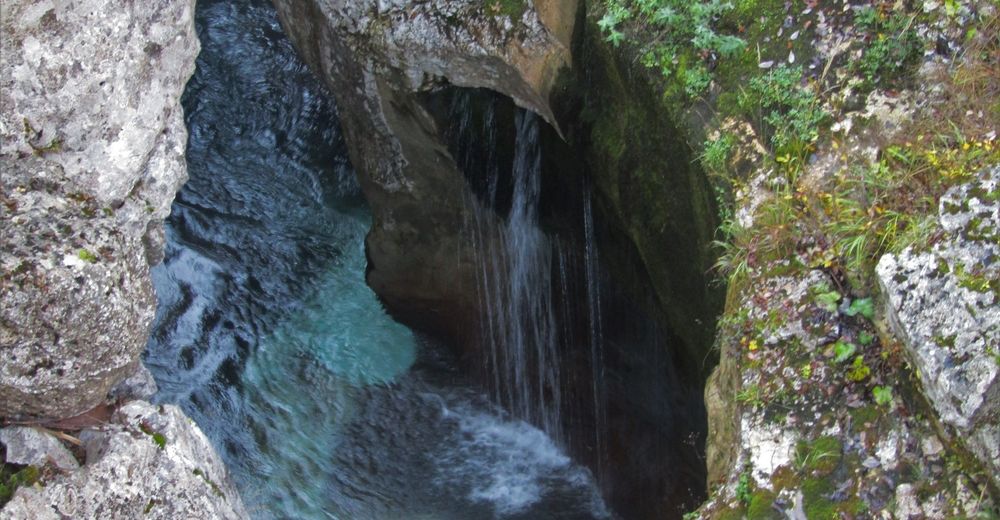
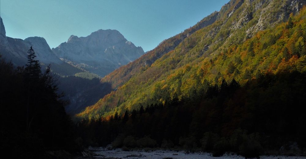
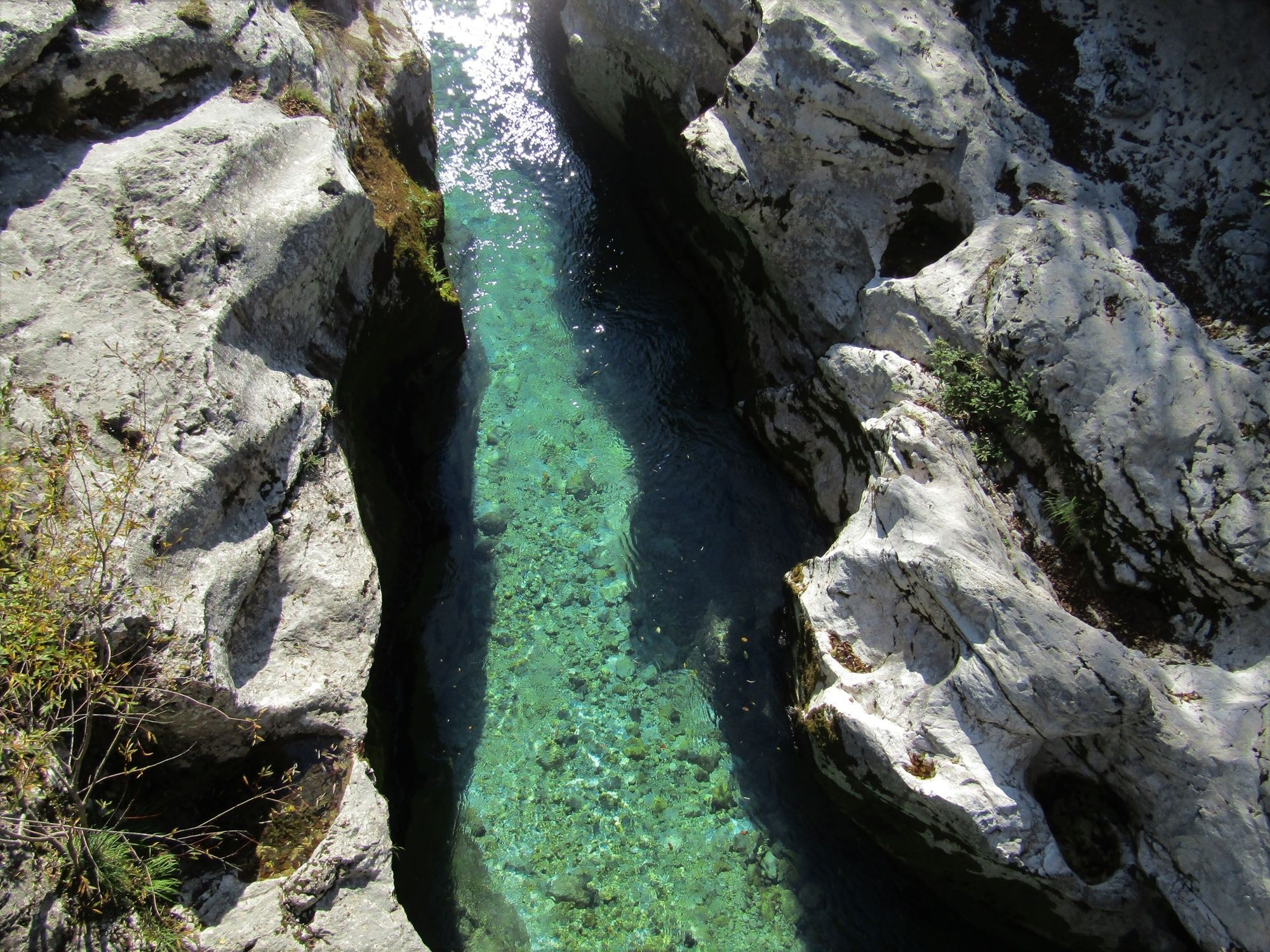
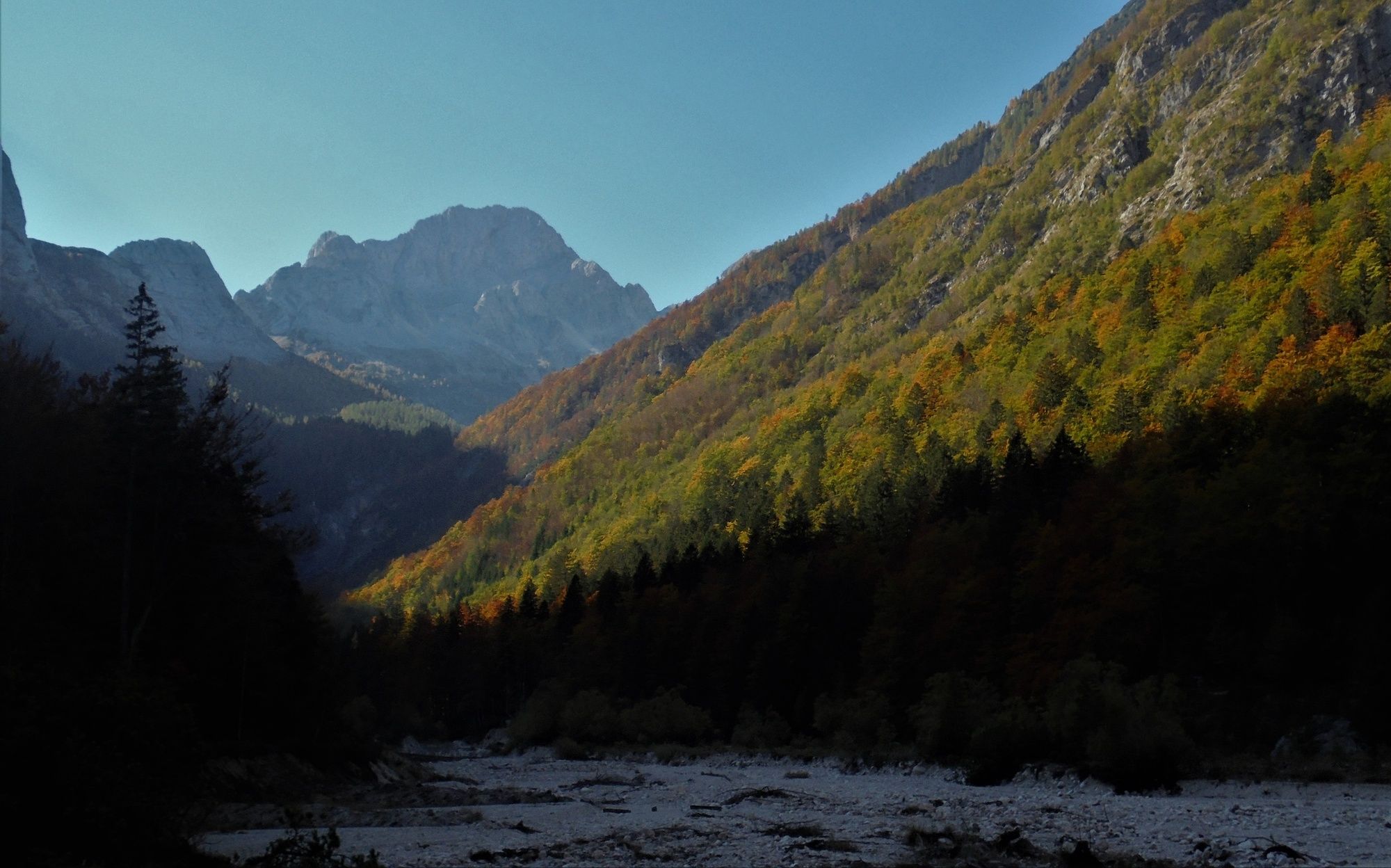
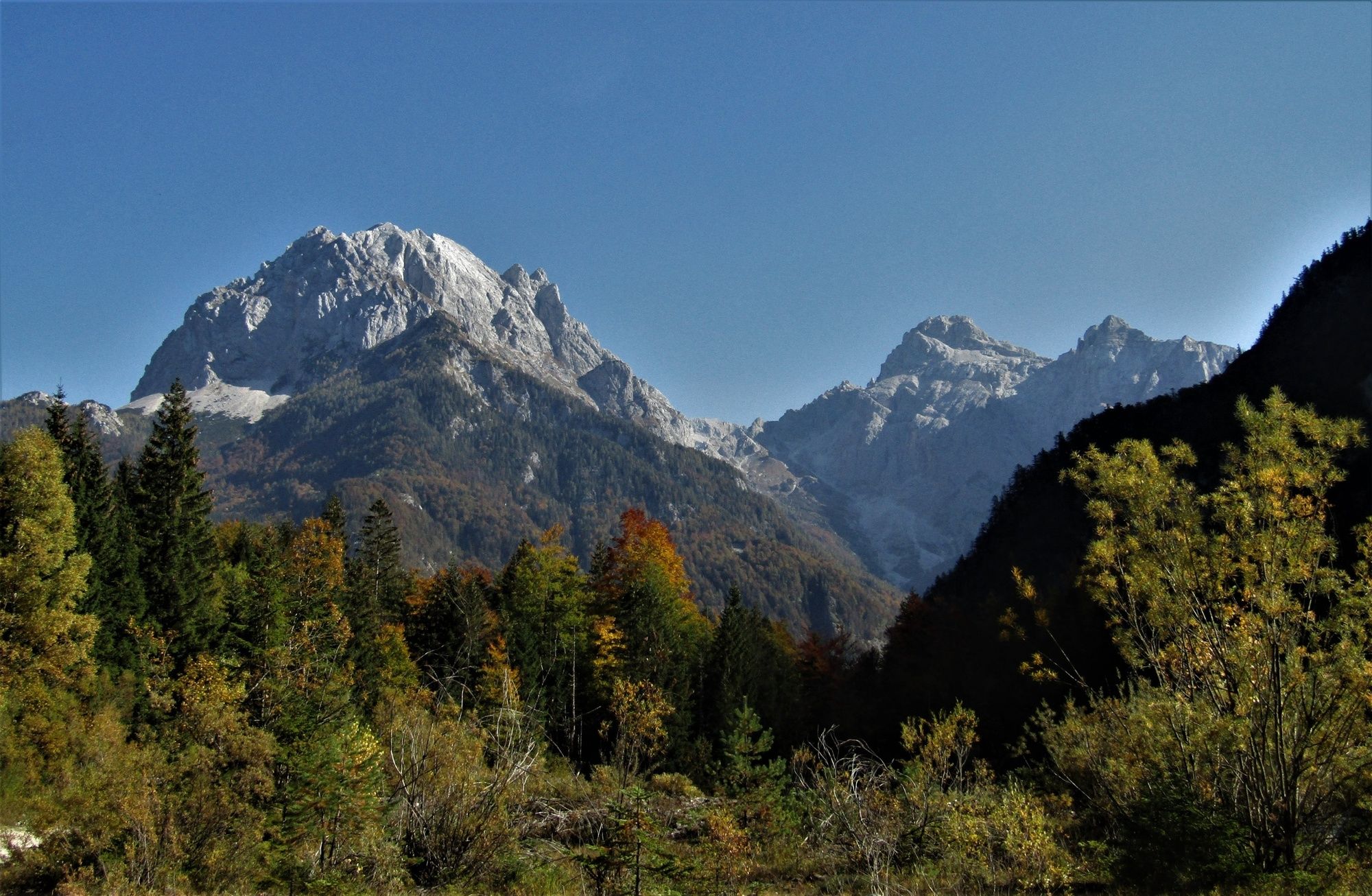
This trail runs through the Trenta Valley which is regarded as one of the nicest Alpine valleys. The major part of the trail follows the emerald Soča River and provides cyclists with splendid views of the summits towering over the river.
- Difficulty
-
difficult
- Rating
-
- Starting point
-
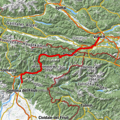
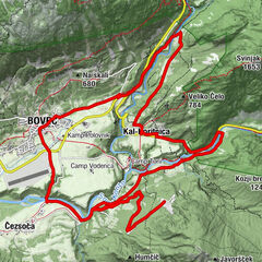
Bovec
- Route
-
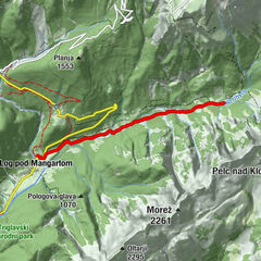
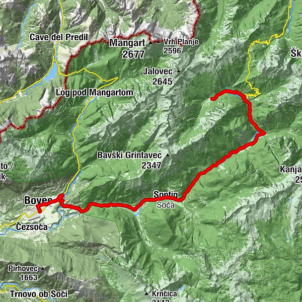
Flitsch0.6 kmKal-Koritnica (460 m)4.1 kmHedvika4.2 kmVzporedni vodni kanal5.2 kmPodklanec9.2 kmŽupnijska cerkev sv. Jožefa11.8 kmSoča11.9 kmGostišče Andrejc12.0 kmGostilna Metoja19.5 kmPizzerija in špageterija Trenta20.4 kmTrentathal20.6 kmCerkev Device Marije Lavretanske23.4 kmPri Cerkvi23.4 kmKoča pri izviru Soče25.9 kmKoča pri izviru Soče29.0 kmCerkev Device Marije Lavretanske31.7 kmPri Cerkvi31.7 kmTrentathal34.2 kmPizzerija in špageterija Trenta34.4 kmGostilna Metoja35.4 kmGostišče Andrejc42.8 kmSoča43.0 kmŽupnijska cerkev sv. Jožefa43.1 kmPodklanec45.8 kmVzporedni vodni kanal49.6 kmKal-Koritnica (460 m)50.8 kmHedvika50.8 kmFlitsch54.5 km
- Best season
-
JanFebMarAprMayJunJulAugSepOctNovDec
- Description
-
The trail runs along the regional road Bovec-Trenta through the villages of Kal - Koritnica, Soča and Trenta.
Sights worth visiting along the trail:
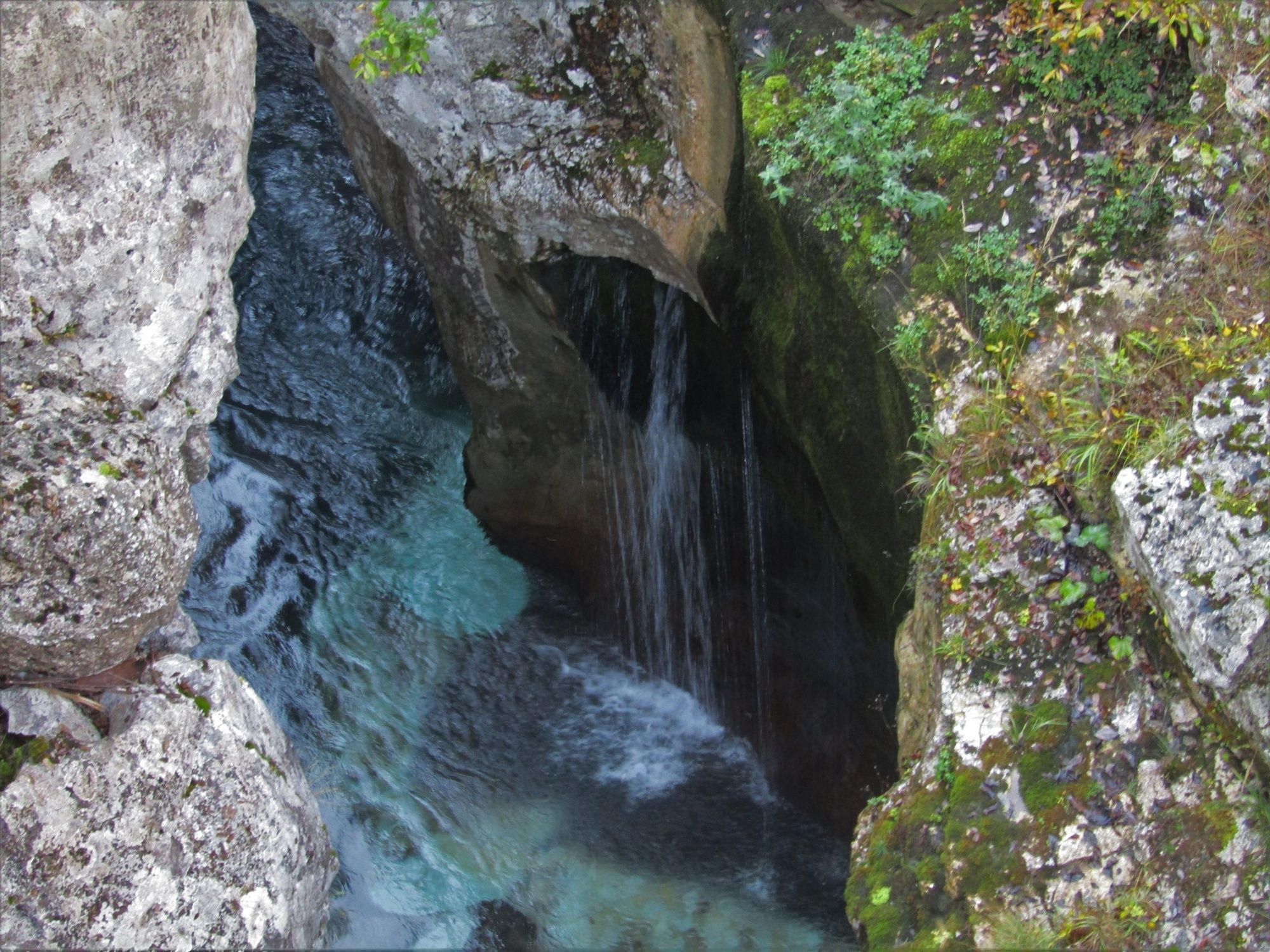
- Natural sights – Small Soča Gorge and the Great Soča Gorge (from the turn towards the village of Lepena in the direction of Trenta),
- The oldest Slovenian Alpine Botanical Garden in the natural environment - Julijana.
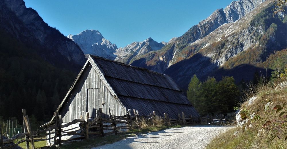
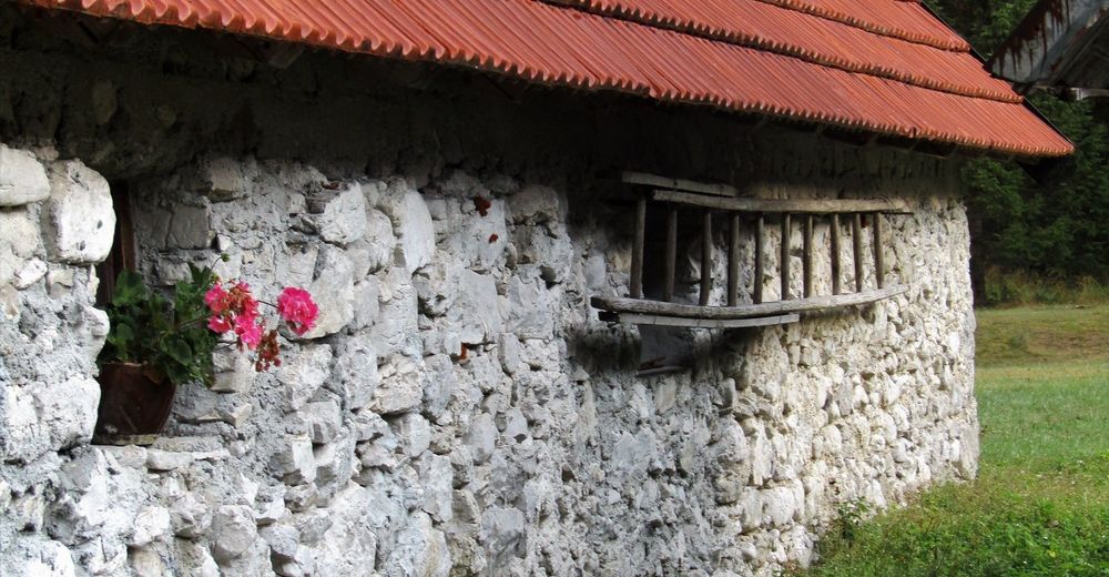
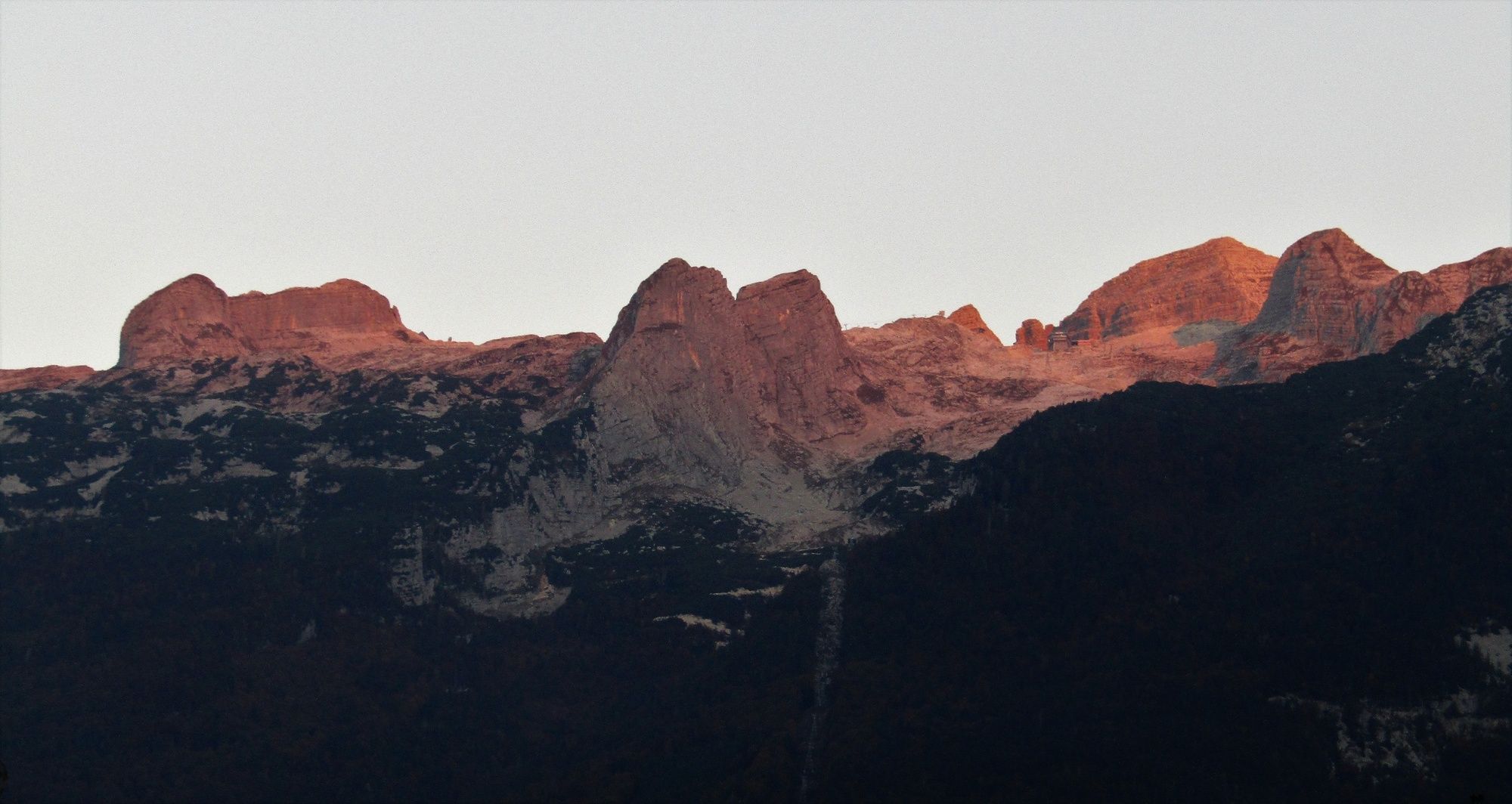
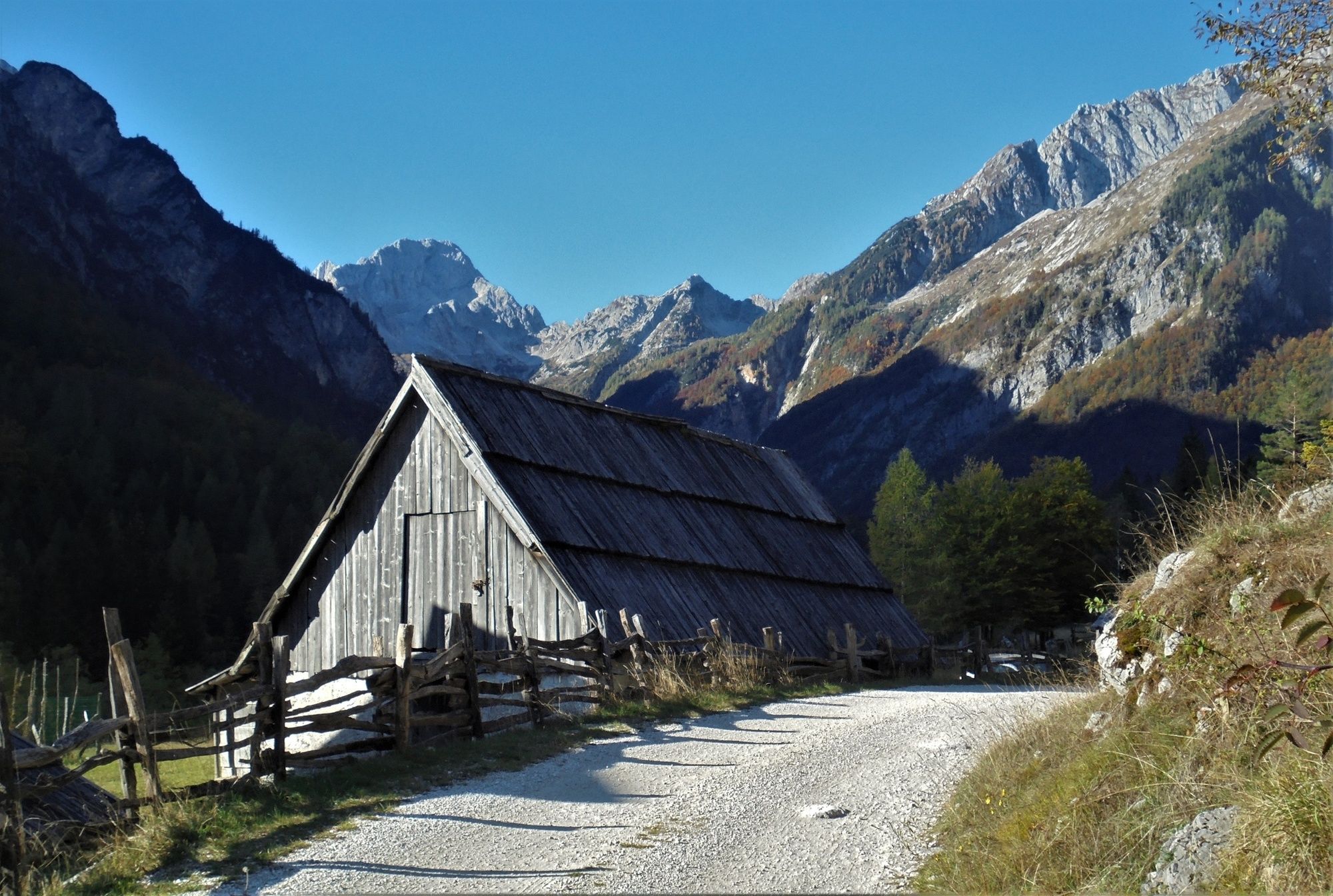
After the turn towards the cottage at the source of the Soča River (49th hairpin bend of the Vršič Mountain pass road) you continue cycling along a paved road. After a short and somewhat steep ascent you arrive to the parking lot next to the cottage. At this point, the road narrows and continues through the beautiful environment of the Zadnja Trenta Valley. On your left and on your right you can see high mountain tops, and at certain locations, you can even see Mt. Bavški Grintavec.
The road from the cottage to the Flori parking lot is not paved. It is quite rubbly at certain steep parts, which makes cycling slightly more difficult for trekking cyclists.
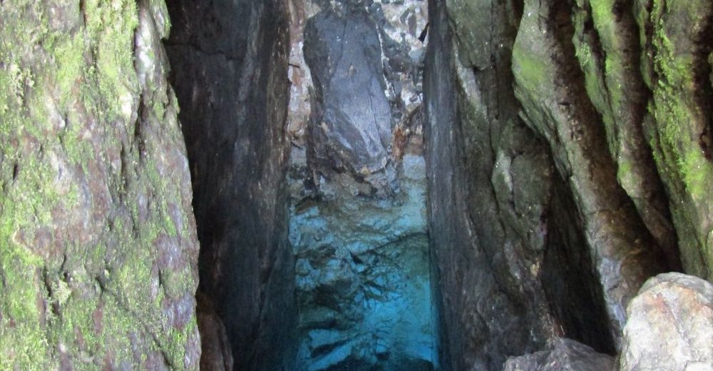
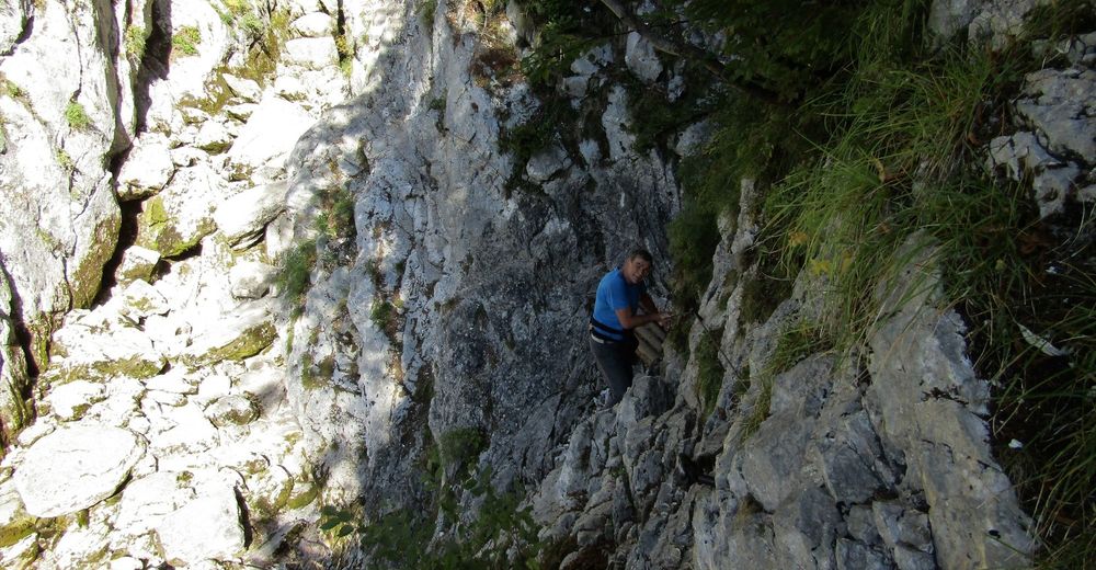
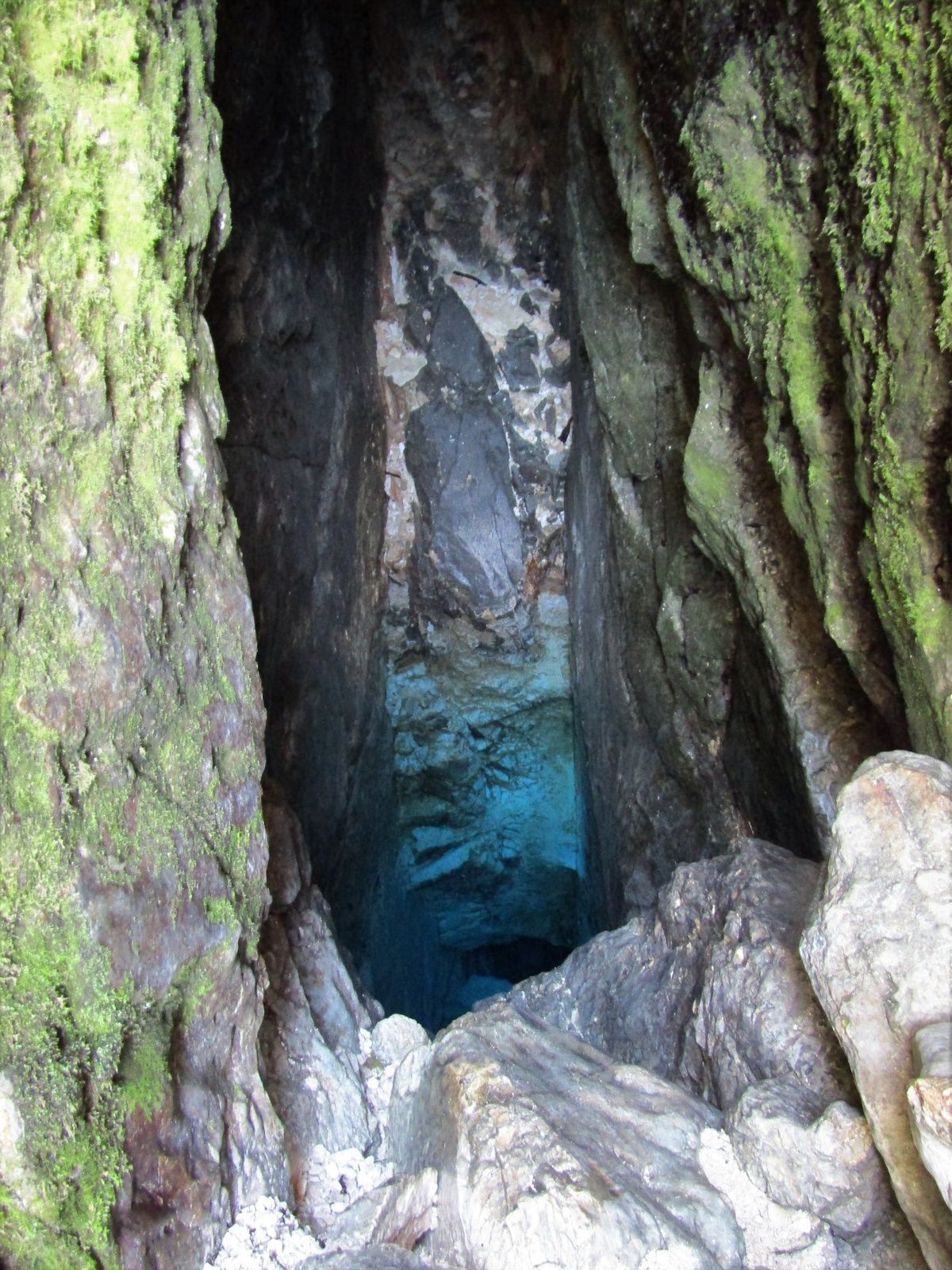
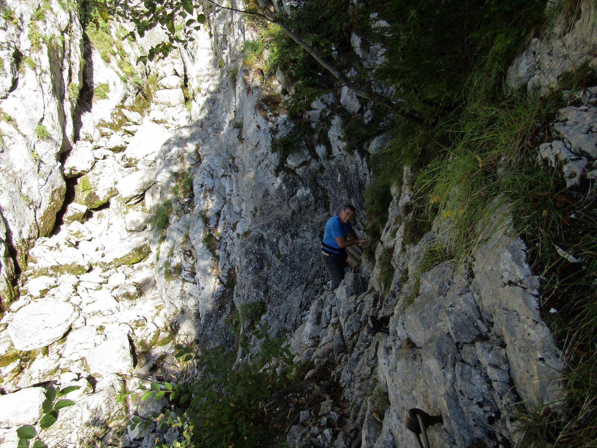
It is also worthwhile to hike to the source of the Soča River on foot. The initially wide trail quickly starts to ascend and takes you to a more demanding part which is secured with a wire-rope. It is possible to climb to the very source of the river.
- Directions
-
From the town of Bovec, the trail runs along the regional road towards the Vršič Mountain Pass. Before you reach the village of Soča you have to overcome a few ascents and descents, however, between the village of Soča and the village of Trenta, the trail gradually ascends most of the time. The ascent becomes somewhat steeper and longer from the village of Trenta to the cottage at the source of the Soča River, however, the views of all the wonderful sights along the trail make the effort worthwhile. The paved road to the cottage at the source of the Soča River turns from the main road at the 49th hairpin bend of the Vršič Mountain pass road. This ascending road runs along the beautiful environment of the Zadnja Trenta Valley where you will enjoy in views of the restored homesteads and the mighty mountain peaks towering over the valley.
At the mountain hut you can decide to continue cycling to the end of the gravel road, or to hike to the spring of the emerald river. Both ways are appropriate because of the views you should not miss. You should also consider the fact that the trail to the source of the Soča River is quite demanding and, at least in its last part, appropriate only for experienced hikers.
- Highest point
- 961 m
- Endpoint
-
Zadnja Trenta Valley
- Height profile
-
 © outdooractive.com
 - Equipment
-
There is a paved road leading to the cottage which is appropriate for trekking cyclists.
The road from the cottage to the final parking lot is not paved and is at certain sections somewhat steep and rubbly. Here, cycling is more comfortable on bicycles with wider tires with more profile.
There are plenty of opportunities to replenish your water supply along the trail.
For the hike to the source of the Soča River we recommend you to wear boots with well-profiled soles because the last third of the trail is routed along quite worn and slippery rocks.
- Safety instructions
-
Before the turn towards the cottage at the source of the Soča River this trail follows the regional road which is quite busy during the summer, therefore caution is advised.
Even though the trail is secured with a wire-rope, the hike to the cave with the source of the Soča River is demanding and less appropriate for persons without experience hiking on rocky terrain.
- Tips
-
The last third of the trail to the source of the Soča River is secured with a wire-rope and is not appropriate for persons without any hiking experience on such terrain.
- Directions
-
You can get to the town of Bovec by car from the town of Tolmin or the city of Nova Gorica, and across the Predel and Vršič Mountain Passes from the north
- Parking
-
Parking is available at any of the several parking lots in Bovec.


-

-
AuthorThe tour Cycling to the valley of Zadnja Trenta is used by outdooractive.com provided.