


- Brief description
-
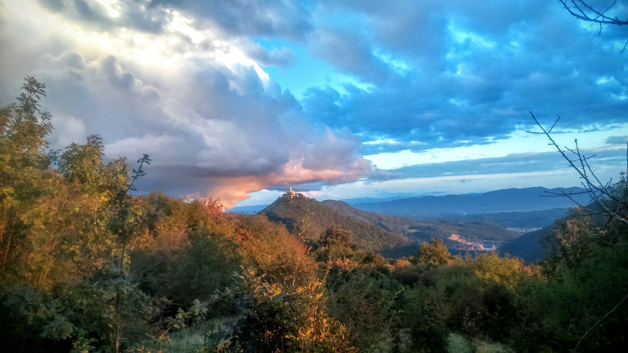
A circular tour where you can explore the hidden world in the rear of Mt. Vodice, visit another strategically important Isonzo front battle position with caverns, memorial and mausoleum, and enjoy in the view of Mt. Sveta gora.
- Difficulty
-
medium
- Rating
-
- Starting point
-
Plave
- Route
-
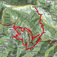
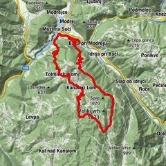
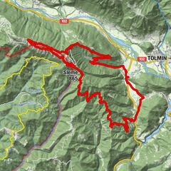
Plava0.1 kmPaljevo2.6 kmBaske8.1 kmPreški vrh (503 m)14.5 kmVodice (651 m)16.2 kmKaverna I.sv.vojne16.9 kmKaverna iz I. sv. vojne17.5 kmPaljevo21.1 kmPlava23.8 kmGostilna pri Mostu24.0 km
- Best season
-
JanFebMarAprMayJunJulAugSepOctNovDec
- Description
-
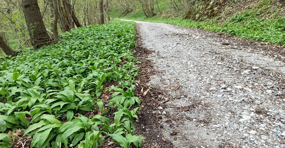
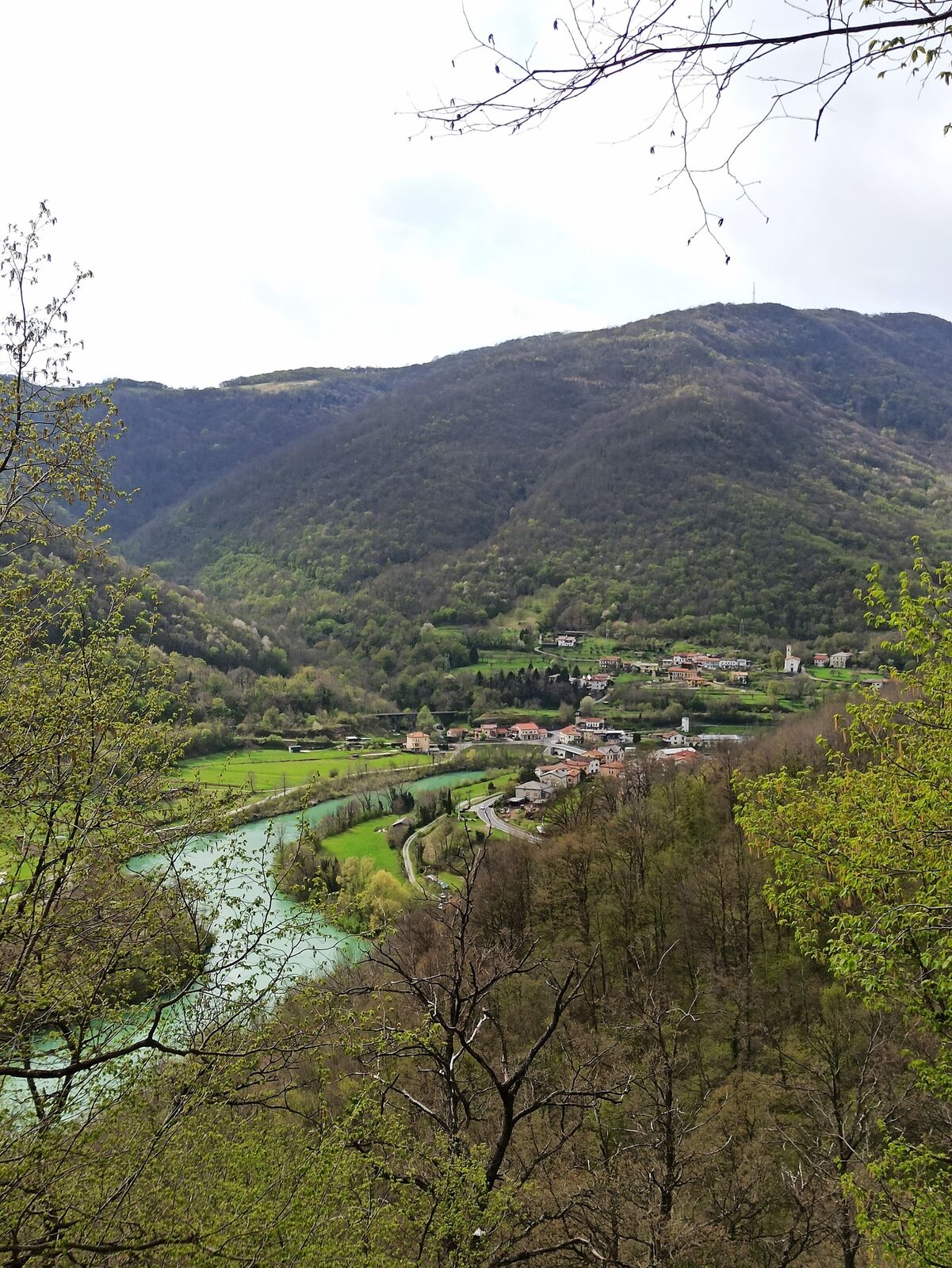
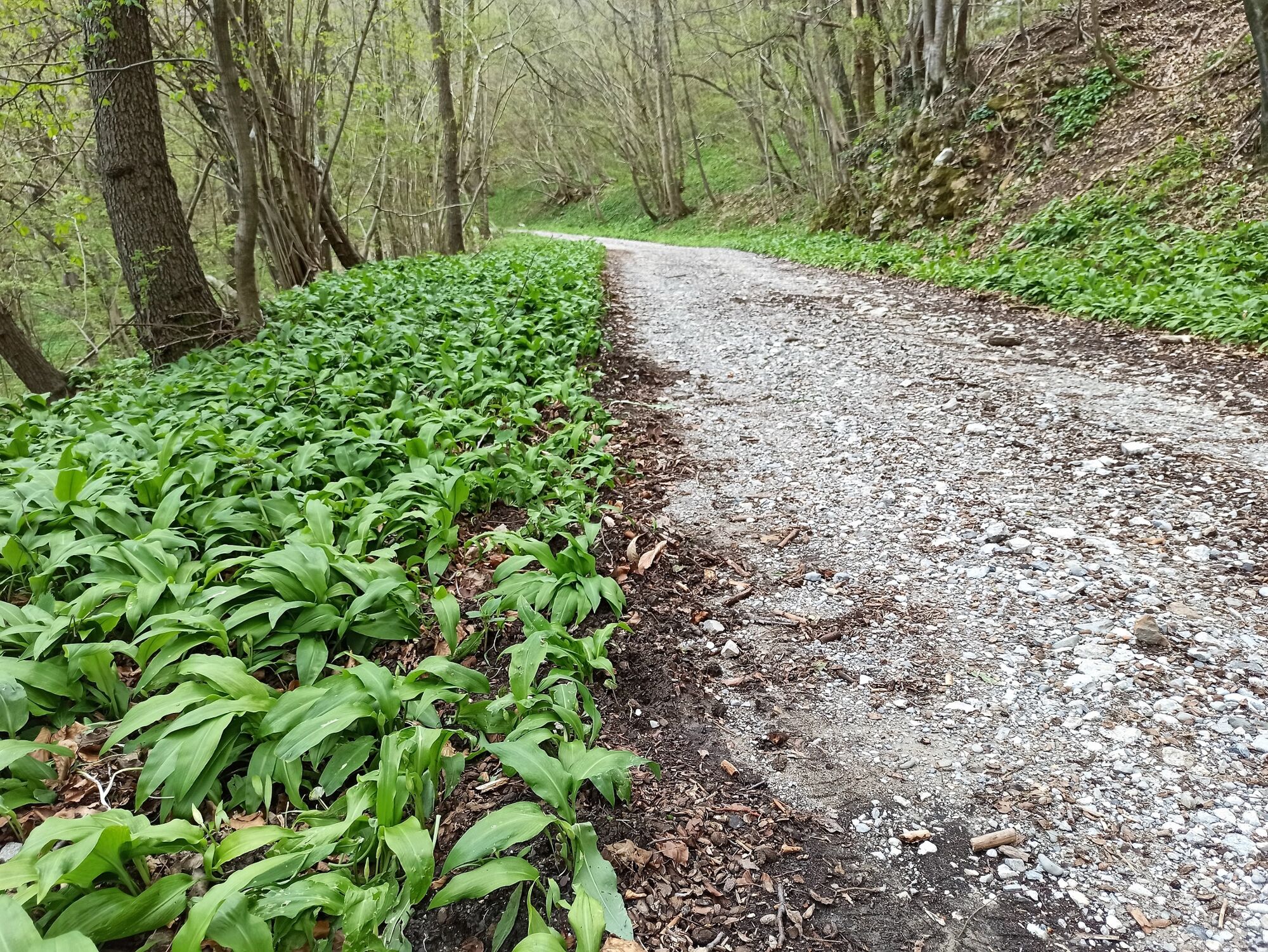
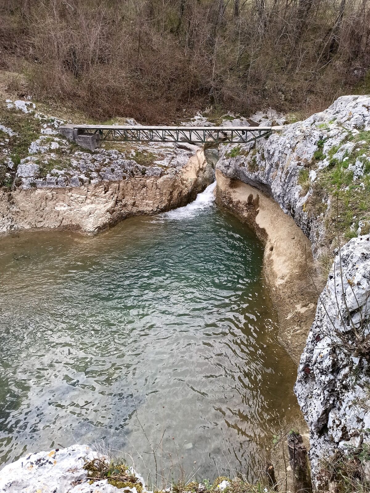
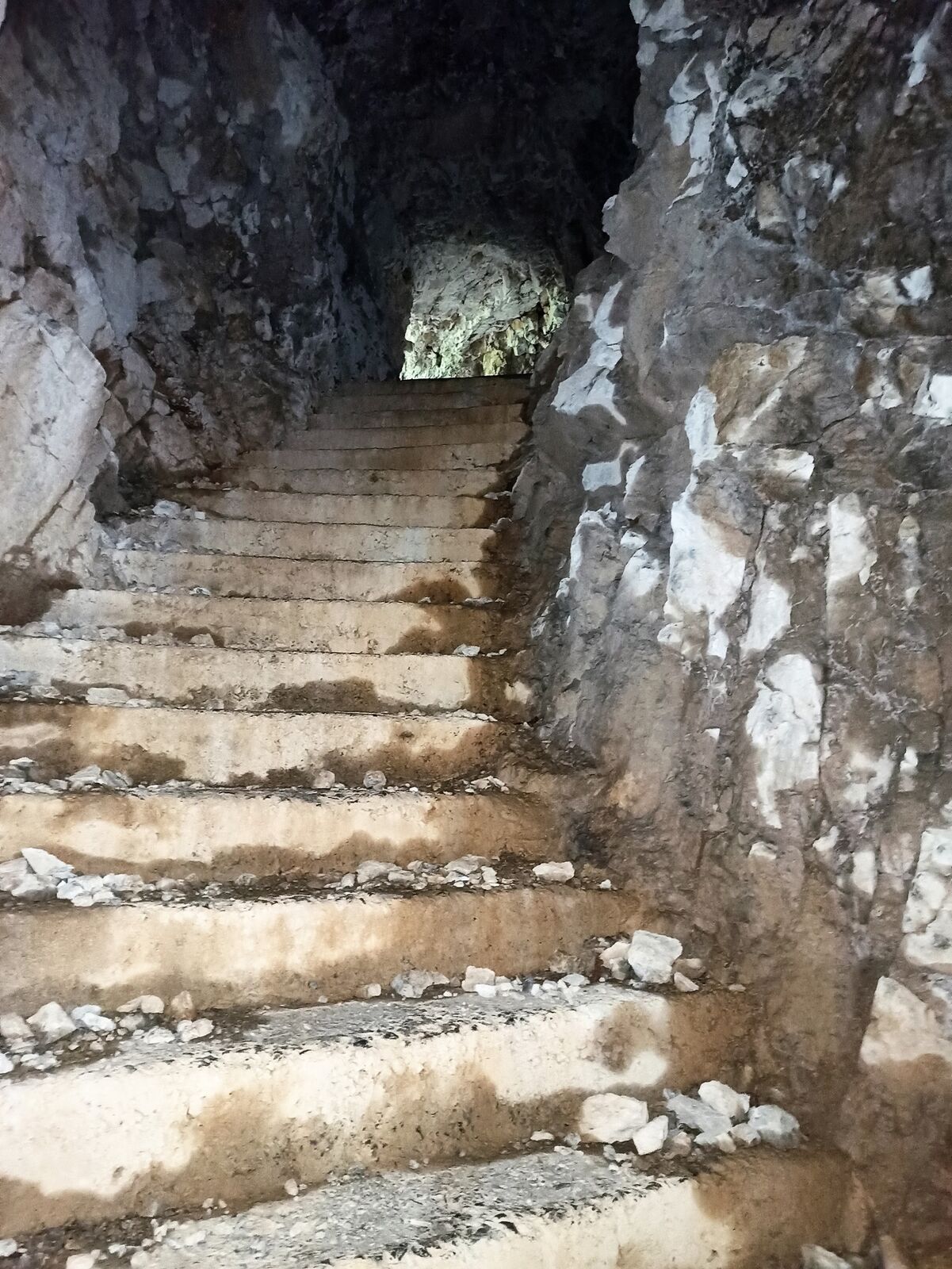
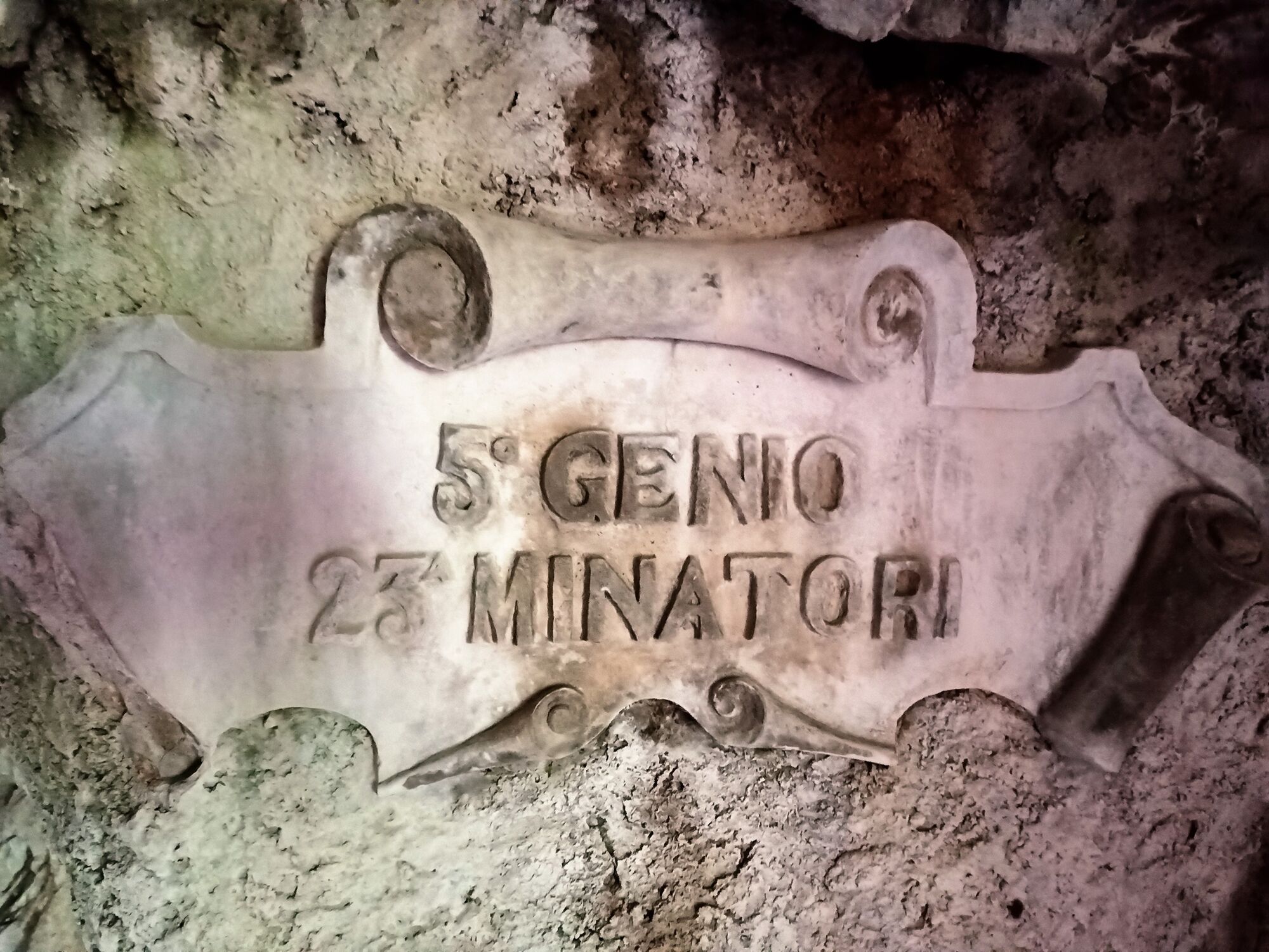
The trail will take you from the village of Plave past the village of Paljevo towards the hamlet of Baske and later into the valley of the Slatna Stream and across the Preški vrh pass to Mt. Vodice. Between Paljevo and Baske, you will cycle in the shade of the forest along a rocky cart track with occasional views of the Soča Valley and Mt. Krn in the background. In the spring time, the forest grounds are covered with a green carpet of wild garlic decorating the environment with its distinctive smell and beautiful white flowers. Descend form Baske into the hidden valley of the Slatna Stream where, during the summer months, you can refresh yourself in the pool and take a rest on a couple of benches and tables. On Mt. Vodice, you can visit the caverns, the memorial and the General Gonzaga Mausoleum. On the top, you can take a rest on one of the benches and enjoy in the view. Descend to the village of Paljevo past the hamlet of Vodice just beneath the top of the mountain. If you turn right at the junction in Paljevo, you arrive to the Church of St. Quirinus on the ridge above Paljevo, where you can also notice the markings of the Walk of Peace leading to Mt. Prižnica (observation point 383, Prižnica memorial park). On Mt. Prižnica, you can visit the numerous caverns or the remnants of buildings where the injured soldiers were being taken care of. If you turn to the left on the main road Nova Gorica–Tolmin and descend to the Soča River along the gravel road to the right, you arrive to the Chapel of St. Aloysius which used to be surrounded by a large military cemetery. If you continue along the gravel road back to the main road, you arrive to the Gostilna Dermota Inn, which is renowned for its grilled dishes, or you can return to the village of Plave and visit the Gostilna Pri mostu Inn which is renowned for its delicious trout.
- Directions
-
Drive from the village of Plave to the main road Nova Gorica–Tolmin, cross it carefully and continue along the paved road to the village of Paljevo. Cycle past the houses until you reach the junction with markings of the Path of the Three Temples and the Walk of Peace. Turn right towards Mt. Vodice. Above the village of Paljevo, you can find the start of a cart track ascending to the junction with the information board of the Walk of Peace. From here, continue to the left, cycle along the cart track through the forest and gently ascend past the private dirt track and the meadows. When you arrive to the paved road, turn to the right towards the hamlet of Baske. Behind the hamlet, turn right on the gravel road which will take you straight to the hamlet of Vodice. When you arrive to the first possible junction, turn right onto a rocky cart track, descend to the first level section and cross the Slatna Stream. You will reach the pool along the gravel road which turns downhill to the right at the end of the level section. Return back and continue descending towards the village of Grgar. Descend along a short and quite steep gravel section and turn right when you reach the end of this section. Continue along the short ascent and then descend down the gravel road across the bridge. Ascend from the bridge to the Preški vrh pass between Mt. Sveta gora and Mt. Vodice (the last part of the ascent is quite steep). Drive from the pass to the top of Mt. Vodice (if you turn left, you reach Mt. Sveta gora). You will reach the top along a gravel road. Descend from the top to the information board down the same route you came from. On your left, you will notice a sign for the hamlet of Vodice and a trail which spreads out soon. Carefully descend down the poor and technically more demanding cart track, which occasionally turns into a single-rut trail, to the gravel road in the hamlet of Vodice. Continue past the houses and shortly descend past the General Novak Memorial. If you continue along the gravel road, you arrive to the hamlet of Zagomila from where you can descend to the main road Nova Gorica–Tolmin and further to the village of Plave. However, you should continue straight ahead and descend along the rough and technically more demanding rocky cart track to the junction above the village of Paljevo and continue along the route you came from. If you turn right at the paved junction in Paljevo, you arrive to the Church of St. Quirinus on the ridge above Paljevo where you can notice a sign for a section of the Walk of Peace (Prižnica memorial park). Descend to the village of Plave along the same route you came from.
- Highest point
- 641 m
- Endpoint
-
Mt. Vodice
- Height profile
-
 © outdooractive.com
 - Equipment
-
Cycling equipment. Basic bicycle and tyre repair tool kit, spare tyre and air pump.
- Safety instructions
-
In dry conditions, the road is easily drivable in all seasons. Caution is required when crossing the busy main road Nova Gorica–Tolmin in the direction of the village of Paljevo, when descending into the valley of the Slatna Stream from the hamlet of Baske (partially technically demanding rocky cart track and steep gravel road) and when descending from the top of Mt. Vodice back to Paljevo (partially technically demanding rocky cart track). If you are a less experienced mountain biker, you should return along the same route you came from to the Preški vrh pass and descend to the right in the direction of the village of Plave and past the hamlets of Zagomila and Zagora to the main road Nova Gorica–Tolmin.
- Tips
-
During the summer months, it can get pretty hot if you cycle along the short ascent from the village of Plave to the village of Paljevo in the afternoon, however, the heat is soon replaced by the freshness of the forests from the village of Paljevo to the hamlet of Baske where the trail is routed beneath Mt. Kuk. Because there are no catering providers along the trail, you should bring a sufficient amount of food and drinks.
- Additional information
-
You can find the closest bicycle repair shop in the town of
Solkan.
Catering services along the tour:
Plave: Gostilna pri mostu
Plave: Gostilna Dermota (next to the main road towards the city of Nova Gorica)
Sights along the trail:
Church of St. John the Baptist in Plave
Prižnica Memorial park
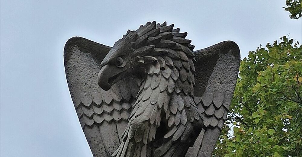
Vodice Outdoor museum (trenches, multi-level caverns, General Gonzaga Mausoleum, eagle monument)
Vodice sightseeing point
Themed trails: connecting Path of the Three Temples (connecting three St. Mary’s temples: Mt. Sveta gora above the town of Solkan, Marijino Celje Pilgrimage centre in the village of Lig and Castelmonte Monestary above the city of Cividale in Italy) and the Walk of Peace (connecting areas, people and the rich cultural and natural heritage along the former Isonzo front)
- Directions
-
You can reach the village of Plave by train. By car, you can reach the village of Plave along the main road Nova Gorica-Tolmin or along the road from the Goriška brda Region (Vrhovlje-Plave). You can cycle to the village of Plave along the Solkan–Plave cycling road.
- Public transportation
- Parking
-
Parking is available at the gravel parking lot next to the Ladišče Mountain hut along the road Plave-Prelesje. Parking is also available at the Gostilna Pri mostu Inn.


- Author
-
The tour Circular cycling tour to Mt. Vodice is used by outdooractive.com provided.


General info
-
Brda
29
-
Nova Gorica
3