- Brief description
-
This stage climbs high up into the mountains. Most of the hike is across rocky terrain. The valley will be crossed briefly followed by a climb up the two-thousander Begunjščica.
- Difficulty
-
medium
- Rating
-
- Starting point
-
Prešeren hut under Stol
- Route
-
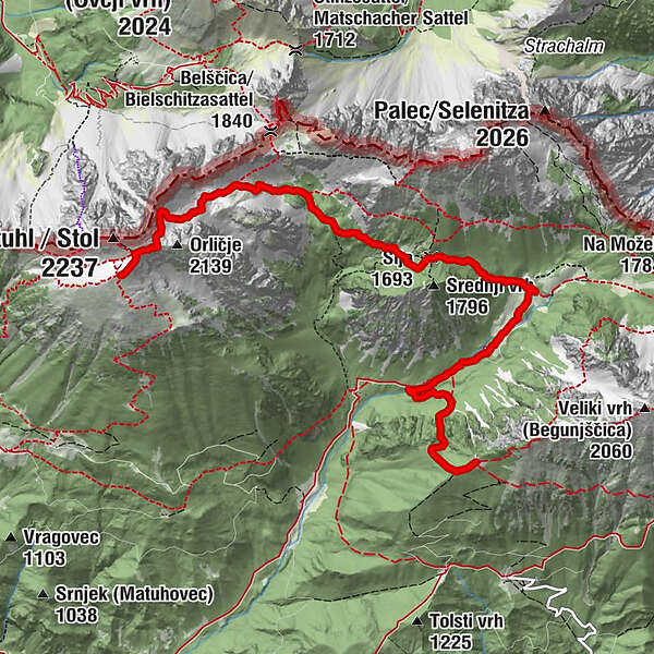
Prešernova koča na Stolu0.0 kmKleiner Hochstuhl (2,187 m)0.1 kmKrkotnik (2,116 m)0.7 kmŠija (1,693 m)3.6 kmDom pri izviru Završnice4.7 kmSmokuška planina5.0 kmRoblekov dom7.5 km
- Best season
-
JanFebMarAprMayJunJulAugSepOctNovDec
- Description
-
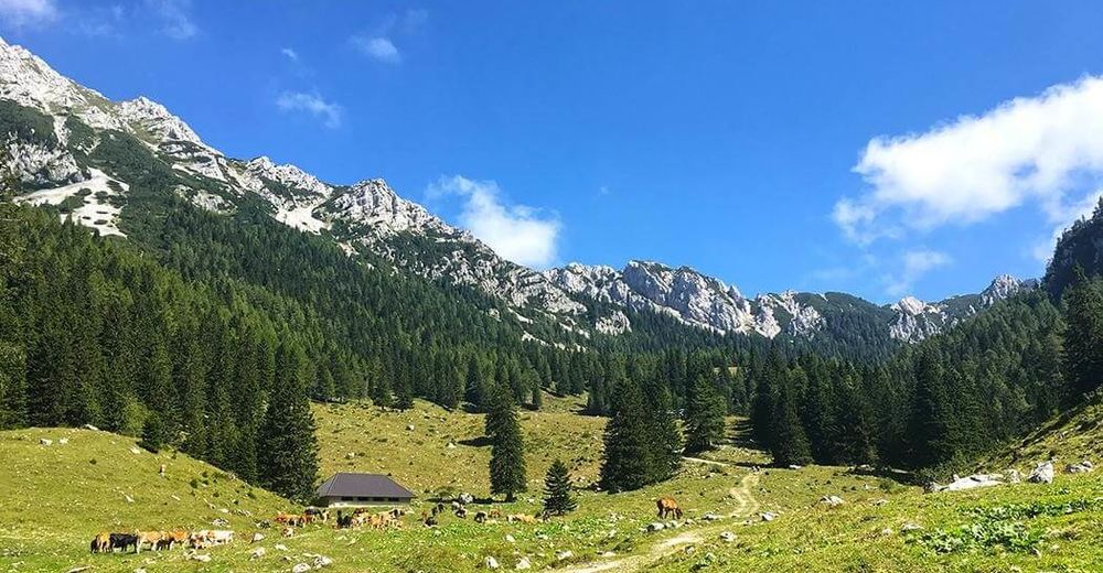
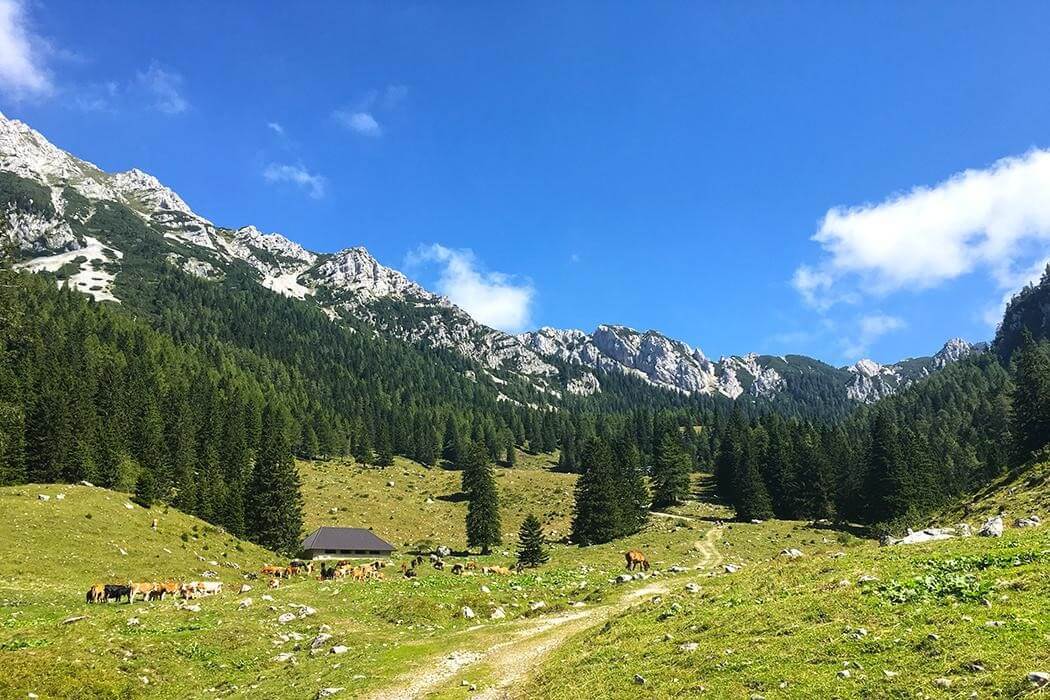
From Prešern hut under Stol the stage continues on the Karawanks ridge for the whole day, The views remain spectacular throughout the stage. The trail later descends into Zelenica valley, before the final ascend to the Roblek hut under Begunjščica.
Zelenica (approx. 1,500 m) is an Alpine valley running in the direction of Ljubelj. It is visited by skiers during winter and is most easily accessible from the Ljubelj border crossing. A cableway operates there during Winter. You will find a well equiped hut at the bottom of the valley, and the mountain training center, where you can take different courses about moving and other skills you need in the mountains.
Begunjščica is a very popular summit during all seasons, since it offers very good mountain skiing conditions in winter and spectacular views with options of challenging or medium trails for hiking. Roblekov dom na Begunjščici is located on the panoramic western ridge of Begunjščica (2,060 m).
- Directions
-
Walk from the hut to Med Stoli pass, which leads up to Stol's summit, Veliki Stol (2,236 m). The pass is just a five-minute walk away. On the pass, a path branches off towards Veliki Stol, which is only 10 minutes away. The Via Alpina route goes straight ahead, following the green-red-white signs indicating the state border, which the trail crosses. You will find yourself overlooking the Mel highland basin between Stol and the Belščica ridge. The trail descends into the basin on the right side below Orlič, then crosses the steep scree slope and descends to the bottom of the basin.
You will pass many boulders on the way down from here to the road junction. 1h 10min. Signs along the way indicate that a path turns off to the left towards the Belščica pass and on to the Klagenfurt hut in Austria. Your trail goes straight ahead and descends to the floor of V Kožnah valley and the crossroads. 10 min. The signs here have a red and a white ring, but not green one. Take care here because both paths lead to Zelenica. The path to the left has fewer climbs and leads to the one-time Dom na Zelenici, which was destroyed in a fire several years ago, then returns by way of the valley past Koča pri izviru Završnice on the way to Završnica. This is the more picturesque of the paths.
The Via Alpina route turns right at the junction and crosses the valley and the abandoned Za Šijo pasture, then climbs up to the Šija pass (1,693 m). 30 min. From the pass, go east and climb down to Smokuška pass and Koča pri izviru Završnice. 45 minutes from the pass. The hike from Prešernova koča to here takes 2h 30min. From the hut, continue south across the Smokuška meadow, then cross it and walk through the woods down to the Završnica valley. To the left are the steep slopes of Srednji vrh (1,796 m), on the opposite side of which is the Šija pass.
You will come to a crossroads after about 25 minutes from which one path leads through the valley to the hamlet of Žirovnica. Via Alpina passes through a gorge on the left then arches back to the foot of the steep gully. There follows a steep climb up the gully leads to a ridge, where you turn left to reach Roblekov dom na Begunjščici (1,657 m) after a few minutes' walk. The climb from the crossroads takes 1h 20min, and the hike from the Iskra hut takes 1h 45min. Roblekov dom na Begunjščici stands on the panoramic western ridge of Begunjščica (2,060 m).
- Highest point
- 2,164 m
- Endpoint
-
Roblek hut under Begunjščica
- Height profile
-
 © outdooractive.com
 - Equipment
-
Usuall hiking equipment.
- Safety instructions
-
No special safety issues on the trail.
- Tips
-
Plan to make a stop for lunch in Zelenica hut. Also, expect more climbs than usually, so you might be a bit more tired.
- Additional information
- Directions
-
You can reach Stol from Završnica and Begunjščica (or Zelenica) from Ljubelj pass.
- Public transportation
-
You can reach Ljubelj pass by bus, that stops in Podljubelj and on the Austrian side of the tunnel (on the top). Than you have about 45 minutes hike to Zelenica hut.
- Parking
-
Free parking is available on Ljubelj pass and Završnica sports park.
- Author
-
The tour Via Alpina Slovenia: Purple Trail: Stage 5 (Stol-Roblek) is used by outdooractive.com provided.