Črna prst (past Orožnova koča mountain hut and over the Planina za Črno goro pasture)


- Brief description
-
The mountain that dominates above Bohinjska Bistrica, a peak with beautiful views, which was once characterised by Julius Kugy as a botanical garden, is quite an inviting peak for hikers. There are still a few former shepherd lodges on the Za Črno goro pasture.
- Difficulty
-
medium
- Rating
-
- Starting point
-
Ravne in Bohinj (735 m)
- Route
-
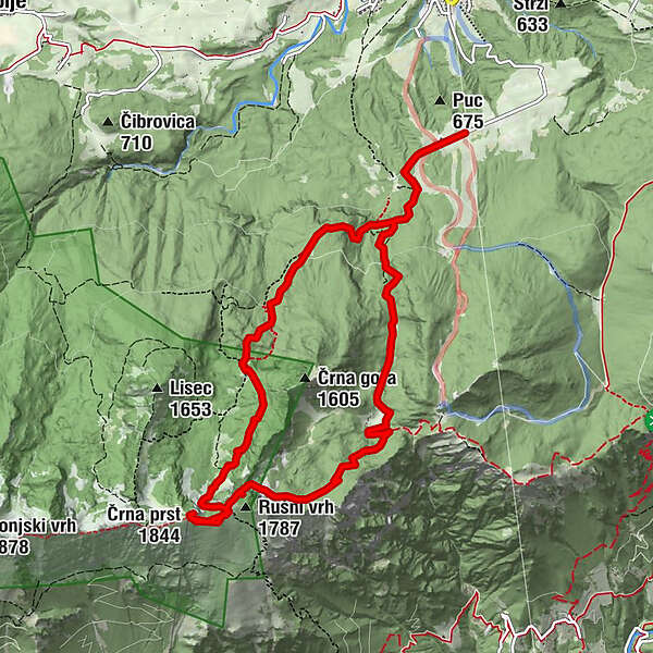
Čez Suho (1,760 m)5.3 kmDom Zorka Jelinčiča5.6 kmČrna prst (1,844 m)5.7 kmPlanina za Črno goro (1,340 m)9.0 km
- Best season
-
JanFebMarAprMayJunJulAugSepOctNovDec
- Description
-
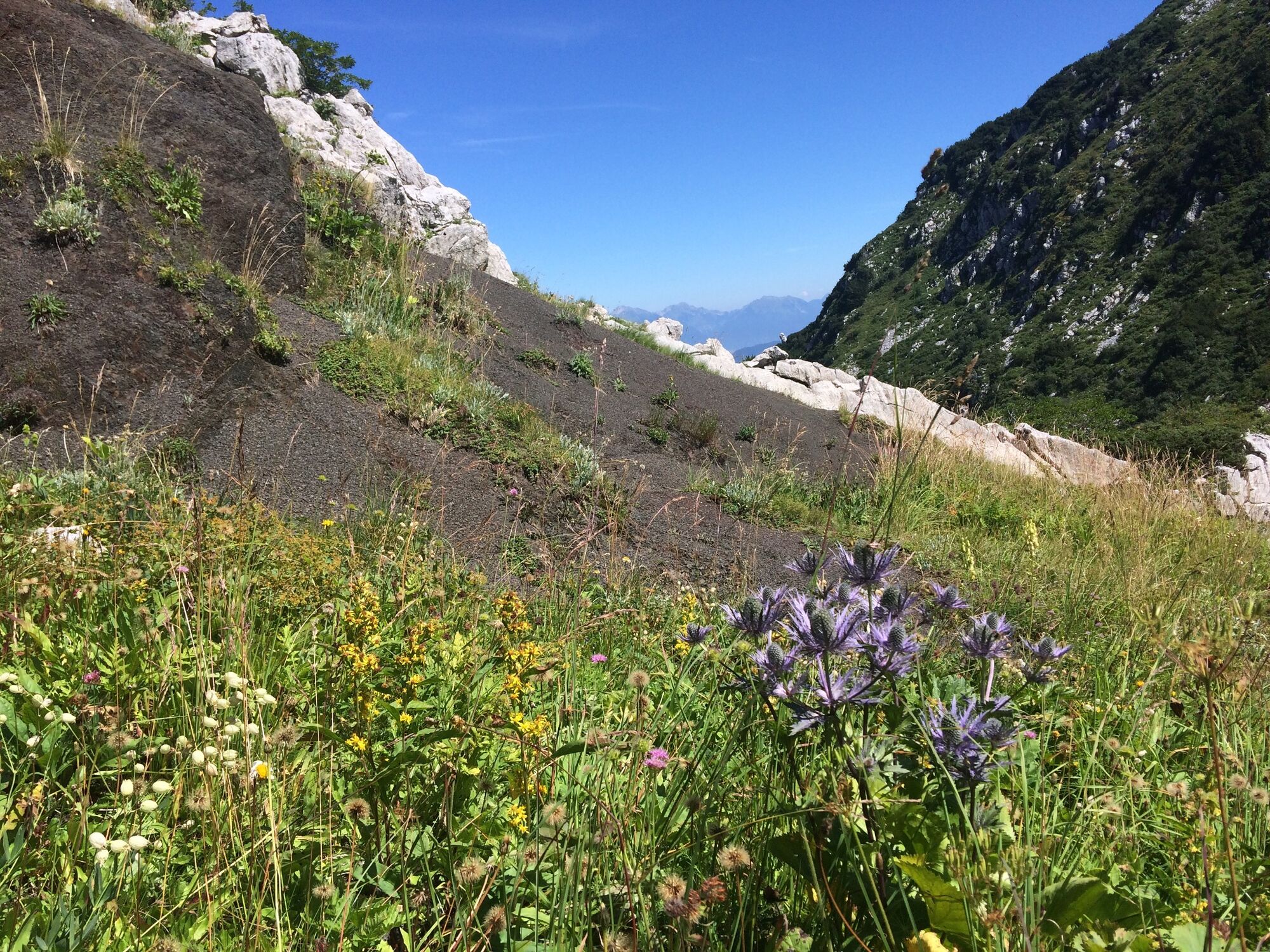
The name Črna prst (Black Soil) originates from an unusual accumulation of black slate below the peak. The mountain is part of the high mountain range between Bohinj and Primorska, where the mild influence of the pre-alpine mountains amidst the grey rocks creates the conditions for beautiful mountain gardens with diverse and rare alpine flowers. Rare species grow on preserved mountain meadows: Alpine sea holly (Eryngium alpinum), narrow-leaved wormwood (Artemisia nitida), hawksbeard (Crepis bocconi) and numerous other endemic plants.
A nice and well-maintained mountain hut Koča Zorka Jelinčiča on Črna prst is a great shelter in the mountain world and a starting point for many tours along the ridge of the Bohinj and Tolmin mountains to Rodica, Vogel and Komna, which is with 31 peaks the longest mountain ridge in Slovenia.
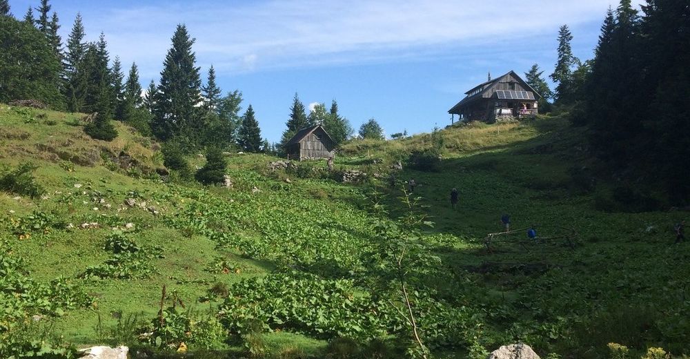
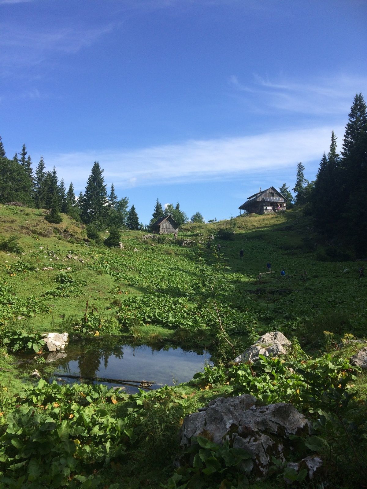
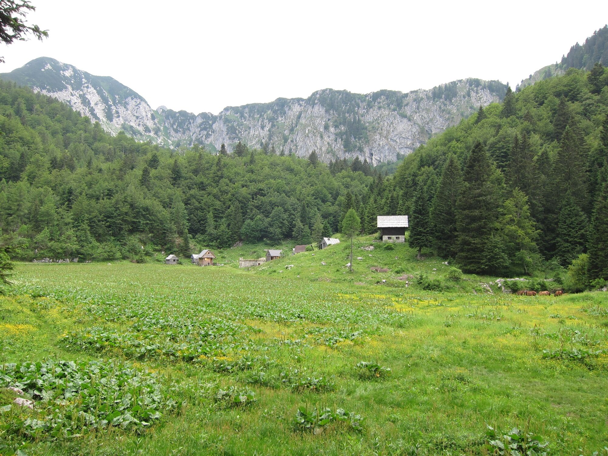
The Za Črno goro pasture (also called Ravharska planina) belongs among medium large pastures. It is surrounded by channels that were used for drainage of water that flew into the Bohinj tunnel in heavy rainfall and obstructed railway traffic. A mountain hut was built on the pasture in 1885 and was named Mallnerhütte or Mallnerjeva koča mountain hut. The hut was burnt down during WWII and has never been renovated. The interest in hiking Bohinj, especially to high mountains like Črna prst and Rodica was initiated by the construction of that hut.
- Directions
-
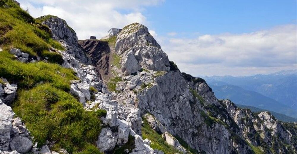
From the car park near the abandoned ski lifts continue towards Črna prst and Orožnova koča mountain hut, initially along the unpaved road where you have a beautiful view of Triglav. After the initial ascent, the road comes to the forest and turns left, when you arrive to a marked intersection. Continue left towards Črna prst, Za Črno goro pasture and Orožnova koča mountain hut (Bohinjska Bistrica and the old path to Orožnova koča mountain hut are straight aread). The path on runs past a private house (which used to be a mountain hut) and then accesses the cart track where you start ascending. In the intersection, continue to the right and through the forest. Past the alpine lodge and cross and come to a marked intersection, where you can continue towards Orožnova koča mountain hut (you can see the Za Črno goro pasture on the left). The trail crosses the slopes towards the right side and visibly descends in between. Continue along a forest path, cross a few cart roads and in the intersection, continue on the right path. In a few minutes you come to a forest path and cross it (Orožnova koča mountain hut can be accessed along an alternative path to the right). Ascend steeply through the forest. Continue to the left, in a few minutes you arrive to Orožnova koča mountain hut. Continue to the left in the forest. The path slowly exits the forest to the slopes below Črna prst mountain. The trail starts ascending and becomes quite steep. Soon you will reach the walls below Črna prst mountain. Hike along the wall upwards, turn left and cross the mountain gorge. In a moderate ascent, initially cross the slopes towards the east. Only a few metres before the pass, a path comes from the Za Črno goro pasture. Turn right on the pass and in ten minutes walk to Planinski dom mountain hut on Črna prst. Only a few steps are required to come to the top.
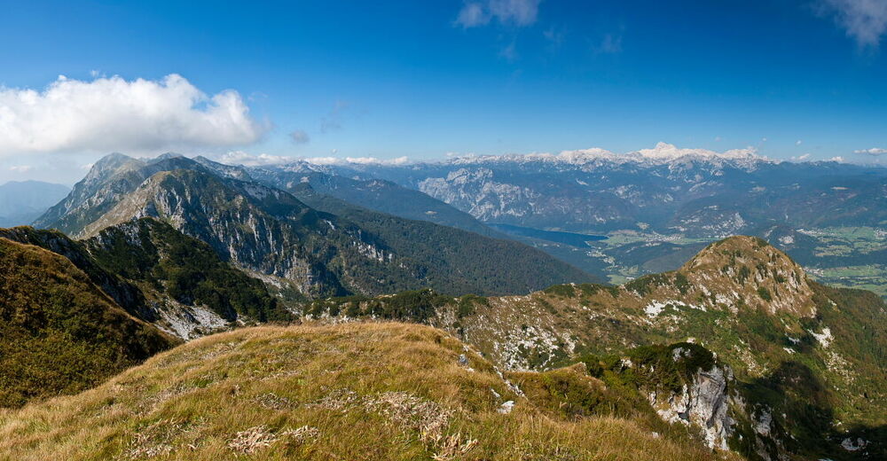
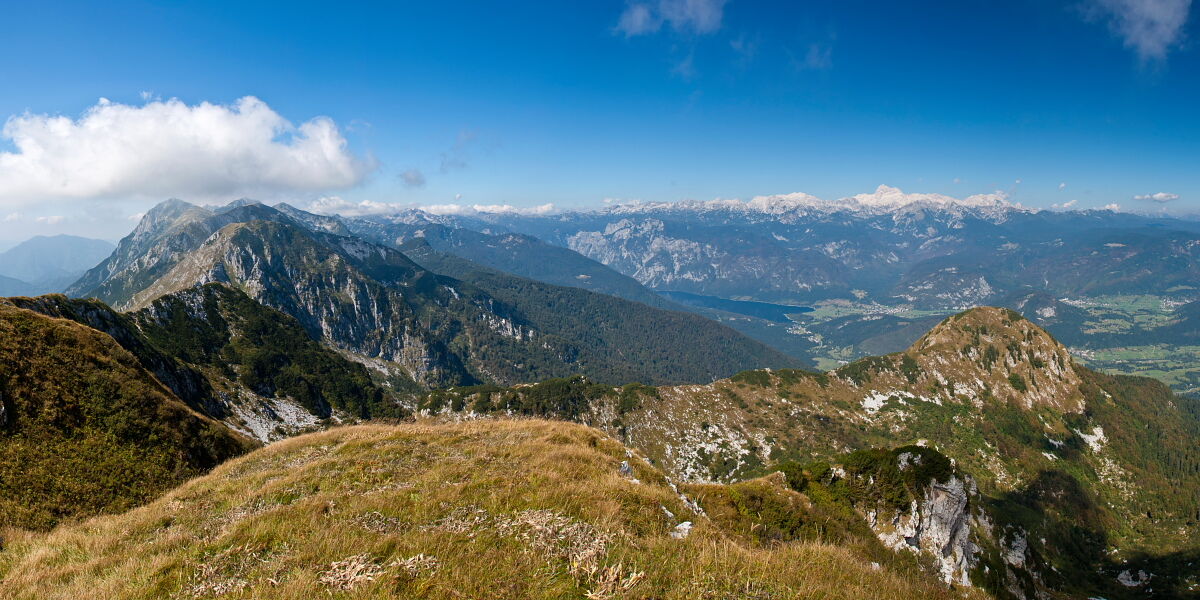
To the east, you can see the ridge of the South Bohinj Range and mount Ratitovec in the background as well as the peaks of Kamnik-Savinja Alps; from east to the south, the view stretches from the Škofja Loka mountain range with Blegos and Porezen to Kojca, the upper part of Baška grapa with Podbrdo, the south peaks of South Bohinj Range above the valleys of Bača and Koritnica, the hills of Idrija and Trnovo Forest, Nanos, Javorniki and Snežnik. To the west you can see the South Bohinj Range towards Rodica and Krn in the background, Matajur on the left side and the Friuli Plain and the Adriatic sea, if visibility is good. To the north, the view stops over the valley of Bohinj and the lake, Komna and peaks above it, POkljuka and the peaks from Tosc to Debela peč, and the Karavanke mountain range in the background as well as the majestic range of mountains of the Julian Alps and Triglav.
Return in the same way and after a ten-minute walk, you come to Čez Suha pass where you turn left and return to Orožnova koča mountain hut and Bohinjska Bistrica. The path soon splits, continue right towards the Za Črno goro pasture. Cross a steep slope where snow remains to early summer. Continue on the grassy section below the Home ridge. In this part, there is a danger of falling rocks in late spring. At the end of this section, cross the scree below Rušni vrh, from where you can continue to the forest. Turn sharp left in the marked intersection towards Bohinjska Bistrica (the peak of Kobla and Bača as well as Petrovo Brdo are straight ahead). After a few-minutes walk, you cross the Za Črno goro pasture.
The trail goes round the pasture along an artificially made channel. The trail descends at the end of the pasture and continues past channels. They were built to prevent water flow in the Bohinj tunnel. When a steep path ends at the signpost, turn right towards Bohinjska Bistrica and come to a forest road where you turn right and after a few minutes turn left to a steep walking path, along which you finally reach a cart track and a intersection. Turn right to Bohinjska Bistrica to the path along which you ascended to Črna prst. Continue to the starting point. Descend past the lodge and cross through the forest to the intersection and turn left. Continue along the cart track, go past the private house and soon reach the road, turn right and return to the car park. (www.hribi.net)
- Highest point
- 1,816 m
- Endpoint
-
Ravne in Bohinj (735 m)
- Height profile
-
 © outdooractive.com
 - Equipment
-
We recommend hiking shoes and clothes as well as enough water. Orožnova koča mountain hut on Za Liscem pasture is open in summer and at weekends in winter.
- Safety instructions
-
There can be fallen trees in some parts of the trail due damage caused by strong winds.
- Tips
-
Prior to every hike, check the weather forecast and trail conditions.
- Additional information
-
Information:
Turizem Bohinj, Stara Fužina, tel.: +386 4 57 47 590
TIC Bohinj, Ribčev Laz, tel.: +386 4 574 60 10
TIC Bohinj, Bohinjska Bistrica, tel.: +386 4 574 76 00
TIC Bohinj, Stara Fužina, tel.: +386 4 572 33 26
TNP Bohinj Centre, Stara Fužina, tel.: +386 1 200 97 60
Julian Alps Card: Bohinj offers free transport and other benefits.
- Directions
-
Drive by car to Bohinjska Bistrica from Bled, through Soteska or over Pokljuka. You can also access the village across Jelovica and Soriška planina. Drive 2.5 km from Bohinjska Bistrica to Ravne.
- Public transportation
- Parking
-
A free car park is located between closed buildings and abandoned ski lifts at the end of Ravne (coordinates: 46.2586, 13.9592).


- Author
-
The tour Črna prst (past Orožnova koča mountain hut and over the Planina za Črno goro pasture) is used by outdooractive.com provided.