


- Brief description
-
Listen to the Sava River and hike the hidden fisherman's paths and discover the stunning natural beauty of its riverside forests and meadows.
- Difficulty
-
easy
- Rating
-
- Starting point
-
Parking space opposite the reception of Camping Šobec
- Route
-
Radmannsdorf2.5 kmLancovo2.7 km
- Best season
-
JanFebMarAprMayJunJulAugSepOctNovDec
- Description
-
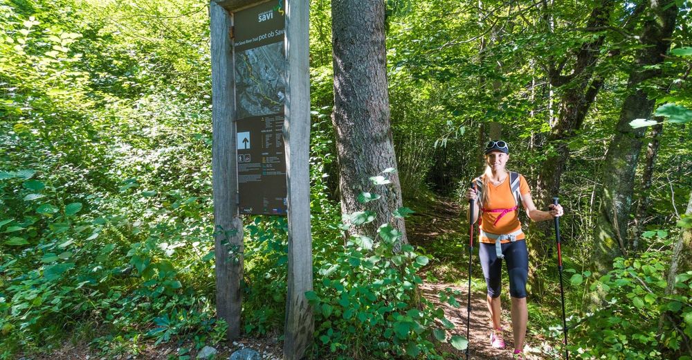
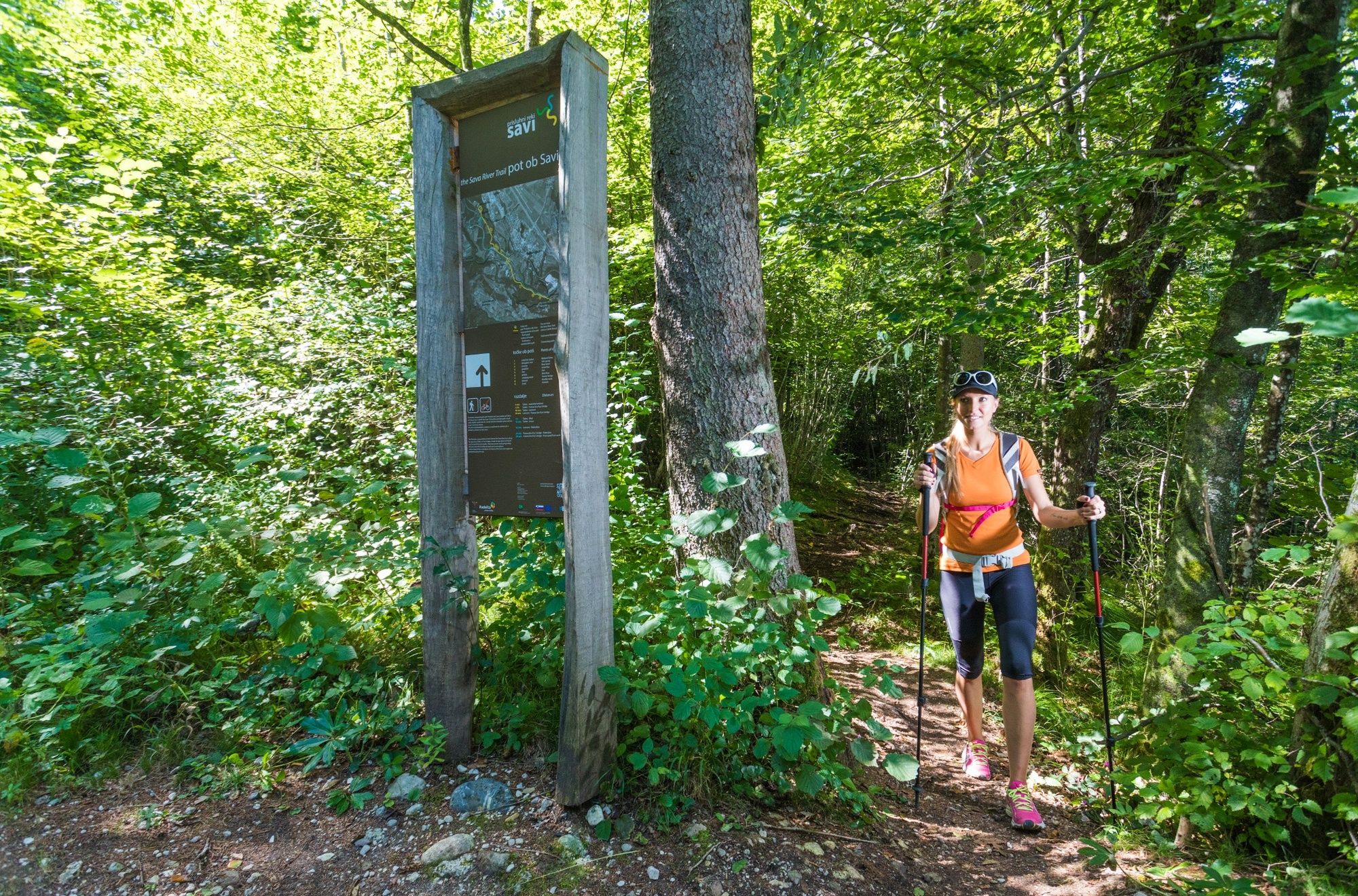
The Sava River Trail is a thematic, interpretational trail that follows the course of river Sava from Camping Šobec to Fux's bridge near Radovljica. It leads its way down cart tracks and narrow fishermen's paths; partly through the realm of marshy forests, partly through riverside meadows - but never too far from the river.
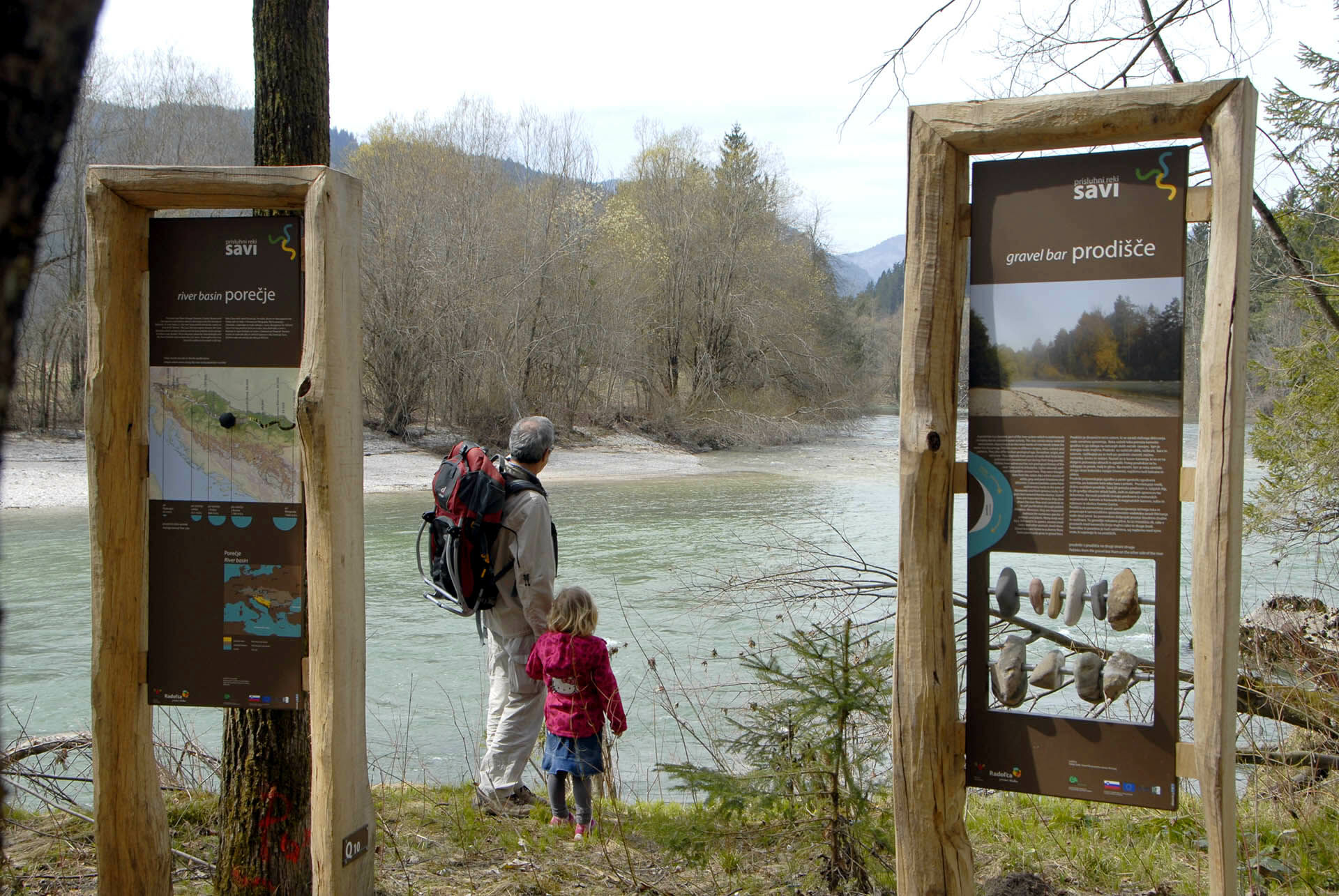
Numerous information panels present along the route present the river basin, gravel bars, boulders, animals in riverside forest and common fish population of Sava river. Two stunning natural monuments are included in this trail : Wetlands at Šobec and Tufa springs (cascades of saturated calcium carbonate deposited on plants).
The trail is excellently signposted and can easily be combined with other nature trails in vicinity : The Three Bridges Trail, Lipnica Castle Natural Science Trail or Grabnarca Waterside Natural Trail.
- Directions
-
After parking the car in the area designated for visitors, head north across the meadow to Šobec wetlands (signpost: Mokrišče Šobec). Having visited the natural monument, retrace your steps back to the car park. Walk south (past the new restaurant) towards the small bridge between the artificial water ponds and Šobec lake. Continue the walk on the gravel forest road, which gradually ascends alongside the campsite fence. Reaching the first junction (open metal gate), turn right and follow the road descending alongside the fence for about 20 meters.
Turn left and follow a gravel road leading across the meadow and into the forest. As you come out of the forest into the wide open meadow ( passing a beehive on your left), a cart track joins from the right-hand side. Follow the sign (wooden pillar) that invites you to the visit of the Tufa spring. Though it might seem a few steps out of the way, it's well worth to visit this natural gem (unknown even to many locals). The story of carbon dioxide dissolving in water, being deposited on plants and forming porous rock called tufa is explained on the information board just below the cascades.
Return back to the crossroads at the meadow, and continue walking southwards. The trails starts descending into the forest and soon reaches the level of Sava riverbed (though the acctual river cannot be seen yet). You make a loop through the red pine forest, before reaching a small meadow. The path leads you further, across a small bridge and onto the embankments of Sava river (information panels).
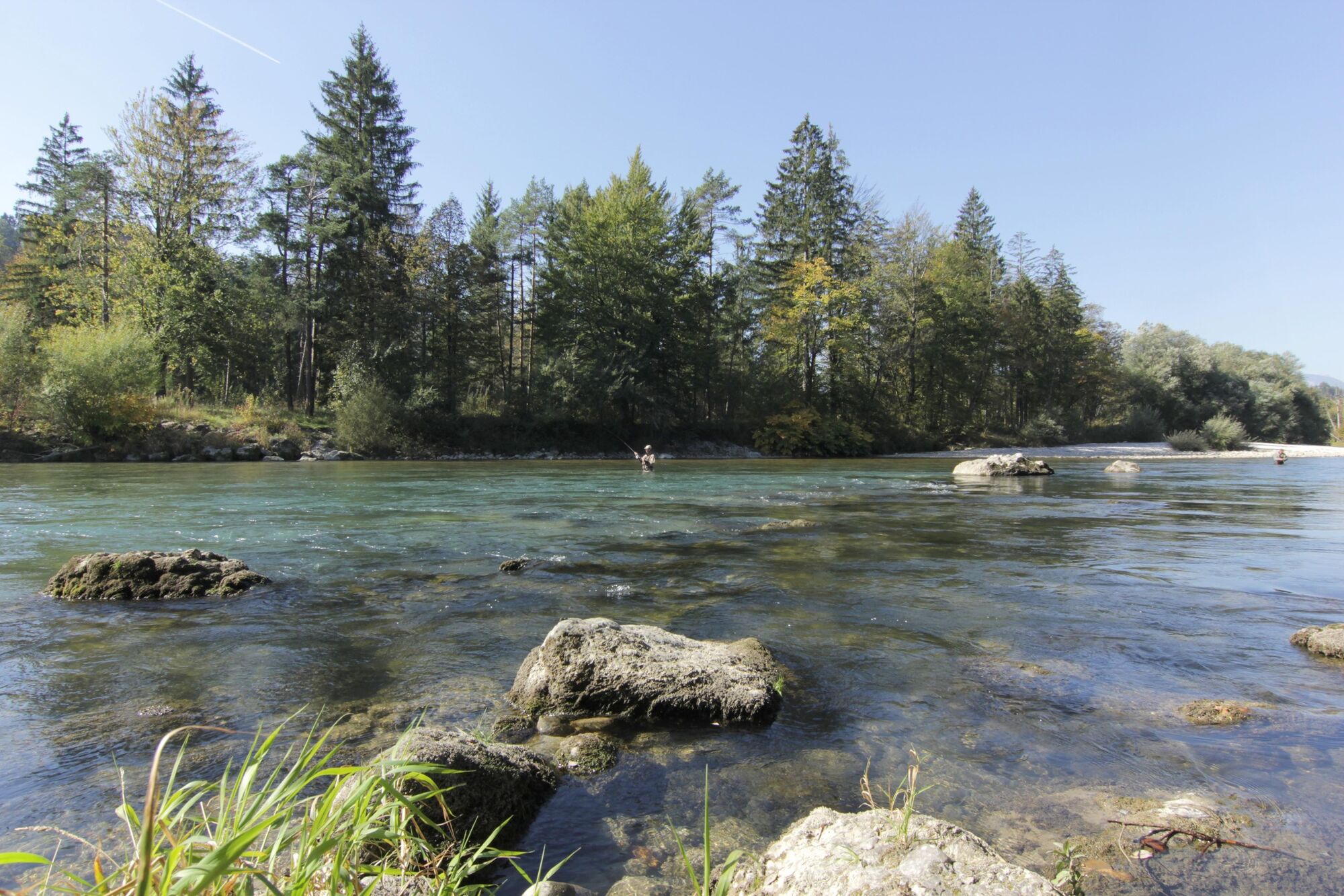
The trail now follows the riverbed, featuring wonderful views of the confluence of Sava Bohinjka and Sava Dolinka and the newborn Sava river. Suddenly you find yourself infront of a busy road and a large bridge spanning across river Sava. Walk across the bridge (using the pavement), to reach a small countryside mansion on the other side. Immediately after crossing the bridge, turn sharply left onto a tarmac road .
Follow this quiet countryside road, passing a group of houses and following the course of the river. Reaching the last house, the road surface changes from tarmac to gravel. Walk straight across the meadow on the field track, ignoring the left-hand side turn. As the track reaches the forest (dry river bed), it suddenly starts ascending. Climb up the forest track bending slightly to the left. The trail soon starts descending and reaches the pristine riverbanks of untamed Sava river. The scenic Fux's bridge is the first encounter with civilisation after the last section of the Listen to the River Sava walk.
Walk across the wobbly bridge and return back to the starting point using Lipnica Castle Natural Science Trail to Radovljica and The Three Bridges Trail from Radovljica to Campsite Šobec.
- Highest point
- 441 m
- Endpoint
-
Parking space opposite the reception of Camping Šobec
- Height profile
-
 © outdooractive.com
 - Equipment
-
In case of wet weather, water resistant shoes can be welcome.
- Safety instructions
-
Due to several springs along the riverside, the path can occasionally be wet or muddy.
- Tips
-
-Even if it may seem as it's few steps out of the course, make sure you don't miss the beautifull Tufa springs beneath Lesce
- Additional information
- Directions
-
Arriving from Ljubljana or Kranjska Gora :
Take exit 3 (Bled) on A2/E61 motorway. Drive straight through the roundabout (direction: Bled) and continue for approx. 1 km to reach the junction for Camping Šobec (large scale commercial sign on the left-hand side of the road). Turn left and continue driving for 1,5 km to reach the campsite.
Arriving from Bled or Bohinj :
Drive from Bled towards Ljubljana to reach the junction for Camping Šobec (large scale commercial sign on the right-hand side of the road). Turn right, and continue driving for 1,5 km to reach the campsite.
- Public transportation
-
Apart from Hop-on Hop-off buses in summer tourist season, there is unfortunately no public transport to Camping Šobec.
- Parking
-
Vast parking spaces for visitors are available to you on the left-hand side of the road. Expect to pay a parking fee on sunny weekends.


-

-
AuthorThe tour The Sava River Trail is used by outdooractive.com provided.


General info
-
Wörthersee - Rosental
1955
-
Gorenjska
141
-
Radovljica
168


