
- Brief description
-
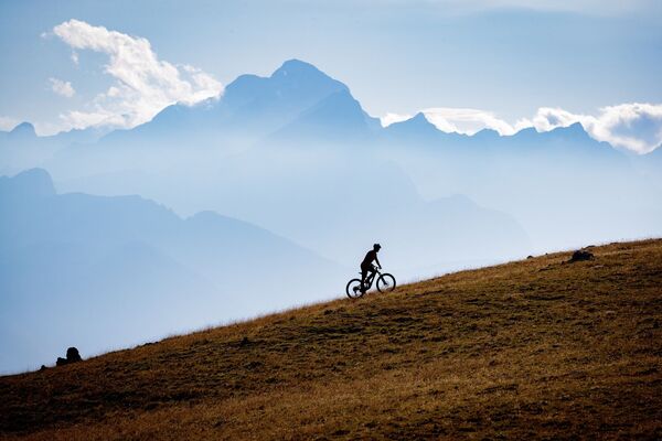
A cycling tour that will take you under the highest peak of the Karavanke mountain range. The tour is suitable for cyclists who want to admire the picturesque landscape during cycling and are not afraid of longer ascents.
- Difficulty
-
medium
- Rating
-
- Starting point
-
Infocenter Triglavska roža Bled.
- Route
-
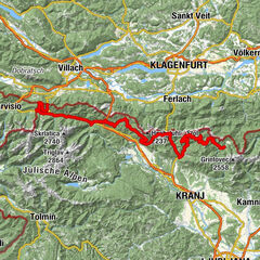
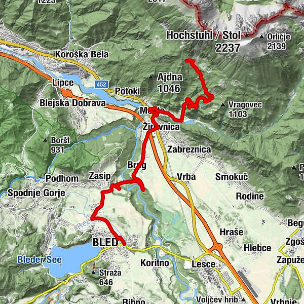
Bled0.4 kmZasip2.6 kmBreg (536 m)5.8 kmScheraunitz (558 m)7.3 kmMoste8.3 kmSlap Hudič babo pere11.7 kmValvasorjev dom pod Stolom14.9 km
- Best season
-
JanFebMarAprMayJunJulAugSepOctNovDec
- Description
-
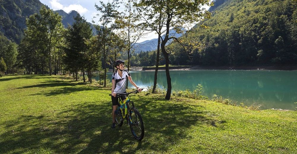
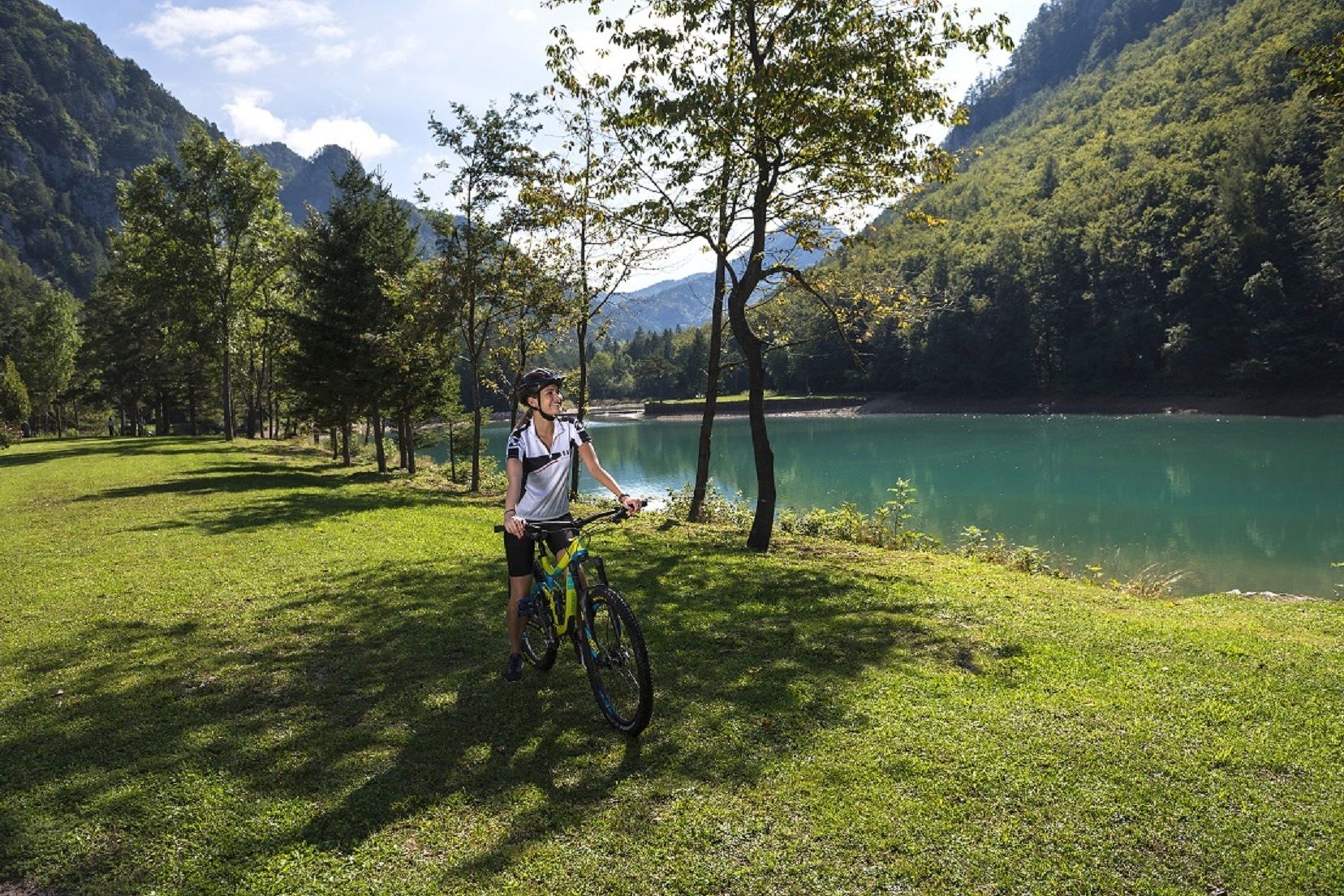
The tour takes you from Bled along the Sava Dolinka River to the villages beneath Stol and to the valley of Završnica, where you start ascending to Valvasorjev dom mountain hut. The tour is suitable for mountain bikers and quite demanding, since it encompasses a 5-km ascent to Valvasorjev dom mountain hut. You will be awarded with magnificent views of the picturesque landscape. Return along the same road, if you wish, you can extend the tour.
- Directions
-
BLED - PIŠKOVCA - BREG - ZAVRŠNICA - VALVASORJEV DOM MOUNTAIN HUT
The tour starts in front of the Triglavska roža Bled Info Centre and continues along the road on the right side of Mercator shop. At the end of the street, turn left and cross Seliška cesta, where you reach the cycling route. Turn right and ride along the cycling route to the crossroad (on the right). Turn right (cross Seliška cesta) and continue along the main road towards Zasip.
Before the village, turn right towards Piškovec. After a short descend you reach the Sava Dolinka River, cross it and drive along the unpaved road. Start a short climb and follow the main road until you reach the village of Breg (asphalt road) and continue through the village. Cycle along the main road and before a short ascent turn left towards Završnica at the red direction sign.
Continue through the village along the road that takes you below the regional road towards Jesenice. After a short and steep ascent, turn left and then descend past the monument dedicated to the victims of WWII. After crossing the bridge, the road starts ascending. In the first crossroad, turn right (direction Završnica) and cross the railway track, then turn right. After a short descent you will start a long ascent on the asphalt road to the valley of Završnica.
At the turning for Valvasorjev dom and Stol, turn left to a unpaved road and start the 5 km long ascent where the steepest sections are paved, but most of the road is unpaved road. Remain on the main (wide ) road and follow the signs for Valvasorjev dom mountain hut. When you come to the mountain hut – Valvasorjev dom, you reach the highest point of the tour. Return to Bled along the same road.
- Highest point
- 1,176 m
- Endpoint
-
Infocenter Triglavska roža Bled.
- Height profile
-
 © outdooractive.com
 - Equipment
-
Bike and helmet.
- Safety instructions
-
The tour is suitable for mountain bikers.
Consider traffic signalisation.
- Tips
-
If you want to avoid ascending to Valvasorjev dom mountain hut, we advise you to ride through the valley of Završnica to the accumulation lake and return to the starting point in Bled.
- Additional information
-
TIC INFOCENTER Triglavska roža Bled
Ljubljanska cesta 27, SI – 4260 Bled
E-maili: info@visitbled.si , info.trb@tnp.gov.s i
Tel: +386 (0)4 5780 205
Web address: http://www.bled.si ; http://www.tnp.si
TIC - Turistično Društvo Bled
Cesta svobode 10, SI – 4260 Bled
Tel: +386 (0)4 5741 122
Web address: http://www.td-bled.si
TIC Žirovnica
Žirovnica 14, SI - 4274 Žirovnica
E-mail: info@visitzirovnica.si
Tel: +386 (0)4 580 15 03
- Directions
-
You can get to the starting point in Bled by car from Lesce (Ljubljana-Karavanke motorway exit) or from other regional roads from Bohinj or Jesenice.
- Public transportation
- Parking
- Author
-
The tour The Challenge of Karavanke is used by outdooractive.com provided.


General info
-
Wörthersee - Rosental
192
-
Gorenjska
32
-
Bled
32