

- Brief description
- Difficulty
-
medium
- Rating
-
- Starting point
-
Trieste
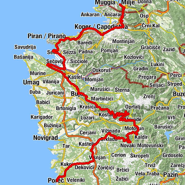
- Route
-
Mulgs (2 m)0.0 kmFarnei0.3 kmRabuiese2.2 kmBuža3.6 kmScoffie4.6 kmValmarin6.6 kmŽepki8.5 kmGostilna Pizzeria Kortina10.4 kmBertocchi10.6 kmOlmo14.0 kmCapodistria15.3 kmGiusterna16.4 kmIsola19.6 kmPregaor21.1 kmValleggia22.9 kmAkvarija24.6 kmDobrava presso Isola24.7 kmSanguetera25.5 kmStrugnano26.5 kmCarbonaro27.0 kmNa Prevalu / Preval27.7 kmLucia (3 m)29.3 kmRibič31.4 kmSezza33.4 kmMulini37.7 kmMlini37.8 kmŠkrile37.9 kmCupilija42.6 kmValizza43.0 kmColombania43.9 kmSan Marco46.8 kmSpecijarija47.8 kmSimonetija48.1 kmCaldania48.9 kmApartments & Restaurant "Lovac"48.9 kmVolpia51.1 kmBuie53.1 kmBibali55.1 kmTribano56.1 kmVrh Roman60.2 kmStazione60.5 kmGrisignana61.3 kmBiloslavi64.6 kmPiemonte68.4 kmAntonzi69.3 kmBiloslavi75.9 kmAntonzi81.5 kmPerelici89.5 kmLevade91.4 kmGostionica Tartuf91.6 kmMurari93.7 kmRežari95.1 kmKanal96.5 kmKranceti97.9 kmKoleri98.6 kmLabinjani98.7 kmRakotule103.6 kmMali most106.0 kmVizinade108.3 kmDanci110.4 kmVrh Lašići111.3 kmBukori111.5 kmOhnići112.4 kmColombera117.2 kmFarini118.1 kmJama Rupačre119.4 kmRadossi di Visignano119.8 kmBercici120.9 kmJama Pošeš121.4 kmVillanova121.8 kmMagrini122.4 kmStancio122.9 kmMicatovici123.0 kmStanzìa Vergottini126.7 kmPical128.6 kmPoreč129.3 km
- Best season
-
JanFebMarAprMayJunJulAugSepOctNovDec
- Description
-
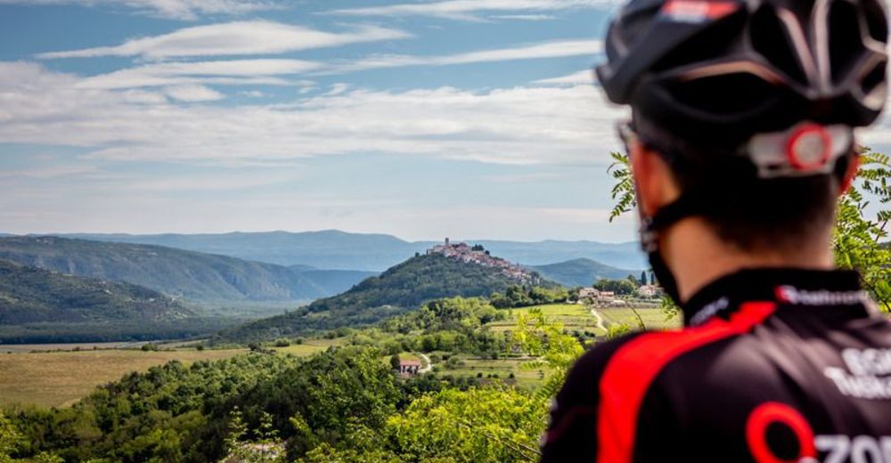
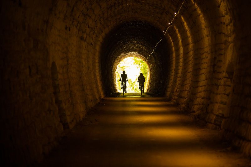
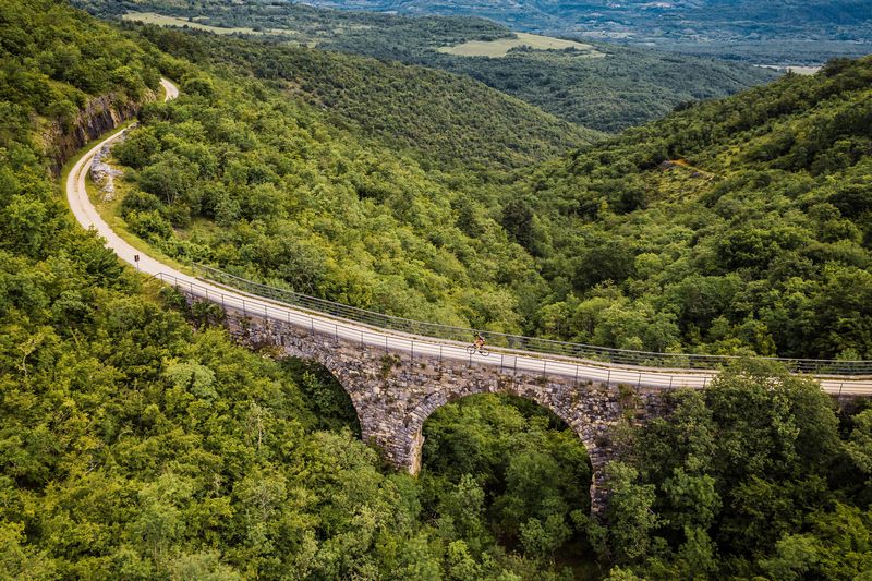
The railway was operational only 33 years, but it still made a big impact on the surrounding area, in both economic and cultural sense. After abandoning the line, te railway was left to decay, until 2006, when the first Parenzana revival project begun- “Parenzana – the Route of Health and Friendship”, that started to convert the line into cycling trail. Through the next 10 years or so, and two other projects, the rest of the railway was transformed and Info centers where set up. The trail connects Italy, Slovenia and Croatia, with most of the trail going on the latter two.
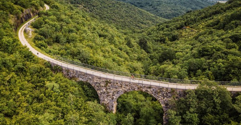
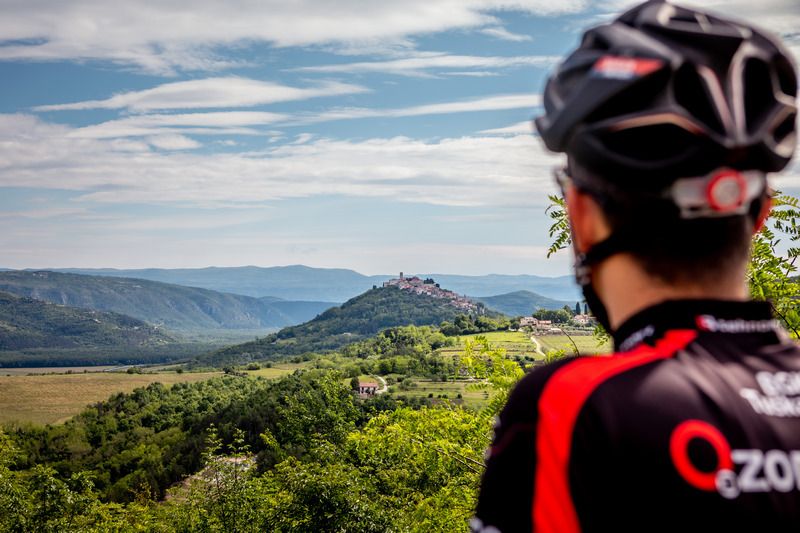
Now you have 120 km of great trekking bike experience (lots of gravel roads), with great views and the hint of history on the tracks. They are not to demanding, so appropriate for everyone. You can do it in one day, when you want to train, but its better to extend your trip to 2 or 3 days, stopping and taking in the views, the feelings and the history.
- Directions
-
There are no turn by turn directions available, but you really cant miss the way, since it is well marked, and gpx files and maps are readily available.
- Highest point
- 301 m
- Endpoint
-
Poreč
- Height profile
-
 © outdooractive.com
 - Equipment
-
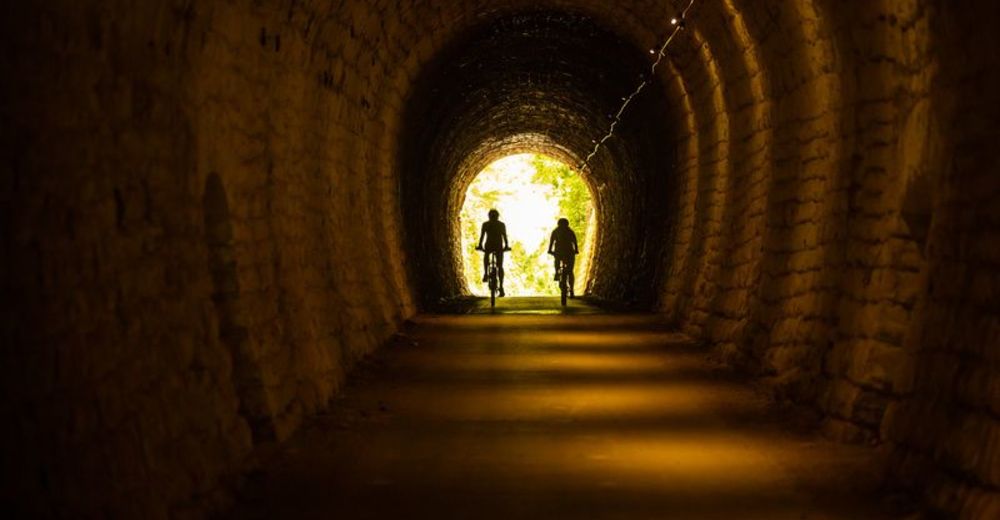
Sufficient water, tire repair kit, helmet, head torch/light (tunnels)
- Safety instructions
-
Check your water stops in Croatia and remember you can call for transfer if you run out of energy to return back home.
- Tips
-
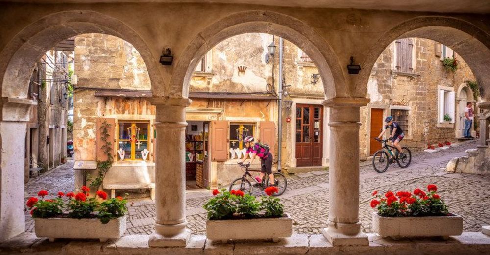
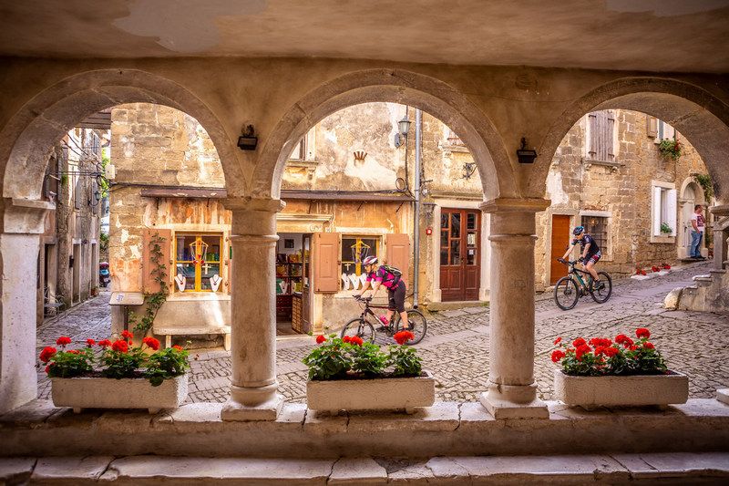
The trail is not that long, but we advise you not to race through it, but rather take detours to visit all the exciting POIS surrounding the trail.
- Additional information
-
You can attend organised events on the trail, rent bikes and guides to make your experience perfect. You can also arrange for luggage and bike transfers, or return to home transfers.
In easy 5 days you can also do round tour, including some of the attractions of the inner Istria.
- Directions
-
Arrive by plane in Trieste and rent a bike, or arrive by bus, train, car...
- Public transportation
-
Trieste, Koper, Portorož, Poreč are all readilly acessible with public transport (bus, train, aeroplane-Trieste). You can put bikes on train or some buses.
- Parking
-
Payable parking available in all big cities along the way.

- Author
-
The tour Parenzana cycling trail is used by outdooractive.com provided.