
- Brief description
-
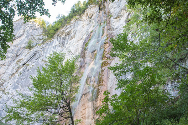
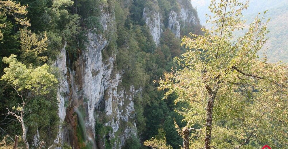
Easy, undemanding fell-walk, with a pleasant stroll through the forest. A sight worth seeing is the waterfall Skakavac with its 98 metres of height.
- Starting point
-
Nahorevo village
- Route
-
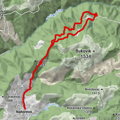
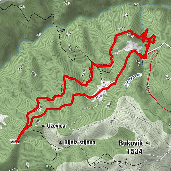
VićaSkakavac4.9 kmVića9.5 km
- Description
-
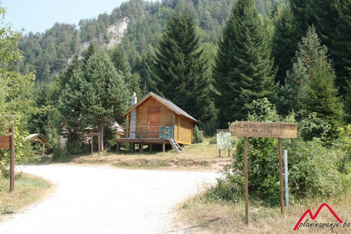
There are a number of picnic sites known to all Sarajevans on Mt Ozren, including Barice, Čavljak, Crepoljsko (1524 MASL), Bukovik (1534 MASL), and the Skakavac waterfall, protected by the state since 1954. Today, the area around the waterfall has been developed into a proper picnic site. Even the macadam road leading to the protected area has been reconstructed, and most critical stretches asphalted.
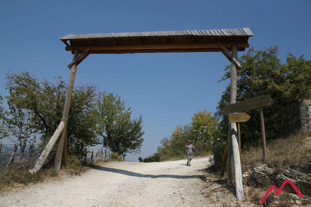
The Skakavac waterfall lies north of Sarajevo, some 12 km from the city centre. It can be reached from two directions: via the Nahorevo road, or the longer Bukovik road. There is a small junction right at the beginning of the trail where you can choose whether to approach Skakavac from above or below the waterfall. The narrower road, which goes downhill through the forest, will take you to the foot of the waterfall. It's less strenuous to take the upper road, see the waterfall from the promontory, then descend and go back down the lower road.
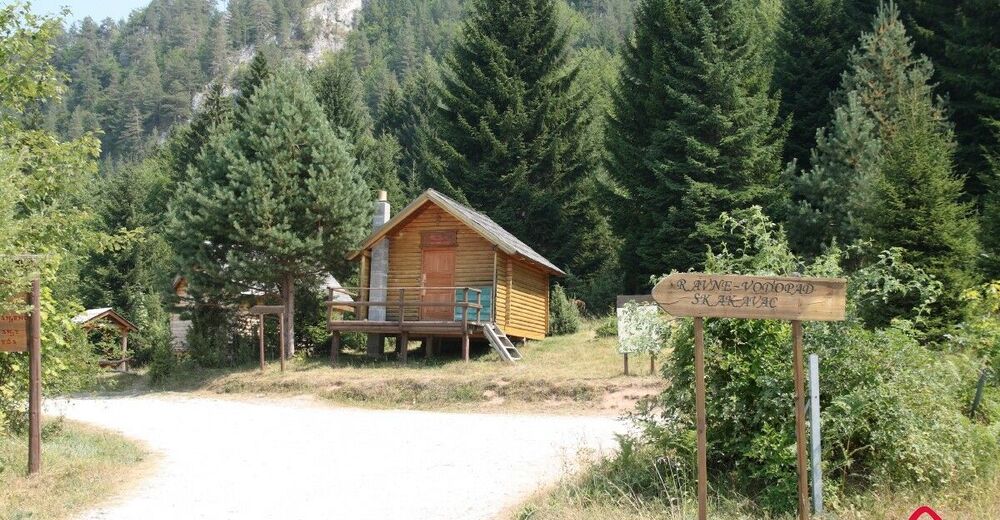
The upper road is generally well-maintained, just wide enough for a passenger car. It's shaded all the way because it goes through the forest. After only a few hundred metres there is a drinking fountain on the left side of the road. The place has been turned into a little rest stop and fitted with a few benches. Two and a half kilometres further down the road there is a fork in the road where the road to Bukovik branches off. There is a turnpike at the fork, thus nature lovers who come by car have to set foot on the ground. On the other side of the turnpike is the Skakavac protected area.
Along the road there are placards describing local flora and fauna. The vegetation round the waterfall includes a variety of endemic species. Spruce-fir and beech-fir forests are most common in this area, spruce being more common on steep terrain. In the vicinity of the waterfall there are termophilic forests, as well as underbrush of hop hornbeam, autumn moor grass and flowering ash.
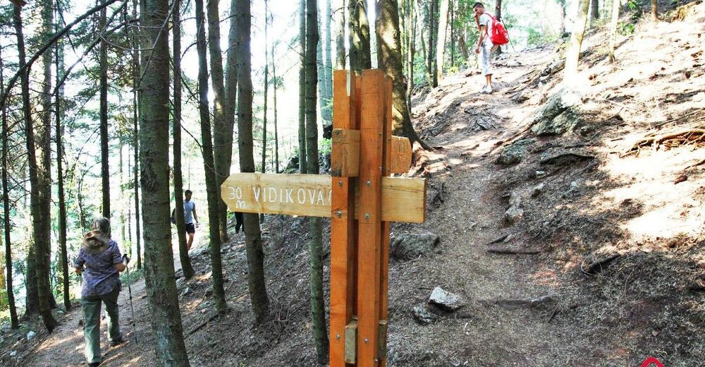
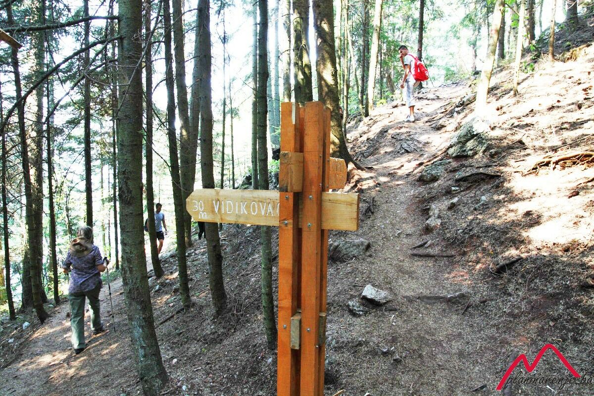
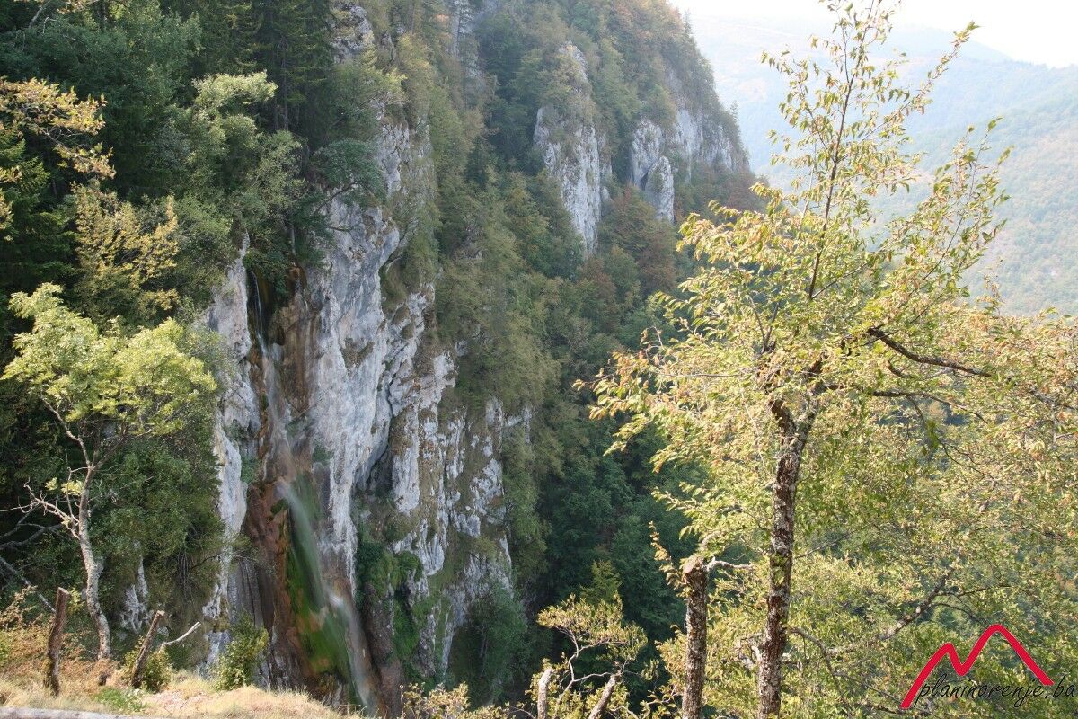
One more pleasant kilometre walk takes us to the stream called Skakavački potok. Right above the road is a chalet which was destroyed during the war and has never been reconstructed. Just below the chalet, to the right, there is a drinking fountain. Left of the stream is a wooden signpost that shows the way to the promontory above the waterfall. From the promontory one can see the crest of the 98-metre waterfall. Although it doesn't have a high flow rate, the waterfall is exceptionally beautiful, especially in winter when it's frozen.
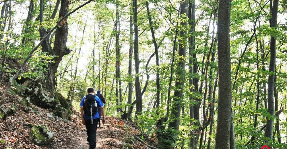
Above the promontory a meandering road slopes down to the foot of the waterfall. It is in a good condition and has railing, and the descent is safe. From 98 metres below one gets a view of the waterfall from a different perspective, this time from the foot. Although the area is well-maintained, care should be taken when walking on the rocks, as they are wet and slippery at all times.The way back is a proper forest trail, just wide enough for two persons to pass abreast. In a few places it is intersected by the beds of streams which are active only in spring and after heavy rainfall. The stream beds are bridged with improvised wooden bridges.
The Sarajevo-Skakavac route is considered an easy half-day walk. Mountain bikers have increasingly been visiting the waterfall recently.
- Directions
-
When you enter the nature park Skakavac head straight down the forest path. After around 4 km you will reach the lodge which was destroyed during the war. Turn left there and follow the forrest path to the viewpoint above the waterfall. From the viewpoint descend down the maintained path to the foot of the waterfall. You don't have to go back the same way; instead, you can follow the marked trail from the waterfall to the place where you parked your car.
- Highest point
- 1,214 m
- Endpoint
-
Skakavac waterfall
- Height profile
-
 © outdooractive.com
 - Equipment
-
Standard mountaineering equipment in accordance with the weather.
- Safety instructions
-
The trail is technically undemanding and there is no risk of landmines. In winter, the trail underneath the waterfall can be frozen, so tread carefully.
- Additional information
- Directions
-
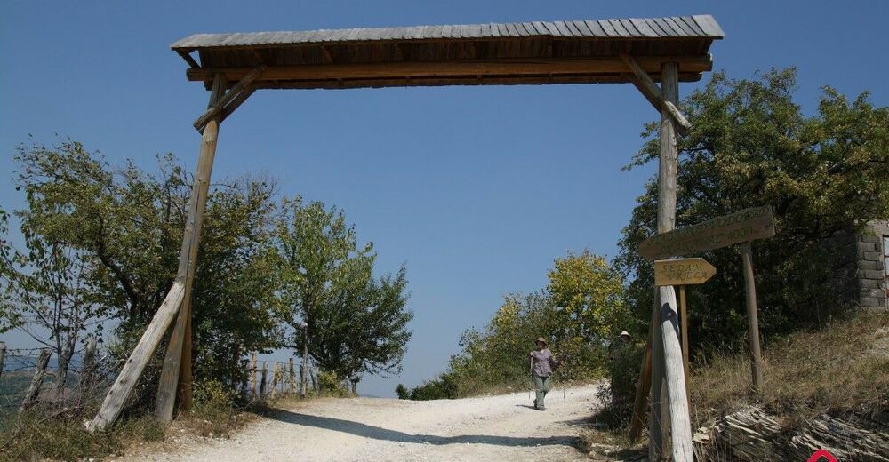
If you're going with your own vehicle head across Koševo an Pionirska dolina towards Nahorevo. Drive through the village and proceed uphill to the sign at the entrance to the Skakavac nature park.
- Public transportation
-
City van to or taxi Nahorevo.
- Parking
-
No car park, leave the car at the lay-by.

-

-
AuthorThe tour Skakavac is used by outdooractive.com provided.


-
Bosnien
44