

- Brief description
-
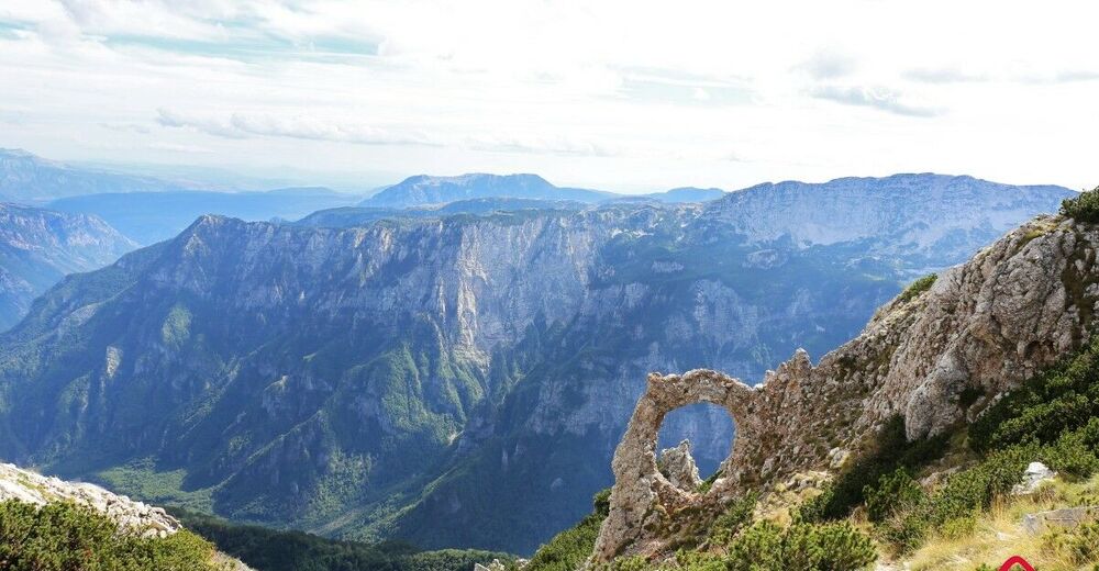
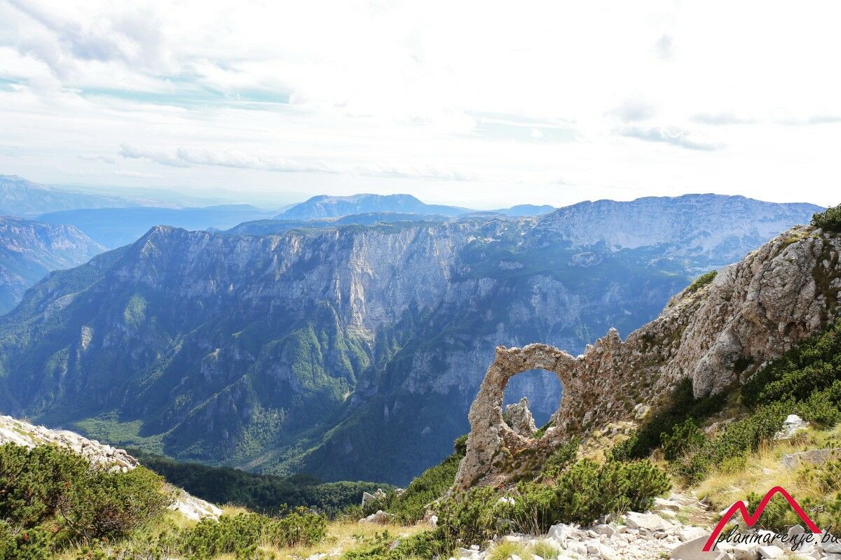
It's a fantastic walk which lets you see the peaks Mali vilinac and Veliki Vilinac, Drinjača and the arch Hajdučka vrata. You can take a break at the Vilinac lodge.
- Starting point
-
Blidinje ski resort
- Route
-
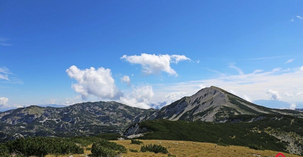
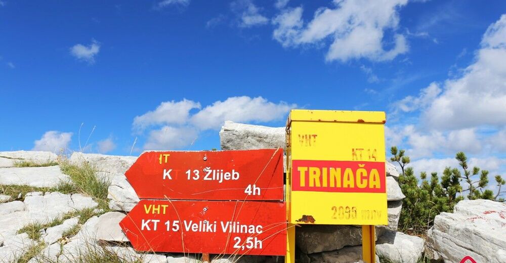
Mali Vilinac (1,996 m)3.1 kmVeliki Vilinac (2,113 m)4.9 kmDrinača / Trinjača (2,038 m)9.0 kmHajdučka vrata (2,000 m)9.2 kmShelter hut14.6 km
- Description
-
This route on Mt Čvrsnica starts from the ski trail in Blidinje, and leads to Hajdučka vrata via Mali and Veliki Vilinac. There are several ways to get back to the starting point, form taking the same road back, taking the road via Zelenike and the most remote trail via Muharnica.
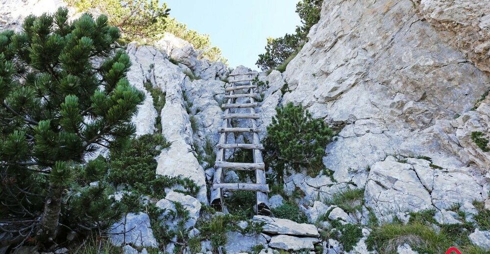
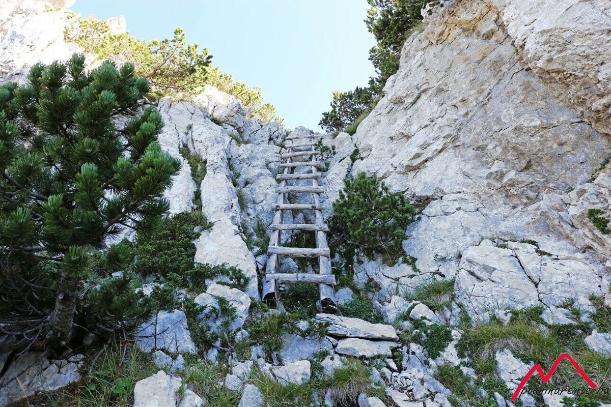
The ascent begins at the ski track, and leads to the top of the ski lift where the forest begins. This is the start of the walking trail which is well marked all the way. The trail is the shortest way from Blidinje to Veliki Vilinac, but also the steepest one. After an hour's walk through the forest, a wonderful view of lake Blidinjsko opens up, and you can also see Mt Vran, as well as Pločno, the highest summit of Mt Čvrsnica. Climb the wooden ladder, installed to facilitate safer climb over a rock, to the ridge. To the right of the ridge, just a metre or two away from the trail, is the edge of the several hundred metres deep chasm. The trail leads through the scrub to the peak Mali Vilinac. At the foot of the peak a trail branches off and leads back to the village of Zelenike in the direction of Blidinje.
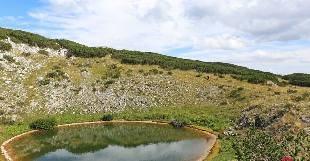
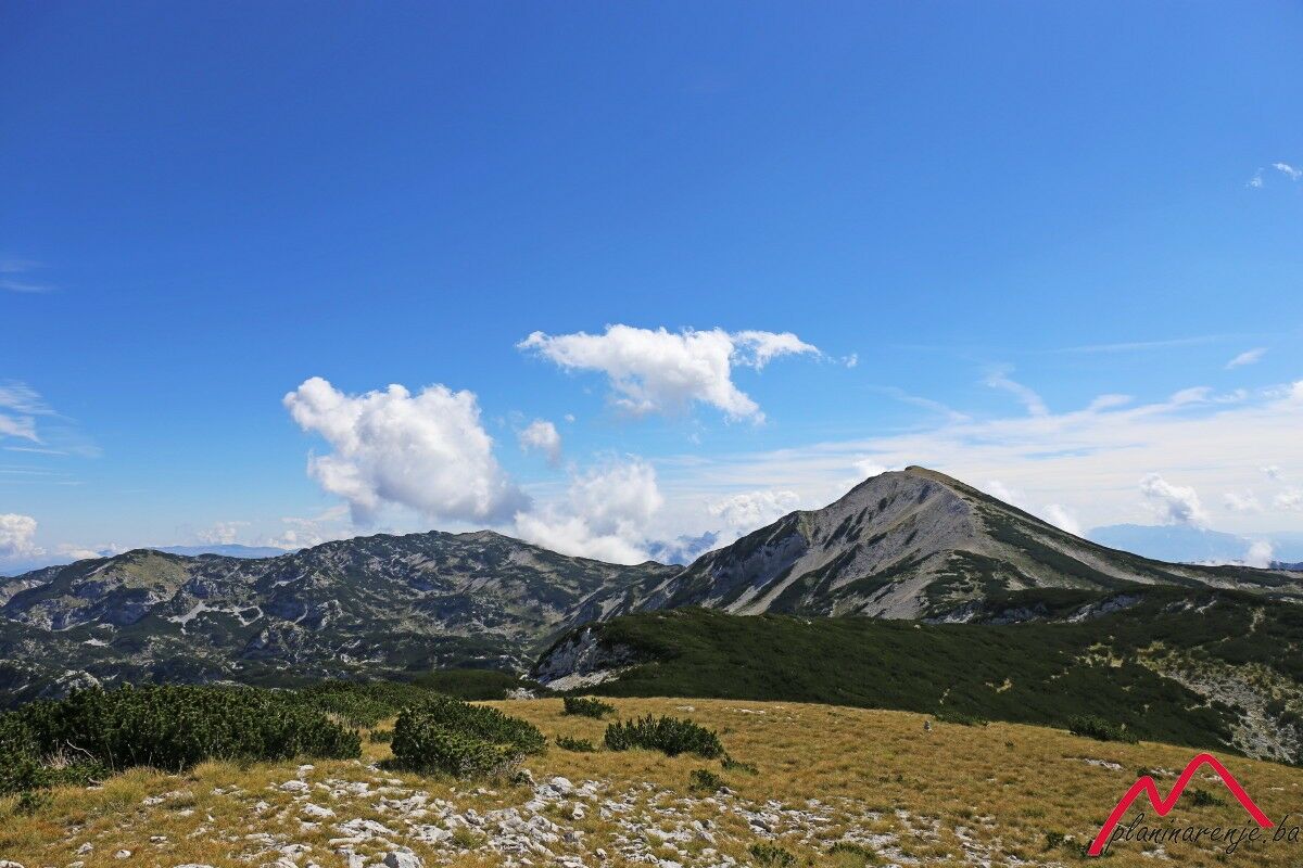
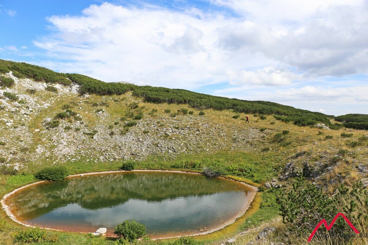
Straight ahead is the peak Veliki Vilinac. First you have to descend the saddle between the two peaks, then master some 250 metres of altitude difference. From the peak it takes two more hours to reach Hajdučka vrata. If you have time you can make a short stop at the lodge "Vilinac". There is a spring not far from the lodge. When you reach Hajdučka vrata you can climb Trinača (also known as Drinača) and head towards lake Crljenak where you can take a break. On your way back you have to ascend Veliki Vilinac and Mali Vilinac again, or cover the 8 km from Vitlenica to the ski resort.
- Directions
-
From the ski resort head southeast, all the way to the top od the ski track. There you'll find a marked trail leading straight through the forest to the wooden ladder which will help you climb a rock. You come out to Mandina Plana from where you should proceed along the ridge to the Ski resort-Zelenike junction. Go straight to the peak Mali Vilinac, then descend to the saddle between Mali Vilinac and Veliki Vilinac. When you climb Veliki Vilinac, continue towards Prijegon. At the junction go right (east) by lake Crvenjak to Hajdučka vrata and Drinjača (Trinača).
Go back the same way to the junction at the foot of Prijegon and head north all the way to Vitlenica and Muharnica.
- Highest point
- 2,095 m
- Endpoint
-
Hajdučka vrata- Vitlenica
- Height profile
-
 © outdooractive.com
 - Equipment
-
Standard mountaineering equipment, in accordance with the weather.
- Safety instructions
-
The trail is technically undemanding and there is no risk of landmines.
- Additional information
- Directions
-
Take M17 to Jablanica. Once there, take R419 and head west to Sovička vrata via Doljani. One short stretch of the road is macadam. From where you enter the Blidinje nature part (Sovička vrata) drive on for 4 km to the left turn towards the ski resort.
- Public transportation
-
Bus or train to Jablanica, then look for transport to Blidinje.
- Parking
-
Park by the hotel at the ski resort.

-

-
AuthorThe tour Ski resort - Hajdučka vrata- Vitlenica is used by outdooractive.com provided.